For those of you who are unsure how far away from destination you should commence your descent, here is a handy little rule of thumb that we use in real world flying:
Height to lose x 3 = distance required
Example 1:

Cruising at 11,000 feet AMSL. Landing airfield elevation is 700 feet (rounded up 1000 feet for easy maths).
.
11,000 feet - 1,000 feet = 10,000
10,000x 3 = 30
.
Therefore, top of descent point is 30 nautical miles from your destination
Example 2:
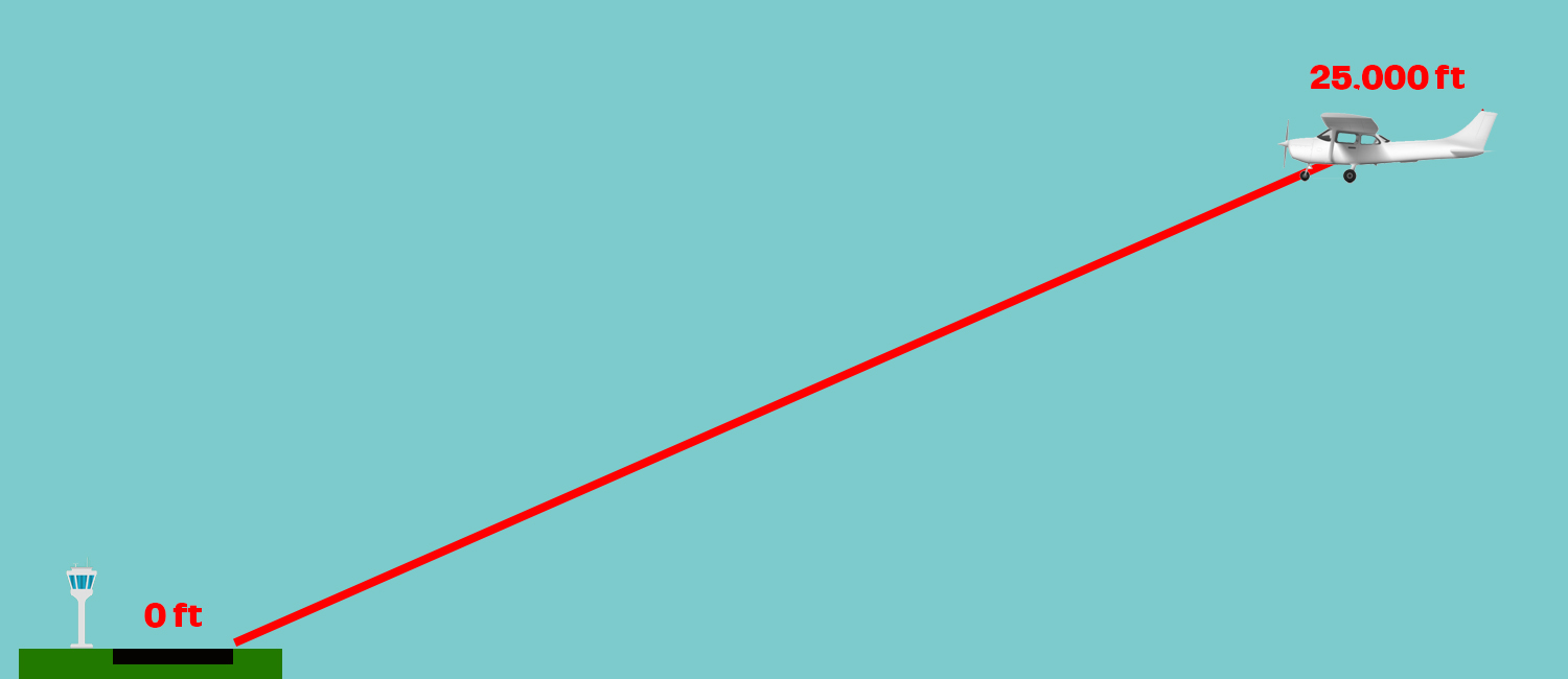
Cruising at 25,000 feet AMSL. Landing airfield elevation is 0 feet (sea level).
.
25,000 feet - 0 feet = 25,000
25,000x 3 = 75
.
Therefore, top of descent point is 75 nautical miles from your destination airfield.
.
This formula works well for flying most conventional type fixed wing aircraft.
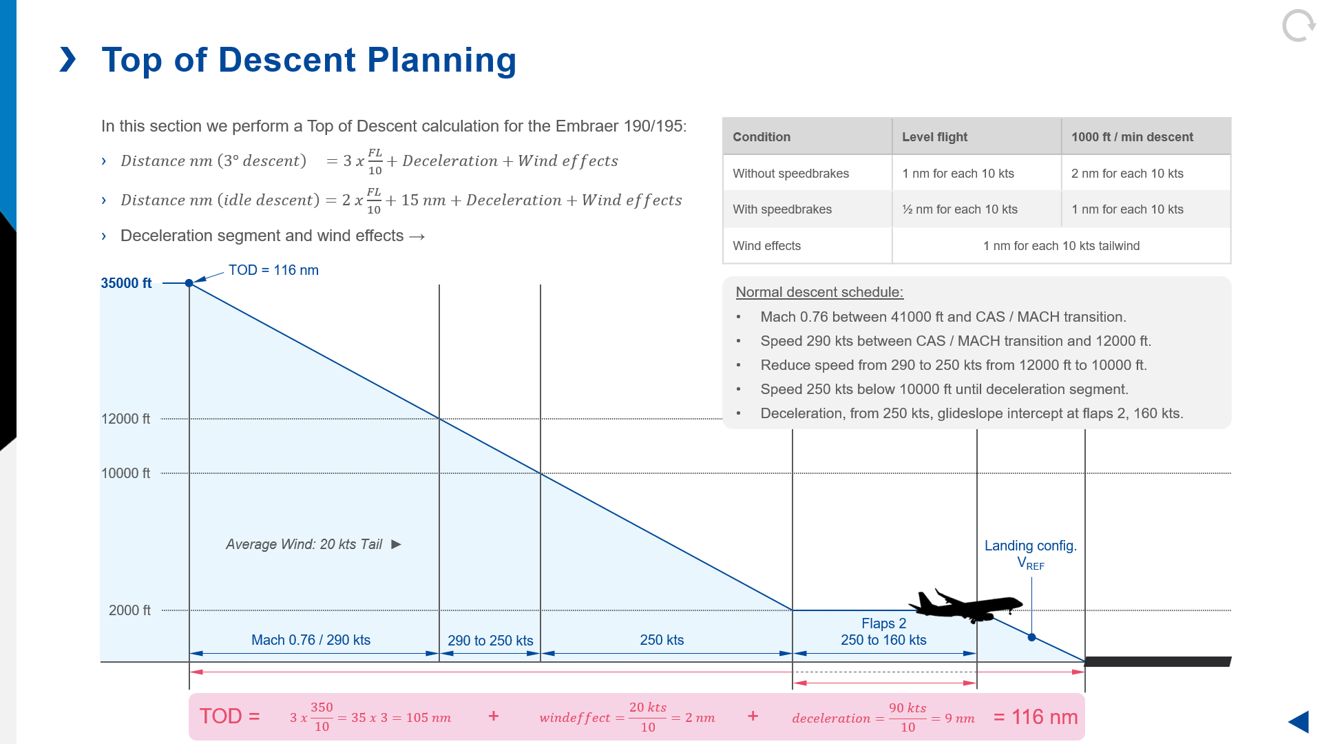
However, for faster aircraft, you may need to factor in a level segment for slowing the aircraft down after descending at a high speed so that you can configure for landing with flap and gear.
This is typically done prior to the Initial Approach Fix (IAF), which is often found at a distance of 10 miles from the landing runway at a height of 3000 feet AGL.
Use the same formula, and simply add 5nm for your level segment on top of the distance calculated for your descent.
Example 3:

Cruising at 25,000 feet AMSL. Landing airfield elevation is 0 feet (sea level). The IAF is at 3000 feet AMSL at a distance of 10nm.
.
25,000 feet - 3000 feet = 22,000
22,000x 3 = 66
66 + 5 mile level segment = 71
.
Therefore, top of descent point is 71 nautical miles from your IAF.
.
Working back from the runway which in this case is 10nm from the IAF, 71 + 10 = a top of descent point 81 nautical miles from the runway.