Thank you for using the Bug section, using templates provided will greatly help the team reproducing the issue and ease the process of fixing it.
Are you using Developer Mode or made changes in it?
No
Have you disabled/removed all your mods and addons? If the issue still occurs with no mods and add-ons, please continue to report your issue. If not, please move this post to the Community Support section.
No
Brief description of the issue:
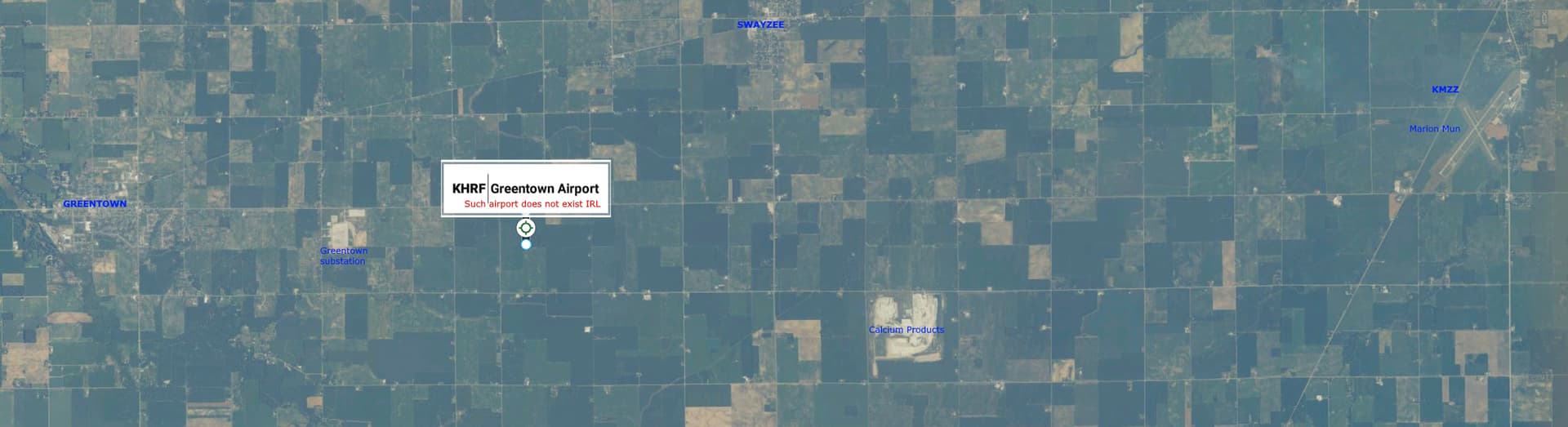
Planing a flight to KHRF I found that this airport is mislocated. KHRF is an airport at Ravalli - Hamilton.
On MSFS is located at Greentown - Indiana, where aren’t such airport.
Instad, the real KHRF was named as 6S5.
Provide Screenshot(s)/video(s) of the issue encountered:
ICAO or coordinates (DevMode > Debug > Display position)
KHRF - 6S5
Detailed steps to reproduce the issue encountered:
Search these airfields on MSFS world map
PC specs and/or peripheral set up if relevant:
Not relevant
Build Version # when you first started experiencing this issue:
Sim Update 14 [1.35.21.0]
 For anyone who wants to contribute on this issue, Click on the button below to use this template:
Do you have the same issue if you follow the OP’s steps to reproduce it?
Yes
Provide extra information to complete the original description of the issue:
Not necessary
If relevant, provide additional screenshots/video: