Do you have any add-ons in your Community folder? If yes, please remove and retest before posting.
Only aircraft addins atm, tested with an official airplane (JMB)
Are you using Developer Mode or made changes in it?
Nope
Brief description of the issue:
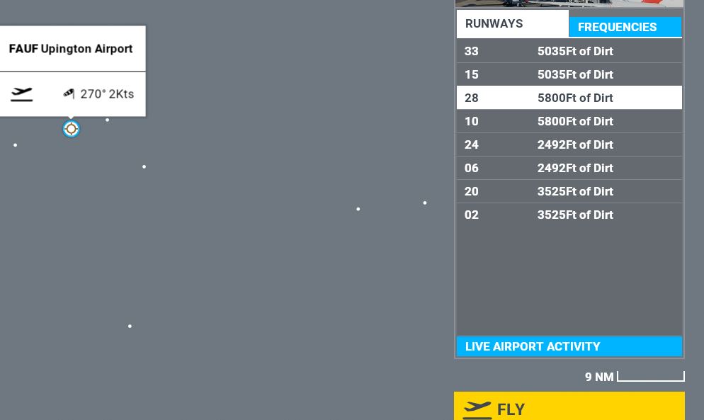
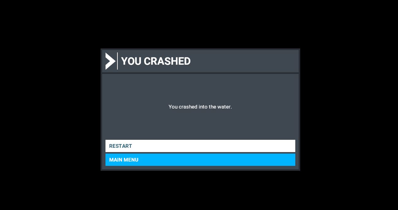
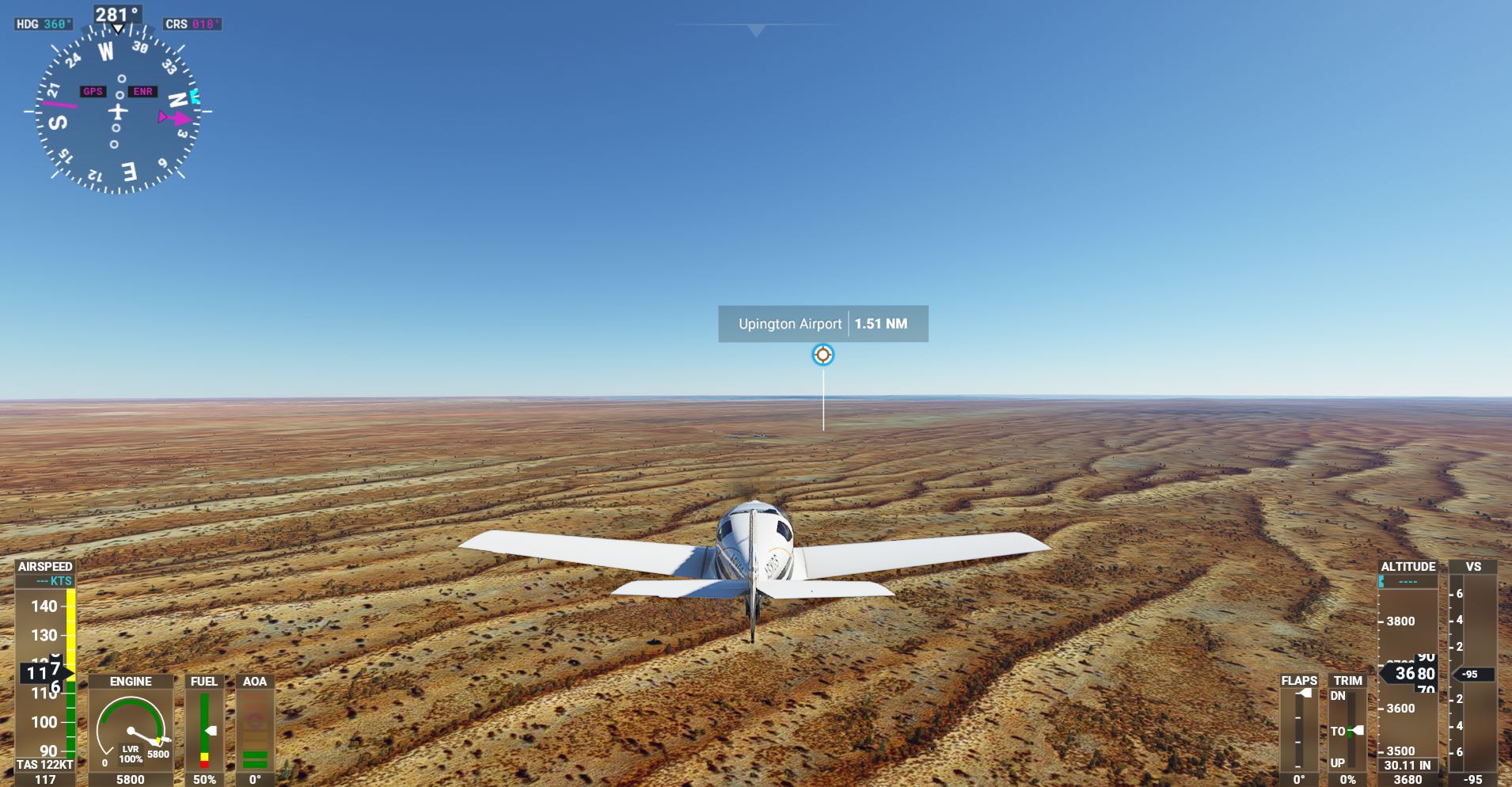
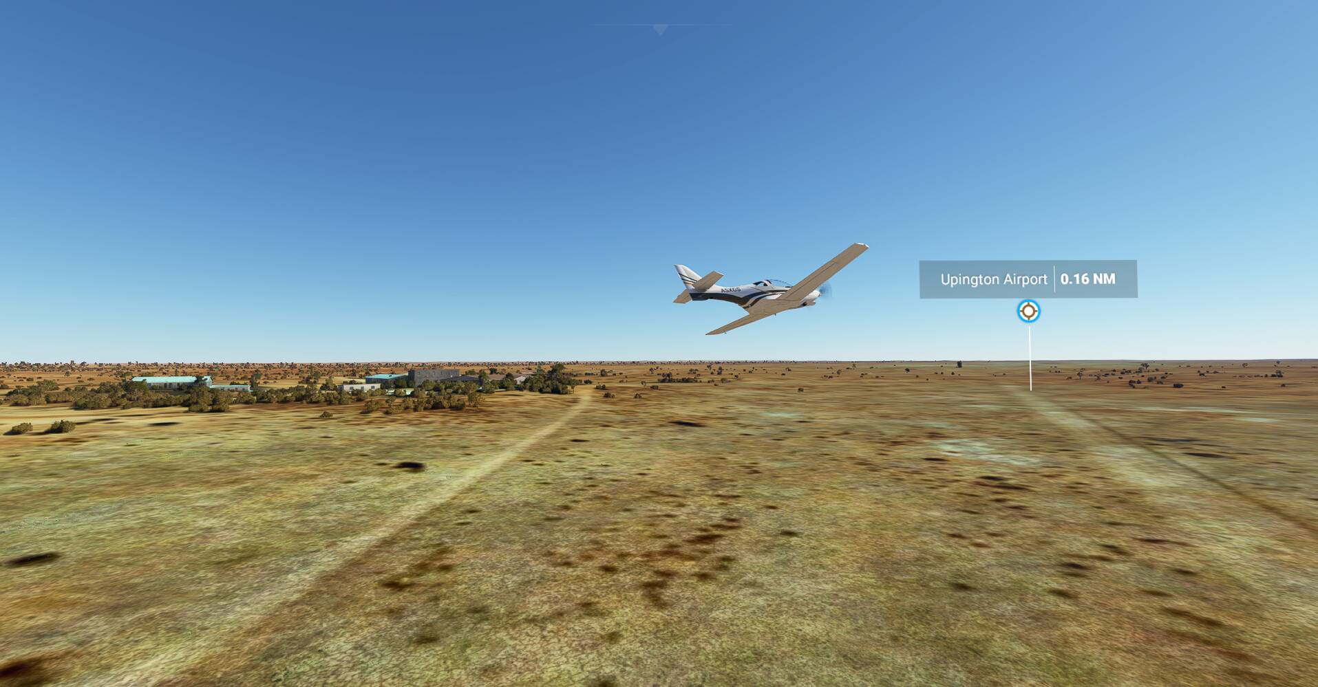
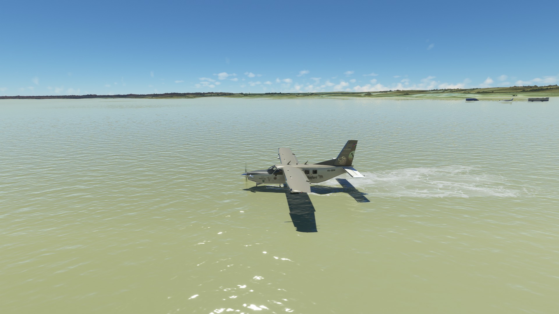
After click FLY going FAUF Upington, it loads and crashes into water immediately before READY TO FLY !
Provide Screenshot(s)/video(s) of the issue encountered:
Detail steps to reproduce the issue encountered:
I tried 2x.. and 4 months ago it was already discovered.. This was reported before and closed, by Galeno1960 on jan’27
PC specs for those who want to assist (if not entered in your profile)
see profile
Build Version # when you first started experiencing this issue:
1.15.10.0
Are you on the Steam or Microsoft Store version?
Store
Did you submit this to Zendesk? If so, what is your ticket #?
Not yet
I am not at my computer at the moment and won’t be for a couple days. However, I have seen a few small bush strips in South Africa with what seems like made up ICAO codes and named after a bigger town in the vicinity. For instance: a few weeks ago my sister flew to the Dundi Lodge airstrip at Augrabies Falls close to Upington in real life in a C172. So I flew the same route in MSFS with a C172 at the same time she was doing it for real.
Due to the time difference between where she was flying in real life in South Africa and me in living in Canada, I had to get up at like 4am to fly with her!
We even shared flight plans as it was a real following-landmarks-on-the-ground flight as the aircraft she flew had no GPS so I ignored my GPS. There are also no navaids on the direct route. Really was kind of neat.
However, as for the current topic: the game showed an ICAO code for the destination field while in real life there is no code. I unfortunately cannot recall the fictitious code but it was also similar to the real world FAUP for Upington. Noted that the Dundi Lodge strip is about 50nm from FAUP.
Looks like there is actually an FAUP airport in the sim and that FAUF airport is extraneous or an airport for seaplanes. Try loading up in FAUP instead!
OK, back at my computer so I can add some comments on what I have seen.
FAUP is verily a legit airport and well known in South African aviation circles because of the fact that, at 16076ft (according to Skyvector), it has the longest runway in all of South Africa. It serves the biggest town/city in the area.
As mentioned, I “flew” in to Dundi Lodge in the sim a few weeks ago. According to Little NavMap and MSFS, the airfield has an ICAO code (FALG) and is called Augrabies airport. In reality it has no ICAO code and it is known as Dundi Lodge airfield. But the airport itself is reasonably accurate in location and runways.
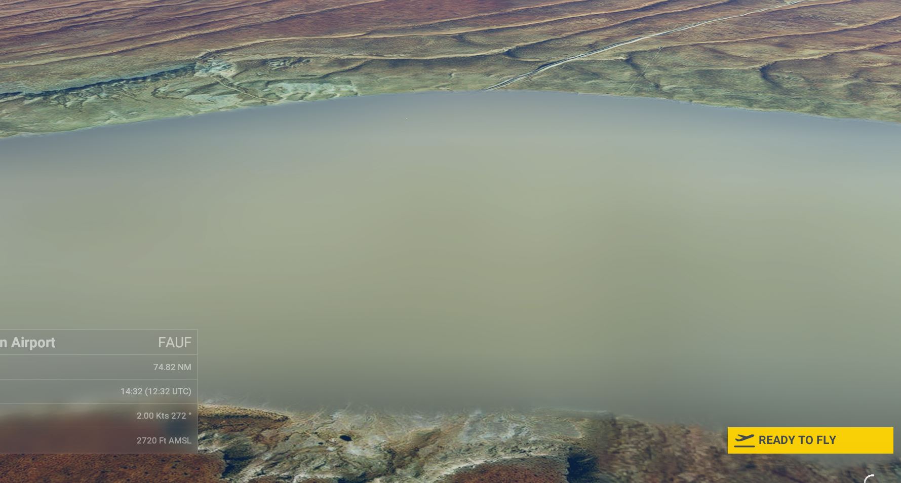
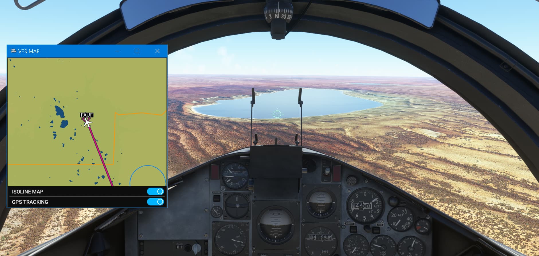
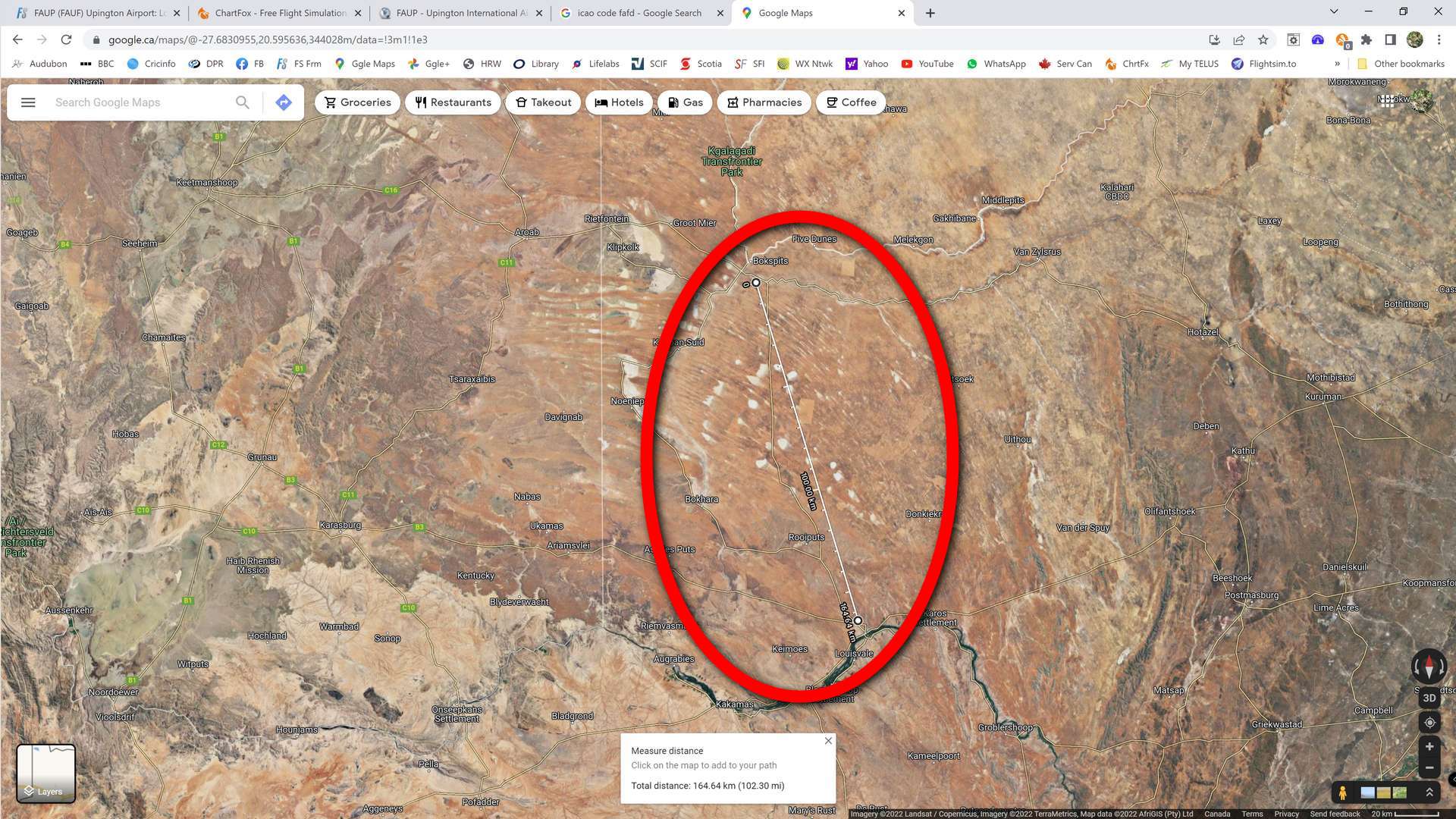
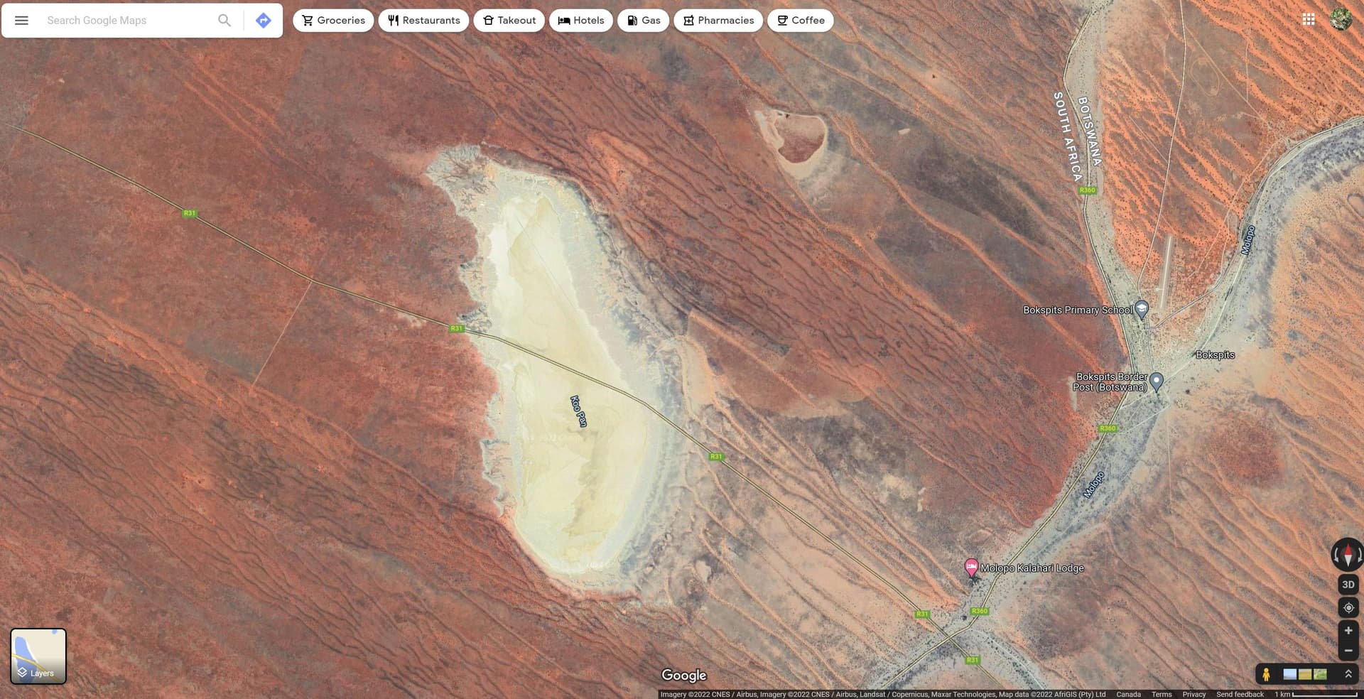
Water in the area @N316TS and @Bewoss : as someone familiar with that area, this is actually VERY ironic! In real life, that area is a pretty major desert that very rarely sees standing water. When flying over the area in the sim, it looks like Asobo/Blackshark have made some major assumptions with the interpretation of open areas called “pans” in that geographic location. Locally, pans are flat, open, low lying areas that MIGHT get a thin layer of water for a few days every year or so when they do get some meaningful rain. This is what the area looks like with the distance between the actual town of Upington and FAUP airport and the phantom “FAUF” marked in red:
And BTW: according to LNM and MSFS, FAUF is quite a major airport with like FOUR runways, the longest being almost 6,000ft in length. Kind of hard to miss I would have thought… but the Google map satellite image shows nary a runway…
Further examples of South African oddities:
Near where I used to fly in the Western Cape there is a small airfield that is locally known as Diemerskraal. In LNM it is called Noorder Paarl airfield with ICAO code FAOC. In reality, no such ICAO code exists.
A bit further north there is an airfield with ICAO code FAFD and called Clanwilliam airfield. Bit baffling because the town of Clanwilliam is about 50nm away and the ICAO code does not exist. Actually, a quick scan shows no fewer than FIVE airports called Clanwilliam airport in a radius of about 30nm in that area called (apparently generically) Clanwilliam with an assortment of ICAO codes that do not exist!
These are just a couple of examples. In passing I have noticed a number of other oddities in South Africa. This leads me to believe there have been some SERIOUS liberties taken with airport naming and phantom ICAO code allocation on a number of bush strips out in the back of beyond areas in South Africa.