Well, I made a flight plan, and it’s so long that I decided to convert it to a BushTrip, with the help of Little Navmap and BushTripInjector.
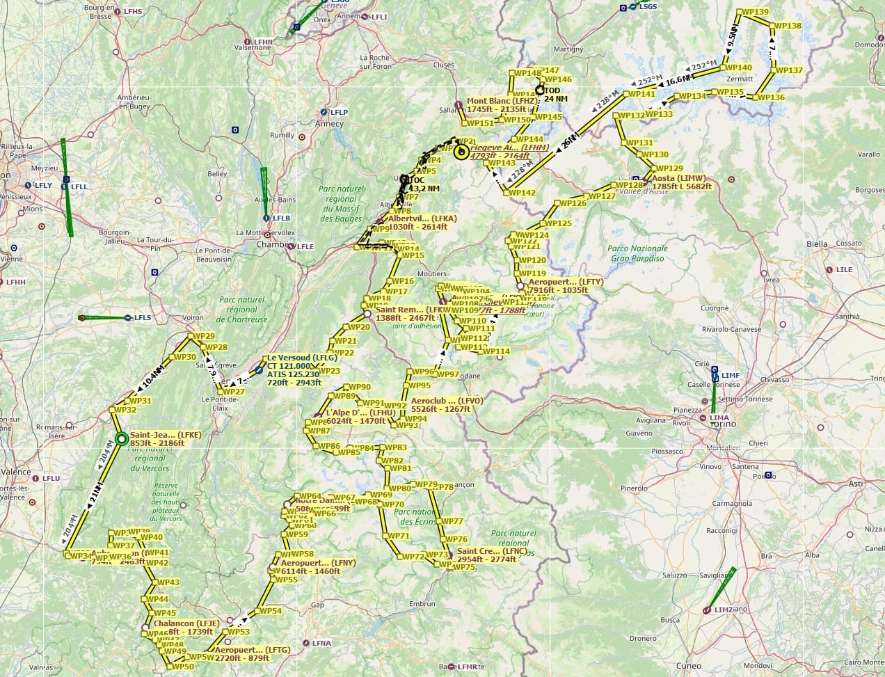
Currently it passes through the following airports (in order): LFHM (Megeve, took your advice), LFKA (Albertville), LFKR (Saint Remy De Maurienne), LFLG (Le Versoud), LFKE (Saint-Jean-en-Royans), LFJF (Aubenasson), LFJE (Chalancon), LFTG (Grand Terrus), LFNY (St. Étienne en Dévoluy), LFPS (Notre Dame de la Salette), LFNC (Saint Crepin), LFHU (L’Alpe D’Huez), LFVO (Valloire Bonnenuit), LFK (Méribel), LFLJ (Courchevel), LFTY (Vers Le Col du Palet), LIMW (Aosta), and ends in LFHZ (Mont Blanc).
It’s kinda demanding on the plane so I chose the NXCub, but perhaps I’ll go with the Pilatus TurboPorter because its excellent performance at STOL and altitude).
I’ve tested a first version and it all goes fine. I only need to write up all the waypoints texts and add some nice 3D images, which is not that easy because there are 165 waypoints.
All of the legs are very short except the last one which is particularly long because it takes a tour around Mont Blanc, so it’s like a 90min flight.
As soon as I have it completed, I’ll share it for everyone who wants to make the trip landing at very difficult strips (altiports) and enjoys viewing magnificent mountains.
Best!
Seb
PS: of course, if there’s anything you’d like to make me add, I’ll add it to the bush trip.