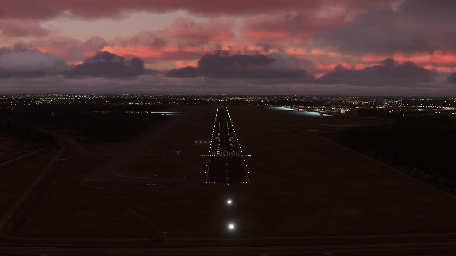
[Freeware Airport] [Work In Progress] EHEH - Eindhoven Airport/Airbase, The Netherlands
I am pleased to announce that I will be making my first contribution to the community.
I decided to add this airport because it is the closest commercial airport to my hometown, and it was not added to the simulator (yet).
Because bing doesn’t have aerial photos of the airport (which is probably the reason it wasn’t in the sim in the first place), I’ve included ground textures extracted from Google maps.
This project is still a work in progress, so be prepared for minor mistakes or missing items.
Airport description:
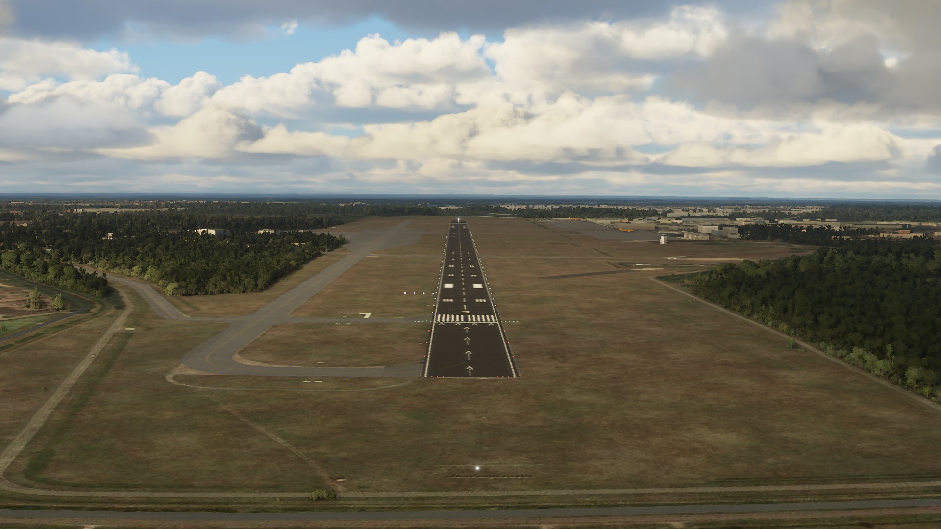
Eindhoven Air Base or Eindhoven Airport (IATA: EIN, ICAO: EHEH), is located on the west side of Eindhoven, between Best and Veldhoven.
Originally a civil airfield that was transferred as an air base to the Royal Netherlands Air Force after the Second World War. The airport is partly used by civil aviation; however, the air force provides all basic services such as air traffic control, weather services, fire brigade, medical service, etc.
With 6.2 million passengers in 2018, Eindhoven Airport is, in terms of travelers, the largest regional airport in the Netherlands. Schiphol Group owns 51% of the shares in Eindhoven Airport. The municipality of Eindhoven and the province of Noord-Brabant are each a 24.5% shareholder. The land is owned by the Royal Netherlands Air Force and the military part (Eindhoven Air Base) still bears the name Welschap.
Random fact: In 2013 the runway designation was changed from 04-22 to 03-21, due to shift of the magnetic pole.
If you encounter any bugs or details that are off, please send a reply so I can correct it!
Also if you’re enjoying the scenery, make sure to post screenshots or videos below!
I’ve tested it! I don’t know it’s a bug but it hangs on loading, even after 20 min without usage of the disk. When i delete the scenery i doens’t occur. More people with that problem?
Loaded up just fine, lovely looking airport. I am doing one for LFOT in France. Learning as I go. Do you know how to add the approaches like ILS yet? Do you mind if I ask you some questions about the process?
Cheers
Mooi! I wanna try to make a decent EHTE, nice learn project and already got the LIDAR data from the field and buildings.
BTW think the airport is blurred at BING because it’s also used for the military, think they forgot Google. But aerial data from The Netherlands is like LIDAR data also available for the public by the government sites.
You don’t but you can of course use it for a 3D model. Think that will some decades ahead before game worlds get shape with real lidar data, would be something. Here in The Netherlands the government has the lidar data available for the public. Don’t know if other countries have it as well.
in Europe are many areas available, I was using them for x-plane and ortho4XP. so I would really love it to use them in MSFS for Faroer Island for instance!
Do you have a link that isn’t from a url shortener? I try to avoid them, as people with bad intentions easily can misuse them! Well that and my pi-hole is blocking it.