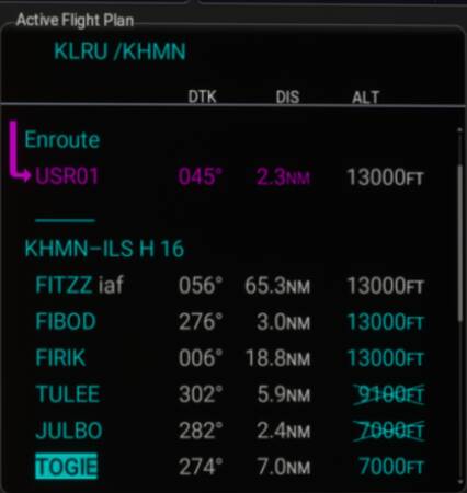
I have loaded a flight plan properly from LNM; everything is loaded properly, except that two of the altitudes, even though they reflect the plan in LNM, the altitudes are crossed out. I can change them (they do not require a change but I can change them), but they remain crossed out.
I would appreciate your thoughts.
Looking at the map, is it possible that the altitude change is too great for the distance between waypoints. If so, I wonder why that is an approach plate in LNM?