I don’t know how many may be interested, but I find that if the display of a geographical grid (dynamic and can be activated as an option in the filters) depending on the zoom level was added to the World Map it would be of great help when looking for a geographical reference on the map.
The geographic grid will also be a good reference for storing latitude and longitude when planning a flight plan.
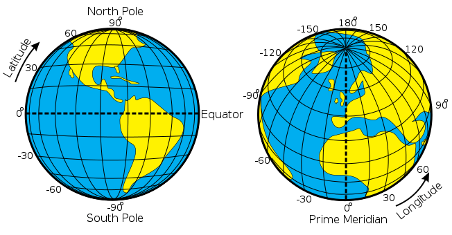

It is possible to specify a Latitude/Longitude position in the search field. Or just clicking on any spot gives the ability to create a waypoint at that location which uses Latitude/Longitude coordinates. The gridlines are there and useable, just invisible.
That’s where the problem lies, simply invisible. When you click anywhere on the World Map, if you are looking for a position you have to go blind, with a visual reference the search is more immediate.
However, mine is a simple request to facilitate the (approximate) search for a geographical position.
Maybe make it a wishlist entry, and I will second that!
1 Like