I’d like to sail some nice cross-country trip with a glider, hopping from thermal to thermal. I did some already but it felt too easy as there were updraft almost everywhere. I did not really had to circle and spiral up. I could just glide straight, zigaging from one to the next.
I set the date to early July, 13h, clear skies and added a few low altitude clouds and a bit of wind. I chose the location where I made few hours of introductory glider lessons.
What settings would be better? What location would be optimal?
If you haven’t already, you could give these weather presets a shot. There are 2 specifically for gliders in here (Soaring Ridge and Soaring Thermals) but the others may be interesting too.
Not sure if since Asobo added gliders these work in the same way now or are even necessary/compatible but I don’t see why not.
I have a bunch more presets for gliders but honestly unsure where they came from now. Could be part of this pack but they just didn’t update the store page description. I have Soaring - Cross Country and a few others, IIRC. Could have come from the GF Discus.
Windy.com has a Thermals layer in beta right now (will be premium subscription when released), but that can help finding nice gliding spots for now in live time/weather; Windy: Wind map & weather forecast
I saw that there were very good thermals in Namibia, on windy.com. And it was confirmed in MSFS. I soared for 45 minute from cloud to cloud. I could have continued longer if I had more time. I just landed on a packed-earth airfield in the middle of nowhere (FYWC).
We have quite a few gliding clubs here in New Zealand. Might be worth picking a country or state you like and googling to see if they have gliding clubs and where they are.
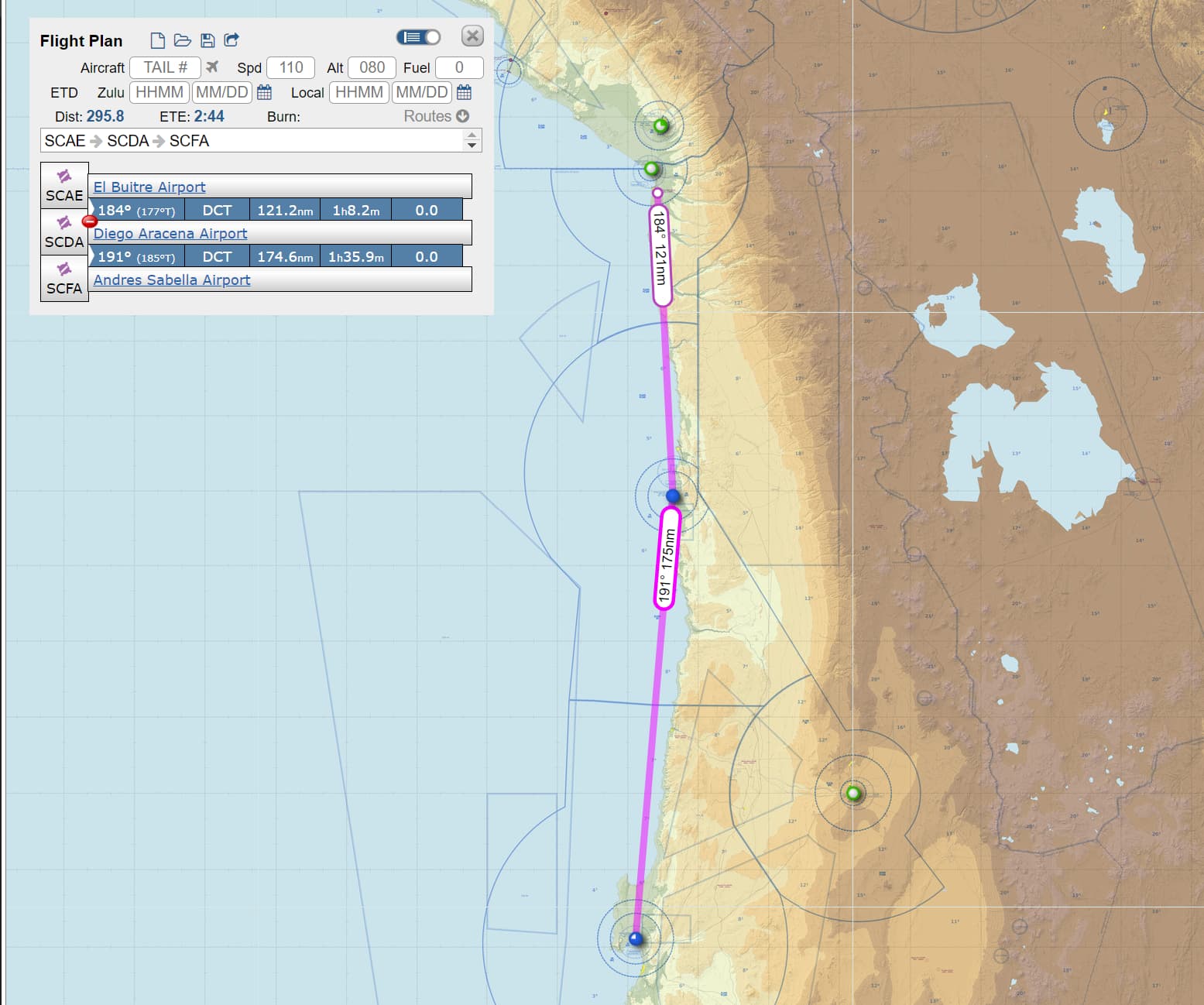
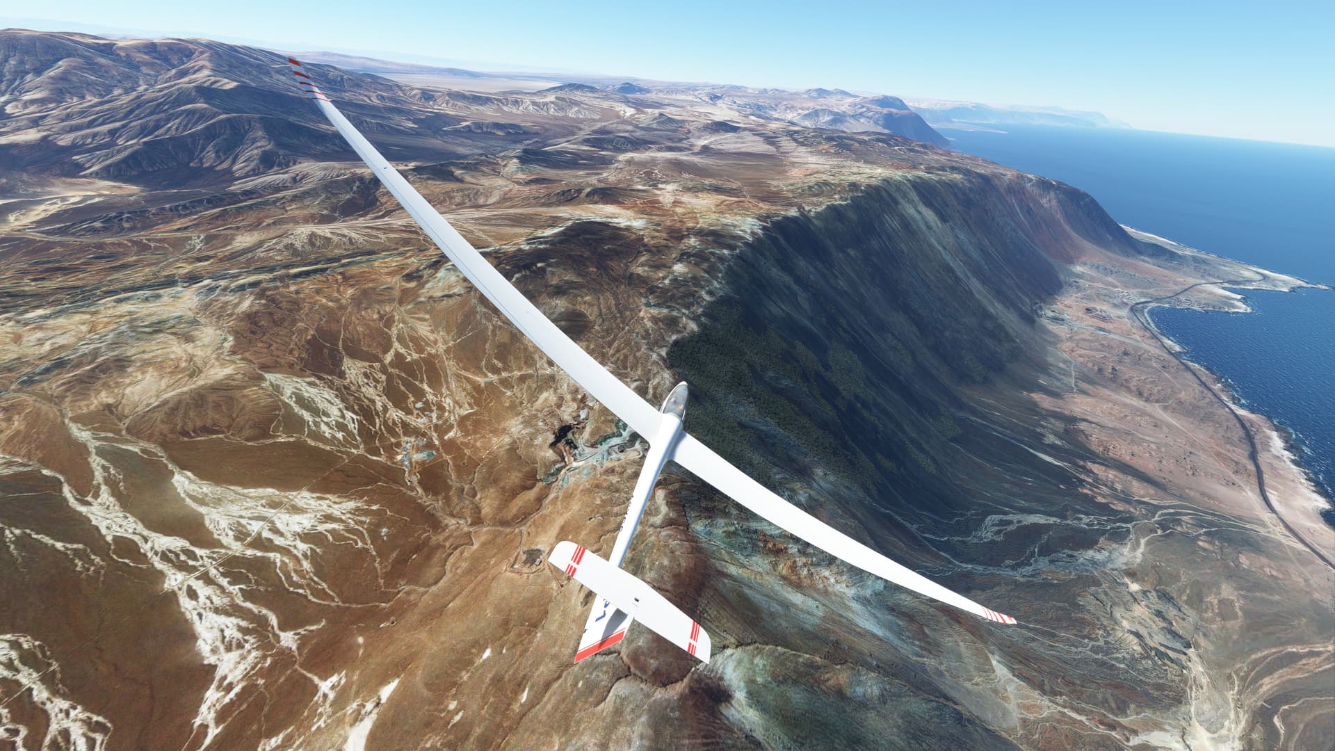
If you’d like to try ridge soaring, there’s a 500 km long stretch of steep sea cliffs on the coast of Chile between SCAE and SCFA that make for a pretty awesome glide. I got lucky and did the whole stretch using Live Weather the other day thanks to what was probably a morning sea breeze. But if you don’t want to chance the Live Weather, just set a west wind of 10 knots in the weather menu and you’re off to the races.
In real life, the best cross-country soaring conditions are when the sky is full of puffy little cumulous clouds at 4-5K’ more or less evenly spaced across vast distances, and they’re not moving much if at all. Each such cloud sits at the top of a thermal so finding thermals is easy, and the clouds are small enough and far enough apart to let plenty of sunshine reach the ground to keep powering the thermals. If the clouds get any bigger, they start blocking too much sun and the thermals die. There can still be thermals without clouds but then they’re hard to find. But in general, such conditions can be found most days Spring to Autumn over most of the US Great Plains.
Now, I don’t know ANYTHING about how MSFS does thermals, and whether it ties them to the clouds. And even if that’s the case, does it work with any of the presets or just Live Weather? No clue on this. Until this gets explored further, I suggest using the graphical airflow help, especially as MSFS does not provide random hawks and buzzards circling in thermals to help you find them in the absence of clouds
MSFS now puts a little green icon in the lower left corner of airport symbols to denote “glider-friendly”. This might mean there are “hard-wired” thermals in the area of that airport as it appears you can fly gliders anywhere. But MSFS has not so marked all glider fields. For example, the one I used to fly at in real life, TS11 (Texas Soaring Association) near Midlothian is not so marked. However, I found the “home drome thermal” that reliably was just off the southeast side of the field in real life, clouds or not, so who knows?
Namibia is one of the gliding hotspots this time of year. Bitterwasser (FYBJ). It is a circular pan (dry lake) of about 3km in all directions. It has strong thermals and the cloud bases are sometimes very high (FL150)
Sadly the scenery is not well modeled. In reality, the pan is flat but in MSFS it is very uneven.
I find that using the thermals in Kinectic assistant is much more realistic currently, hoping this will improve in the next updates.
Here is a list of glider spots I want to try this coming holiday:
Bitterwasser, Namibia
Nephi, USA
Mifflin, USA
Truckee, USA
Parowan, USA
Chambery, Barby, FR
Grenoble (LFLG), FR
Sion, Switzerland
Bern, Switzerland
Innsbruck (LOWI)
Marpingen, DE
Aboyne, UK
I fly in glider only in real live weather, it’s 10 x better. If the weather is not favorable, I change places.
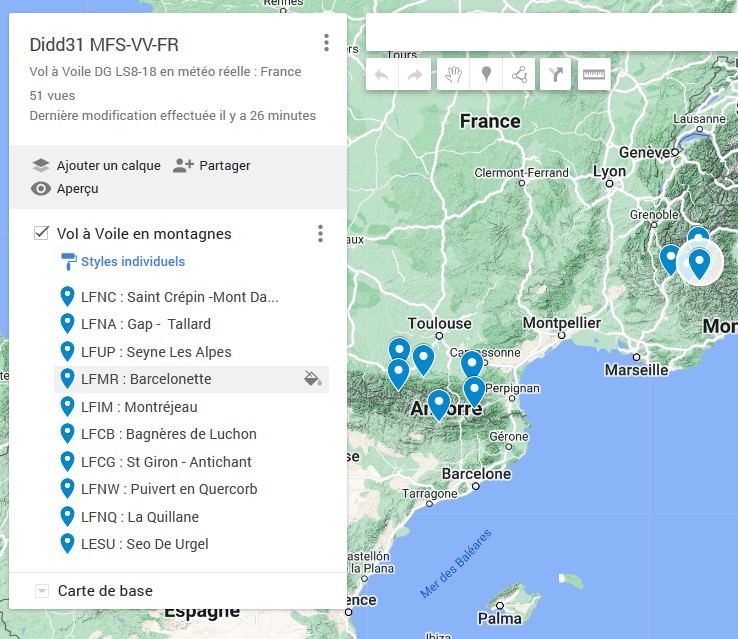
My favorite corner is St Crépin-Mont Dauphin in the southern Alps [LFNC] (by wind from South-Ouest or South it is excellent). On this runway you can be towed by the Cessna, it has enough distance to take off.
The interest of the glider is to know how to adapt and take advantage of changing weather conditions, flying with a fixed weather that makes flight easy is not simulating … On top of that in this case, the clouds are really nasty and artificial. In live weather it’s magnificent! and much more interesting!
It’s just my opinion…
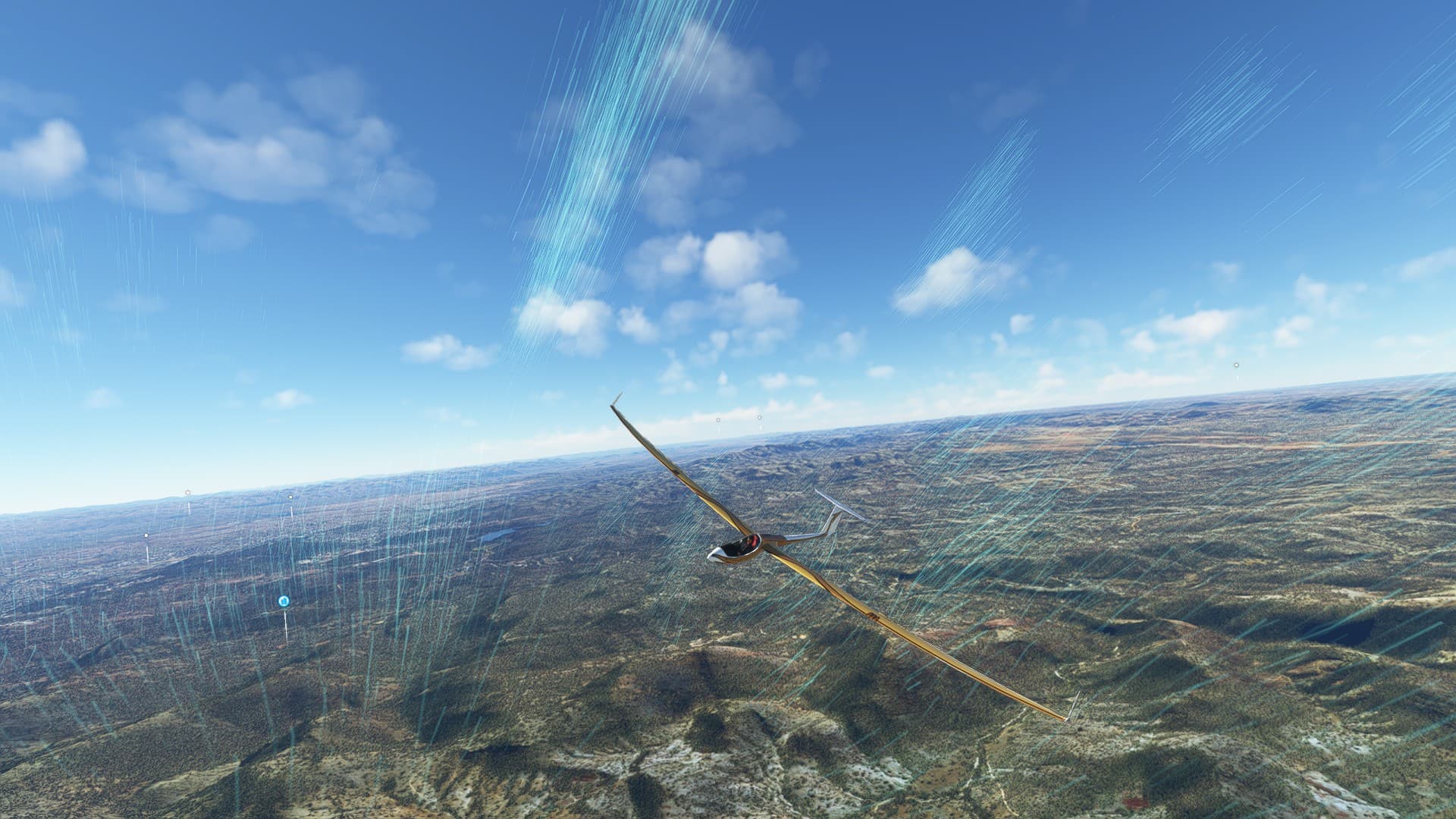
PS: the DG LS8 flies really well, I love it, It can stay hours in the air in the mountains when the weather allows.
Has anyone noticed, and perhaps used, the glider (‘Soaring’) specific weather settings? I appreciate they’re not the preferable Live weather, but they are there. I’ve seen them but I’ve yet to try.
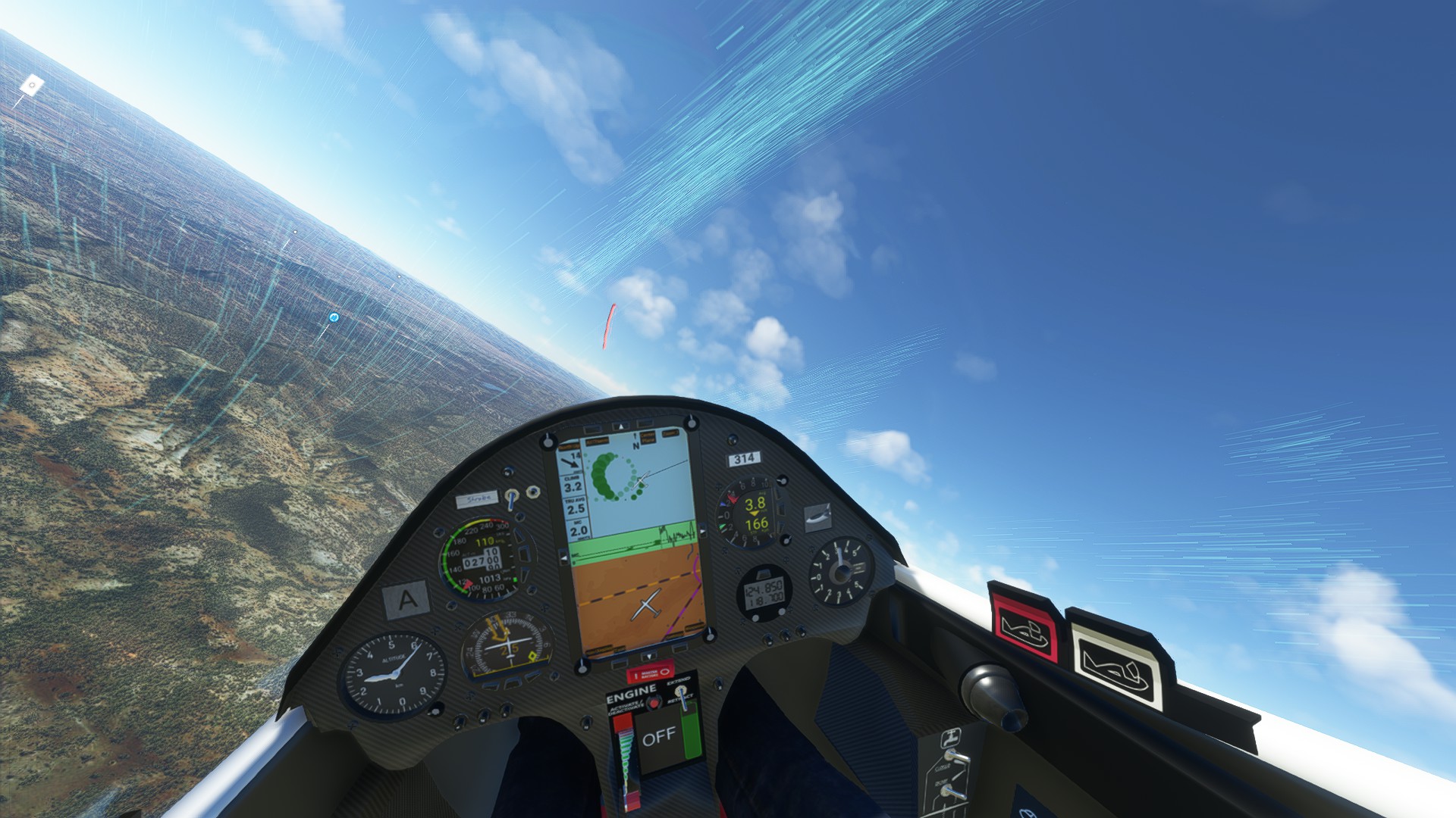
The problem is that the ideal weather conditions for gliders are entirely dependent on where you are. For slope flight it is necessary to manage so that the slopes exposed to the sun are also exposed to the wind. But as clouds can shade slopes … Hum hum it’s hard to achieve a good weather setting. In live weather ( or not ) you can activate or assign a button to the display of upstreams( green lines ) , it helps a lot to gain altitude.
RASP 'desktop' - RASP UK (Stratus), (A better link to the desktop RASP app’). This is the advanced RASP map that I have used when gliding. I should have used this link and not the basic data RASP map.