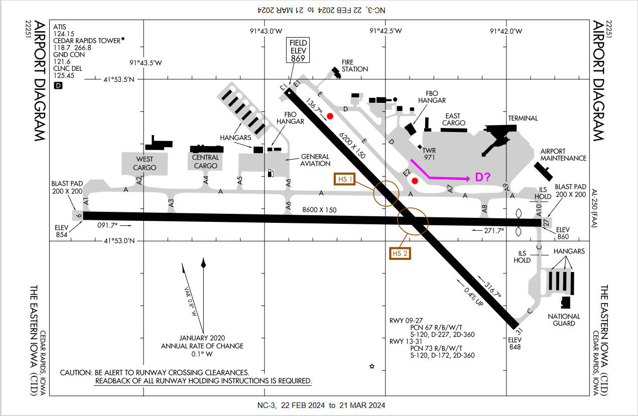
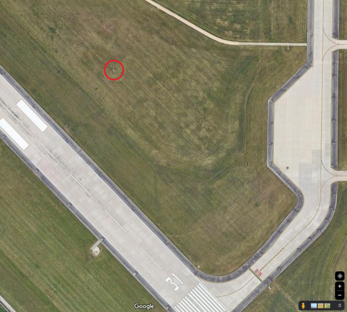
I have submitted this airport via the World Hub but it has been rejected due to missing windsocks. There are none indicated on the only chart I could find, so I located 2 using aerial imagery (marked on the chart with red dots), but the admins say there should be 4 - any idea where they are? Also, does anyone know if TWY D extends past E2 all the way to A9?

Nice detective work. Thanks!
1 Like
the admins should tell asobo to fix their airports then because i have found several dozen that don’t have any windsock at all.
2 Likes
Thanks for giving KCID some love! Local Cedar Rapidan here!
1 Like
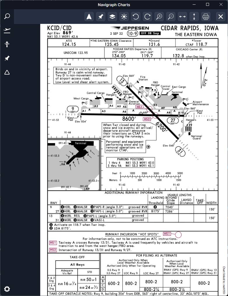
I think the world hub mods are using Jepp charts for windsocks and unfortunately they are not always a good resource for that. I’ve found several that do not coincide. In fact, the two you found here are not shown on the Jepp chart at all.
Do they still say CID stands for “certainly it’s delayed?” I lived in SE IA many moons ago, and that was the going joke.
There’s a 10 year old airport layout plan (ALP) that seems to label taxiway D as extending all the way through as you suspect. However, without an ALP, imagery, or direct knowledge, discerning truth in taxiway names and signage is going to be a major time-sink fraught with error.
One way I’ve been attempting it is finding local photos on Google, or watching YouTube videos from airplanes at that airport. It can get you in the ballpark, but again, it’s a lot more time spent than correcting runway lighting.
My fear is this whole thing is going to end up in editing wars like Wikipedia. The problem is there’s really no good source of truth, many official materials are either hard to get, old and out of date, or don’t exist at all. And unofficial materials suffer from the same.
So you pour a bunch of time into making the most plausible edit, only for someone else using their interpretation of truth to shoot it down. Hopefully there will be more guidance to this effect.
1 Like
Would habe to use updated ones everu month. Thats the key to jepp charts
Except the Jepp charts are not always thorough or accurate in regards to that minutiae. Windsocks are all over the place and good luck on taxiway signage and designation, especially at smaller airports (for which Jepp charts don’t always exist anyway).
Again, lots of time-sink with certain elements, so there needs to be a consensus on how nit-picky we must and/or should be in those regards.
I dont think windstocks shouldnt have a neccesary auto rejection for it. If anything a WARNING what is missing
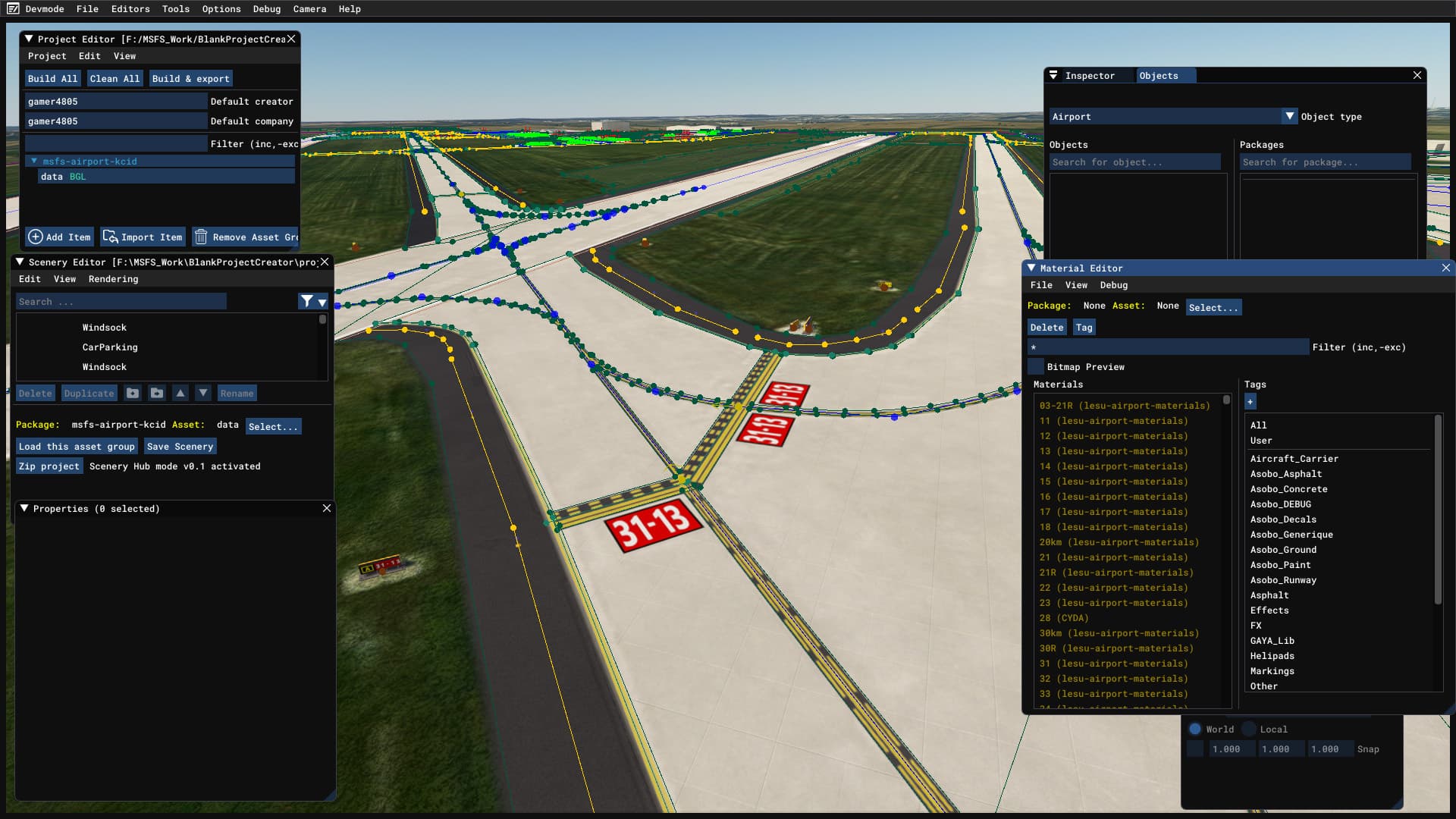
Yes it’s now finished and accepted via the world hub so will appear in-game when they update. It took a long time as I manually created the black outlines (never again!) around taxi-lines due to the lighter colored concrete aprons, and no assets currently exist for this to be done automatically.
The layout is still out of date as the Bing imagery doesn’t yet show the latest iteration of the airport.
3 Likes
Do you have a before and after shot?
2 Likes
I haven’t heard of that saying. It isn’t super bad, but flights to/from KCID, being a regional airport, get lower priority at major airports like KORD compared to flights to/from London, for example. So, whenever there are delays at connecting airports, it trickles down pretty badly to KCID.
As I said, they’re not in the right spots on the chart
Awesome work putting in the black contrast lines. That should definitely be an automatic option. I have a wishlist on that somewhere.