I wonder if, as residents of a given region, we can somehow help BING maps to get more accurate. For example, the quality of the maps for Switzerland leaves much to be desired but there is a much higher quality map prepared by the federation (link below). Wouldn’t BING like to apply for the use of this data in their maps? Or maybe they would need the support of the residents for such a request to be easier accepted? Does anyone know how does it work?
Yes, but wouldn’t it be more efficient for BING to apply for the rights to use already existing data? Perhaps, if such data is public, the costs would not be too high.
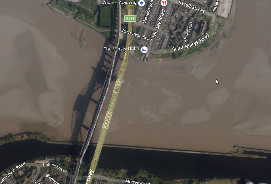
I haven’t really ever used Bing Maps until yesterday when I did a search of an area that I was really surprised didn’t have more detail and that’s the bridges over the River Mersey near Liverpool. I found this image in Bing Maps.
What’s notable is that almost all aerial photography sites including most governmental GIS info sites do their aerial photos at midday in the summer to minimize shadowing. Clearly this image is taken late or early in the day from the shadows of the bridges on the river. If you were trying to even autogen the bridges from an image like this it would be next to impossible. You almost never see something like this in Google maps. Bing has a long ways to go in my opinion. Now the good part is that if you were looking to build 3d objects you do have a template for the bridge structure in those shadows. lol
The data is public for non-commercial use I suppose. So you cannot use it for commercial use and charge money for it like MS is doing with MSFS. I guess the data for MSFS has to be bought in most cases.
Depends what part really. If I look at my area (also Canada), Bing maps data is anywhere from 2-10 years old and ranges from very high, under 0.5m resolution to 1997 webcam resolution. I can point out areas that are so poor in resolution in Bing Maps that half of towns are missing in MSFS because the AI can’t even detect that there are buildings there where the matching Google data set is 0.5m resolution or better.
Neither system is perfect nor has 100% coverage of the planet at that super high res. Overall though, Google has more of it and better photogrammetry simply due to the fact they’ve been doing it for years longer than Microsoft has. MS will catch up eventually.