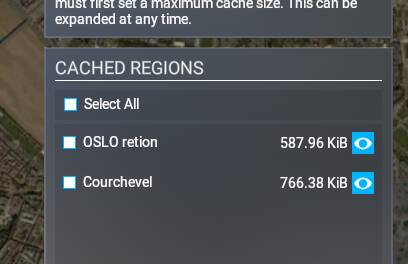
I tried to make a manual cache of OSLO region aswell as a few other select “tiles” of Norway and France.. However, the cache files are only a few kilobytes…
I thought that these cache files were pre-downloading all of the Bing imagery for me? So that it can be used “offline” should one lose internet connection? So why are they only a few kilobytes, and what’s the point of setting maximum “manual cache gigabyte limit” when the cache files are 2kb?
Also, why can’t I have roaming at the same time as manual cache? I would assume that I could “live stream” the rest of the world, whilst my OSLO and other cached areas are pre-cached?
When you use the manual cache feature, there are different levels of data collected depending on your zoom level of the are you are caching. If you zoom way in you will get very detailed information and huge download of data, but if you cache from maximum range (zoomed out) it will only collect general data about the cached area resulting in a smaller download.
The trouble with using the manual cache feature to get maximum detail, is that a. it will take you forever to to highlight any large areas you want to cache, and B. take forever to download the data.
Also that feature seems to not work from update to update, so it worked for say su4 but then became broke at su 5, and I think they have fixed it again Im not sure.
Thanks, but it really doesn’t answer my questions. Why are they only a few kilobytes? even at it’s worst, every tile would be at least 5gb, even at zoom level 16 (because sattelite photos takes a lot of space, even at bad quality, I know this from XP11 scenery making).. This makes no sense why they are two kilobytes each.. And it’s not possible to use automatic and manual cache at the same time, which is strange, because right now I have manual cache, and it should have downloaded OSLO with many gigabytes, but it’s only 2kb… If I fly in Nepal, I can still see photoscenerey, even with automatic/roaming cache set to “forced off” (because I have manual cache activated).
Its quite possible we’re in one of the ‘not working’ cycles. Did you file a response to zen desk maybe they can answer your question better. Like I said when its working and you zoom way in to define the cache, it makes a big file, if your zoomed way out the file is small. Zoom level seems to equate with how much detail / data the cache holds…
If you create the cache while zoomed out, you can cover a really large area with very little space requirement. As you zoom in and get to the higher LOD in the cache map screen, it will increase in size. There are 3 levels of cache detail. WHen you’re on the highest level, your cache even for a small-ish area could potentially be 10s of gigabytes.
This has been tested deeply and it does little to nothing other than download photogrammetry so that if your internet drops you can still see the PG , it does nothing else. It does not improve frames, loading times, performance nothing. It is meh at best.
@creativeslime Are you even reading my post? I’m saying that these cache files are 2kb maximum. It downloads nothing, no photogrammetry and no sattelite photos, that’s why I’m asking for someone to explain to me what’s going on here.
@Crunchmeister71 No it was not answered. I’ve selected a wide area of the whole city, soomed all the way in. It should download high quality photos, but the cached files are 2kb top. KILOBYTES, not gigabytes. Not even after flying over these areas does these cache files rise in size.
First, it must be clarified whether Oslo has photogrammetry in the MSFS.
I have not found anything on this. If Oslo has no PG, the manual cache
download is is very low, because there is nothing to download.
Correct. The ground tiles are stored in the rolling cache when you fly over them.
These can also not be preloaded manually. This has been verified by often enough.
This is also what @kreativeslime wanted to tell you above.
If you create a manualcache.ccc, you can preload photogrammetry of specific cities.
If you don’t create one, the PG will be saved on the fly in rollingcache.ccc.
Which cities have photogrammetry, you can see here:
However, I cannot judge how complete the lists are. New cities are added with each World Update.
Try it out. Manually load the area of a city that definitely has PG in MSFS (London, New York etc) and manually load a city that definitely does not have PG.
In a way it is possible to create your own by using the rolling cache and flying a grid pattern (I think with a drone also works). After your flight close the sim and rename your rolling cache before setting up a new one again and if you want to return to the same place or city it’s just a reverse procedure. I haven’t tested if it works offline but I can’t see why not.