Hello, i have implemented the following ILS at LFRZ :
		<Ils lat="47.30912763326678" lon="-2.16437780404925" alt="1.11842171009630" heading="253.5" frequency="108.50" magvar="0.0" ident="MT" width="5.0" name="ILS RW25">
			<GlideSlope lat="47.31412162573031" lon="-2.13786580101335" alt="1.49877828173339" pitch="3.0" range="10.0N"/>
		</Ils>
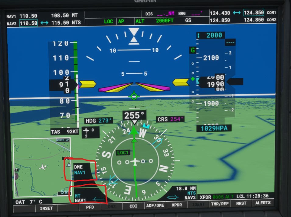
It works well to land but it doesn’t provide distance to the aircraft when using DME instrument do you know why ? On the attached screen you can see NTS (VOR DME) where the distance is readable on NAV2 bottom right and MT( LOC DME) where the distance is not readable nor in NAV 1 or DME ? any Idea of how to correct this ?
If you look in “bglcomp.xsd” in your “…Tools\bin” folder you´ll see that an Ils (type ctIls) accepts a Dme as a child element (in type grpsIlsChildren). I assume that you must explicitly add it (since not all Ils have an attached DME, I think).
1 Like
@cgbFlight thanks for this hint I will investigate.
Indeed it was the solution : I miss a “Dme” attribut which solve this , thanks a lot for your help.
	    <Ils lat="47.30912763326678" lon="-2.16437780404925" alt="1.11842171009630" heading="253.5" frequency="108.50" magvar="0.0" ident="MT" width="5.0" name="ILS RW25">
			<GlideSlope lat="47.31412162573031" lon="-2.13786580101335" alt="1.49877828173339" pitch="3.0" range="10.0N"/>
			<Dme lat="47.30912763326678" lon="-2.16437780404925" alt="1.11842171009630" range="30.0N"/>
		</Ils>
1 Like