[In Development] Hadrian's Wall 180AD

New developer Time Machine Designs is excited to announce the development of our first scenery addon for MSFS.

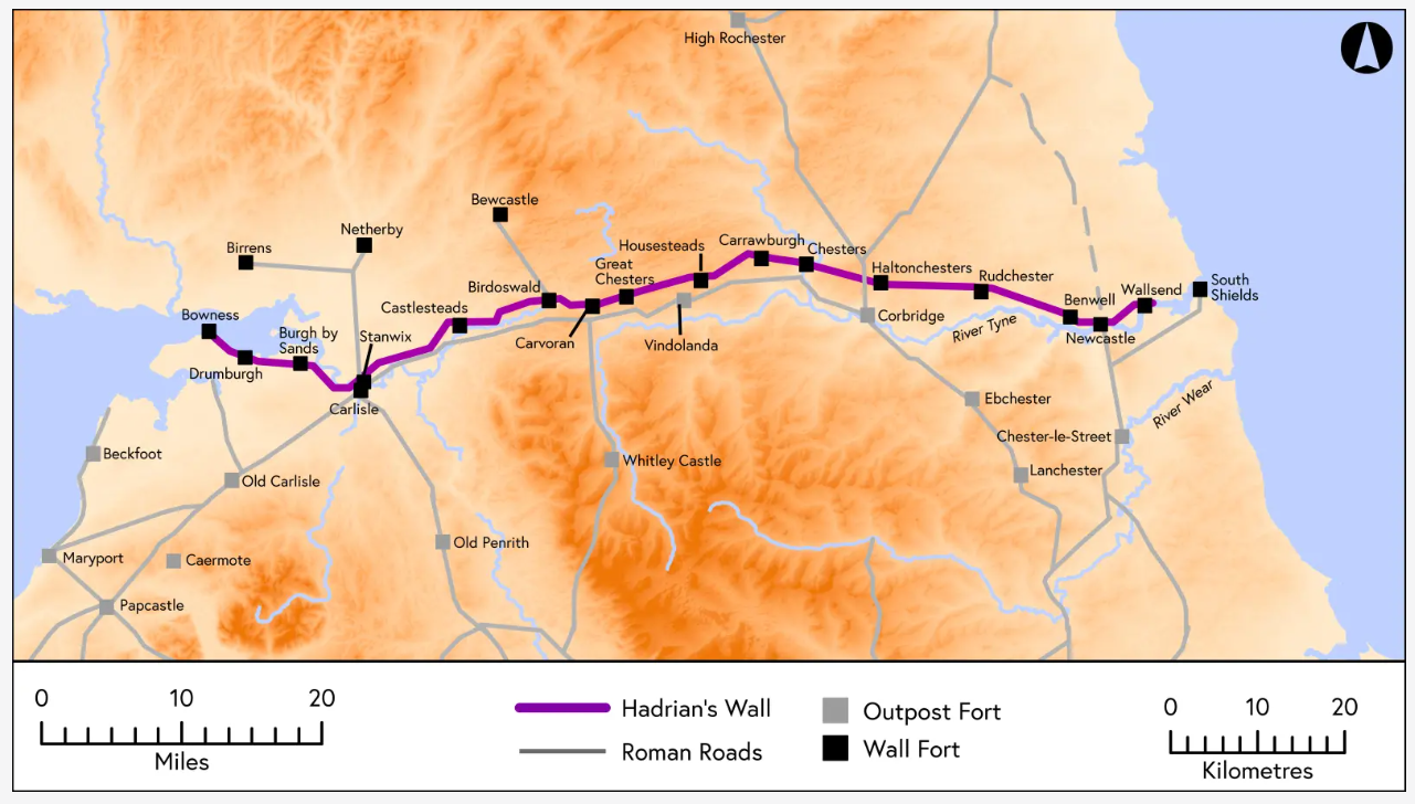
“Hadrian’s Wall 180” reconstructs the great Roman wall that stretches east to west across England as it appeared in the year 180AD / CE.

Our addon will allow simmers to experience the world’s first complete reconstruction of the entire Hadrian’s Wall system as it appeared at its peak.

Using individually modelled structures from ovens to fort HQ buildings we will bring you:

  • 73 miles of wall
  • 140 miles of earthworks and obstacles
  • 152 turrets
  • 78 Milecastles (small forts)
  • 18 complete legionary forts with villages
  • 4 bridges
  • The complete Roman town of Coria (Corbridge)
  • Each structure accurately placed according to the available data
  • Retextured landscapes to remove modern towns, roads, buildings and quarries

The entire system is being modelled using the latest archaeological and historical research and in future posts we will tell you more about the unique partnership behind the project.

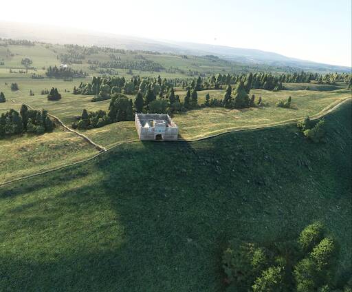
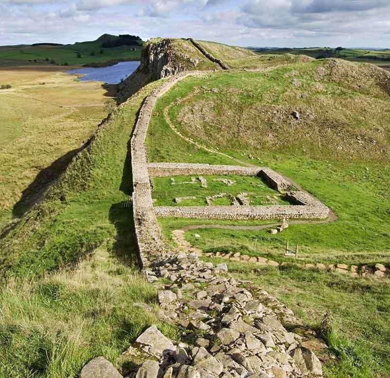
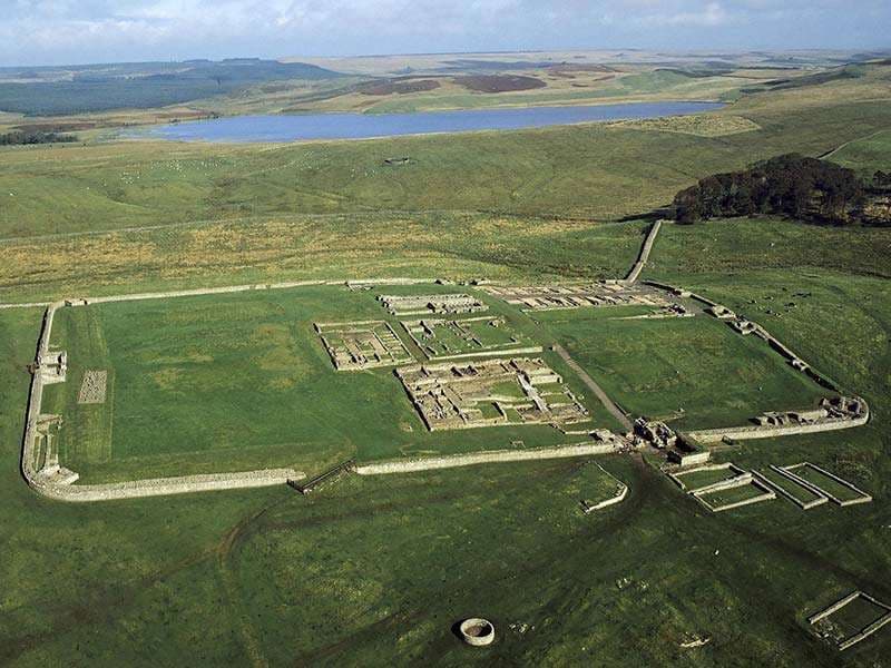
For now though, here are some initial work in progress shots.

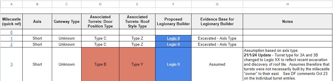
From the desk research - mapping of milecastle & turret types

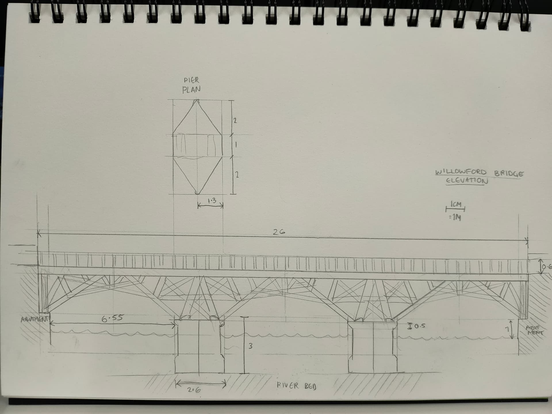
Technical drawing of the Willowford Bridge

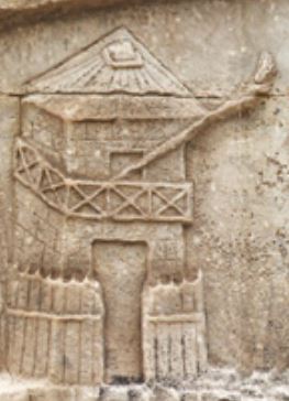
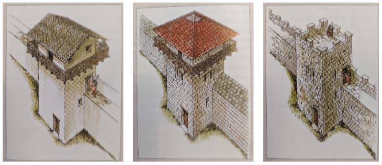
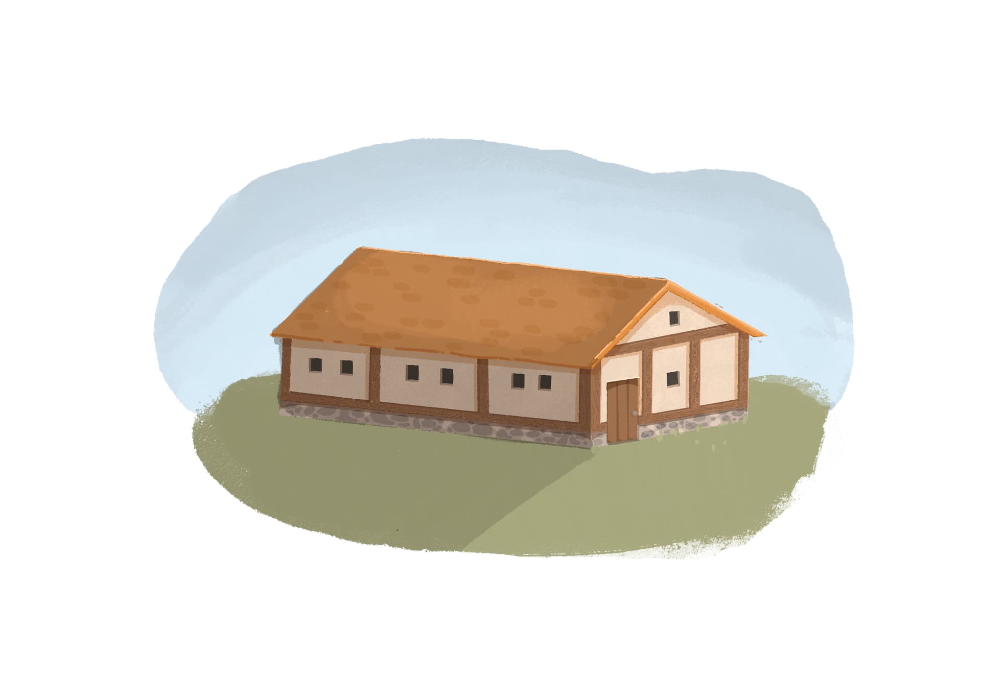
Early concept art for a village house
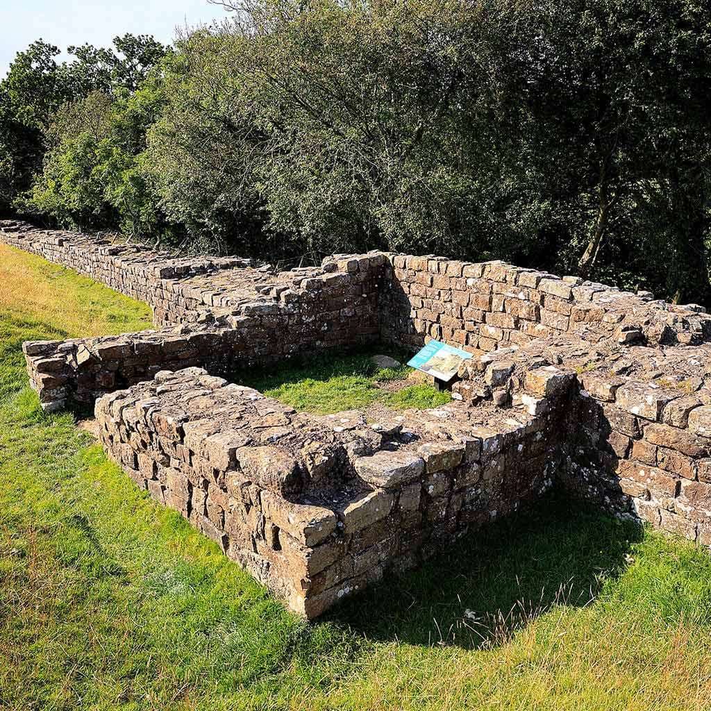
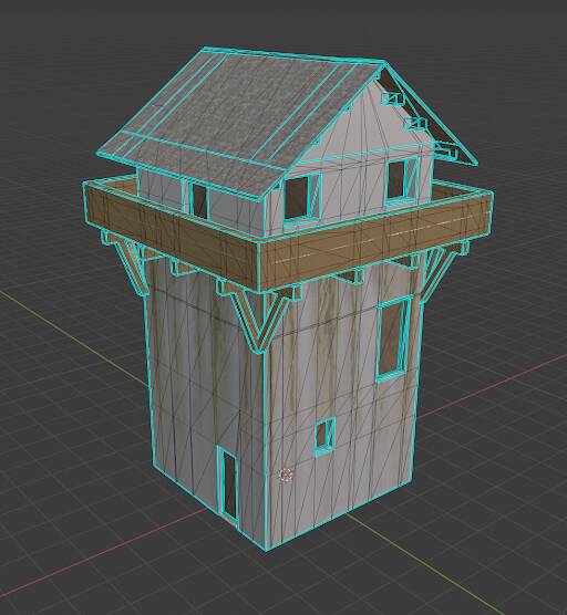
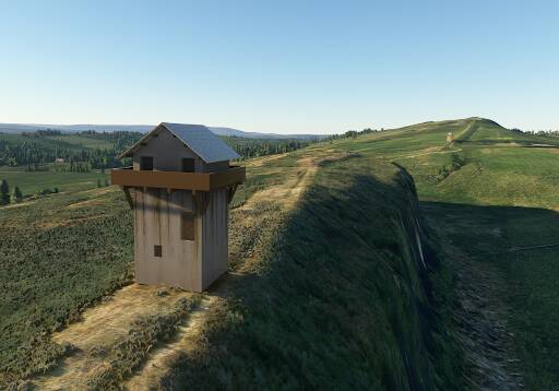
Milecastle 42 model

Wallsend Fort (Segedunum) model

We look forward to bringing you more updates as the project progresses.

19 Likes

Is this available for Xbox?

Very excited to be part of this!

1 Like

Having walked along much of it, I’m looking forward to seeing the finished product.

Vedi vidi vinci and onwards and upwards.

2 Likes

That is absolutely our intention - I am waiting for the MSFS accreditation process to complete so we can get it into the Marketplace for you all.

Will keep you posted on progress!

2 Likes

Thank you a great addition living close to the scenery

1 Like

And a test for placing Milecastle 40 in its position along the Wall (temporary textures!).

Milecastle 40 Test

7 Likes

That looks and sounds epic man! What an undertaking. :heart:

1 Like

Thanks! You know what they say, go big or go home! :smiley:

1 Like

Hope you add the Sycamore Gap tree as well! Seriously though, a great initiative.

3 Likes

As it happens the in-sim sycamore tree was on the list for removal as it was only 300 years old - but I promise we had nothing to do with the real one being cut down being cut down!

Three of us were up at the Wall on a research trip a couple of weeks before the vandalism happened and walked along the ridge to the sycamore taking milecastle measurements. It has been strange to think that we were some of the last people to see the tree, whilst we were working on the project.

2 Likes

Obviously the answer is it was shot up during a practice ground attack mission by units of the Roman Army Airforce… Here we see Marcus Lucius “Parva Avis” Quintus, a Flight-Centurion in the IVth Ala of the squadron serving with the XXth Legion, waiting to take off on an air mail flight with wax tablets for Vindolanda :slight_smile:

12 Likes

@FlightSimmer676 :rofl: Absolutely brilliant!

I have been wondering what kind of livery we could come up with for flights along the wall - now we know. It’s on the list!

Clearly, this map is wrong…

5 Likes

Every school kid knows that all airways lead to Rome.

Accurate rendering on the north facing doors of Milecastles should include engraved letters, correctly conjugated:

image

3 Likes

… a hundred times.

:rofl: :rofl:

2 Likes

Funnily enough, if you look closely you might just find some sentiments left by the locals, though not necessarily correctly conjugated…

2 Likes

For our first weekly update we thought it might be helpful to explain a little more about Hadrian’s Wall for anyone unfamiliar with it.

The Wall might be better described as a “system” comprising fortifications, access points and settlements.

Construction began 122AD/CE by order of the Roman Emperor Hadrian and defined the north-western border of the Roman Empire. The area beyond it was populated by tribes who were not assimilated into the Roman Empire.

The Wall itself stretches for eighty Roman miles, running coast to coast across England from Bowness-on-Solway in the west to Wallsend in the east. It is thought that three Legions were involved in its construction, each varying the design of specific elements.

The Wall was punctuated every mile by milecastles (small forts) which were built with gateways on their north and south sides.

This level of access from the territory to the north may suggest that the Wall was also originally designed to allow the controlled movement of people and trade, as well as presenting an uninterrupted barrier and allowing Roman troops to easily pass through to the north.

Two square turrets were then built at intervals of one third of a Roman mile between the milecastles, providing uninterrupted observation.

During the building of the Wall the decision was taken to construct larger forts on the Wall line. These were of varying sizes to accommodate garrisons of infantry, cavalry or mixed formations.

By 180AD/CE the system was fully developed, hence the date for our reconstruction. By then villages had formed outside the forts providing services to the units based there and a system of bank and ditch defences (the Vallum) built to the south of the Wall to further control access to the “military zone”.

Our intention is to allow you to fly along the complete system and experience it as it appeared then, complete with variations in buildings and sites.

Two thousand years later stretches of the Wall are still standing and excavations have revealed turrets, milecastles and forts, allowing us to reconstruct buildings and sites.

In future posts we will explain a little more about the various elements as we reveal how they will appear in the sim.

The Roman Empire at its peak

The course of Hadrian’s Wall and its forts

|744px;x423px;

The centre section of the Wall today

The base of Willowford Turret

Milecastle 39 today

Housesteads Roman Fort and village houses

(Photos courtesy of English Heritage)

7 Likes

Cracking post

1 Like

Love this project. Day One purchase for me.

3 Likes

Our focus for this week’s update is the smallest element of Wall, the turrets that sat between the milecastles and forts.

Positioned every third of a Roman mile, 152 were built into the Wall itself.

Whilst many can still be seen, none survive above the first few courses of masonry. However, enough is known to be able to identify three basic designs, distinguished by the different position of their ground floor doors.

There has been much debate about the height and form of the turrets, informed by visual evidence from contemporary sources such as Trajan’s Column in Rome and by reconstructions in Germany and at Vindolanda, on the Wall.

We have decided to use the three most commonly reproduced designs and allocate one to each of the Legions thought to have built the wall.

These are

  • Two floors with an open roof platform, assigned to Legio II
  • Three floors with a balcony & pitched roof, assigned to Legio VI
  • Three floors with a balcony & pyramidal roof, assigned to Legio XX

Each turret is located according to either its known or calculated position. In the case of Turret 3A, it was only discovered in 2022.

Whilst we cannot know the actual designs used and attributions, this does mean that we can offer you a view of how the turrets may have appeared and visual clues as to whose “sector” you are flying over.

A turret with signal beacon from Trajan’s Column

Turret, Trajan's Column

The three turret designs we are using

Tracking the turret designs & attributions

Technical drawing

Turret drawing

Pitched roof turret model

Turret design

Testing Turrets 39A & 39B in sim (temporary textures)

Turrets 39A & 39B

7 Likes