I know there are not screenshots per se but I still would like to share them. I use Flight Events to record these flight tracks. I try to use real-world routes as much as possible, but in certain cases — domestic flights in China for example, they use unpublished internal airways — I can only approximate. For planning I use SimBrief / Navigraph.
I have always loved watching these moving maps on the flights as the airplane moves little by little towards the destination - I am not sure what it is but it really calms me in a way. ![]()
These are the ones I did in the past few weeks
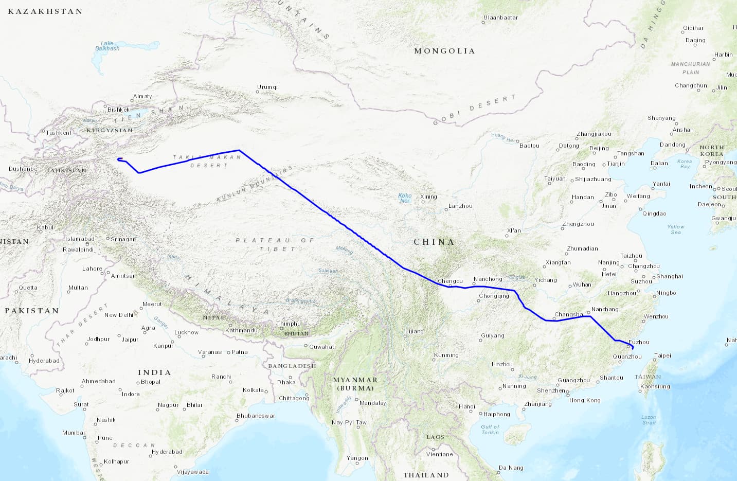
Fuzhou FOC/ZSFZ — Kashgar KHG/ZWSH
New York JFK/KJFK — Honolulu HNL/PHNL

Beijing Daxing PKX/ZBAD — Phuket HKT/VTSP

Shanghai Pudong PVG/ZSPD — Pyongyang FNJ/ZKPY

Shanghai Pudong PVG/ZSPD — Tel Aviv TLV/LLBG

Chengdu Tianfu TFU/ZUTF — Fuzhou FOC/ZSFZ

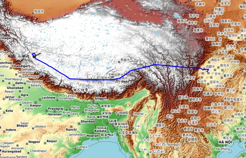
Chengdu Tianfu TFU/ZUTF — Shiquanhe Ngari Gunsa NGQ/ZUAL