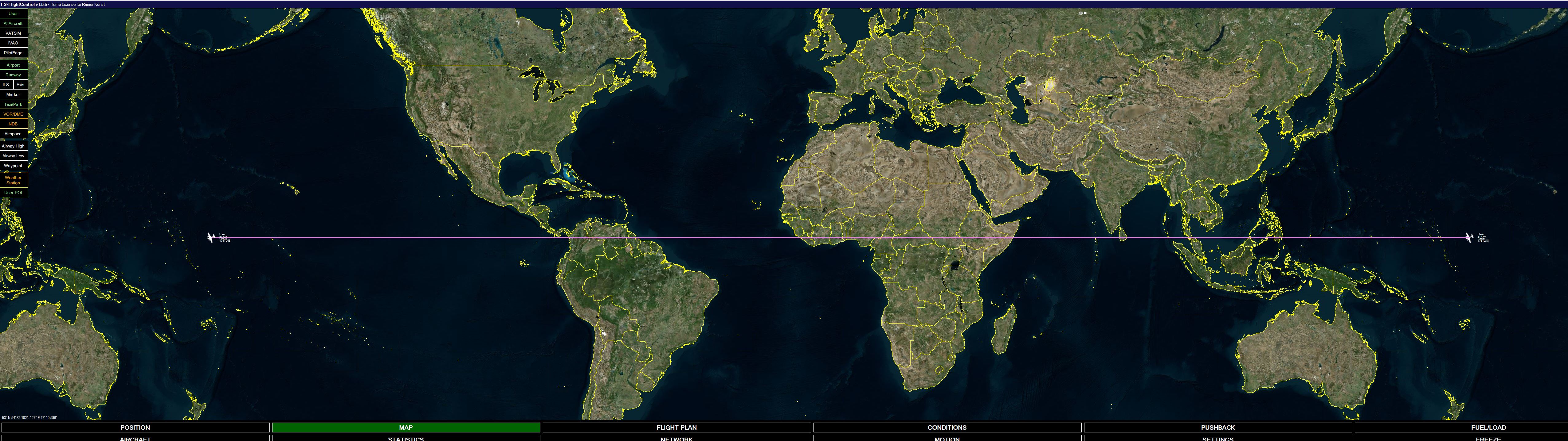
I didn’t really want to believe it, but now I have the optical proof.
I placed in the air at -179 degrees and flew west.
Then I switched on Tracing in FS Flight Control and waited. Exactly at the date boundary I was beamed once around the world.
Thanks to my large 49 inch monitor, I can also display this:
Suddenly the whole path was faded in. What a visual voodoo this is with the MSFS. Far from reality and it happens with every flight plan. But here I can fully recreate it.
Copernicus put it better 500 years ago.
I’m already waiting for Ship AI, which will then be hurled once around the globe at lightning speed.
No in the coordinate system MSFS flight simulator is using the world is a disk. like in any coordinate system.
it would be a disc when you can’t fly from -179 to 1.
(also your software for showing your route can have an issue with this)
No the FMS shows the same Path, there is no issue. That’s where it was first noticed. This is simply a completely wrong implementation and does not occur in any other sim.
Is there a graphical thing in the sim that happens when you cross the W180 line? Can you take a screenshot or a video showing any physical or visual artefacts of this transition?
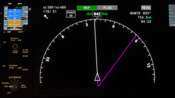
I’ve noticed that with any route that crosses the dateline. On the nav displays the magenta line goes up to the line, then seems to shoot backwards across the globe wrapping around to the other side of the dateline. I assumed it was just a limitation of the way the coordinate system was designed.
I tested this using a King Air out of HI99 to ROAH. I used LNM to monitor my progress. The only issue I saw was that the flight plan did not cross the International Date Line. The aircraft did not transport around the world and LNM traced my progress across the boundary as normal. However, after crossing the boundary, the flight plan flipped to show as if I had flown in from the other side of the world.
I don’t know how a real Garmin behaves on the date line, but it is likely an issue with the avionics implementation.
Your flight path follows pretty exact the equator.
Try, for example, a flight from Sydney to Amsterdam.
Also take in consideration that the world isn’t flat but almost round.