Incorrect land elevation ESNZ, ESJA


ISSUE DESCRIPTION

Description of the issue:
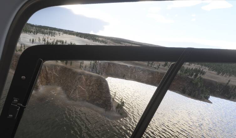
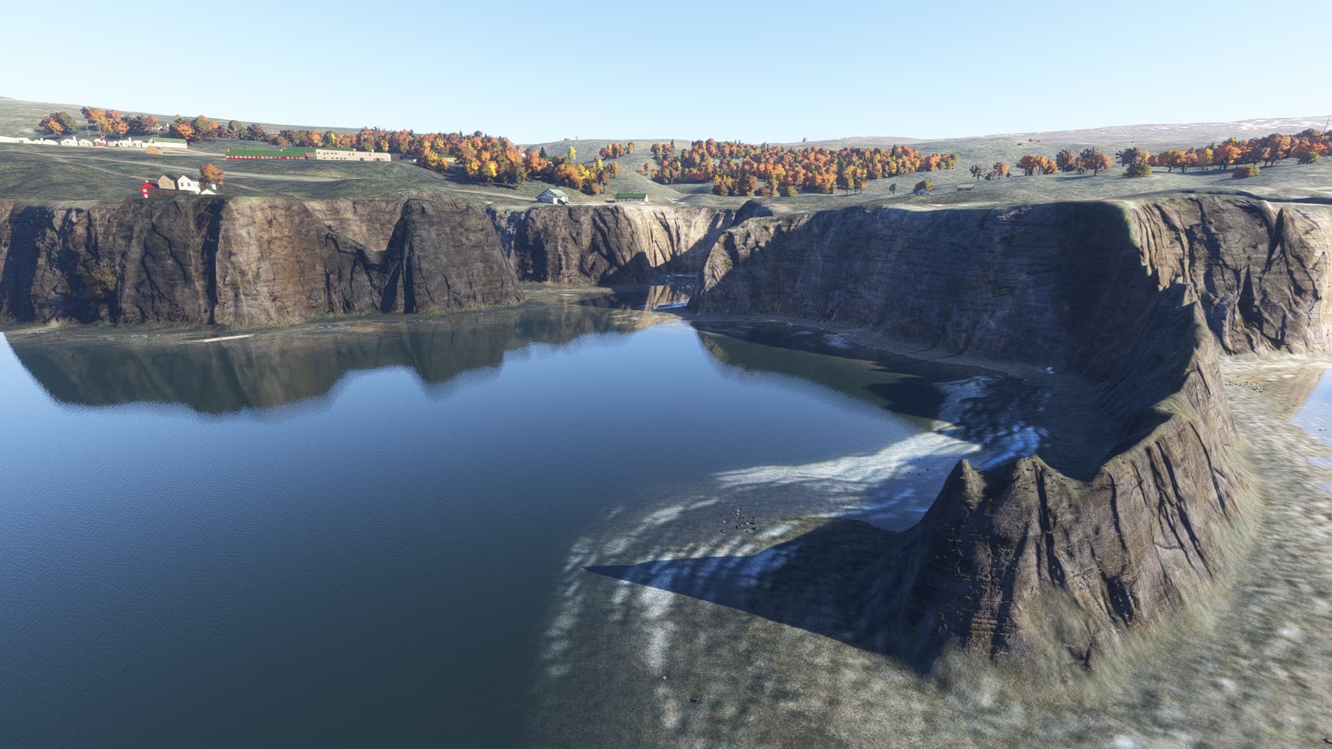
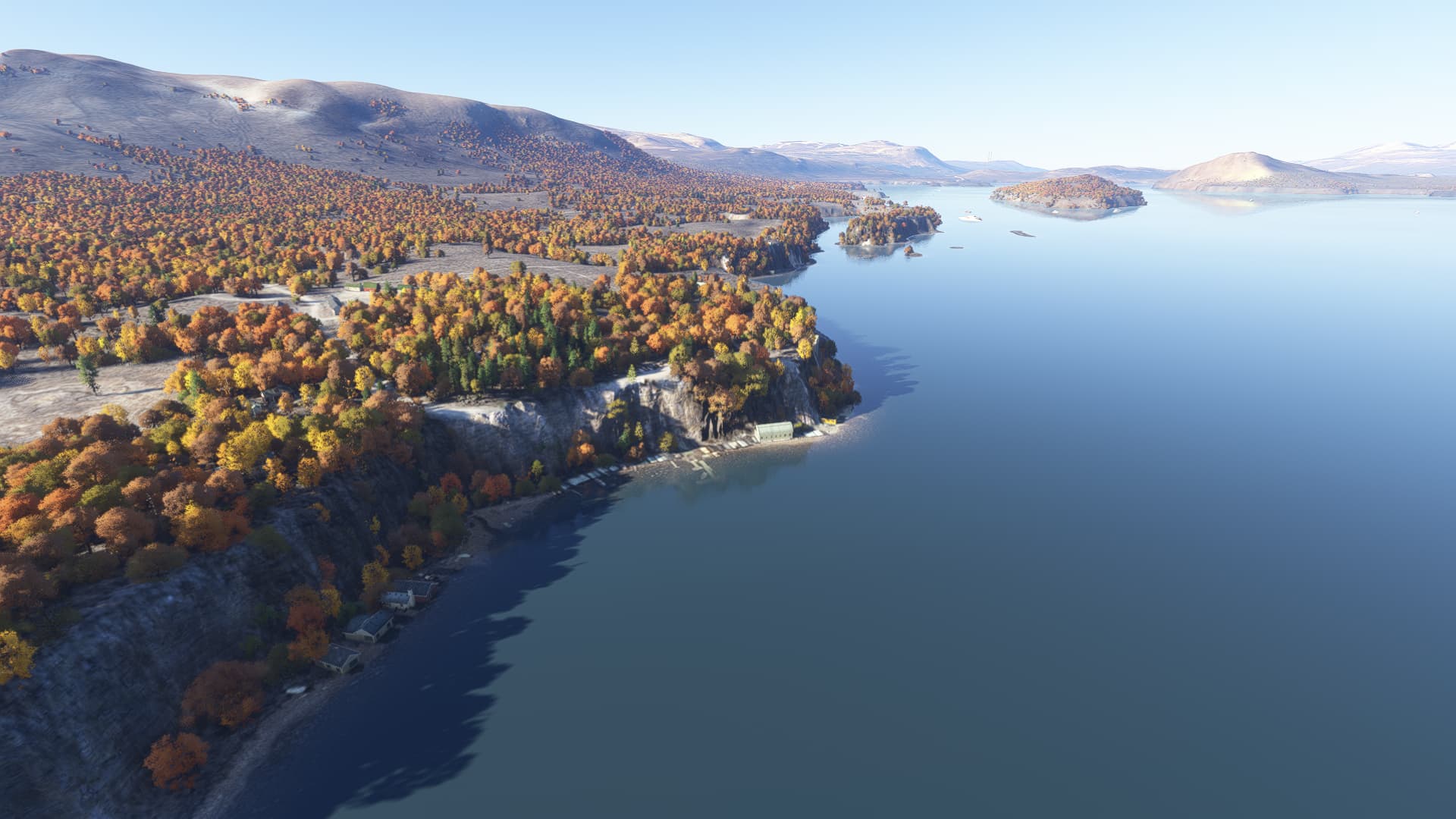
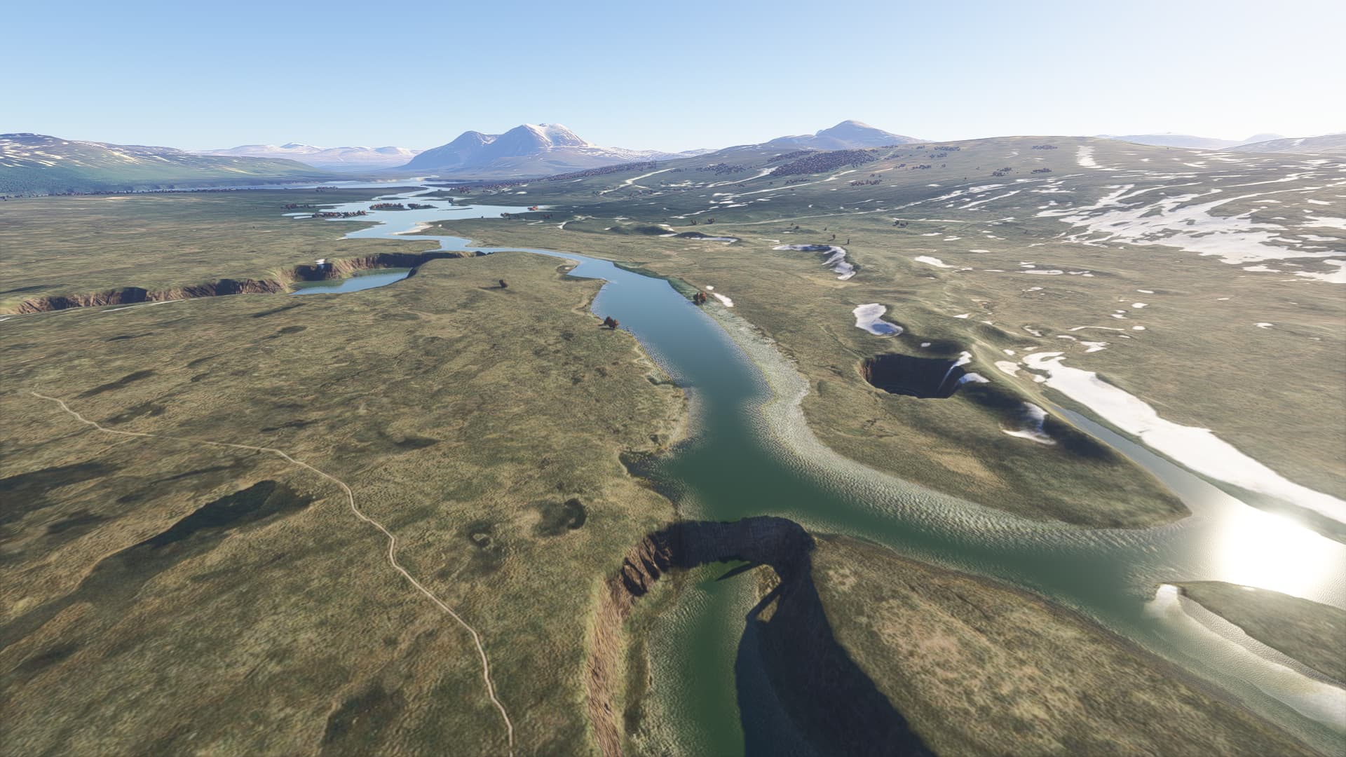
Incorrect land elevation.

ICAO, coordinates, or specific location:
ESNZ, 63.19466167347332, 14.49969262565085 and nearby land areas and islands within Frösön, Rödön and Storsjön (large lake). Same problem at ESJA, Åre Molanda, on the west side of the lake.

Impossible to make ILS approach to RWY 12. Impossible to make a safe take-off RWY 30.

[PC Only] Did you remove all your community mods/add-ons? If yes, are you still experiencing the issue? Yes.

FREQUENCY OF ISSUE

How often does this occur for you (Example: Just once, every time on sim load, intermittently)?
Every time

REPRODUCTION STEPS

Please list clear steps you took in order to help our test team reproduce the same issue:

  1. Restart PC
  2. Clear Community
  3. Reinstall MSFS 2024

YOUR SETTINGS

If the issue still occurs with no mods and add-ons, please continue to report your issue. If not, please move this post to the User Support Hub.

What peripherals are you using, if relevant:
I have tested with only mouse and keyboard connected. No improvement.

[PC Only] Are you using Developer Mode or have you made any changes to it?
No, no changes,

[PC, MSFS 2020 Only] Are you using DX11 or DX12?

[PC Only] What GPU (Graphics Card) do you use?
Nvidia GeForce RTX 4090 24GB.

[PC Only] What other relevant PC specs can you share?
64 GB RAM
Intel Core i9 13900K 5.8 GHz

MEDIA

[END OF FIRST USER REPORT]


:loudspeaker: For anyone who wants to contribute on this issue, Click on the button below to use this template:

Do you have the same issue if you follow the OP’s steps to reproduce it?

Provide extra information to complete the original description of the issue:

If relevant, provide additional screenshots/video:

Do you have the same issue if you follow the OP’s steps to reproduce it?
• yes, similar around Idre airport, ESUE

Provide extra information to complete the original description of the issue:
• Elevation of lakes do not match elevation of land areas, northwest of ESUE

If relevant, provide additional screenshots/video:

It is still the same problem with the elevation that I reported earlier at ESNZ. However, after SU 2, it is now possible to make ILS approaches to runway 12.

Do you have the same issue if you follow the OP’s steps to reproduce it?

Provide extra information to complete the original description of the issue:

If relevant, provide additional screenshots/video:
• It is still the same problem with the elevation that I reported earlier at ESNZ. However, after SU 2, it is now possible to make ILS approaches to runway 12.

ISSUE DESCRIPTION

Flying in Swedish mountain area shows all lakes and rivers at least 50 feet below ground level, creating a big cliff down to the lakes/rivers.

ICAO, coordinates, or specific location: Swedish mountain area, northern parts.

[PC Only] Did you remove all your community mods/add-ons? If yes, are you still experiencing the issue? YES and YES

FREQUENCY OF ISSUE

How often does this occur for you (Example: Just once, every time on sim load, intermittently)?
Ever time

REPRODUCTION STEPS

Please list clear steps you took in order to help our test team reproduce the same issue:

  1. load in to any place with lakes on northern mountain region

YOUR SETTINGS

If the issue still occurs with no mods and add-ons, please continue to report your issue. If not, please move this post to the User Support Hub.

What peripherals are you using, if relevant:

[PC Only] Are you using Developer Mode or have you made any changes to it? NOPE

[PC, MSFS 2020 Only] Are you using DX11 or DX12? MSFS2024

[PC Only] What GPU (Graphics Card) do you use? RTX5090

[PC Only] What other relevant PC specs can you share? I9 13900, 64GB

1 Like

Do you have the same issue if you follow the OP’s steps to reproduce it?
• Yes

Provide extra information to complete the original description of the issue:
•Same issue occurs in the mountains around:

Riksgränsen, Torneträsk, Ritsem, Nikkaluokta, Stora Sjöfallet(ESYMT), Kvikkjokk (ESCEI), Stáloluokta (ESDCG), aswell as in Padjelanta and Sarek national parks.

Interestingly at Riksgränsen there is a visible line of elevation increase going through the border area (see first picture)

If relevant, provide additional screenshots/video:

1 Like