I’m a newbe. Can someone tell me how to interpret the air traffic symbols, etc. on the Garmin 1000nxi? For example -25 and an up arrow (ascending?) and a triangle-like symbol (aircraft direction?). Thanks.
Apparently you’re not such a newbe.
That’s right… the triangle represents the aircraft.
Up arrow it is going up.
Arrow down, she’s going down.
The aircraft altitude shown in numbers can be in relation to your aircraft, for example (+25/-25), that is, it is the relative altitude in relation to your aircraft.
This is a simple way of explaining traffic and its movements.
Working Title made the sim G1000 conform to the real world unit as much as possible. So you may use actual manuals to understand and operate the sim version.
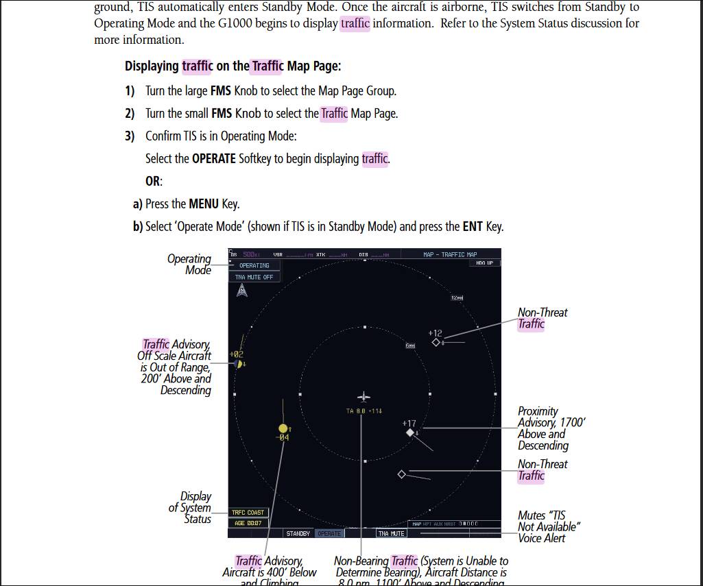
See page 6-69 (screenshot below).
This topic was automatically closed 30 days after the last reply. New replies are no longer allowed.