Navigraph provide(d) Navdata for Kai Tak for P3D, they should have it at hand. I used to fly in there with the PMDG 747 and FlyTampa’s Kai Tak scenery frequently and as far as I remember I didn’t have to put the file back in every time…
Does this mean that everyone on Xbox is going to have the same problem as me?.If so can this be added to the fix list?
At the MM you should be at 762ft AND have visual with the lead in lights AND the runway.
THE IGS guidance AFTER the MM is not relevant because you have already broken right visually or initiated a go around.
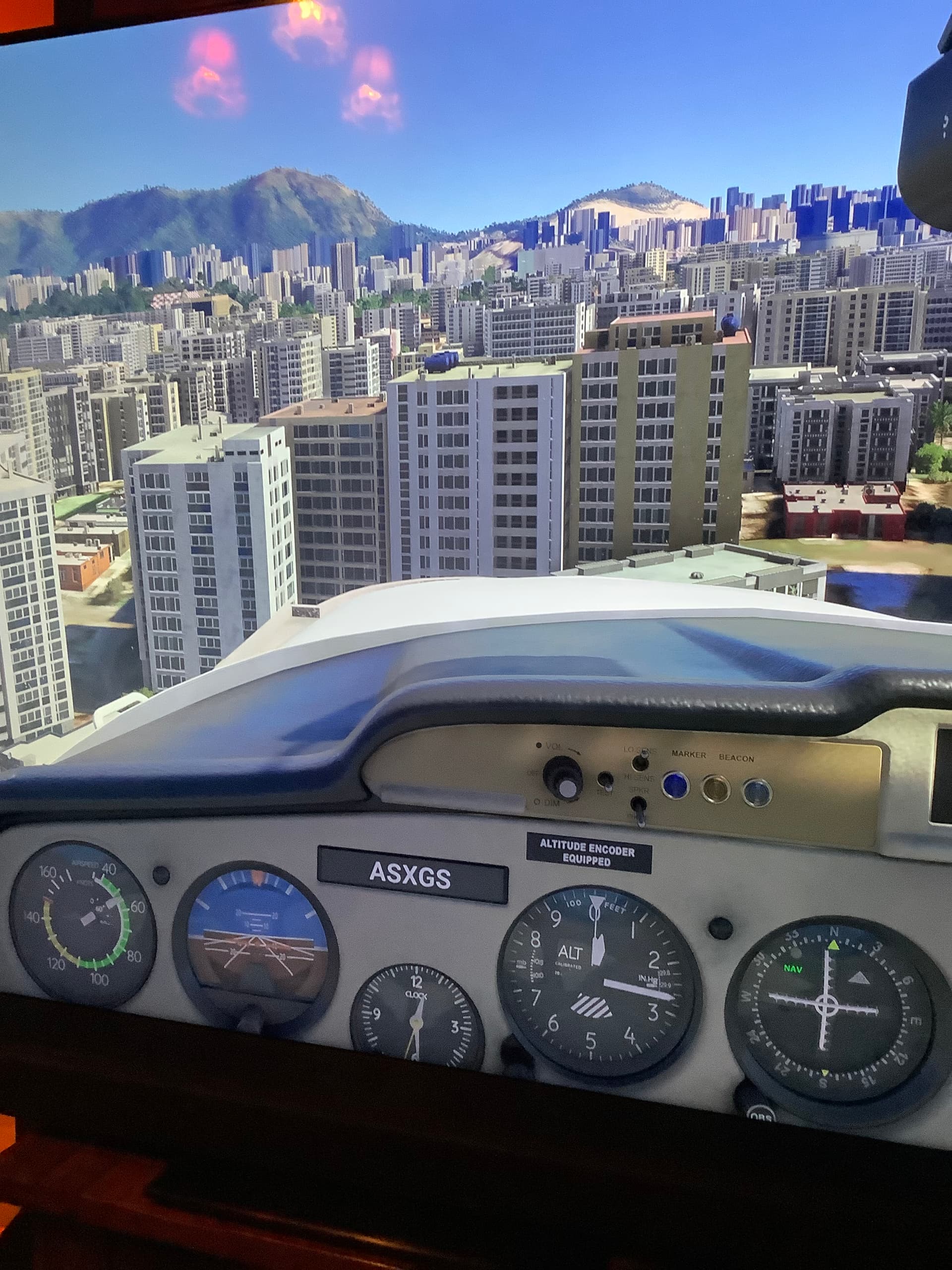
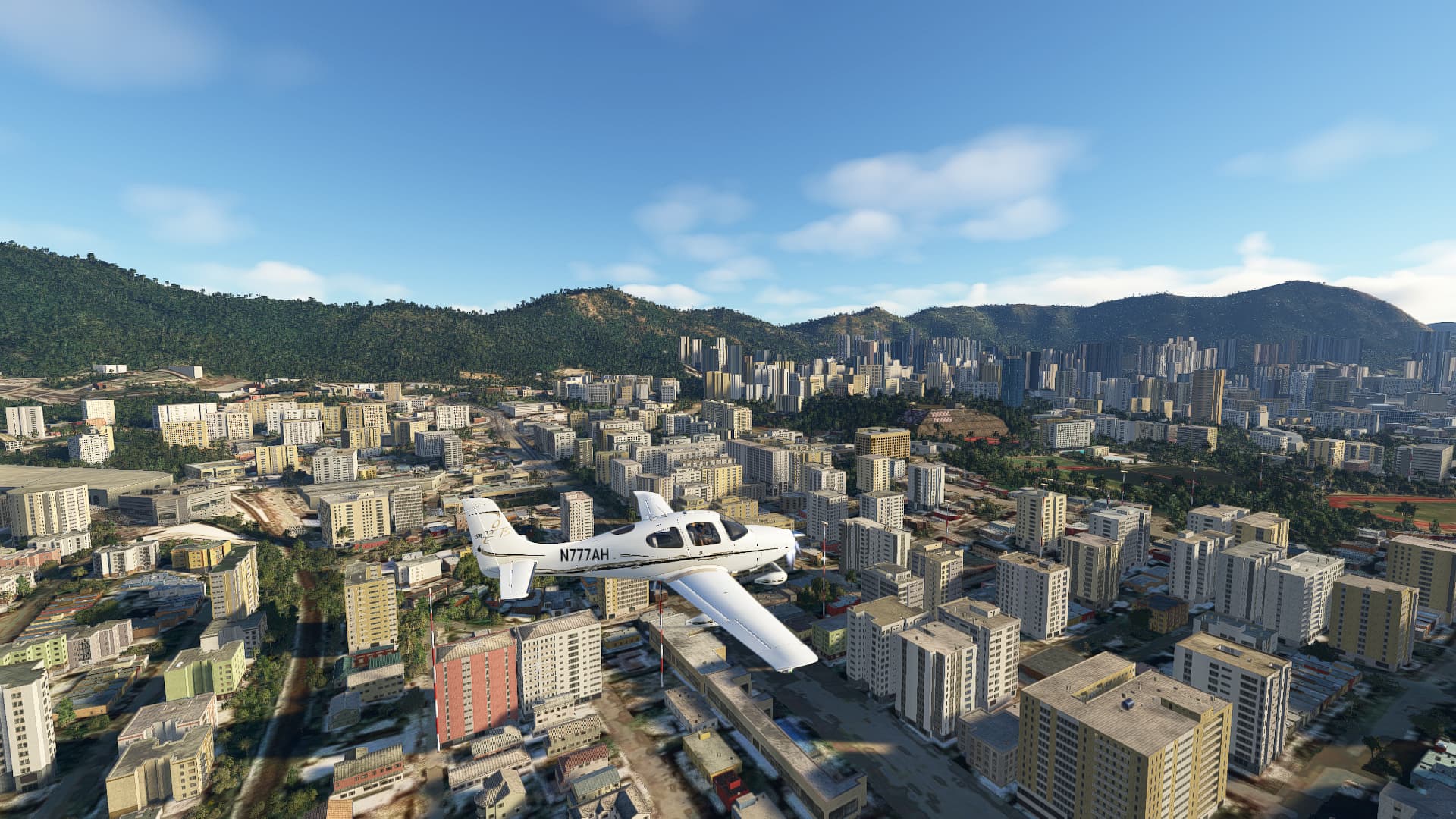
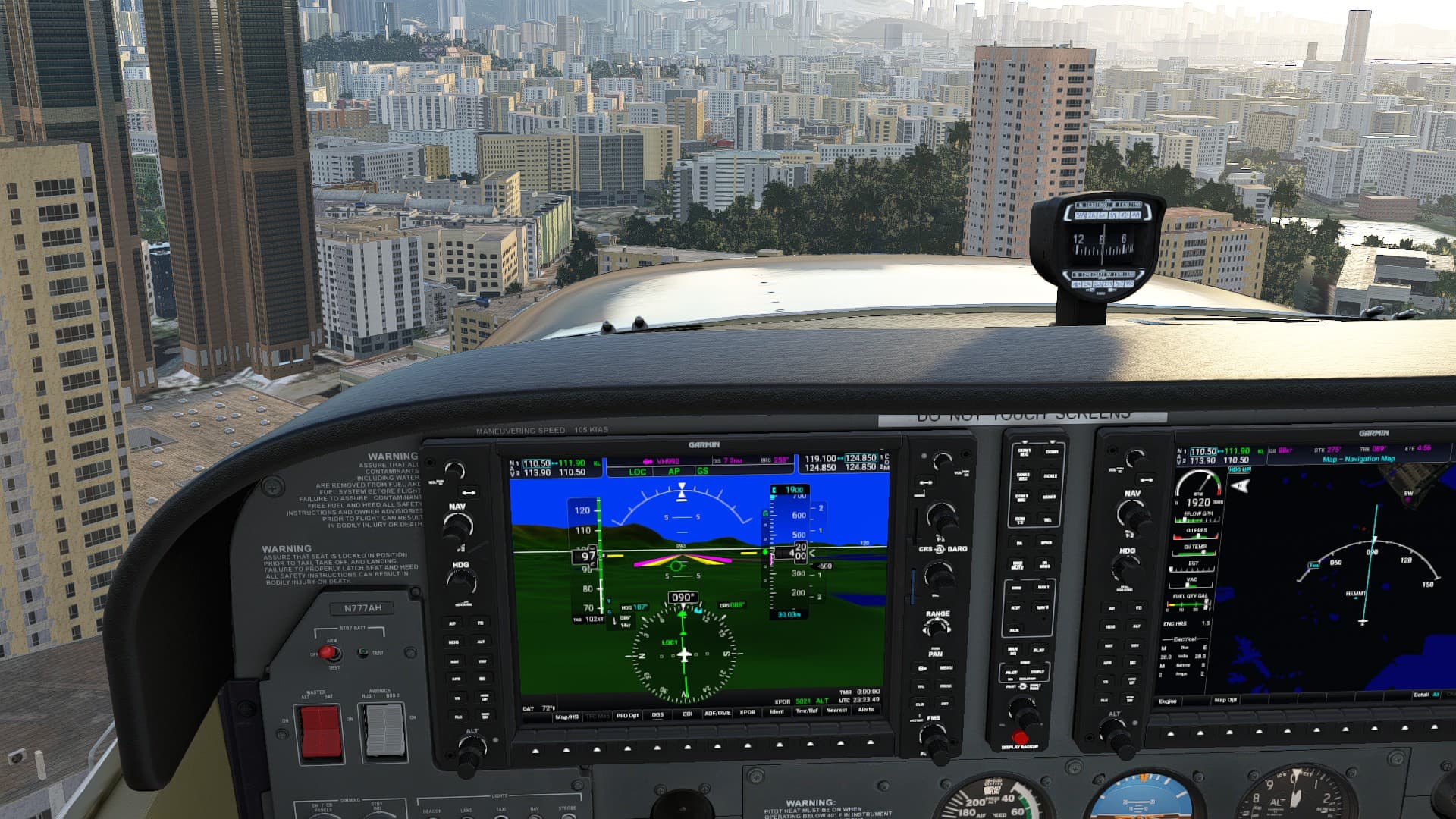
Yup I am aware as I have been happily negotiating Kai tak for many years with Pmdg747 and Flytampa Kai Tak .The issue is that on Xbox the ILS/ IGS / on freq 111.90 is flying 747/ Cessna 152 ( only ones I have tried) into the buildings as the 'beam ’ for glideslope is too low.Does not happen on my now uninstalled Model Instruments Kai tak.The Navdata appears to be faulty on Xbox with the new Kai Tak scenery as per my photo on a previous post.
The IAP actually shows 610’ at MM13 (which is the Middle Marker). Use Little Nav Map to view the Approach that MS programmed into the BGL file.
Here’s a way to eliminate if it’s an XBox specific program. You and I both have access to the SR-22 and now the G1000 NXi. Fly the Instrument Approach using IGS13 all the way from 8,000 feet at CH to the reversal curve down to the airport. Let’s compare results. This minimizes flying technique because the Autopilot will be coupled FOR VNAV most of the way down. I’ll explain that caveat below.
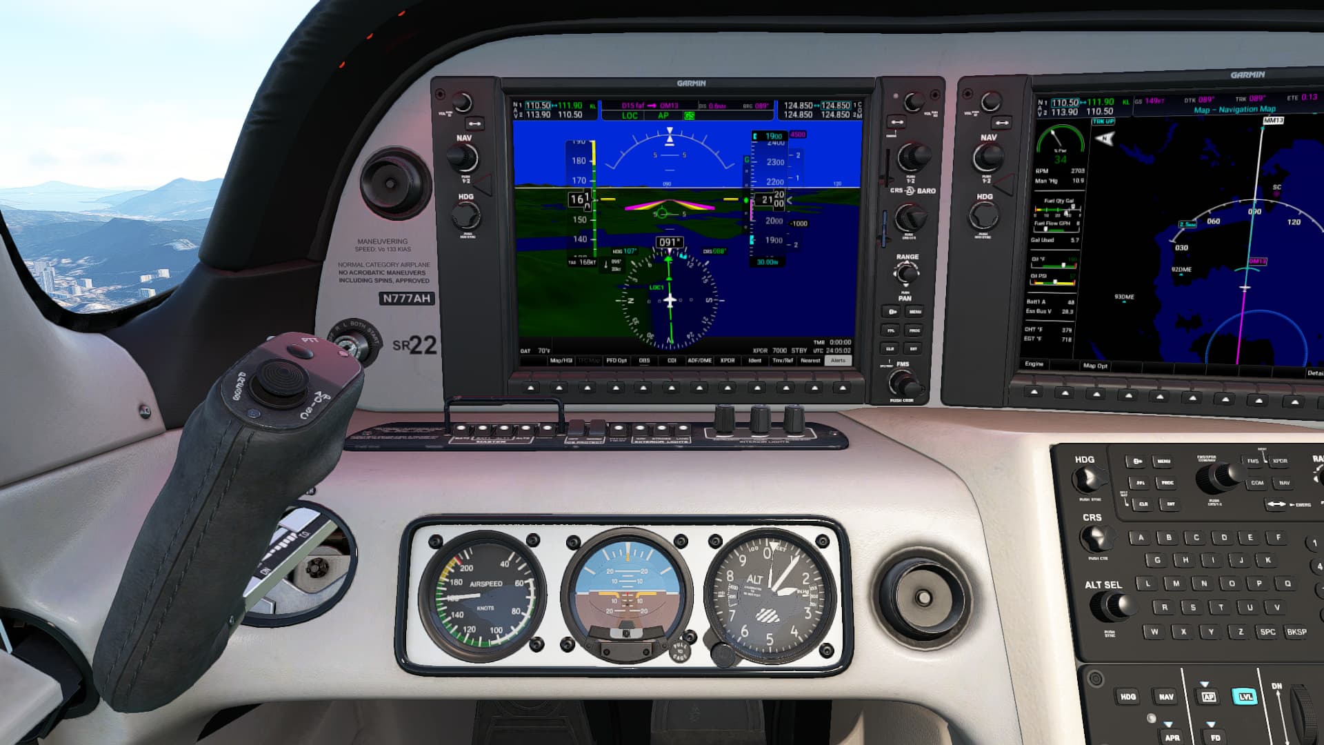
First off - what does IGS R13 look like from a BGL file (which MS built to overlay the airport and define the runways/taxiways/instrument approaches etc.):
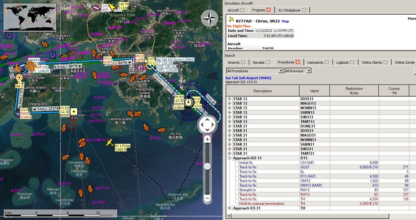
There you go - the vertical fixes are in Tabular format to the right.
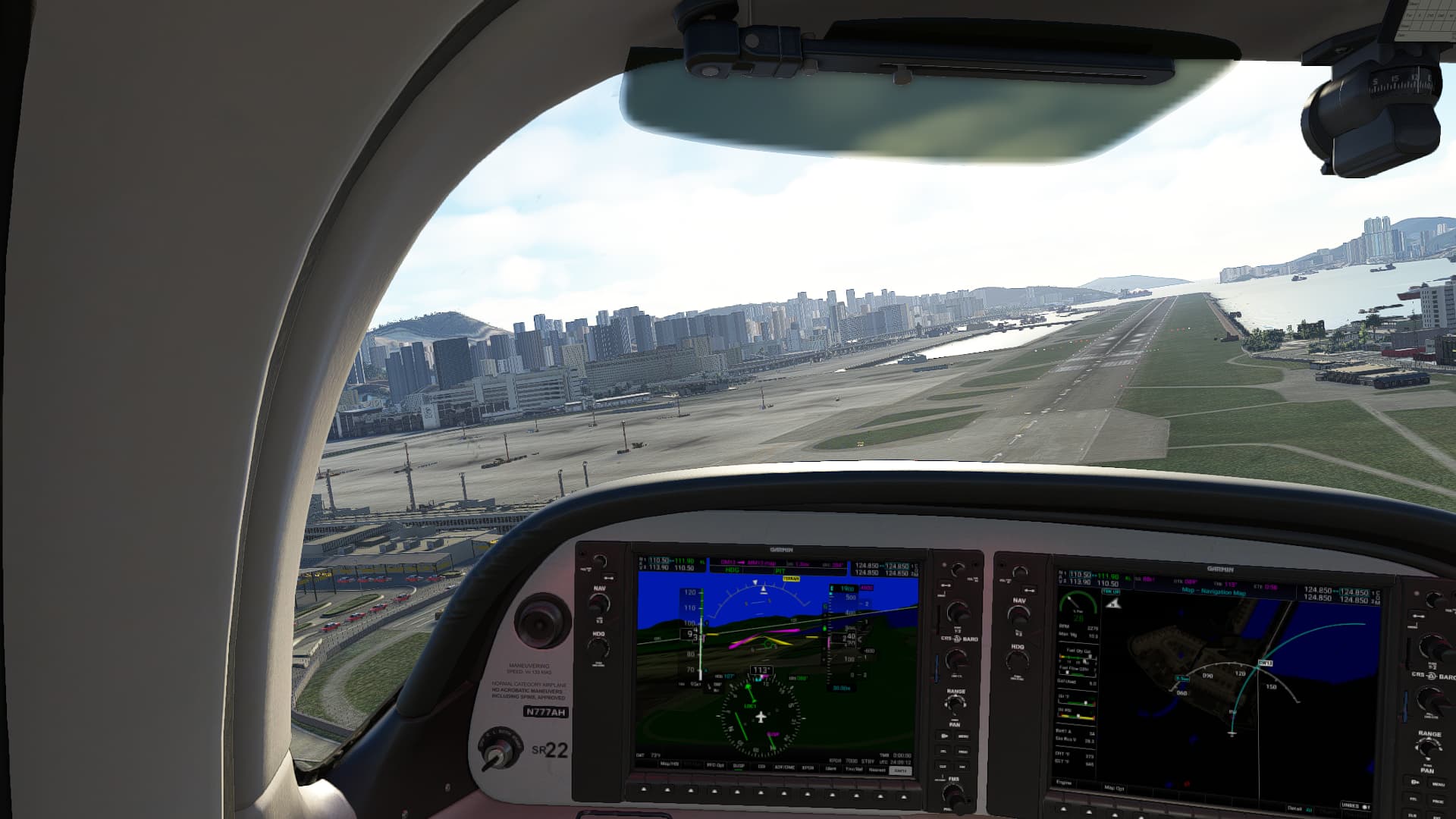
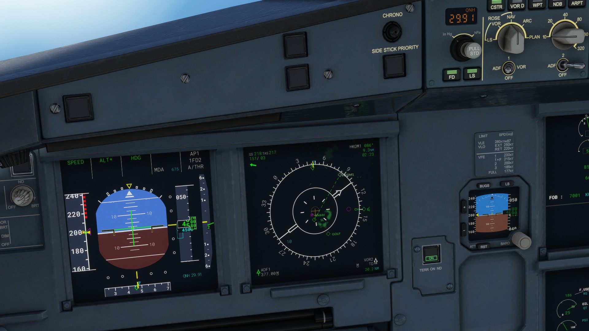
Frequency is indeed 111.90. Note that you are at the D15 FAF before you are in range of the ILS cone pickup - that distance using the built-in utility in LNM is about 5.1NM. That’s part of the Coupled VNAV caveat above.
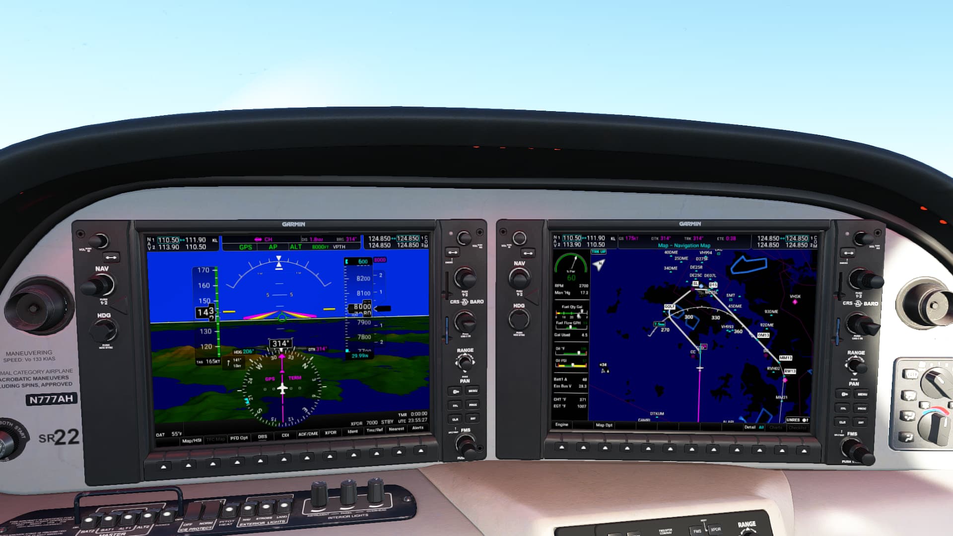
This is the setup just before I arrive at CH: you can see the approach in the MFD is identical to the LNM plate above. I have 111.90 dialed in active on NAV1 and it recognizes the frequency as KL. I’m already at 8000’ so I dial in the target altitude to the lowest allowed clearance on the approach, which is 610’ so I use 600.
I’ll try to keep screenshots to a minimum, but it’s important to note that MOST of the approach is flown under GPS (which is not BaroNAV sensitive - but I keep hitting B anyway since ILS is BaroNav sensitive and I’ll need it later), up until about you enter the ILS cone and are just about adjacent to Discovery Bay.
Intermediate shot: I’m still tracking using VNAV and managing energy through a low throttle for the descent on the GOLF->SL leg. Everything is still working.
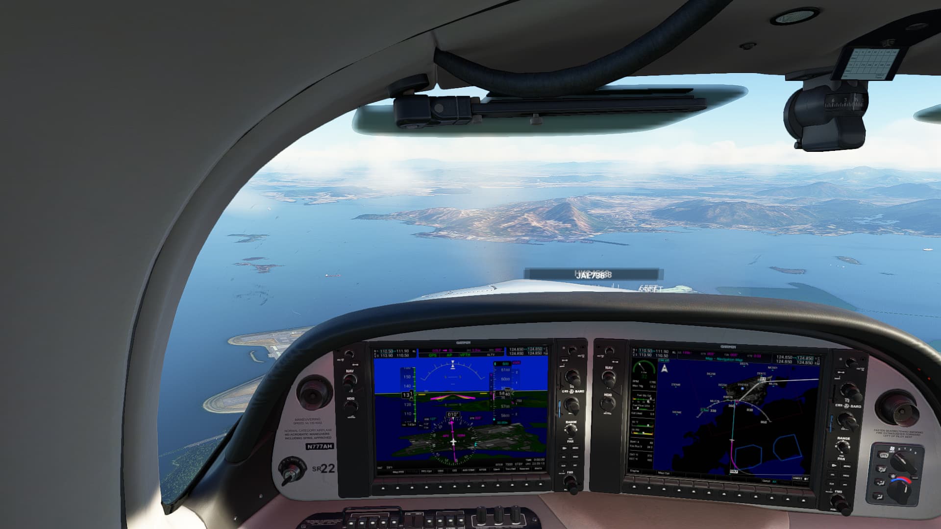
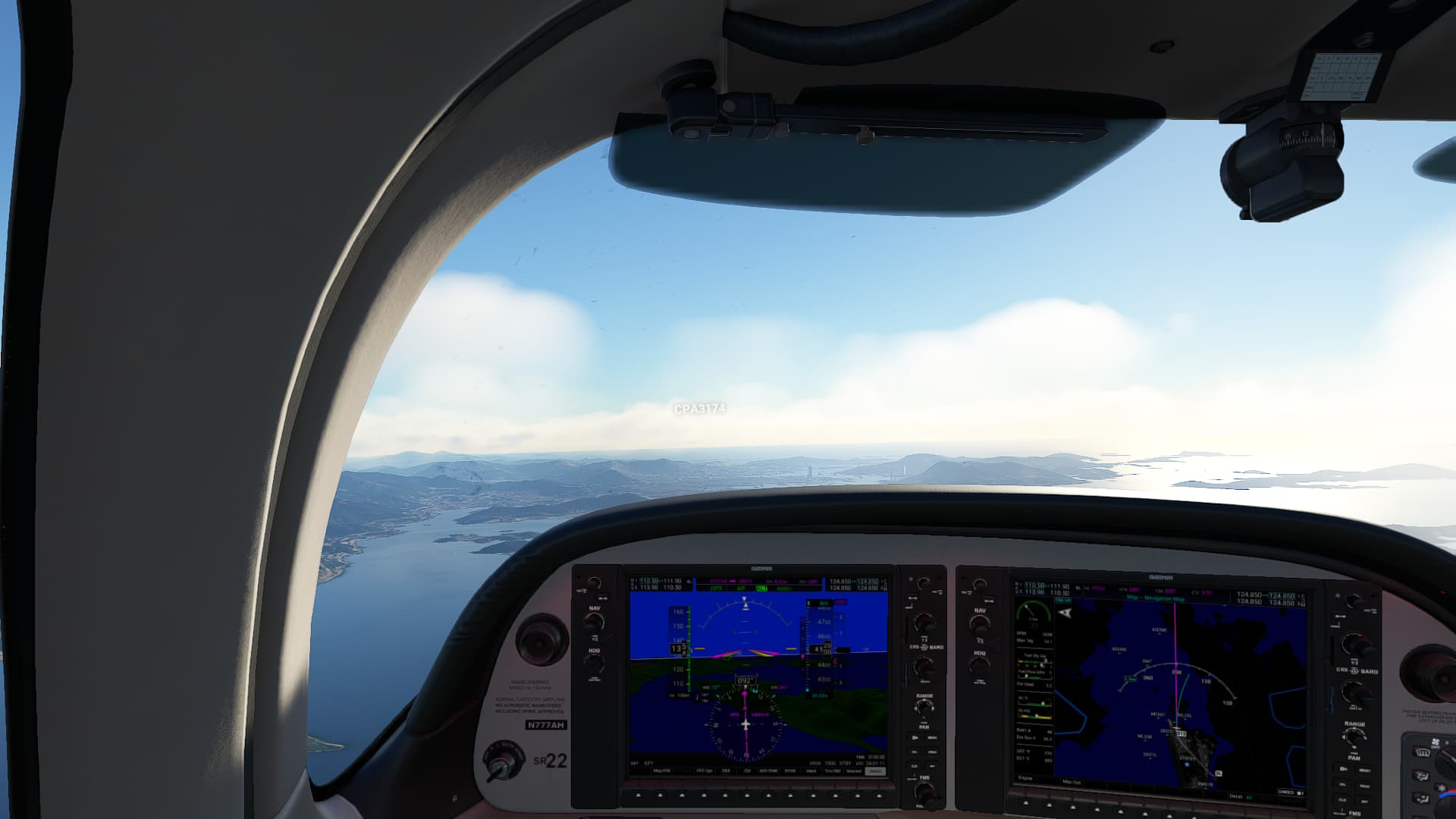
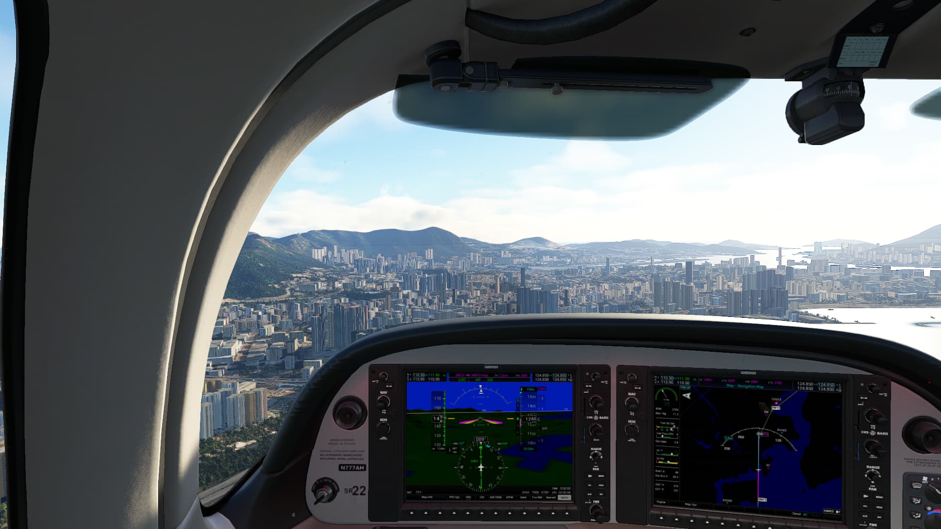
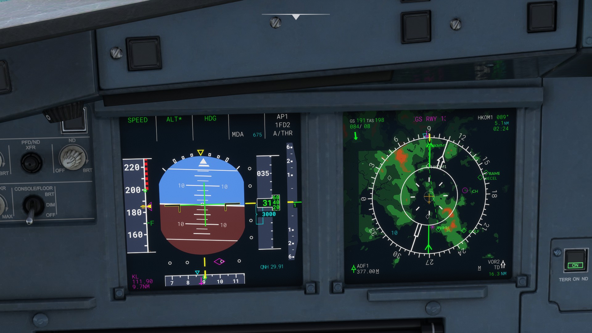
At or about Discovery Bay - on the D15 (FAF) to OM13, GPS VNAV stops - you’ll see ALTV and VNAV stops arming. This coincides with the beginning of the ILS Cone, so I switch to LOC1 and it picks up the lateral guidance with no hesitation. External shot for visual reference of position.
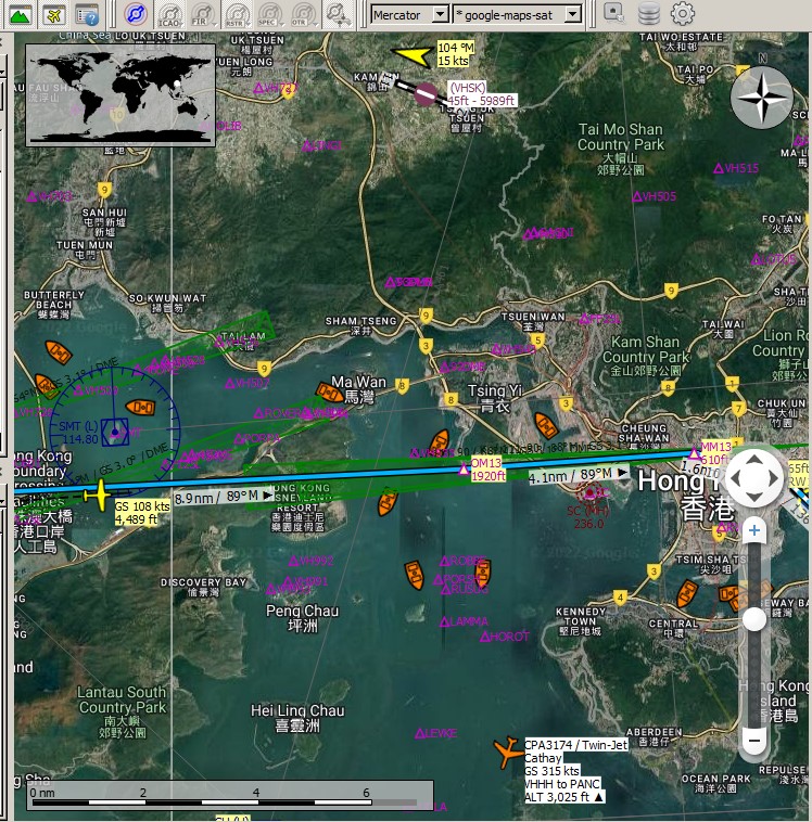
At that point you begin a 1500 fpm descent to OM13 at 1950’. I use the altitude range arc (cyan arc) to calculate if my vertical descent will get me to 1900’ before OM13, and adjust the throttle accordingly - around 30 percent power. Note how high I am on the slope - the GS diamond is all the way at the bottom of the scale.
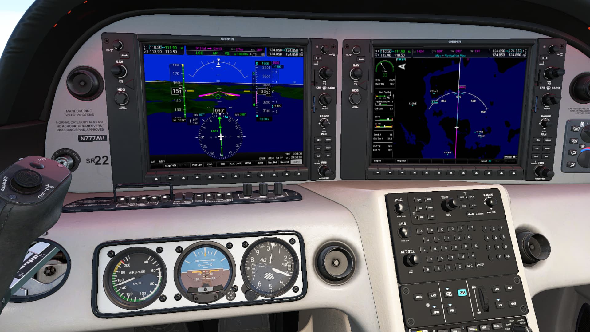
I make the altitude fix no problem and GS starts flashing indicating we’re tracking vertically.
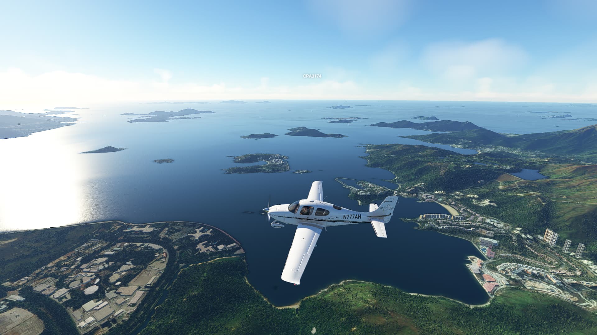
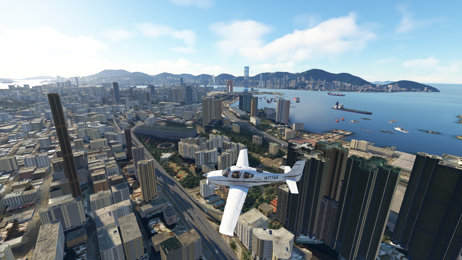
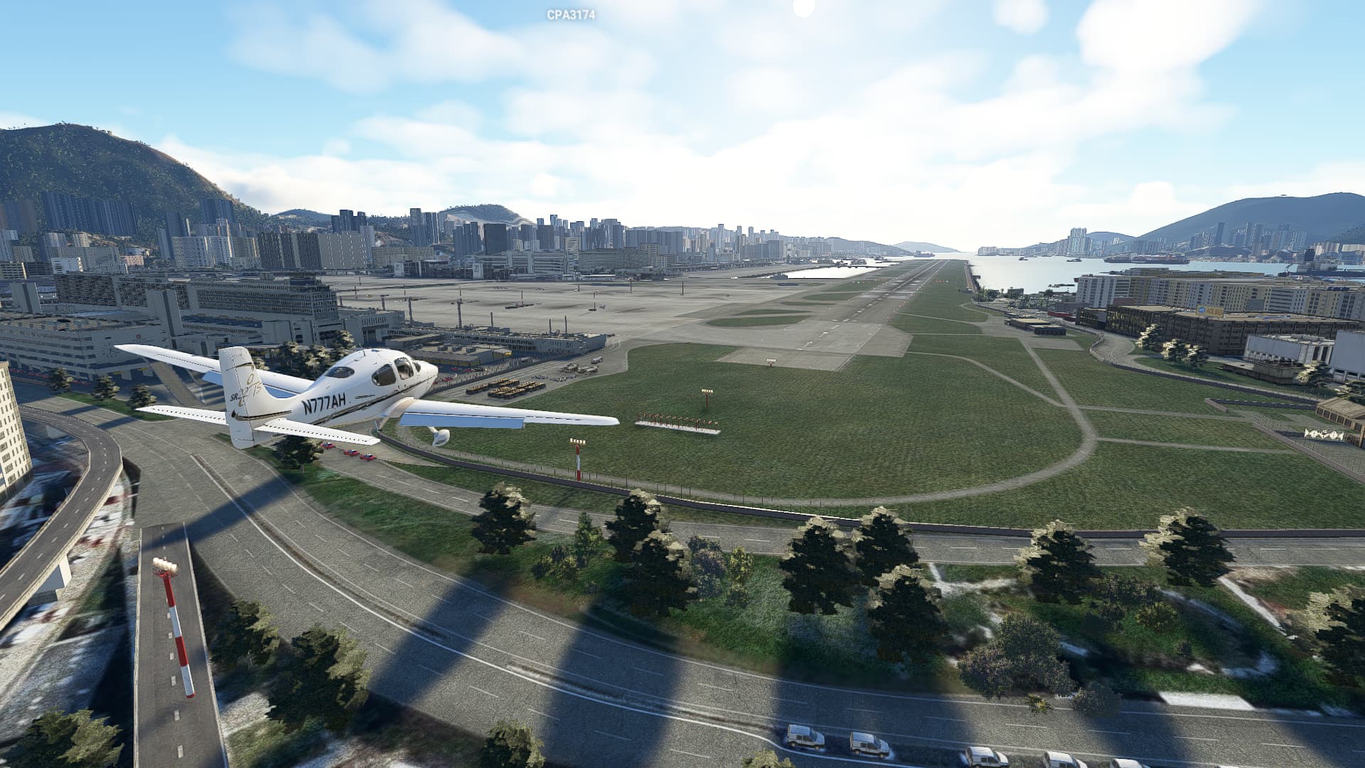
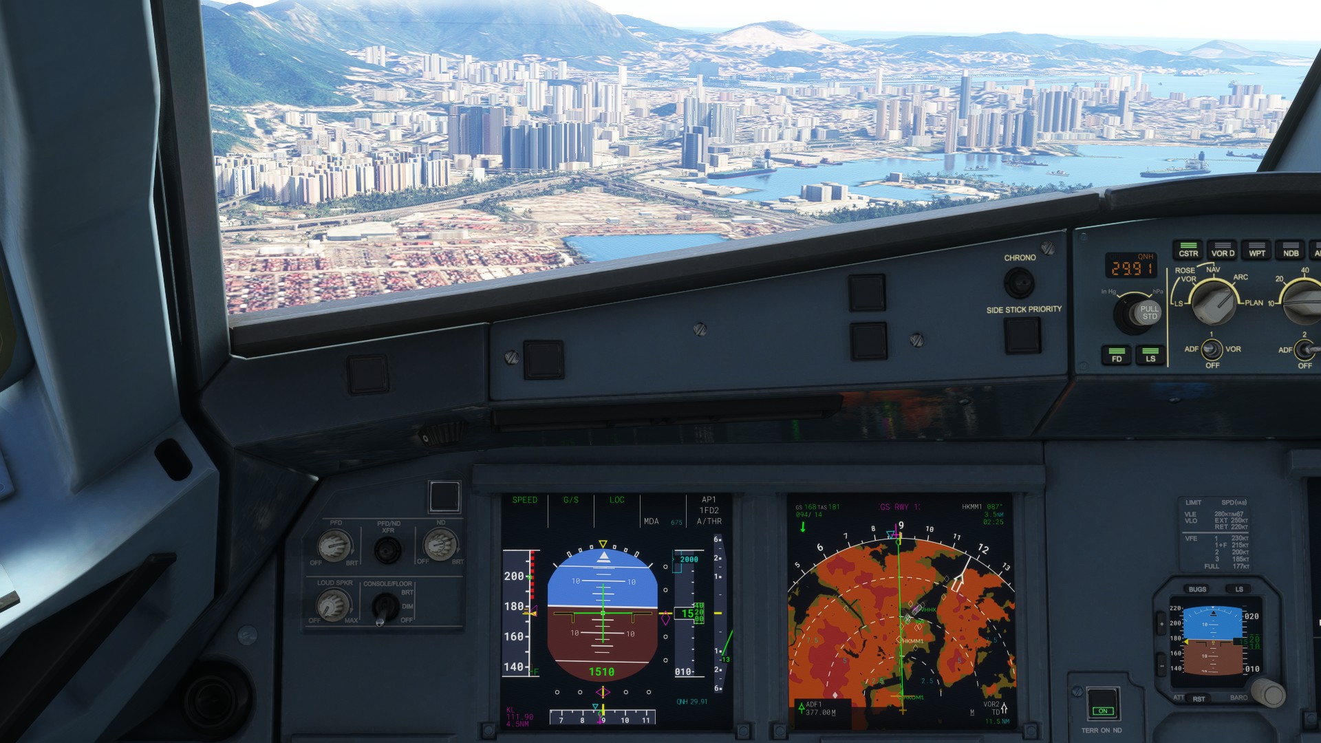
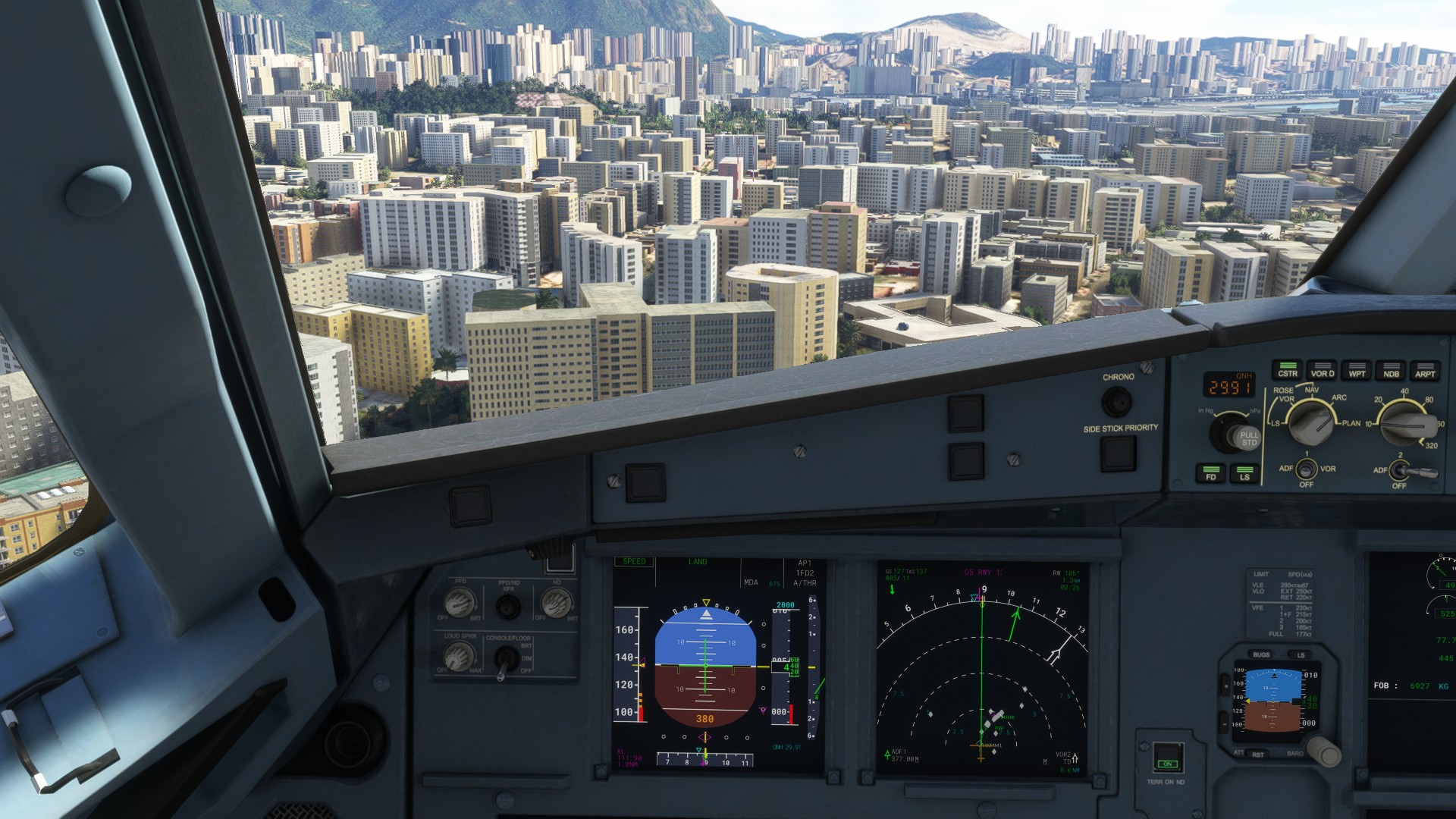
I’m about to make landfall at Nam Wan (MFD) and that’s also OM13 - so we’re still on slope; visually not in danger of terrain intersection.
For visual perspective, this is me a few seconds before the MM13 and turn to 107M final - see my relative position? About the only thing that is hazardous is that black skyscraper at my 2 o’clock, but I’ll pass clear since I’m on course laterally.
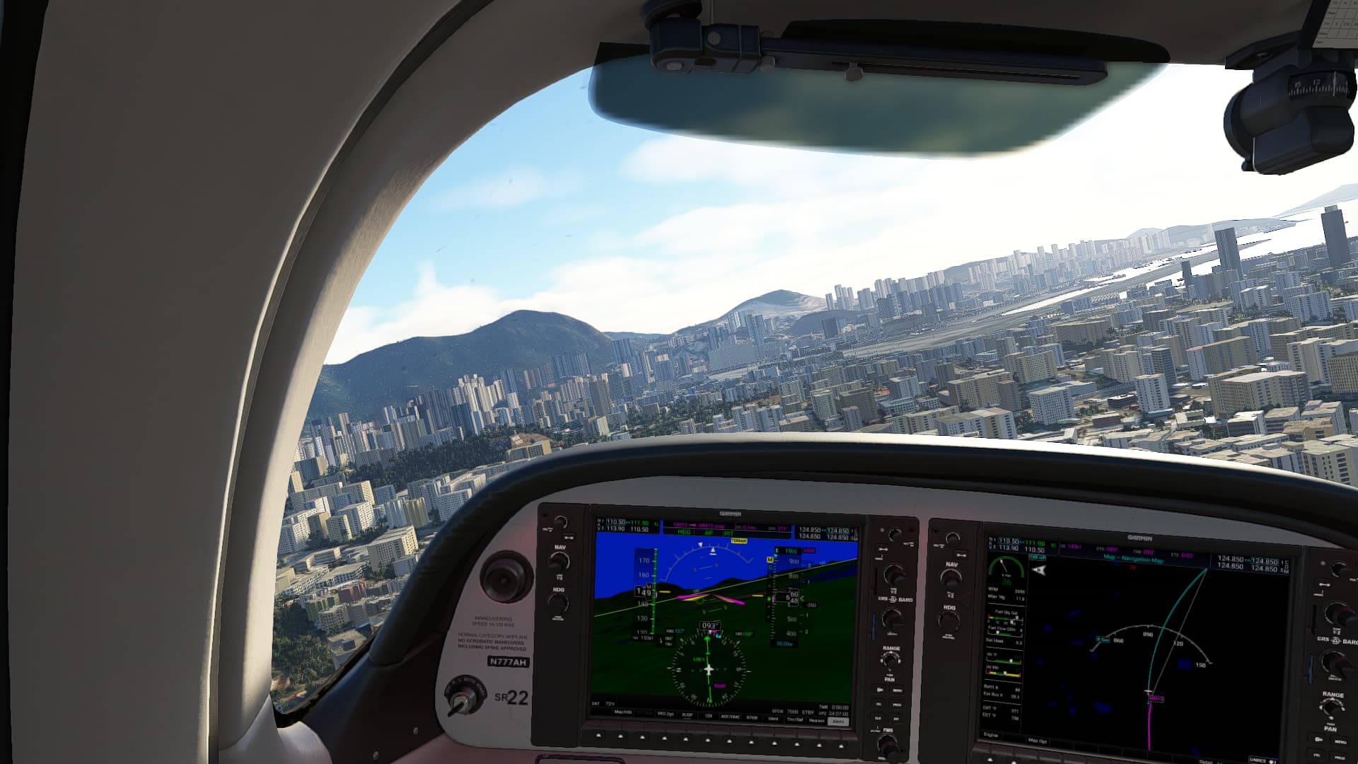
I just miss the timing on MM13 - I should have turn anticipated sooner, but since we’re visual anyway, no big deal. Still well clear of obstructions, and note Glideslope is absolutely tracking, but since we’re now on HDG to 107M, it really doesn’t matter - pilot’s responsibility to remain clear of obstacles. I’m still not anywhere near a terrain intersection. You can see from the external shots, I’m still above the buildings on the approach.
So if you still end up BELOW slope using SR-22 and NXi, I’d probably say there might be something unique to the console. But if you successfully fly it and clear the terrain, it’s something else.
You have obviously gone to a lot of trouble to produce this post which I do appreciate.You obviously like exact approaches ,I generally don’t …but have done them before with Flytampa Kaitak.I won’t bother with the full approach procedure as you did it is not necessary for me, but will pick it up later in the approach .But I know when I input 111.90 freq it will have the same result.
If Model instruments kai tak and Red wing Kai Tak can make it work on ALL aircraft ,why not Asobo,in my case anyway.
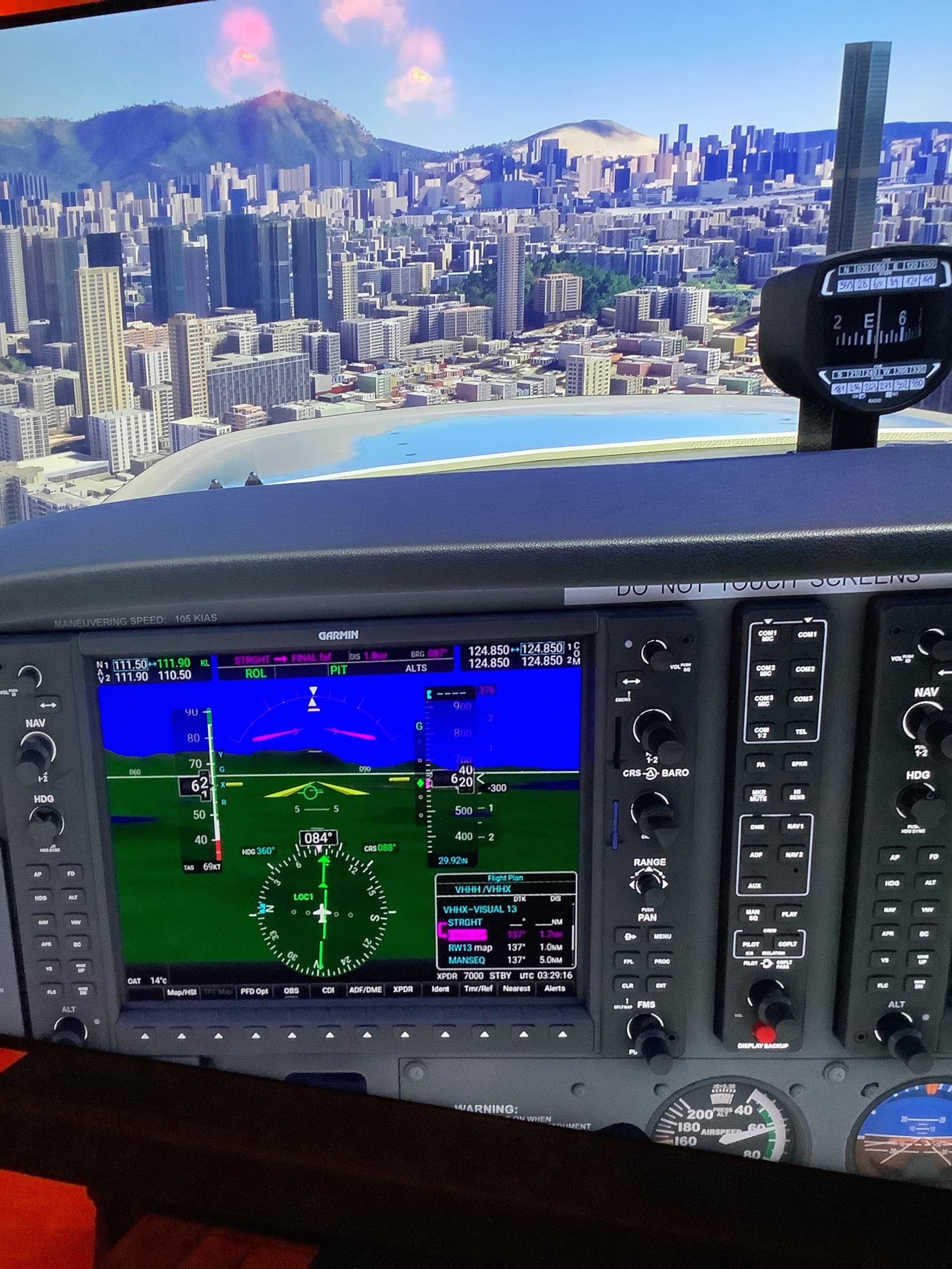
Ok firstly I am on standard do don’t have SR22 .Used Skyhawk with G1000 , usual inputs ,same problem see attached photo ,620 ft at this location is way too low and you can see I am way back from the turn point.I repeat this does not occur with the 2 x payware Kai Tak airports .
Please report this issue even though you are not having it on pc( I assume you are pc ) .
I think we are done here but thanks for your effort ![]()
There’s gotta be something going on with this. I’m gonna check with Working Title since they maintain a NavData (Navblue anyway) integrity Channel.
WT recommended I use the Simvar Util from the SDK.
I did something simpler. I removed Navigraph, took the G1000 SP and NXi and flew an ad-hoc route to line up with the ILS cone before OM13, so I could match you.
You are indeed 300 feet below expected fix. So this photo should look real familiar now. I’ve queued this up for consideration by Dev Taem.
I also found out that Navigraph has had VHHX in it’s database since August 2020 launch (!) so the IAP they have is the correct one I’ve been flying.

Hey man, I was right ![]()
Thanks for replicating at least I know I am not imagining it!,thanks for staying with it and I look forward to a fix…
Hello, I would like to add that I play on the Steam version without navigraph and to me the G/S seemed very low, I have flown it in the A320neo and 787 and multiple times I have had to disconnect the AP early to avoid CFIT and almost skimming the approach lights. Also, I can only seem to acquire the G/S at a shorter range than the expected 11-12 NM on the approach chart and having to descend below 2500 ft in order to be near to the G/S centre, I can fly the approach tomorrow and take screenshots as i go if that would help.
Yes the Glideslope portion of the IGS only appears at approx 7 DME for me on Xbox .With Model Instruments KaiTak and Red Wings KaiTak and in every other Incarnation of FS it was much further out.
Do you have the same issue if you follow the OP’s steps to reproduce it?
Yes, flying the approach the LOC and G/S appear later than anticipated and seems too low for the surrounding builings
Provide extra information to complete the original description of the issue:
I play on the Steam edition on PC without navigraph or any 3rd party scenery
following the approach chart for the IGS rwy 13.
the localiser and glideslope do not appear in the expected spot and the glidepath seems too low meaning the aircraftis almost at rooftop height and unable to see the runway when expected to make the turn to 135
If relevant, provide additional screenshots/video:
ILS is not acquired at the expected point on the approach chart
Localiser appears at around 10NM DME, no sign of Glideslope
G/S finally appears just over 7NM DME having descended manually to stay near the expected path
just after OM (at4.5NM DME) path around 1500ft
looking at the building that is taller than the rest and the aircraft is below rooftop height
I know you’re supposed to come off the A/P at this point and turn for the runway but screenshots took priority 1.0NM DME and 430ft with rooftops and approach lights looking very close and the checkerboard only just above the surrounding roofs


Folks - please note the status of feedback-logged - Dev Team will now attempt repro. If successful and they ingest the defect, it will switch to bug-logged for scheduling and fix. Thanks to everyone for their participation in this thread.
May I spot another problem? I’m afraid the checkerboard hill is too small, and too dark for approaching especially at night in a boeing 747. The VHHX addon I’ve installed have a much larger checkerboard, and much lighter at night.
Also, I’m afraid the strobe lights leading the aircraft to rwy 13 should place from the coastline of Kowloon, to enhance the low visibility landing situation.
Here is a video I recorded landing at VHHX before the release of SU11.
The old FSX Kai Tek FlyTampa addon was supremely well done. The landing lights extend all the way out to the coast line and are very bright. The runway is very visible from very far as well. In MSFS I can’t see either until I get really super close to them. Same with the MSFS addon from Redwing, not very bright.