I am in the market for a good FlightPlan/moving map program for MSFS. I have played around with LittleNavMap, and it works, but seems extremely complex with a high learning curve. Navigraph, from YouTube videos, seems friendlier but, of course, it is a subscription product. Which is better from both a user standpoint and frustration level? And I am confused as to rather Navigraph can do VFR type charts. Any advice/opinions would be welcome. Many Thanks!
1 Like
Navigraph has a much cleaner interface and it’s external app just keeps getting better and better. It does have a rather clean VFR layer on it’s external app and allows you to smoothly zoom all the way in to see the taxiway names. It’s got all the features of a VFR map including landmarks, city boundaries the works. It’s just a lot easier to read (i think) than LNM or skyvector
Having some minor time with LNM in the early days of MSFS2020, i too found it a bit complex. However those that use it swear by it’s functionality once you learn how the app works if you are a heavy VFR pilot which typically relies on an entirely different kind of navigating altogether…

4 Likes
One of the features I like a lot about LNM is the LittleNavConnect server, which runs on the MSFS computer and allows me to display my flight on an instance of LNM running on a different computer on my LAN. I use Google maps as the background in LNM.
I fly mostly GA, 80% VFR, and 20% IFR, using autopilot unless I want to turn it off temporarily to fly around interesting scenery. The LNM departure, waypoints, and approach can be set in saved LNM flight plans to exactly match the flight plan I have in the Garmin 1000 NXI, so I am happy with having all the LNM information on a monitor dedicated to nothing else.
1 Like
Personal Comments and Observations
I’ve been using LNM since I first started on MSFS 2020, and it’s a great tool.
I am also a Navigraph user. One of the really nice features of Navigraph now is the weather overlay - especially useful for IFR flyers.

Both products connect to the sim for real-time flight progress tracking (aka Moving Map).
4 Likes
Thanks for the reply…Does Navigraph require a constant internet connection during the entire flight? I am on a metered connection and have come close in the past to exceeding my bandwidth limit. My internet provider just loves it when that happens. So, I’m worried that long flights, or a bunch of short ones, using Navigraph would do me in! Thanks for any information you can provide…
Steve
The SimConnect piece which provides the Moving Map shouldn’t consume bandwidth since in both programs’ cases the sim is talking to the local side of the tool.
The Weather overlay probably does consume bandwidth. LNM too would consume some bandwidth if you choose to have it refresh the NOAA data which gives current winds aloft during your flight. I’ve not measured the consumption so I couldn’t tell you exact numbers.
I recommend you contact the author of LNM and Navigraph respectively and they can advise which parts of their programs have a constant-on component that could impact your data plan.
1 Like
just to add to this: keep in mind navigraph remains as a service, meaning most all the data you’re getting is being streamed via the internet. This includes pulling charts and downloading METAR and ATIS data (and the occasional app update). You may be able to minimize your bandwidth use from the app, but out-of-date data could pose problems for you if that kind of thing matters to you
My assumption and experience with this kind of stuff is that the bandwidth used for grabbing this data is likely minimal, probably on par with getting your email or loading a webpage with the same information but don’t hold me to that. I’m sure some data gets put into a cache created by the app but as casualclick said, you’ll need to contact the respective developers more information.
Thankfully, MSFS does have ways to play the game offline and can accommodate for those on metered connections
Thanks for the reply! Can you advise me on how to be sure that my MSFS is not online in any way? I was not aware of this possibility. Thanks a lot.
Steve in Kansas
Was on the same boat. Changed my mind a few days after I took a deep dive and started using LNM. Once you get familiar with it, there’s nothing that can compare to it. The author could be selling it 50-100 Euros/USD and it would still be a bargain. Someone give this man the Nobel prize. Even years later I frequently find small sweet LNM features I had no idea they existed. A 15 to 30-minute tutorial in Youtube should be more than sufficient to get you going with the basic stuff.
This doesn’t mean that Navigraph is inferior. I’d rather call it “complementary”. I’ll use it for charts and perhaps to declare a SID/STAR, but afterwards I’ll always review these by LNM. Or I’ll use LNM to create the flight plan and quickly review all available SID/STARs and then just set them in Navigraph (usually via SimBrief).
9 Likes
I concur: one of the greatest FREE add-ons to the sim.
4 Likes
For me, the main strengths for Navigraph are the NavData and the Charts. Navblue + FAA Supplements sort of approximates the currency of Jepp Navdata inside CONUS (although I find pockets in smaller airports where the Airbus data is still stale), but for anyone flying in other global regions - Jepp is king.
As for Charts, speaks for itself - there are many places to access a patchwork quilt of Charts for free, but some are badly out of date. The immersion of having Charts available inside the cockpit (I fly mostly glass cockpits) can’t be beat.
As an EFB, Simbrief + Navigraph does a pretty good job and is invaluable to the tubeliner crowd who have a lot of specificity required for things like winds aloft at multiple Flight Levels - that’s the stuff that LNM can’t cover.
On the other hand, if you’re a low-level GA flyer like me, the ability to overlay all the navigation data on a detailed topo chart is where LNM really shines. And before I had access to Navigraph, my first RTW in the sim was with LNM,which was invaluable.
I really can’t say one is more needed than the other. They have overlap for certain, but one is oriented towards GA (LNM) and the other can cover both GA and has integration into Commercial ops (Navigraph). NG has done a LOT of work with Charts - and it’s really shaping up to be a one-stop shop for serious IFR and tubeliners.
1 Like
I use both at the same time. Navigation ist a must but I miss to see other aircraft of Vatsim.
Also miss the Info who is online and where, like Ctr, App Gnd…
Thanks for all of the great responses…I think I will hunker down with YouTube and learn LNM,I am almost totally a GA flyer so it sound perfect for me…Many thanks again!
Steve in Kansas
2 Likes
Another great choice is Plan G, if you subscribe to Navigraph, you can load it into their app and the interface is a lot easier to learn than LNM, its right handed click anywhere in the map gives you a lots of choices that LNM makes kind of complicated, like putting the frequencies in your Nav 1 or 2 radio, relocating your plane anywhere in the map, getting an airport runway view, show approach procedures, departing procedures right in the map, etc. I used to use LNM, but I find myself using Plan G most of the time , if you add Navigraph, a lot of the information is the same, it also offer different types of maps, topo, bing, google, etc. It in includes a radio panel and a PFD panel, basic but very useful, try it you’ll like it. Great for VFR, and I also use in IFR with Navigraph. It is super easy to create and modify flight plans, etc.
I know this post is a bit old now, and OP probably already made a decision but as these come up in searches I thought I’d share my thoughts having used both.
LNM:
Pros
- I don’t find it as hard to use as some people say in the forums. I watched a couple of YouTube videos and was quickly up and running planning lots of VFR flights
- Topo maps and google maps are especially useful for finding things you can see from the sky to aim for if you want to fly a proper VFR flight and do the navigation as you would without a GPS aid
- For VFR you can display the navlog with the different way points, headings, timings etc to fly dead reckoning. I have this on an iPad next to me as my navlog
- It keeps a pilot log of all your flights
- Can generate air craft performance automatically so you you can easily work out fuel, timings to waypoints etc
- Allows you to select a parking slot as departure rather than just an airfield and this is imported to MSFS
- Displays an elevation graph at the bottom to check you are cruising at a safe altitude easily
Cons
- None for VFR flying if I’m honest once you know how to use it
- IFR is not so great as its missing the key charts
- You can select SIDS, Approaches, etc which display on the chart but it gives you no detailed procedure notes so you need to go look these up yourself for ultimate realism (though technically you can fly the route following the lines or autopilot it fine)
- I don’t fly online but if you do, you’ll need to update the navigation data monthly and will need a separate subscription to something like navigraph anyway)
Navigraph:
Pros
- I like to try and fly as real as possible and get assigned a SID or STAR by ATC. Navigraph means I can pull up the appropriate item on charts and fly it as you would in real life
- Charts are invaluable for navigating airport taxiways and understanding all procedures including what to do when things don’t go to plan in the middle of a flight
- The iPad app is much more polished than you get with little nav map web interface
- Up to date navigation data
- VFR has standard departure procedures where an airport requires them drawn on the map
Cons
- There are lots in my opinion for a reasonably expensive piece of software, but it depends on what you value. I would argue the price for the charts alone is enough but its missing some great features that you get for free in LNM especially for VFR
- There appears to be no elevation graph. You can work it out by looking around your route but its time consuming
- There is very little information on the VFR maps compared to say Google Maps which means picking your own reference points is tricky eg a golf course might make a really good waypoint for VFR but I can’t see much in way of landmarks listed
- No navlog of any kind, so if flying a VFR via Navigraph you have to resort to completely manually working out the timings and literally writing it down yourself… or following the line on the moving map, which is probably what a lot of GA pilots do these days if I judge by YouTube, however I wanted to specifically practice navigation skills outside of a GPS eg dead reckoning
- No pilot log, I’ve installed Volante after a recommendation from someone else and that is great but shame it’s not included when Volante and LNM both have the feature. I was really hoping for one program to simplify things
- No option to select a parking gate to start at. If you import the flight to MSFS and then select a parking gate it will mess up your flight plan, usually just a small amount, but a few times its done some crazy things like have me fly backwards and forwards twice across a single leg. Note, they have improved this somewhat now since you can now import the flight directly from the inbuilt panel. To work this way you need to just pick a gate at your starting airport and then once in game load the flight from the inbuilt panel. It updates G1000 and ATC so this kind of negates the con.
Conclusion:
I think Navigraph is worth the subscription for the data updates and the charts + procedures, especially if you want to fly online or just make it as real as possible. I will continue to pay for it as I’ve started doing a lot more IFR as well as VFR recently. I think I’m going to stick with LNM for VFR at least until Navigraph expands its VFR capabilities
Note: Another disappointment with Navigraph, considering it’s a paid service is that it’s kind of slow to get features out. I found a post from 2022 about Charts 8, the UI product you’ll use for flight planning and moving map that declared a number of new features that would be coming soon (in the coming months). Some have been added like weather overlays but others such as a navlog have not appeared. I might be in the minority for these and that’s fair enough as they have to prioritise feature development that appeals to the biggest cohort of users.
Hope anyone considering this question finds any of this useful but note, its my own personal findings and I might be missing some features because I don’t know how to use it or as time goes on some of the things I miss might have been added
2 Likes
You can try msfs map ng on your Android devices.It is really smooth software!


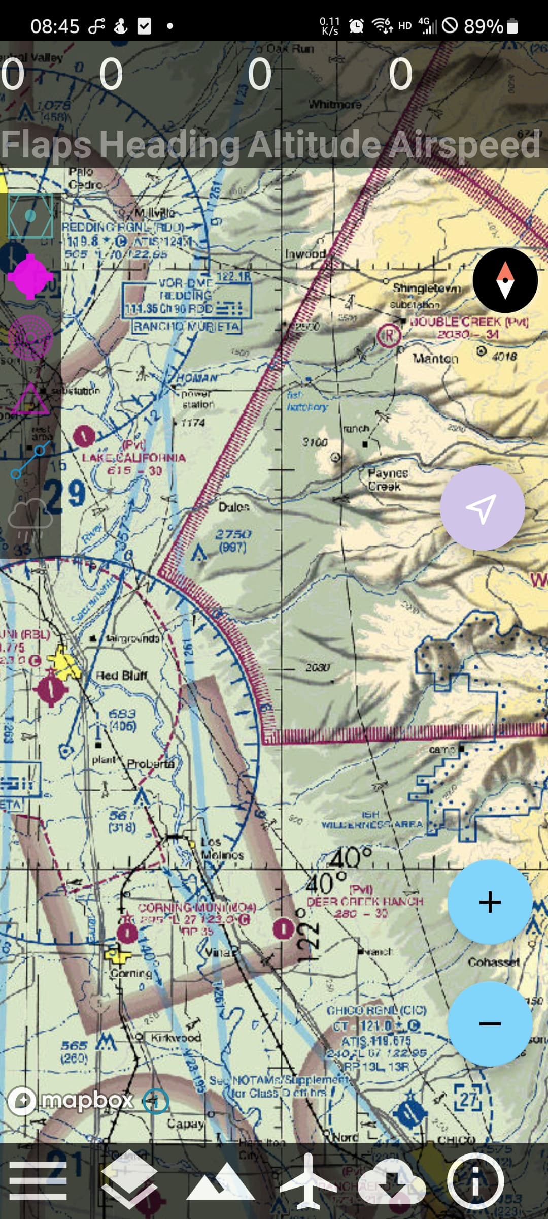
https://play.google.com/store/apps/details?id=com.gsy.msfs_mapbox_kotlin
2 Likes
I have been a long time LNM user and like many find it amazing that such a tool is freeware. However, now I am flying the Fenix family of airbus I have to use Simbrief (either directly or importing LNM route files into the Airbus via Simbrief). This works fine normally but I am increasingly finding that SIDS/STARS and Transitions that I select in LNM are not recognised in SImbrief. I wondered if this is because the data in Simbrief is “live” and that in LNM might be stale. Eitherway I find that Simbrief works fine with a flight plan that has SIDS/STARS but not so good if you are just routing via waypoints.
**Disclaimer - I am a Navigraph user**
If you do not have a Navigraph subscription, you are dealing with two distinct Navdata sets, which can explain why you’re getting inconsistencies.
Simbrief is pulling from Navigraph AIRAC when planning online.
LNM by default will look at whatever Navdata is present in MSFS. With SU16 and SU4 respectively, that’s now Lufthansa/LIDO. You also have to synch LNM to the Navdata in the sim. That’s a five minute job in 2020, up to 20 minutes (or longer given my experience) in MSFS 2024.
Navigraph makes it easier for the synch because they have a separate FMS Data Manager that is LNM aware - and can update the AIRAC in LNM just as fast as it does for MSFS and their Navigraph Hub. If you’re on Lufthansa / LIDO, you’re in for the long wait.
Because of that difference in Navdata sets, you will get inconsistencies in waypoints, routing, etc. - especially if you’re planning outside the Continental US. It’s better if you’re consistently using the same Navdata in both the sim and Simbrief. That means signing up for Navigraph all things considered. Which honestly is well worth it IMO.
2 Likes
Thanks for this - very helpful. In fact I do have a Navigraph subscription and I will be using Simbrief increasingly as I use the Fenix family more and more.
Does Navigraph have that side on, altitude above highest points view along your entire route that LNM has?