Quick q: anyone know why there would be an ILS system that looks like this in LittleNavMap?
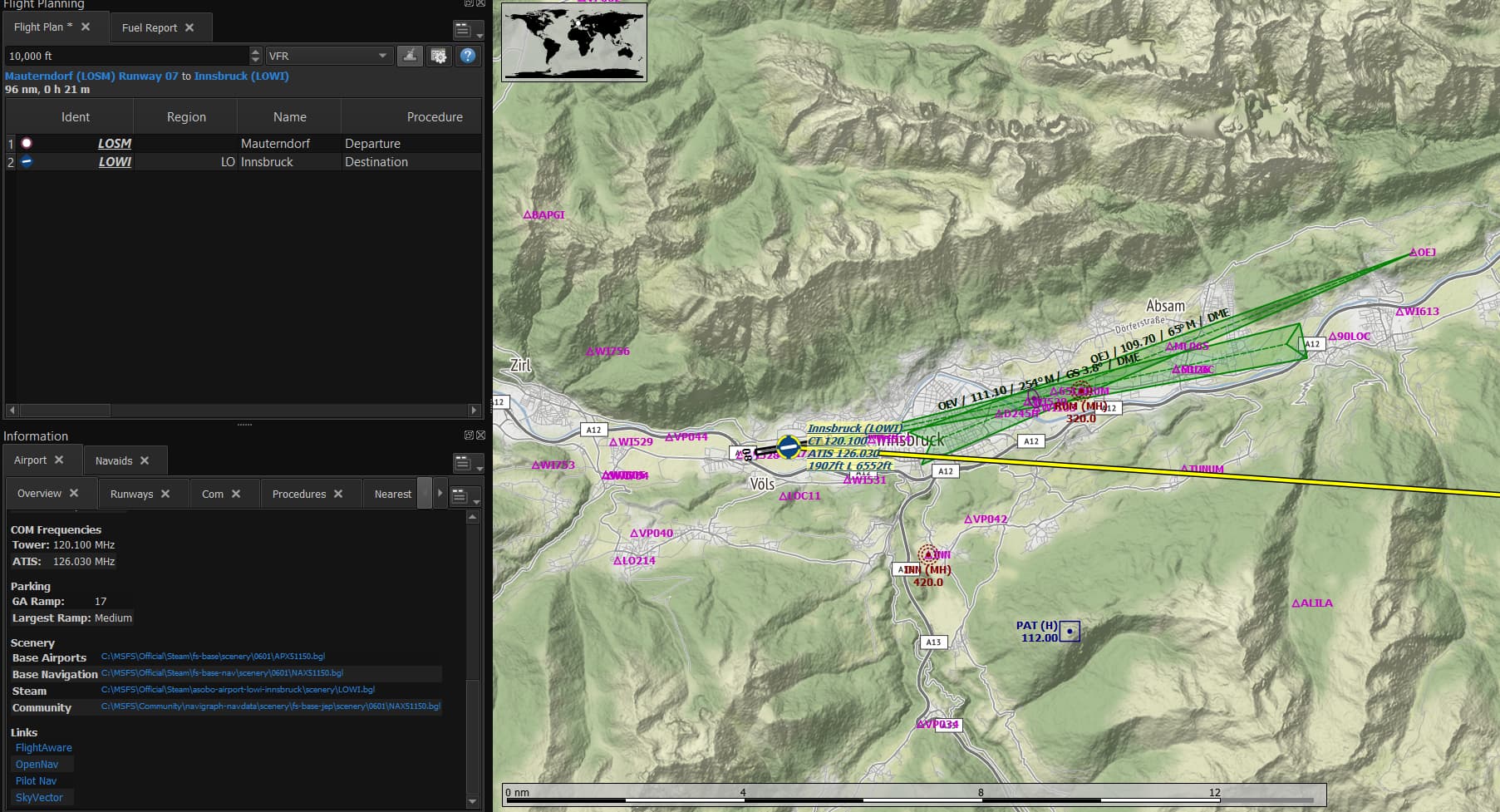
It doesn’t look correct… do you have the approach plate for that ILS procedure?
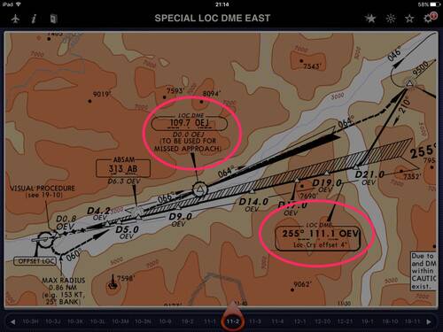
I think the second LOC is for a missed approach… check the frequency of the second one, is it 109.7?
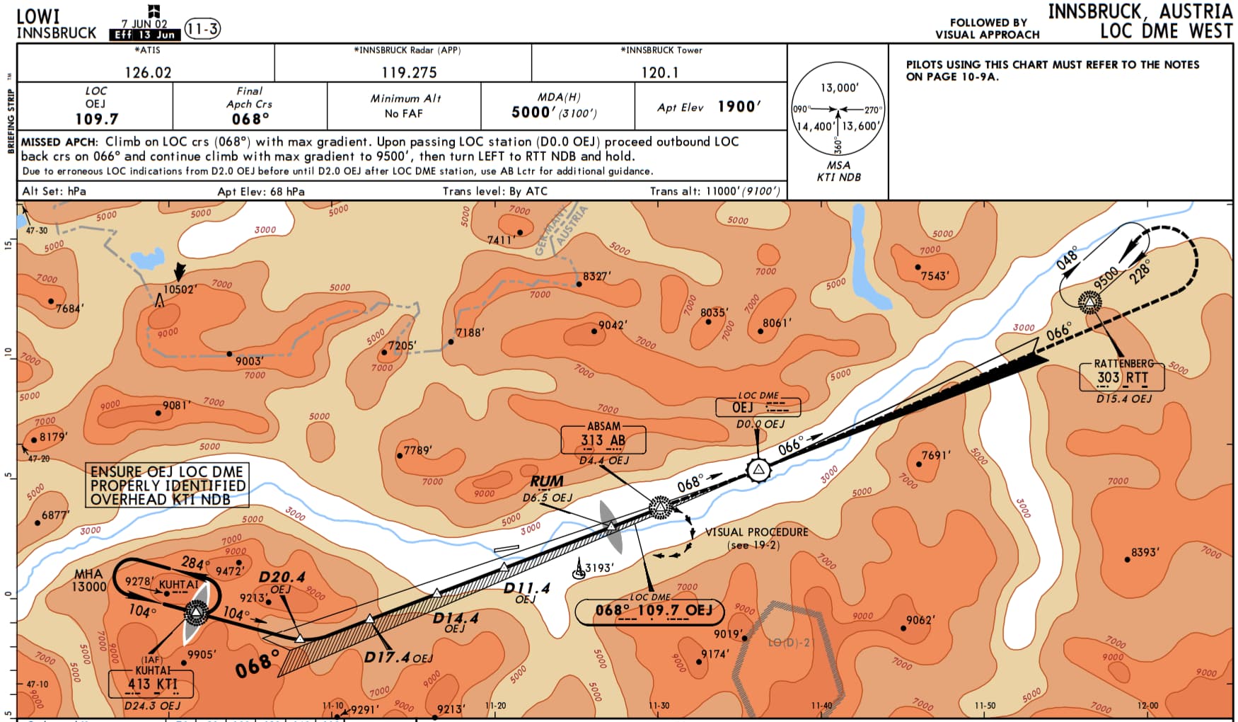
Google the LOWI approach charts.
It looks like OEJ is supposed to be west of the airport.
negative. was just scouting interesting looking ILS approaches in LNV and saw this and thought it looked strange
i’m using Navigraph data here so I think that’s what’s being represented
I’m not an expert on approach charts, but I’ve never seen LNM show a missed approach feather, which is why I’m guessing it’s supposed to be the west LOC/DME feather shown here. I’m open to an expert’s analysis.
LOWI has some crazy approaches!
1 Like
Yeah, it is the LOC DME West approach that ends with a visual procedure @ D4.4 OEJ to either RW 26 or RW 08 (with another circle to land) initally coming from the west.
Edit: the backcourse of OEJ is also used for departures heading rtt (i.e. SID RTT2H form rw 26)
These are known a “offset approaches” where the Localizer is offset from the runway by three degrees or more.
They are that way IRL for a few reasons, often terrain.
You can do a goggle search for more info.
2 Likes