Ok. So after significant pressure from the community regarding the live weather, They have finally acknowledged (albeit briefly) that this is an issue. This thread is Not a discussion about the issue.
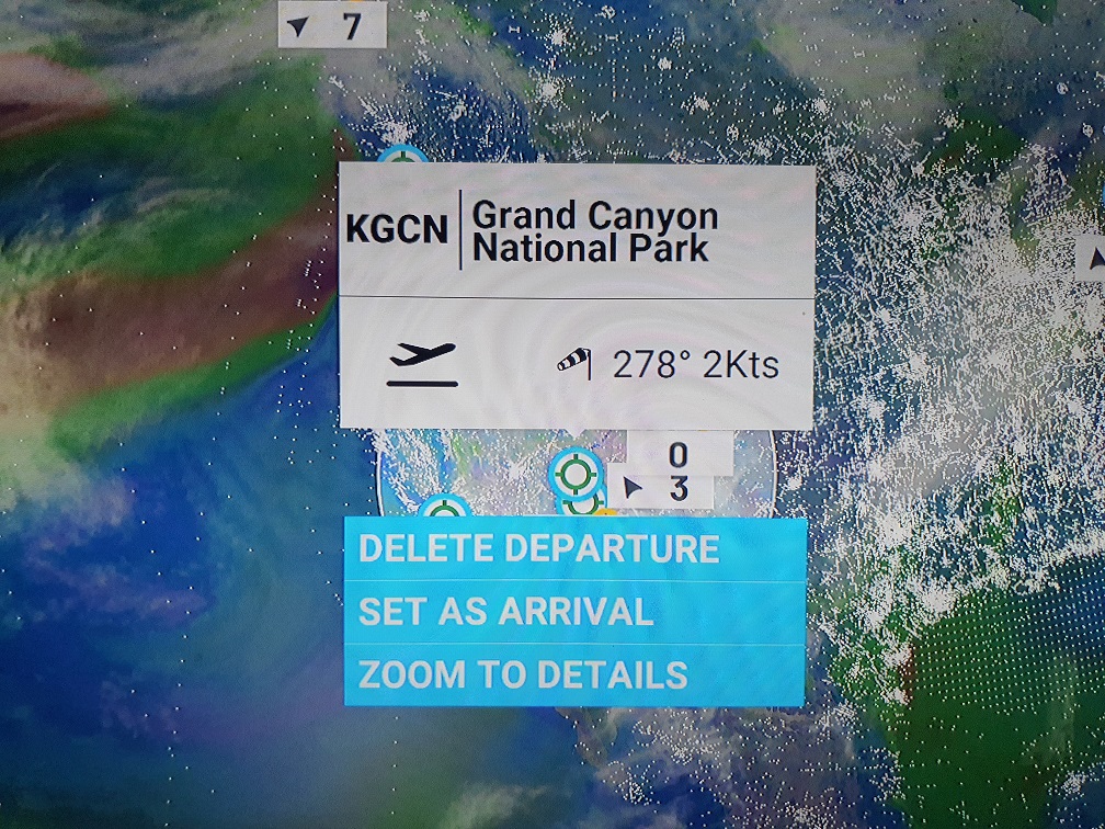
The best way that you can help your fellow sim pilots is to create highly structured and detailed reports regarding every single action you make in the game after launch, and what your results are. This means, every single click, menu setting change (of any kind!) Location and Aircraft. It would also help to record the wind that is shown when you select the departure destination on the globe-map.
And then posting the report here. For those of you that are interested in game development or testing. This is the real stuff. This will give you a realistic experience helping to test and hopefully fuel the improvements for a real product that is in production.
We need to direct our efforts, and put on the first big display of what we are capable of as a community from a technical sense.
Zendesk is pretty overloaded right now. I’m hopeful that we may be able to discover some specifics of how and when the weather works and doesn’t work, and have that information available to the community, rather than going into their support system where we can’t see it.
I’m pretty positive that the developers browse the forums also (even if they say they don’t)
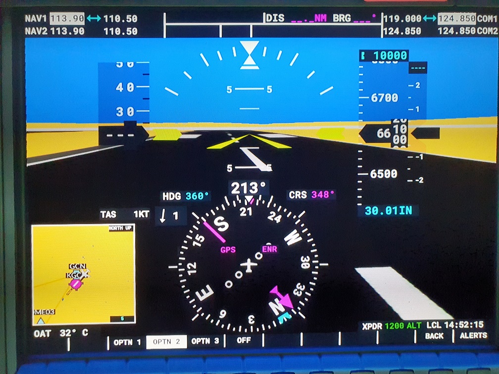
A note for the posters above who posted screenshots of G1000 wind indicators on the ground:
In real life, the Garmin avionics calculate wind speed and direction with the difference between true airspeed and ground speed, and between heading and ground track. So, with 0 TAS and 0 GS, there’s not much for the avionics to calculate.
In other words, if the Garmin avionics in-game behave in the same way they do in real life, screenshots from the air are probably more useful to demonstrate the wind issue.
Yeah, it does seem to properly simulate this. If you are on the ground with a wind coming from behind you at 10 knots, it won’t show that you have 10 knots of indicated airspeed, but if the wind is coming from in front of you, it simulates that this wind hits your pitot tube and is registered as wind/ indicated airspeed on the G1000
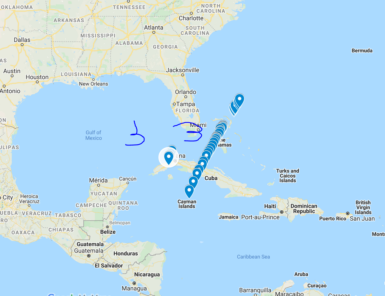
I’m using my flight tracker to see if I can find a point to the west of the US where it starts working. A significant change in the wind should be visible on the flight line. In this picture we can see that it’s very slowly getting pushed north from the 225/03 wind.
If youre just looking for the wind cuttoff point and not also doing a regular flight, slew mode works wonders. Just pop into it and fly until you get wind, then back up until you get 3kts. You’ll close in very fast on the line. That’s how I did all of my map points. Also, if youre in something with the fmc, you can pull lat and long points from it (not sure if/where to do it in the g1/3000)
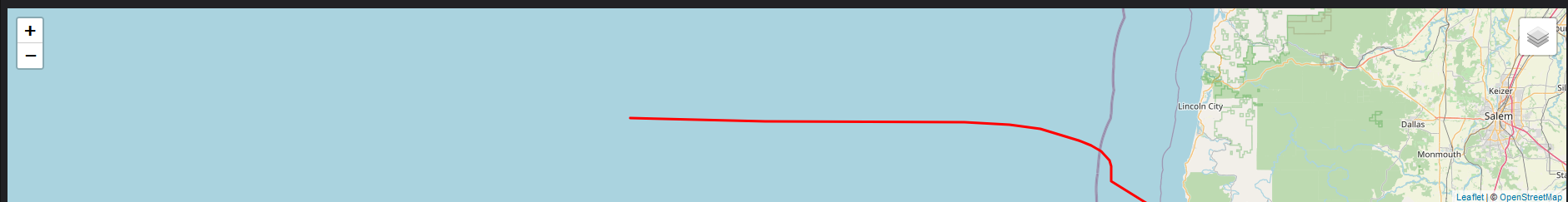
Did that a bit with the cuba line, and was able to reproduce it. There’s definitely a shear line where it goes from working to not working. Coincidentally, I’m also working, and the line method lets me do it in an automated manner, it can just fly and record the track while I do other things
So I just noticed something interesting. I’m flying from rome to nice right now. Both locations have live weather working. However, midway through the flight, just after I passed over Corse, there was an abrupt shift and the wind changed from 10kts to 22kts. It wasn’t an update, it was just a wall and a change. An interesting development into how wind zones are broken up.
