Massive Ravines around Hungerford in the UK!

Do you have any add-ons in your Community folder? If yes, please remove and retest before posting.
Removed!

Are you using Developer Mode or made changes in it?
No

Brief description of the issue:
Massive ravine around Hungerford in the UK. Seems to be caused by either the Canal or the River?

Provide Screenshot(s)/video(s) of the issue encountered:

Detail steps to reproduce the issue encountered:
Just fly over Hungerford

PC specs for those who want to assist (if not entered in your profile)
i7-8700k, GTX 1070 8gb, 32gb DDR4 RAM

Did you submit this to Zendesk? If so, what is your ticket #?
Yes #99458

2 Likes

Typo fixed & Reported to Zendesk!

1 Like

Another view from different angle!

2 Likes

I came here to report this and see it was reported over 2 years ago and nothing done about it. Do any of these issues get fixed? (New to this forum - was just looking for where to report the Hungerford Canyon).

they’ll probably fix, but in the meantime, if that issue bothers you, you can use the little fix below (done by newbie so probably not perfect :wink: ).

Edit : Link removed … looks like direct link on free public sites may trigger some false warning for some users by some security software so it’s better i don’t post links anymore because i don’t know where to put the file, glad you could get the file and that it worked for you and they will probably fix it for everyone else in of the upcoming releases (it’s should be fixed in 2 minutes for them).

2 Likes

The Thames is shown in a ravine along a lot of its route. It makes the Reading festival like a Dali melted watch

Thanks, I’ll try that. I can see my house on the screenshot :slight_smile:

Just installed it and had a quick flight - awesome! thanks again :slight_smile:

1 Like

Hi there,

Do you have a latitude and longitude you can provide for the test team?

You can find it if you use Dev Mode and go to Debug > Display Position.

Thanks!

The Ravines stretch from near Henley on Thames (51.507637 -0.872492)
to Ufton Swing Bridge on the River Kennet (51.412978 -1.113425)

and on the Thames past Reading Festival (51.468528 -1.013572)
to Pangbournes own ‘Niagara Falls’ (51.486836 -1.084155)
and on two miles upstream of Pangbourne (51.507964 -1.112216)

Again on the river Kennet just east of Hungerford (51.413254 -1.495201)
to north west of Hungerford (51.424633 -1.517485)
Also on the River Dun from Hungerford to where it crosses the Kennet and Avon canal (51.414172 -1.539243)

This area is quite complex with the rivers canals and lakes occuring at different levels.

1 Like

ISSUE DESCRIPTION

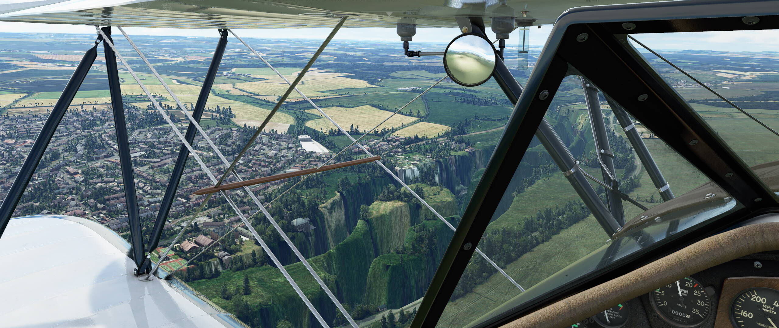
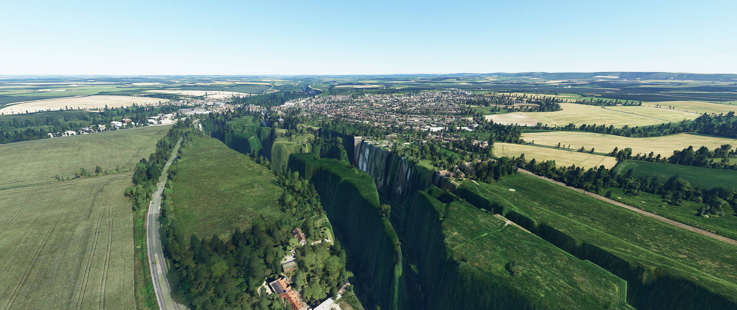
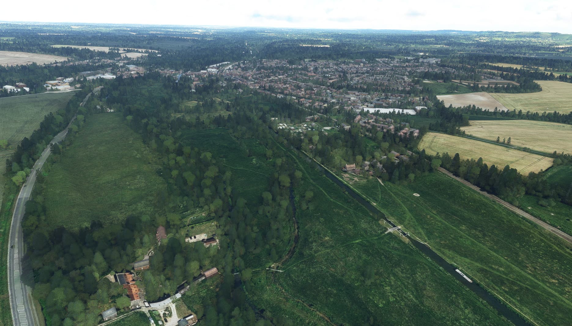
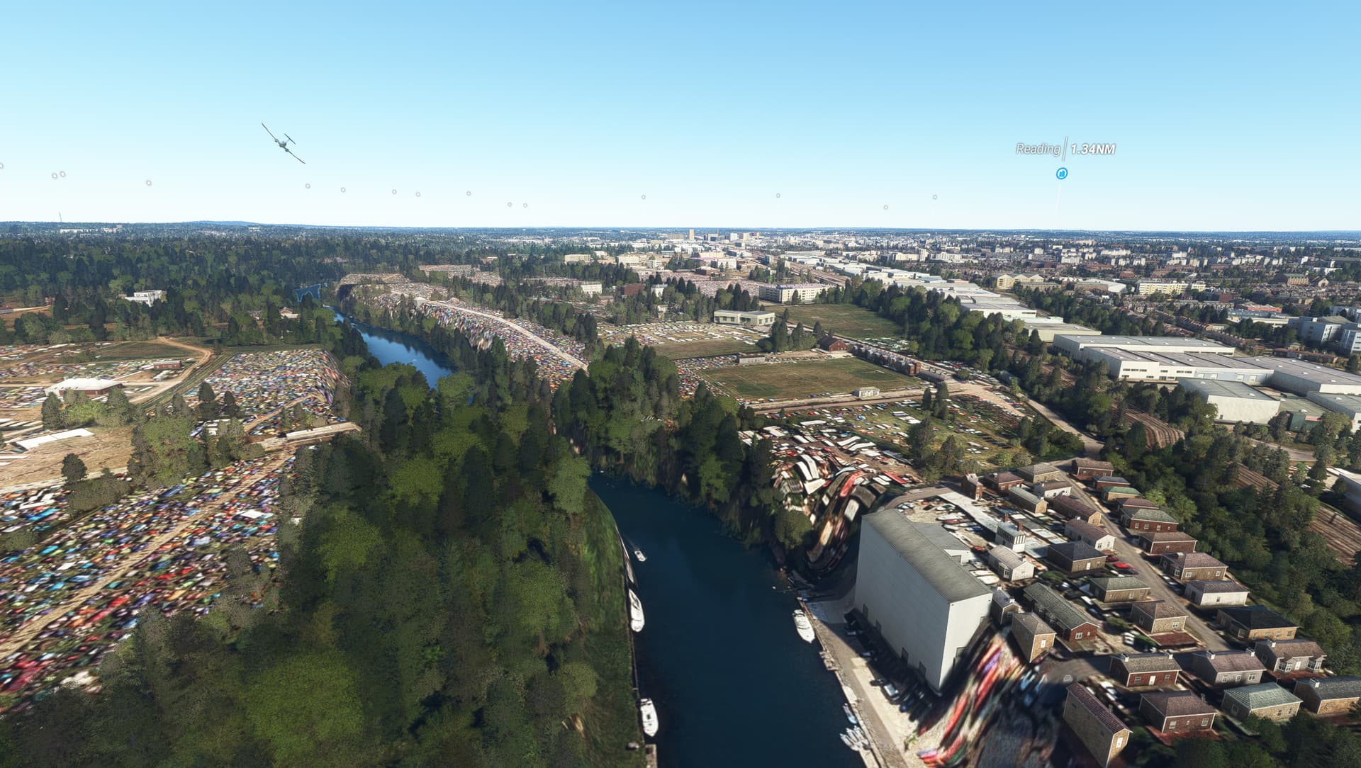
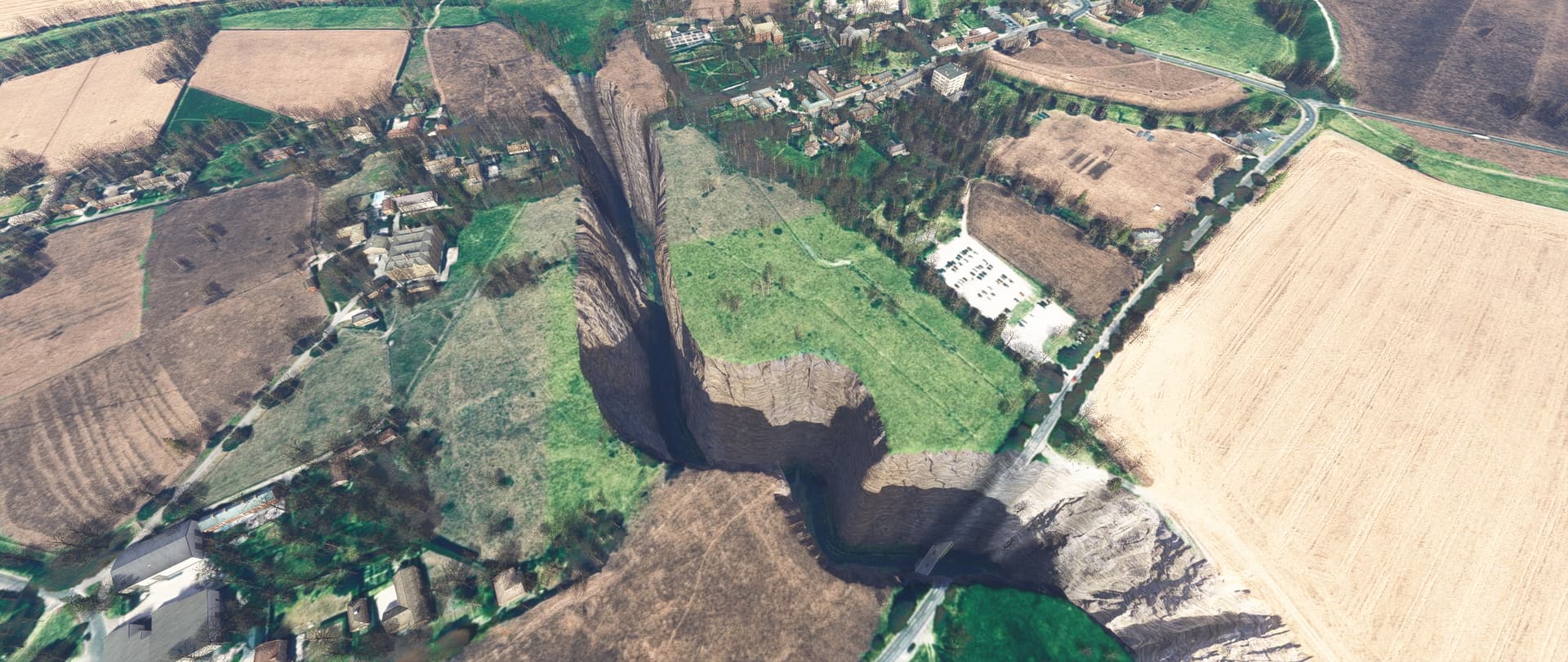
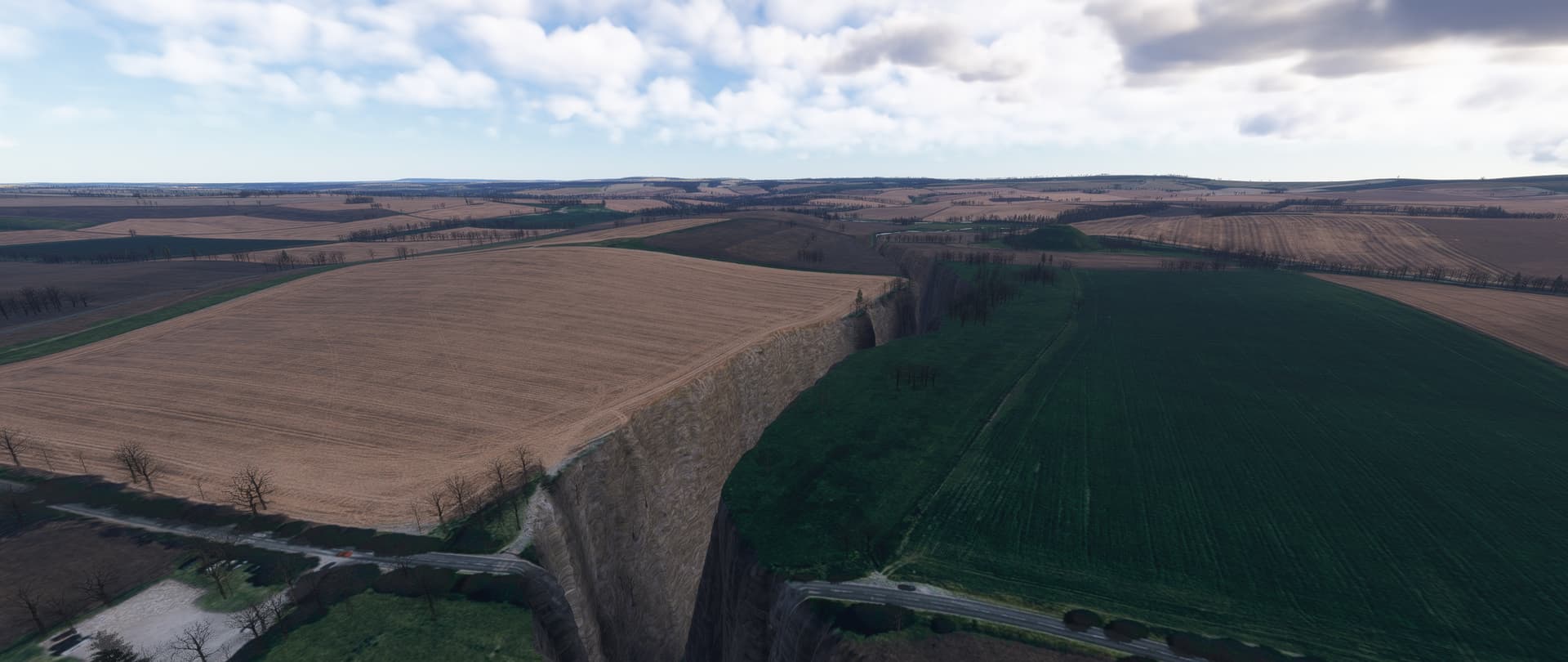
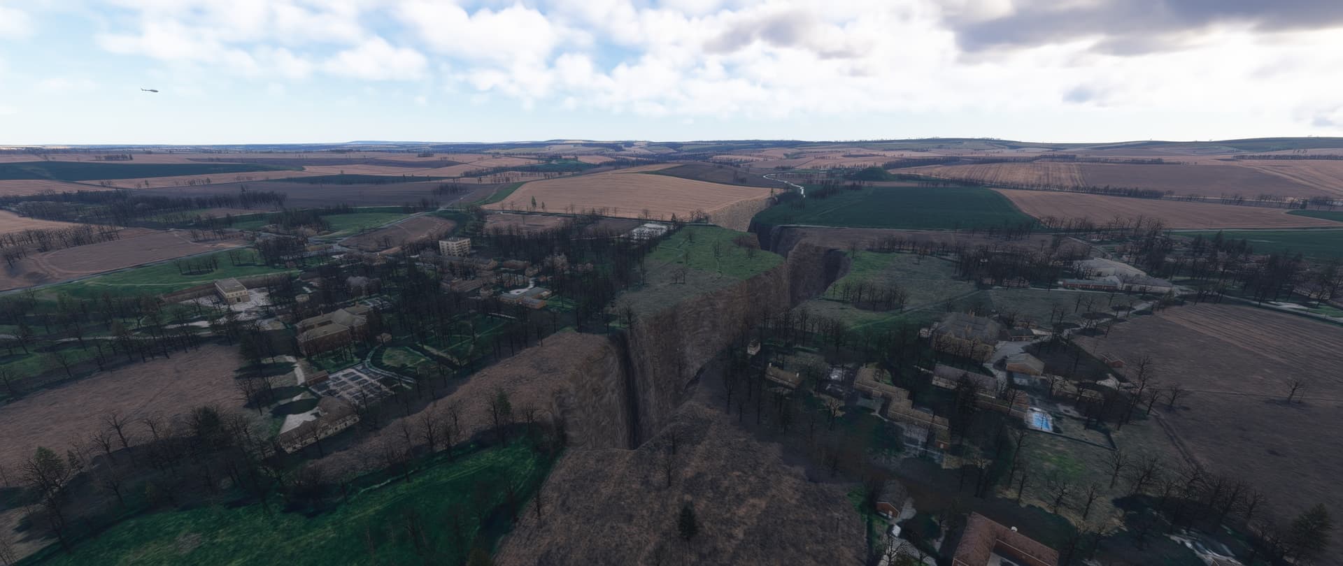
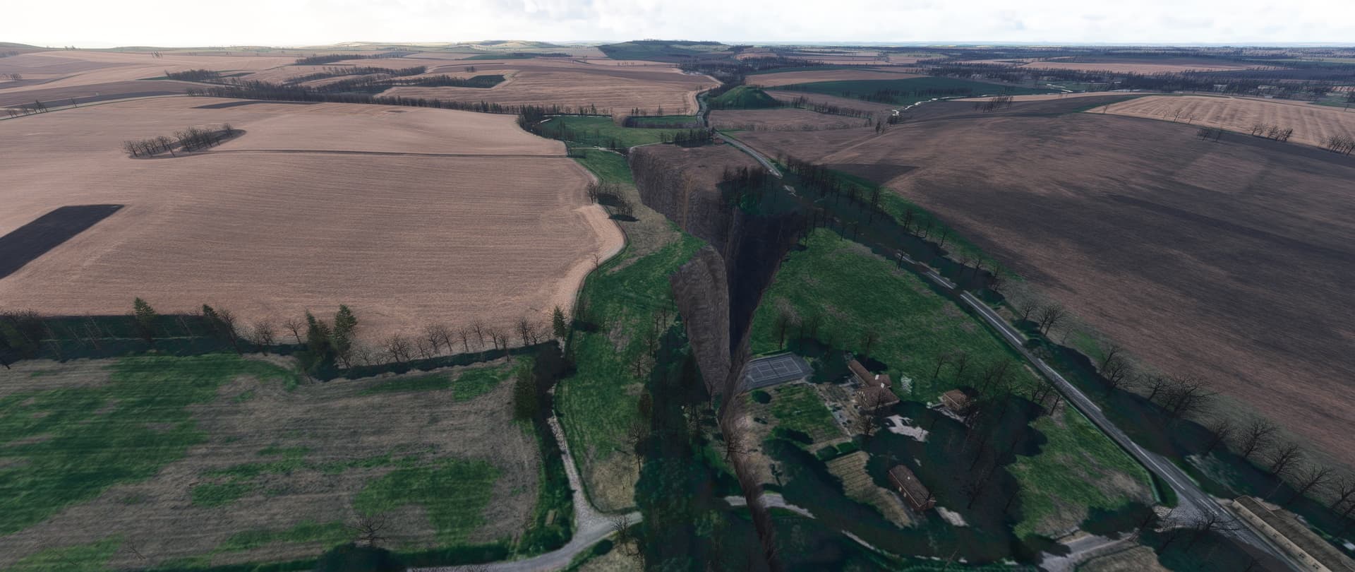
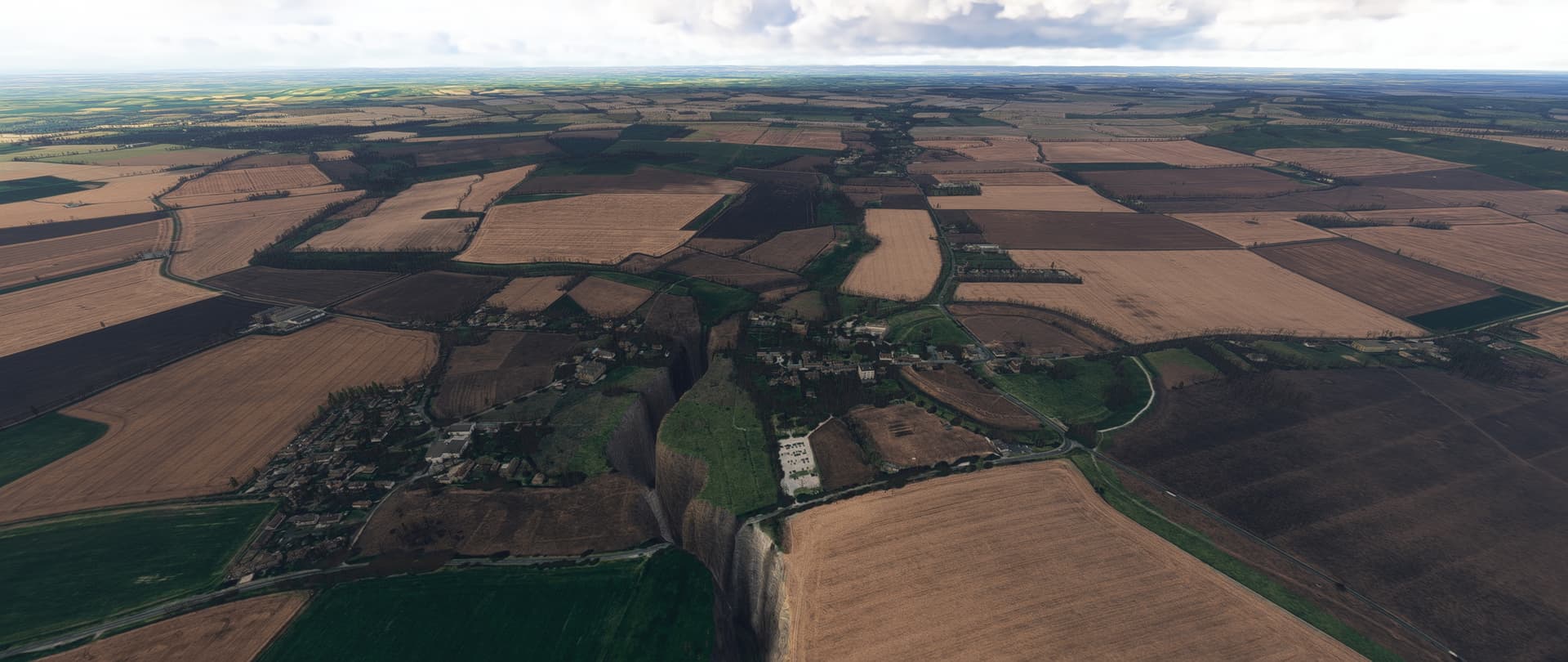
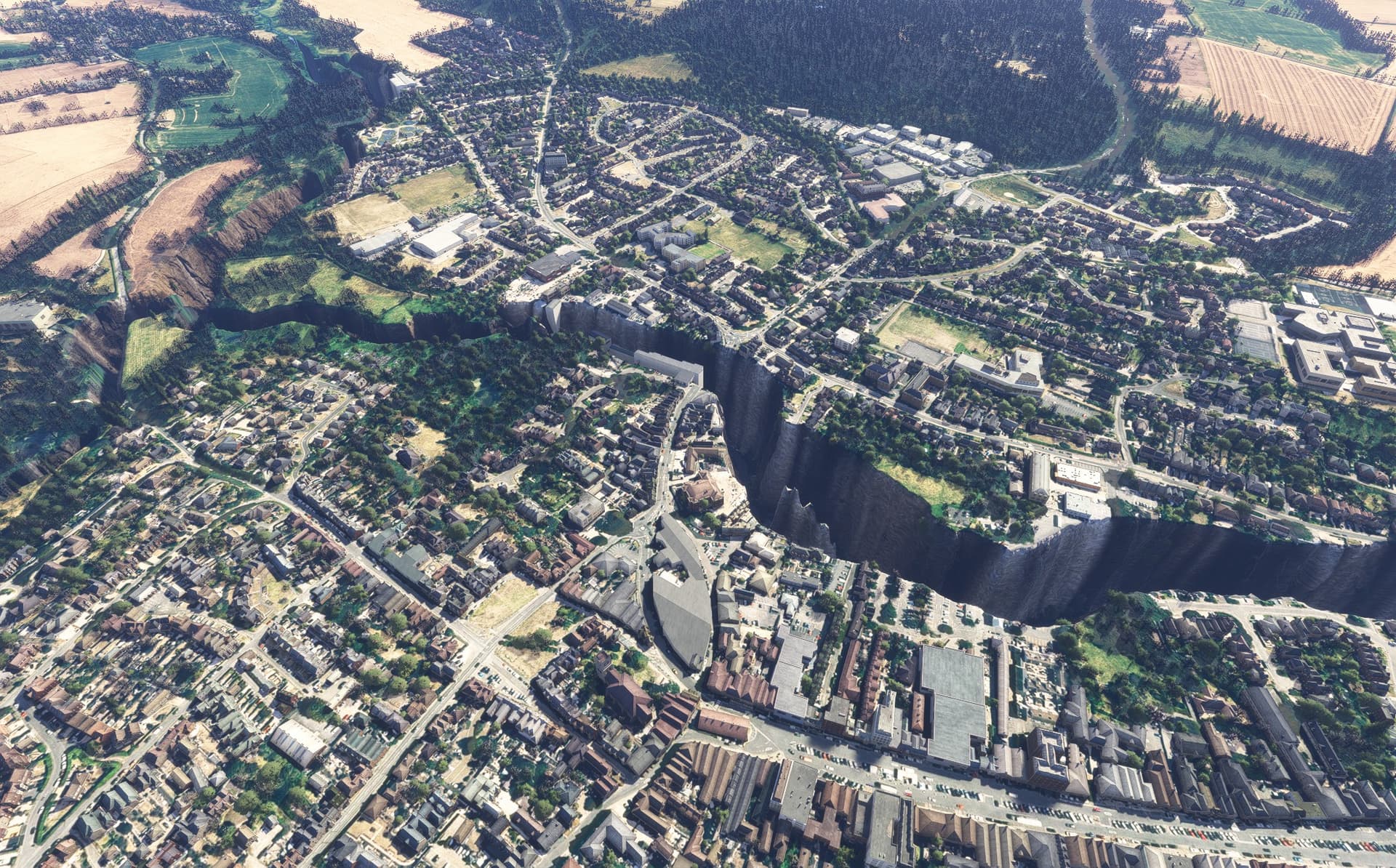
Description of the issue: Depressed Kennet River valleys whan flying low in Hungerford, Marlborough & Silbury Hill & Avebury area. Also the River Avon in Chippenham is the same.

ICAO, coordinates, or specific location: Marlborough, Hungerford, Avebury & Chippenham areas. All in Wiltshire, UK.

[PC Only] Did you remove all your community mods/add-ons? If yes, are you still experiencing the issue? Yes!

FREQUENCY OF ISSUE

Every time

REPRODUCTION STEPS

Please list clear steps you took in order to help our test team reproduce the same issue:

YOUR SETTINGS

If the issue still occurs with no mods and add-ons, please continue to report your issue. If not, please move this post to the User Support Hub.

What peripherals are you using, if relevant:

[PC Only] Are you using Developer Mode or have you made any changes to it? NO

[PC, MSFS 2020 Only] Are you using DX11 or DX12? DX12

[PC Only] What GPU (Graphics Card) do you use? Nvidia RTX3060 12gb

[PC Only] What other relevant PC specs can you share? CPU i7-8700K

MEDIA

[END OF FIRST USER REPORT]


:loudspeaker: For anyone who wants to contribute on this issue, Click on the button below to use this template:

Do you have the same issue if you follow the OP’s steps to reproduce it?

Provide extra information to complete the original description of the issue:

If relevant, provide additional screenshots/video:

Do you have the same issue if you follow the OP’s steps to reproduce it?
• Yes

Provide extra information to complete the original description of the issue:
• Pics were taken a few seconds apart with the drone camera, only difference being the height.
Directly above Avebury, UK 51°25’40.2"N 1°51’21.2"W
Taken using SU1 1.3.23.0

If relevant, provide additional screenshots/video:


Do Microsoft/Asobo ever fix or even look at these issues?