![]() Thank you using the Bug section, using templates provided will greatly help the team reproducing the issue and ease the process of fixing it.
Thank you using the Bug section, using templates provided will greatly help the team reproducing the issue and ease the process of fixing it.
Are you using Developer Mode or made changes in it?
NO
Have you disabled/removed all your mods and addons?
YES (I use only 3rd party planes)
Brief description of the issue:
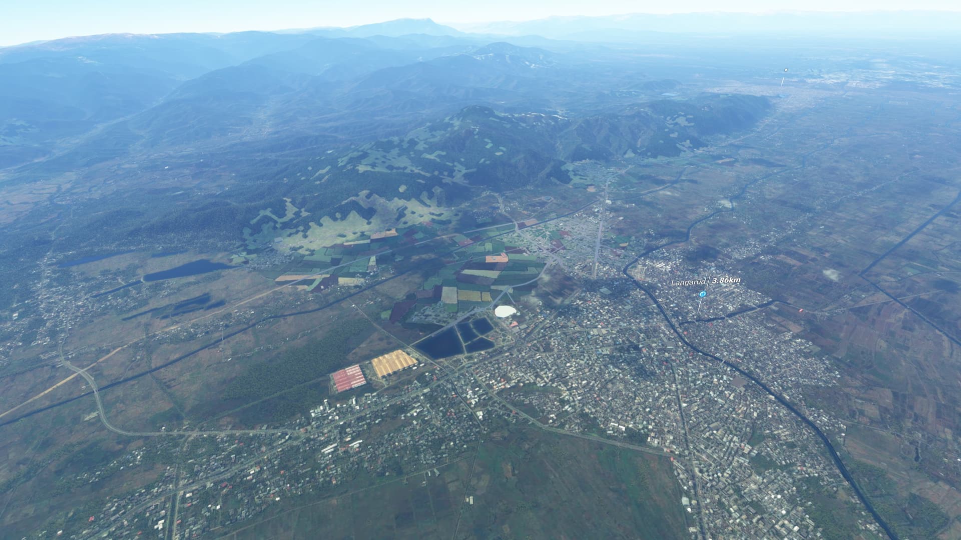
There is a lot of missing satellite data for the Gilan and Mazandaran provinces in Northern Iran. This picture is from around the city of Langarud in Gilan Province.
Provide Screenshot(s)/video(s) of the issue encountered:
ICAO or coordinates (DevMode > Options > Display position)
37°10’11.6"N 50°07’46.3"E
Detailed steps to reproduce the issue encountered:
Just fly over the area
PC specs and/or peripheral set up if relevant:
8core AMD CPU, 32GB RAM, 3080 RTX
Build Version # when you first started experiencing this issue:
1.12.13.0
There is a lot of missing satellite data for the Gilan and Mazandaran provinces in Northern Iran. This picture is from around the city of Langarud in Gilan Province.
If I open Bing maps I can see quite detailed satellite photos of the area. I don’t understand why aren’t they showing up in MSFS. I have all the online options turned on btw.
Also this problem isn’t unique for this area. It’s all over the planet. Especially Eastern Europe, Africa, South America etc. All places for which detailed bing map data exist already. Why aren’t they being translated to MSFS?
![]() For anyone who wants to contribute on this issue, Click on the button below to use this template:
For anyone who wants to contribute on this issue, Click on the button below to use this template:
Do you have the same issue if you follow the OP’s steps to reproduce it?
Provide extra information to complete the original description of the issue:
If relevant, provide additional screenshots/video: