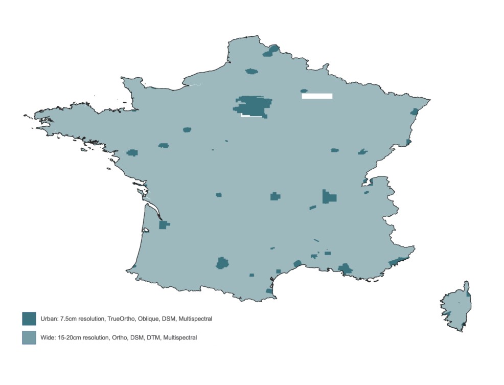
You cannot consider Asobo/Microsoft purchased the whole package from Vexcel for each country.
For example on Vexcel site the whole France is done at 15-20cm and several portions at 7.5cm. However in the game, only few areas (part of French Alps) are actually using Vexcel data and only the 15-20cm
Have you compared actual in-game 2020 to 2024 of some areas to compare? I am seeing the difference for the places I have checked in Japan and am seeing they have updated aerials. I gave an example, I don’t feel I need to spend any more hours to convince you if its true or not.
An easy way to see if an area is vexcel or not is to check landscape. If it’s rounded and approximate it is not vexcel. I did not see any mountains showing this in Japan so far.
They market Vexcel aerial for countryside if you look at my first post, and photogrammetry for cities.
I don’t challenge there could be a change in Japan as you do need to remember they also improved general mapping with Maxxar. Maybe what you show is that ?
Clearly they also said that Vexcel aerials were released for Japan, but I guess to be consistent with the rest this would be for national parks and natural landscapes… I would not see the benefit of vexcel non photogrammetry for flat areas like cities.
I fly VR on a quest 3 from time to time… With Virtual Desktop I managed to find okay settings… But yeah lots of issues
I usually run flat on a 4k LG C3 with a 4090 with secondary scaling a 2.0 (effectively running the game on 8K) with DLSS Balanced or Q. Way better image than 4K DLAA
I don’t understand why they can’t just give us a map so we can enjoy it.
You’d think as a flight sim, next to aircraft working properly cough Savage Ultra cough Skyvan cough ATR, that having ultra high resolution terrain would be a key selling point to enjoy for VFR but instead they can’t be bothered to even highlight the good features.
I can vouch for the bits I’ve seen as being fantastic, I just don’t understand why they can’t be bothered telling us exactly where it all is. Don’t they actually want to people to enjoy the sim for the best it can offer, despite the current issues? What’s the logic here?
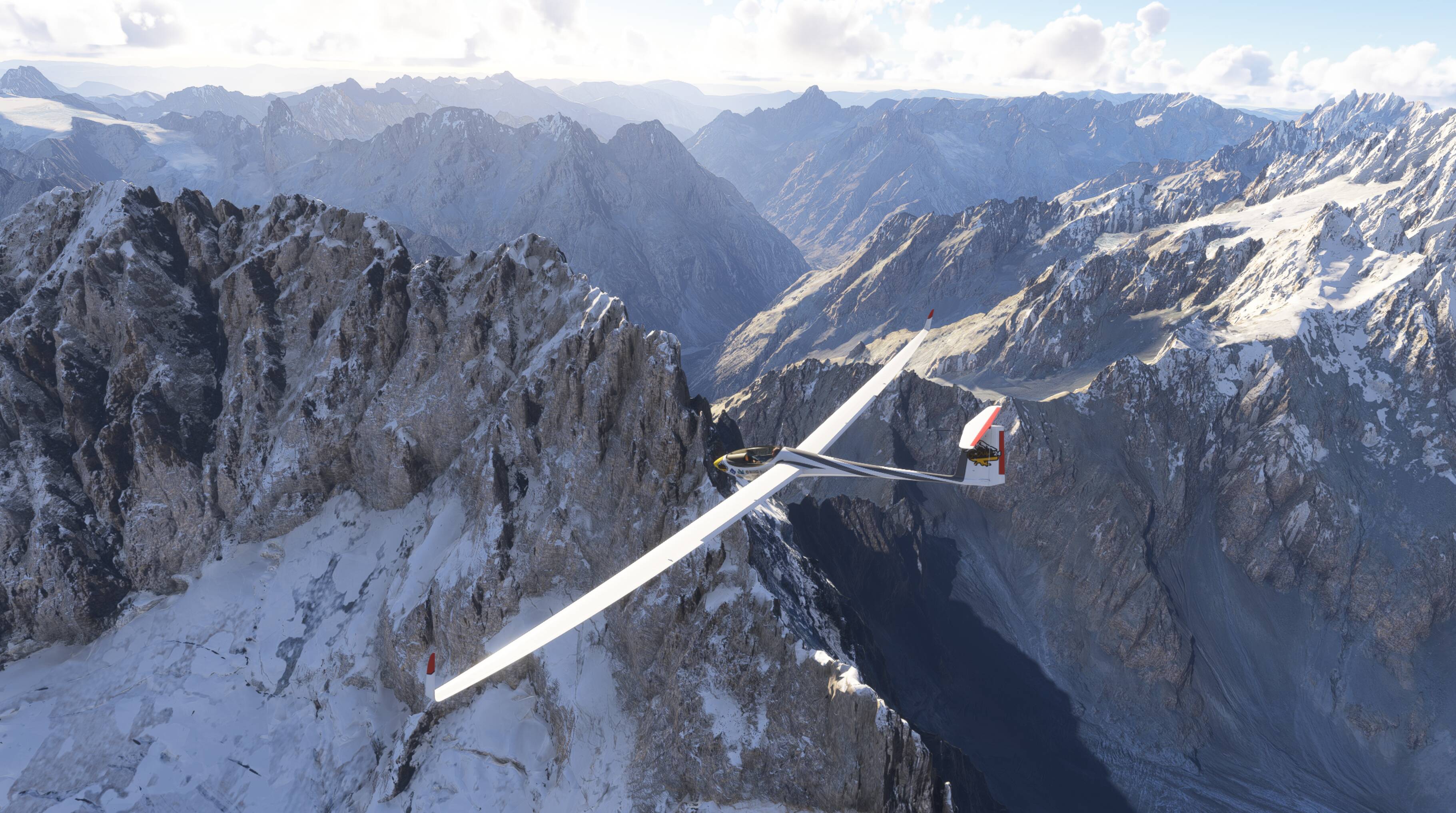
One of the most beautiful and impressive areas with significant altitude variation is a part of the French Alps between Gap, Montmeilleur, and L’Alpe d’Huez, west of Turin. Near Saint-Crépin (LFNC), you’re right in the middle of it. The area is also relatively large—ideal for gliding.