As part of my FS2020 World Excursion I decided to visit Machu Picchu in the Peruvian Andes. Using Google Earth and the sim map I was able to locate the area where the rubble should be. The villages are where they should be and so are the rivers, but no ruins that I could find. The good news is, if you want to experience extreme turbulence then go look for Machu Picchu. I tried first in a 172 which got shredded, and went back in a TBM. The ruins are supposed to be around 7,000 feet but the peaks go to 12,000 so you do a lot of valley flying in what amounts to wind tunnels. It a fun trip, and if you find the ruin let me know.
I Dunno , it took thousands of years for machi pichu to be discovered I find it highly unlikely you could find it in a few minutes… lol…
BTW why use google maps when the game is based off of BING ? Seems like finding things using bing would be easier than using google because the images would be more similar…
How about some screenshots ? of where it should be…? maybe the game just rendered a pile a melted rocks? lol
challenge accepted I’ll go look for it later today if no one goes looking and posts picters first.
2 Likes
The rubble was on Google Earth, I never use Bing. I probably should have taken some shots, but didn’t think of it at the time. There is a river that lines up on google earth and the sim map and the rubble should be close to that river. It’s not a POI in the sim, but easy to fine on Google Earth.
Good Hunting
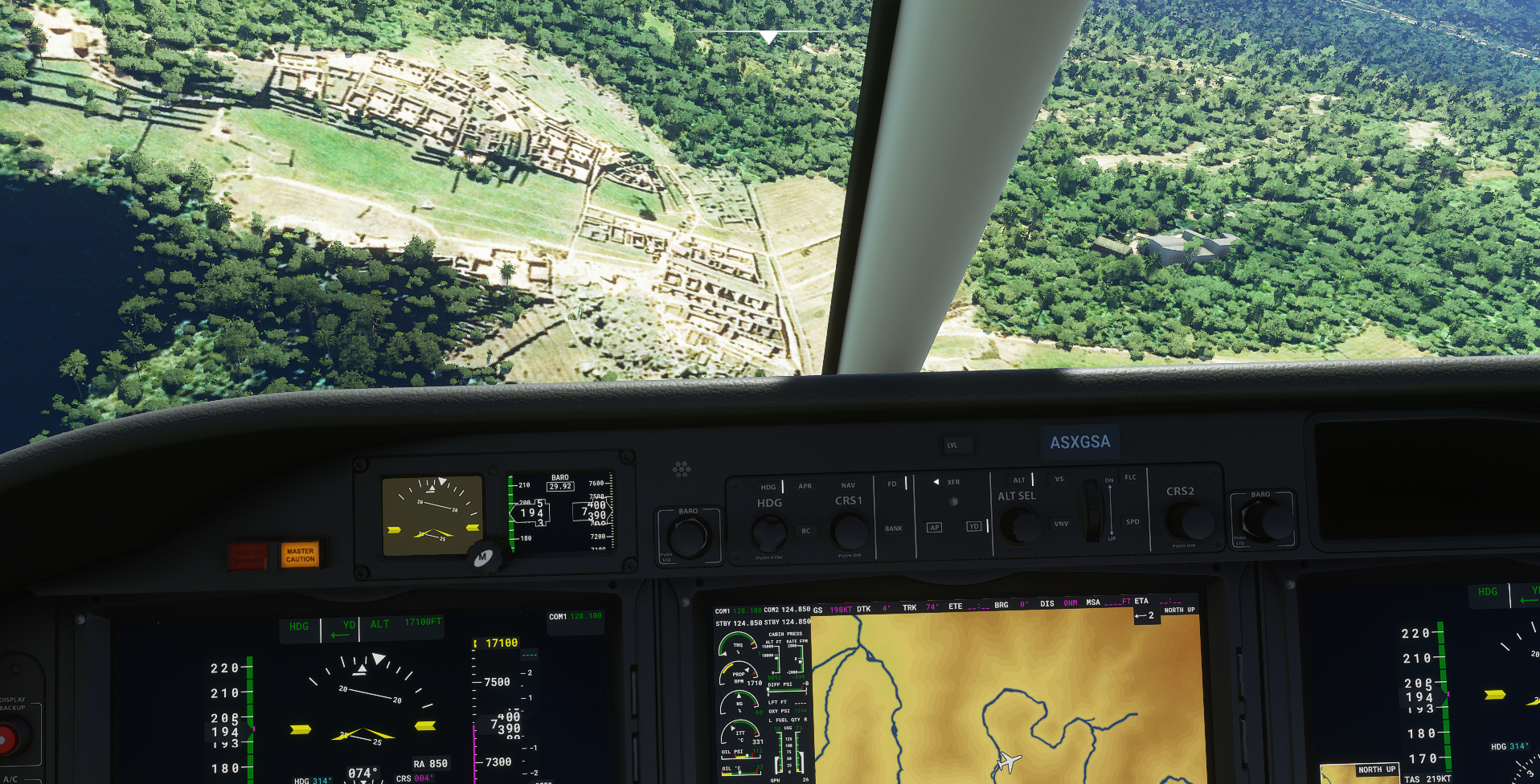
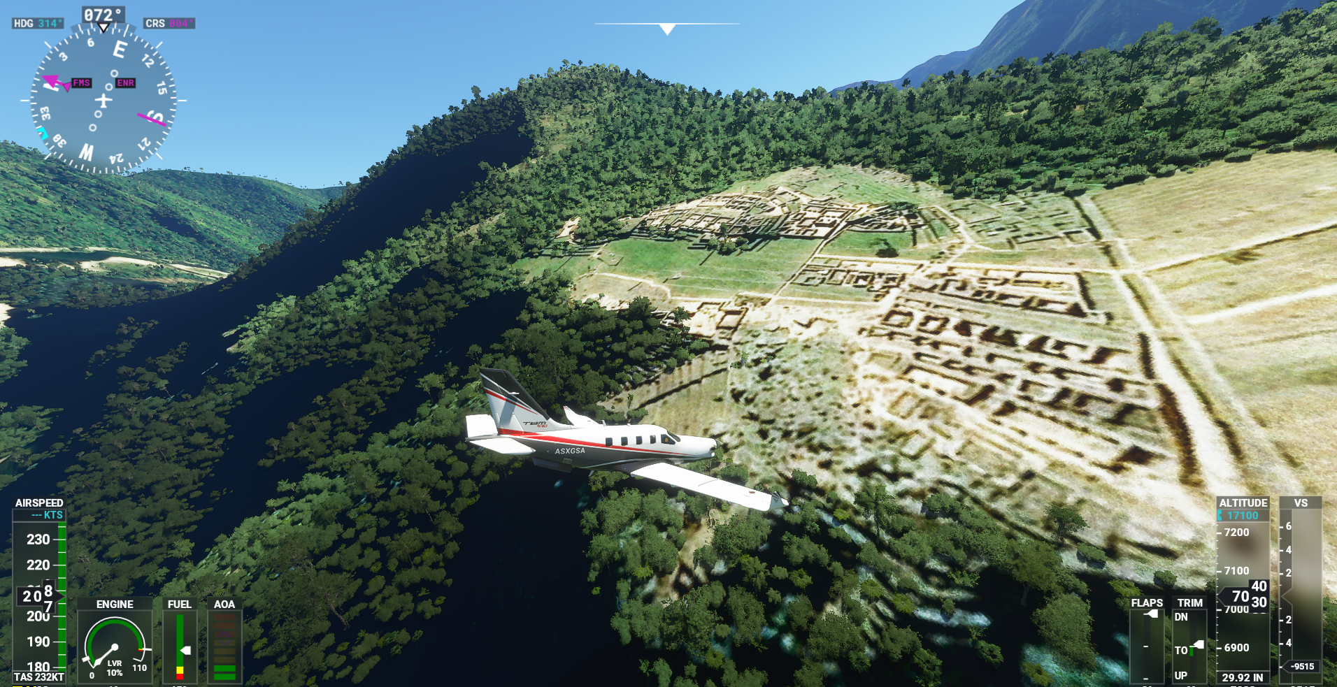
Here you have it.

You should depart from Cuzco (SPZO) heading 295º, then, as soon as you see a lake turn 320º and look for the Urubamba River valley. Then go down following the river.
It is not too far away from Cuzco (about 50 miles). I used (…ahem!) Google Maps as a visual aid for sightseeing.

I don’t know if you can see it better with a better rig.
Good luck!
cool save me a flight to , there…
Hopefully this will be added as a ‘point of interest’ in the future.
4 Likes
I must have flown over it I don’t know how many times. I looked on Google maps and that is right where I was. I came in from the north and the turbulence was rude. I will try your route and use Google Maps instead of Google Earth. Would be nice if you could fly a route then turn it into a flight plan that you could send to others. Exploring for hidden sites is fun, especially in out of the way places.
Good thread, gonna check this out sounds like a fun search!
Just went to SPZO to try TumblingBee’s rout, but the fog was too thick. Will try again later.
Ironically Machu Picchu inspired MSFS.
1 Like
Would be nice to get an update of the local mesh, to have the true situation of valleys and hills. Unfortunately google terrain seems also coming from a lack data, maybe the same source as bing maps… many years ago I tested with free available nasa srtm data in this area, and they where also bad , just in the ruins area as we do see now in the current MSFS
13 years ago I made a personal mesh / dem out of a particular data, based on elevation curves of local Peruvian 1:25000 national agriculture map and which where proceses to digital Terrain by local map editorial “LIMA 2000 SA”,… they provided raw data from this area…
This mesh File was functional in older fs2004 and fsx versions, unfortunately I have no way, no knowledge to convert this bgl for the new MSFS… would appreciate any hint or help! Some technical crack with any idea, here in the forum community?
1 Like
Not to hijack this thread, but one can also fly over the Nazca Lines in Peru.
Very interesting sightseeing trip.
https://en.wikipedia.org/wiki/Nazca_Lines
SuperVertrix
1 Like
One of the first POIs I searched out. I knew it wasn’t listed so I got what I expected, black blobs where the historical buildings should be. I hope someone with the talent I lack will be good enough to render the ancient buildings for us all to enjoy. That is if it is allowed.
Bits of the ground have invisible holes there. There is a nice little strip devoid of trees, a perfect bush landing spot if ever I saw one. It’s on a ridge, kind of over looking the site.
Once landed, and taxiing to a full stop, the front wheels fell into a hole, and the prop buried itself! A gap between elements of the mesh I assume.
After leaving there, I flew through the valleys heading roughly SW. There is an airstrip past the mountains that way, where I encountered a 42kt crosswind. 
Are you using the Deluxe or Premier version of FS? I just spent a lot of time flying around that switchback road the you see on Google maps right next to Machu Picchu and there was no Machu Picchu to be seen. I am running the cheepie version of FS2020, so I wonder if some stuff was left off, or that I really ■■■■ as a navigator. I’ve lined myself up on that switchback, paused the sim and right where it should be is a bald spot in the trees. This last time I just dropped a 172 right on top of the place and Machu Picchu was no where to be found.
Yes, I have the Deluxe edition, but I don’t think it has to do with the images you get, since there is nothing built in that place. It’s just a photorealistic scenery, the same I suppose you have…
(-13.1635382, -72.5450380) here the ruins are
And for landing with helicopters use this:
(-13.1621376, -72.5236186) - that’s a real landing place
Copy & paste coordinates in search mask of the MSFS world map
planes cannot land closer than SPZO… or landing outdoor somewhere on the stony river banks of Vilcanota/Urubamba River, close to Santa Teresa West to MP
1 Like
We had a case of Pilot Error. In Options>General>Data I had Bing Data World Graphics switched off.
4 Likes