We will be hosting an Official Fly-in alongside a group of community members (you!) on Twitch. This is an open event, free to those who would like to fly along with us and available for all skill levels. The goal is to have a great time, explore new locations of the world, and make new friends.
Hosted by @Jummivana and @Pieter1982NL. Guided Tour by @zkdos
When: Friday, 2000Z, for two hours.
Where: The Official Twitch Channel of MSFS
There will also be a Discord event channel open for those who want to voice chat.
Please see below for details on the upcoming Fly-In Event.
FLIGHT DETAILS
Note - the stream will be starting 1 hour later than usual!
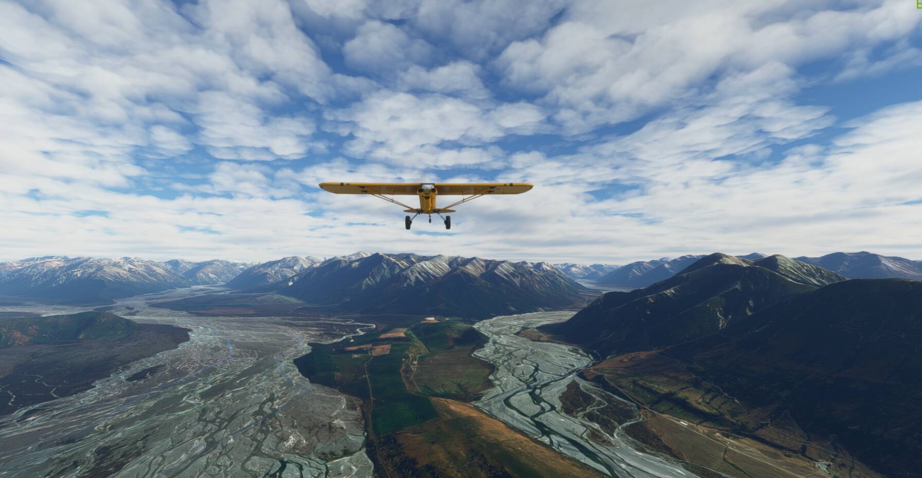
A bush trip through the stunning scenery of the Southern Alps in New Zealand’s South Island.
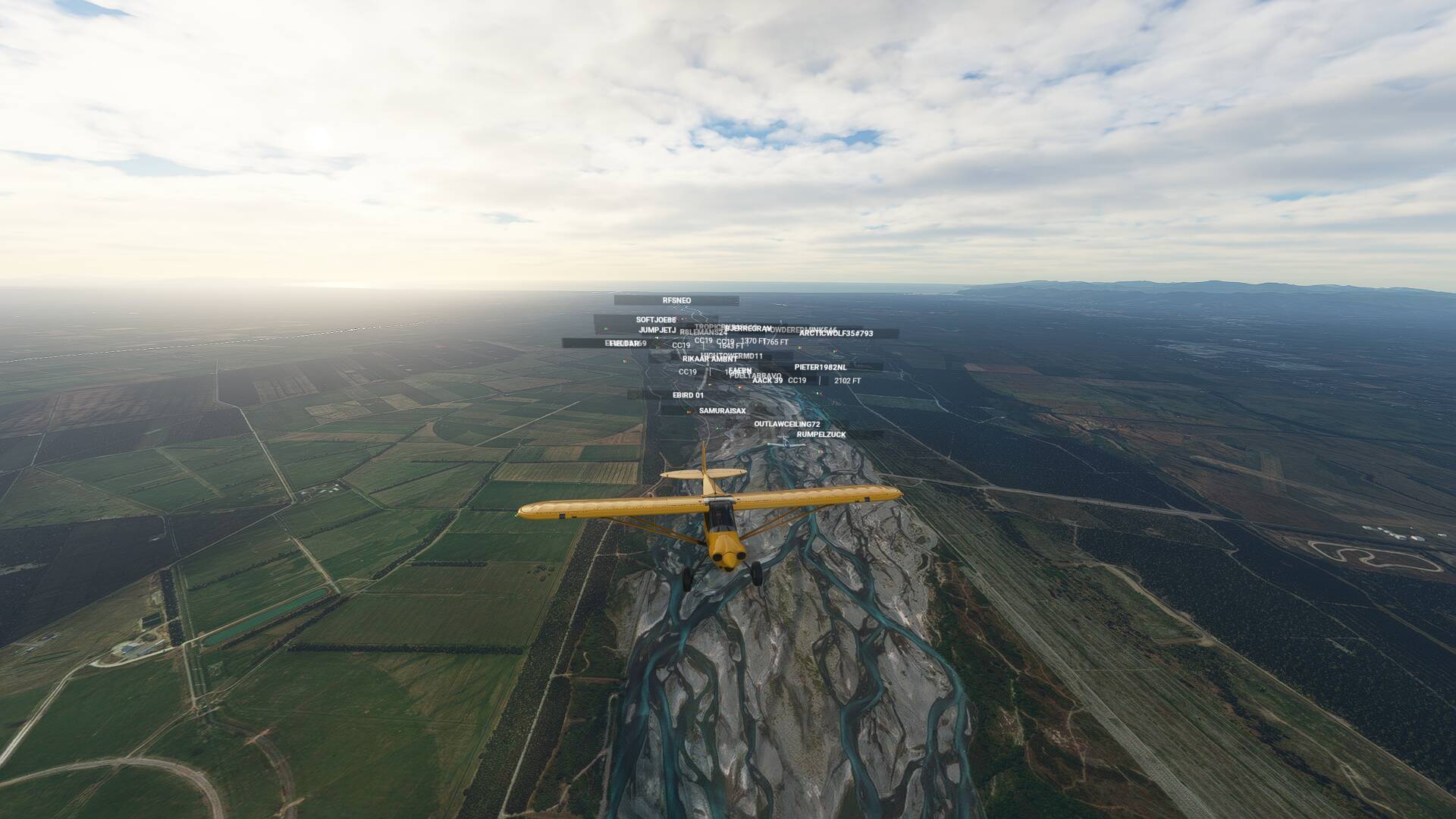
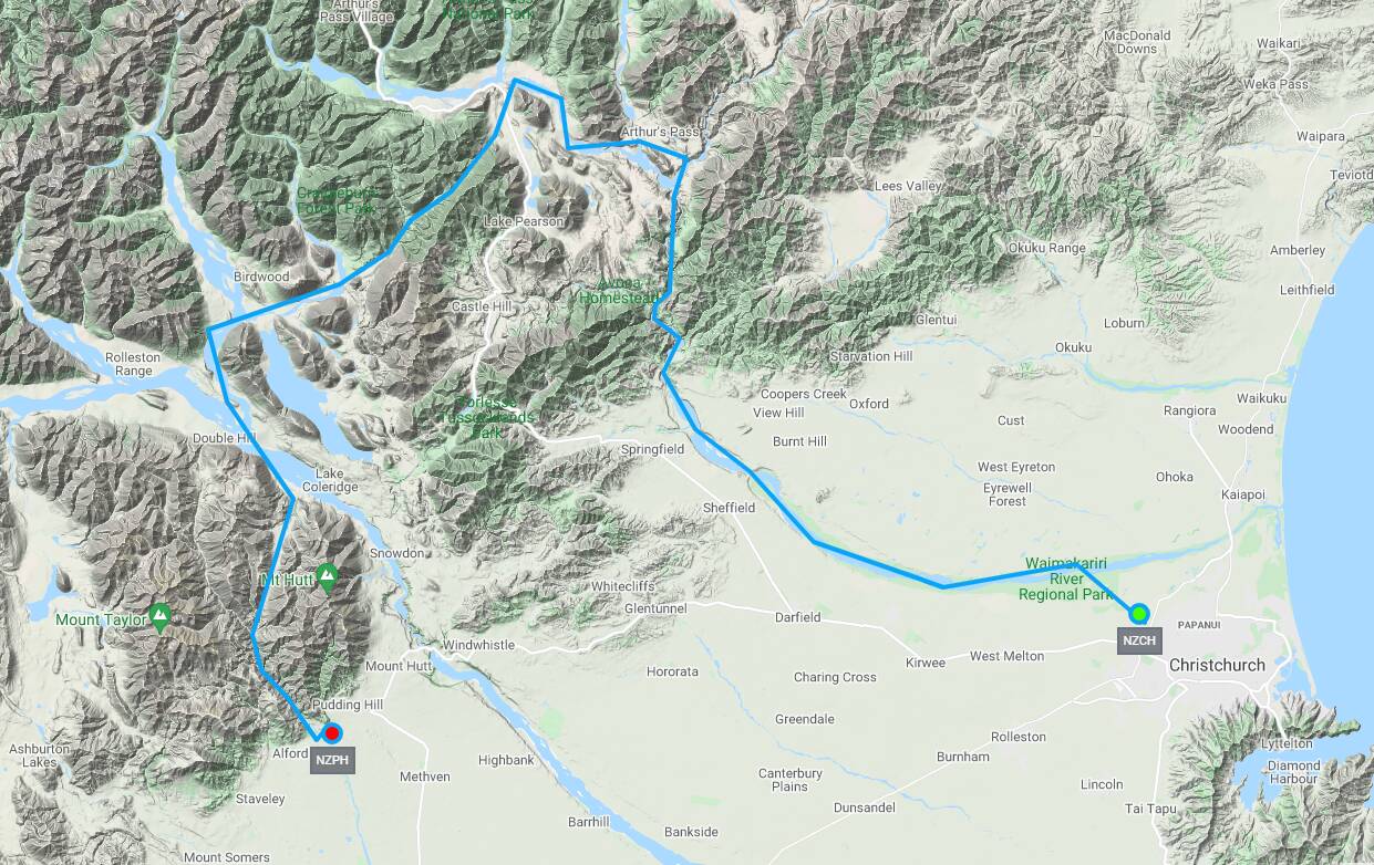
Depart from runway 29 at Christchurch International, and pick up the course of the Waimakariri River. Follow it’s wide braided pathway inland across the Canterbury Plains until it narrows suddenly to cut through the Waimakariri Gorge at Waypoint 5.
Follow the twists and bends through the steep terrain of the Southern Alp foothills, before the river widens out again at the confluence of the Esk River and the landscape opens up to reveal slithers of farmland.
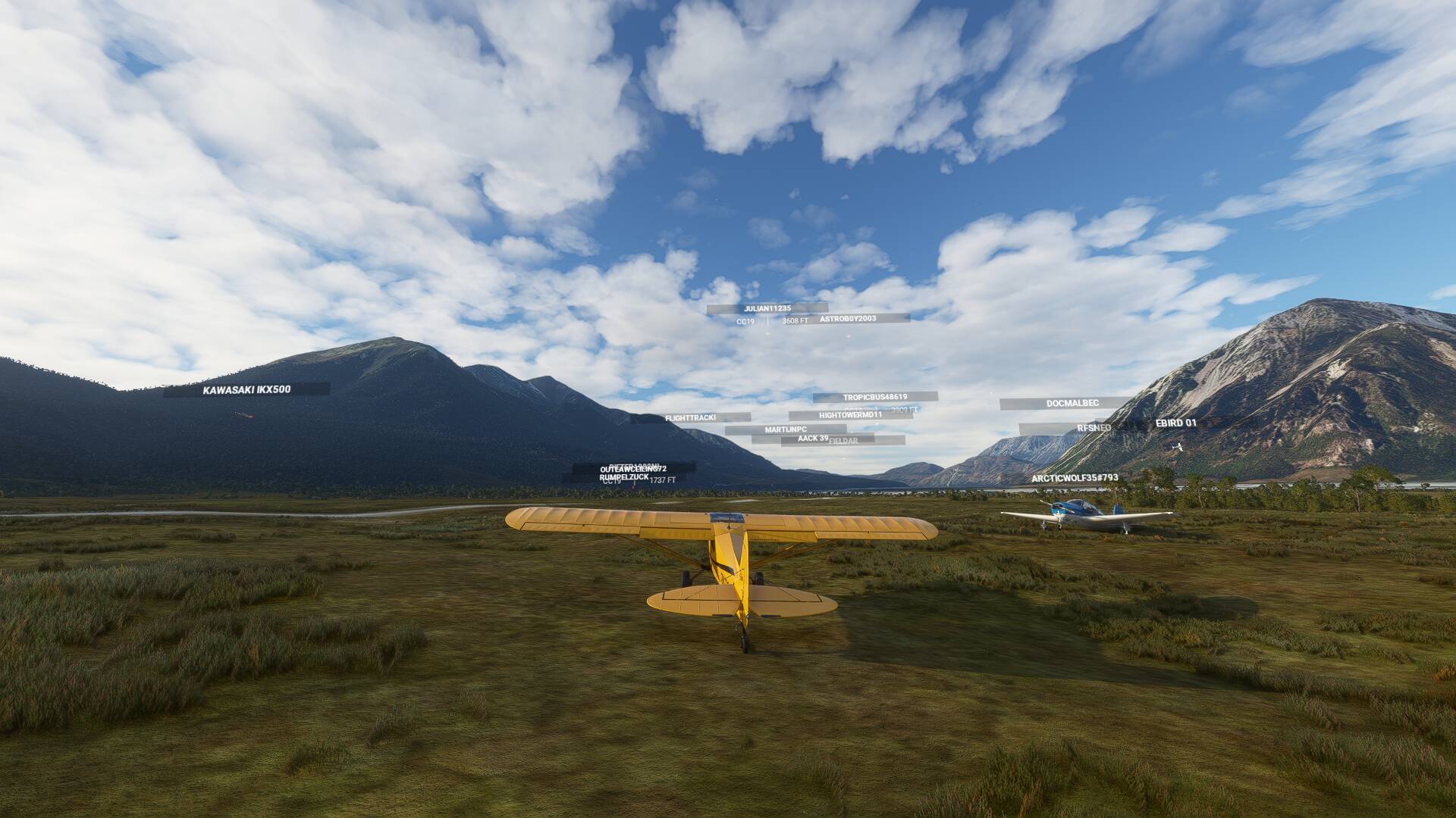
This area is known as Arthurs Pass, and is popular camping area for locals. Follow the GPS guidance over the fields, then back onto the Waimakariri riverbed tracking north west along the valley floor to pass the aptly named Sugarloaf Mountain.
Waypoint 15 will turn you south, following the Cass River tributary that flows through a much steeper narrower gorge, with the Craigeburn Range to your left. You’ll need to climb to at least 4500 feet to clear the Cass Saddle (4350 ft AMSL) at the head of the valley, before the landscape widens out ahead of you to reveal another braided river.
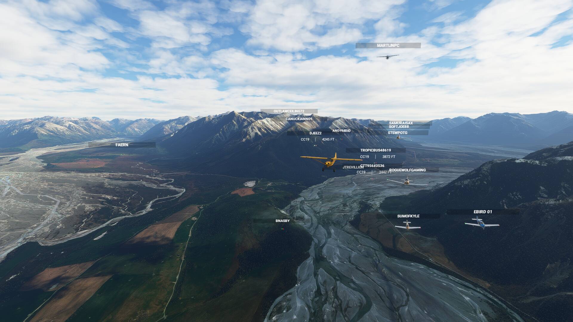
This is the Harper River and it flows south west past Mount Ida on your left to merge with the larger Wilberforce River at Waypoint 21. As it does, turn left around Mount Oakden and follow it south east. A narrow peninsular juts out as the Wilberforce in turn merges with the even bigger Raikaia River- at which point, I recommend switching to outside camera view and checking out the view behind the aircraft. It’s a spectacular landscape when viewed in wide angle.
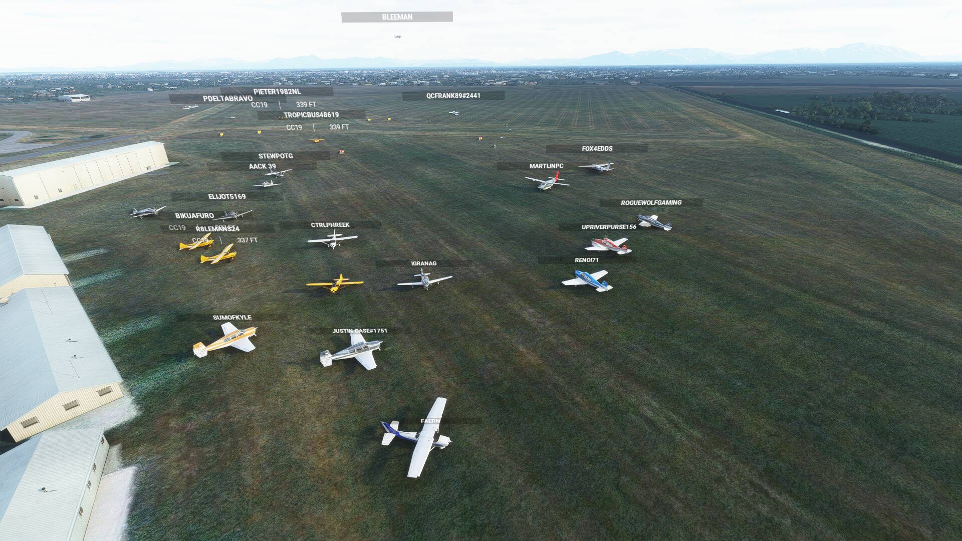
Continue along the Raikaia until you reach Waypoint 23, then tuck into the valley between Black Hill and Mount Hutt Ranges to pick up the Swift River. This last river will take you back out to the Canterbury Plains where airport NZPH (Pudding Hill) is located at the valley exit.
At the time of writing, the grass runway at NZPH is incorrectly orientated NW/SE and has been reported to Zendesk. The correct vector is orientated 02/20 and if you follow the GPS flight plan, it will put you onto a left base for runway 02 for a scenic approach at this quiet remote airfield.
AIRCRAFT
Recommended aircraft: X-Cub, Shock Ultra
We will be starting at NZCH Runway 29. Please load your aircraft 10 minutes prior to take off and taxi over to the taxiway or parking.
MULTIPLAYER SETTINGS
Please adhere to the following settings so you can see everyone / be seen by everyone.
| Variable | Setting |
|---|---|
| Server | North Europe |
| Multiplayer | All |
| Live traffic | As desired |
| Weather | Light winds, High overcast clouds |
| Time of Day | *08:30 |
COMMUNICATION
To communicate with others, a voice channel on the "Official Microsoft Flight Simulator Discord” at https://discord.gg/msfs will be available to join.
It is advised in this flight to turn off both aircraft collisions and terrain collisions. If you do crash, you can use “slew” mode to join the pack. If the pack will be too scattered before the first stop, we will use slew on a defined point to regroup.
FLIGHT PLAN
A .PLN file is provided here: https://worldtour.flights/flightplans/251
To use the flight plan, follow these steps:
- Download the flight plan to a easy-to-remember location
- Open MSFS
- Go to the World Map
- Click “Load/Save” on the bottom of your screen
- Click “Load”
- Navigate to the downloaded flight plan
- Click load.
LET’S FLY
This is meant to be a fun and informal flight. Everybody is welcome, no matter the amount of experience.