I thought with the new world update for Germany we get new satellite images.
Bing maps is not updated but Google maps is, maybe they mistaken about it.
There are some new satellite images implented. I reported snow around EDGT last year and had big hopes with WU6. Now the ground textures show even more snow. 
Yeah, sadly since MS owns Bing they will only (makes sense, of course) use Bing data. And Bing data is way behind Google data. And it will always be way behind. That’s why when MOST 3rd parties create scenery they use the Google data instead. But MS won’t do that.
I’d say it depends. For example Faroe Islands on Bing Maps are far better than on Google Maps.
1 Like
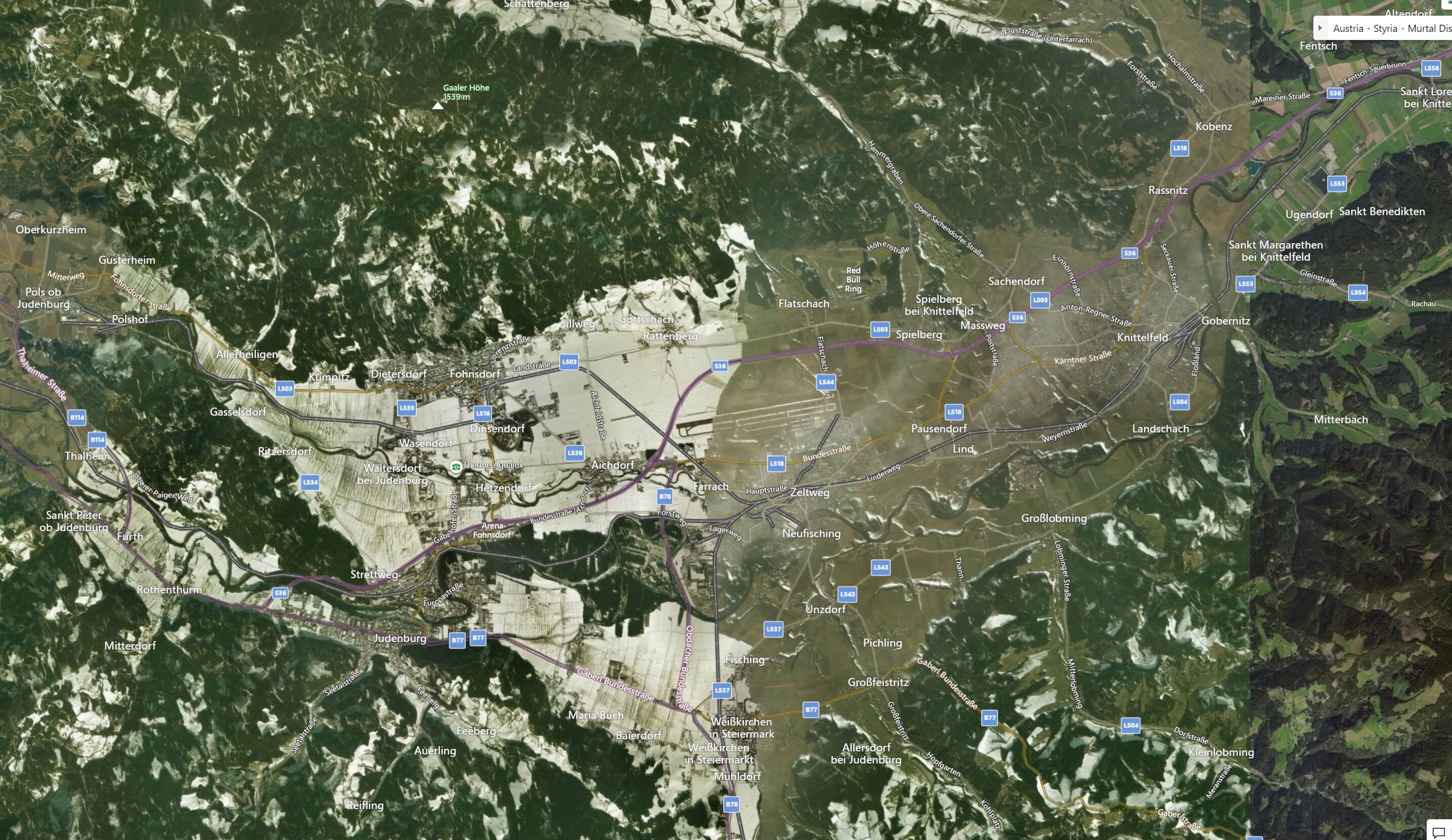
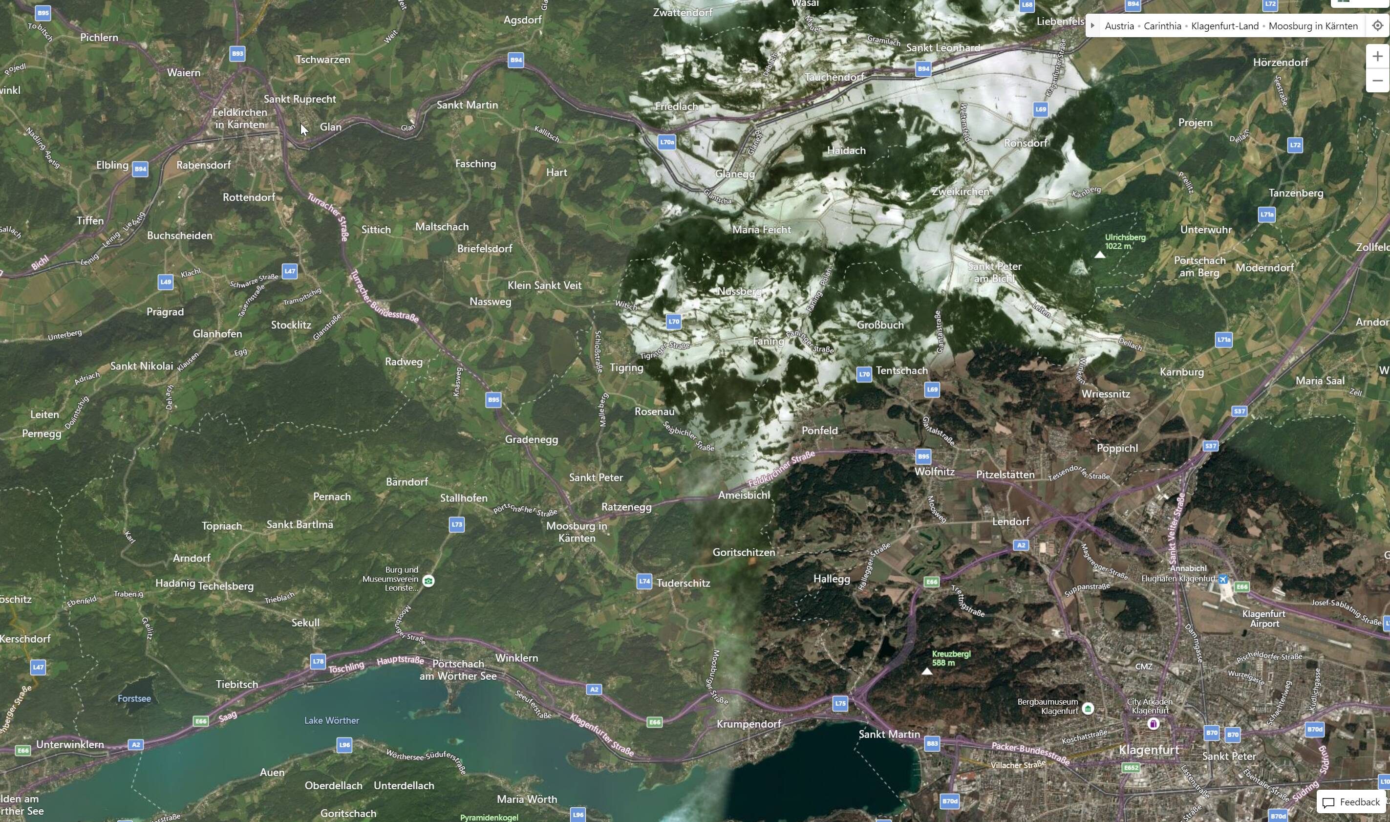
The aerials are especially bad in Austria. You see snow on fields in flat/low areas in the middle of summer, badly patched images with constant parallel lines every few miles. This is especially bad around Zeltweg airport (middle of Austria), north of the Klagenfurt airport and in the area north/west of Klagenfurt up to Innsbruck.
You can’t tell me there aren’t better images available for Austria in the year 2021.
I looked at Bing and can confirm that this is exactly how it looks in MSFS.
After hearing Jörg’s announcement, I was 100% sure this would be fixed with WU6 and very disappointed now.
See examples below:

It is really strange.
On bing.com is now new stallelite date (Frankfurt / Munich) but inside MSFS is still using old data.
Frankfurt is over 3 Years old inside MSFS (in bing.com it is only about one year!)
Munich is over 5 Years old inside MSFS (in bing.com aprox. 3 Year)
Funny fact about munich - in Munich is the german HQ of Microsoft - but because the Data inside MSFS is so old (construction not started) - there is nothing  even the construction of the building havent startet.
sorry, you are wrong… for example in frankfurt, bing is ahead of googe data.
I life in Munich and I am also disappointed because in MSFS is still very old data and I noticed that in google maps now is new data from this year.
Yeah, but be precise - even on Bing.com the satellite data is newer as in MSFS it self.
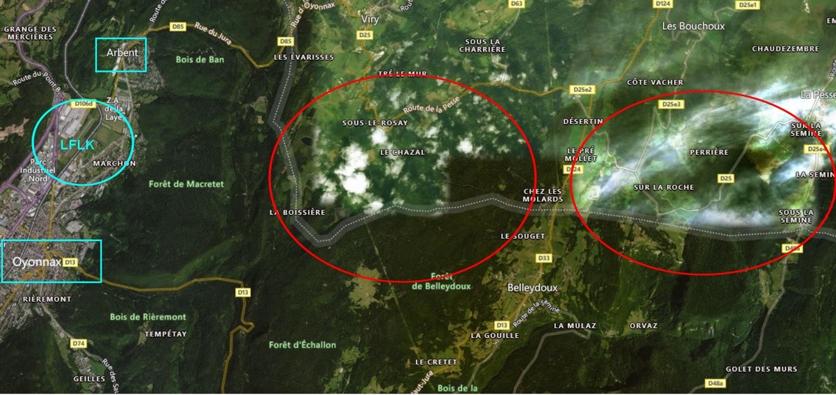
Regarding snow, you’re both right and wrong: in reality, on Bing Maps, it’s not snow, but most often very opaque white clouds. When the clouds are too opaque (sometimes you have to zoom in or out on the map to see them), the algorithm takes these clouds for snowfields. This kind of problem is also found in France, east of the Oyonnax-Arbent aerodrome (LFLK). I raised this issue on zendesk very early on, but without any response or conclusive results with the updates. This problem does not exist with GG Maps.
New Zealand has 7 year old data in places with 2 year old data on Bing. Doesn’t make a lot of sense. When they were having issues a week or so ago it reverted to the new data for a few hours.
Around the Interlaken / Bernese Oberland area it looks exactly as it did before WU6. And completely different to the nice detailed photography on Bing of the same area. Very disappointed.
1 Like
The images I refer to all have snow and not clouds.
Snow, no snow, clouds, no clouds, whatever, that’s not the problem.
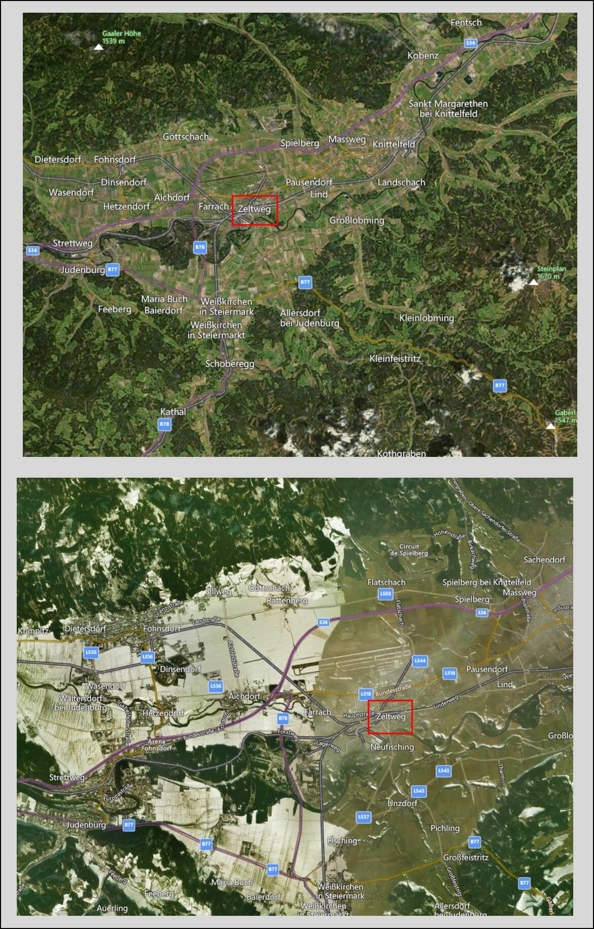
The problem is that depending on the zoom that we do on a given region, we do not get the same result at all: under these conditions, the MS algorithm is currently unable to correctly process the area, regardless of this area in the world.
The proof in pictures…
I was planning to flying around the middle east today, Syria to be exact and the satellite images still show the nuclear reactor that Israel destoyed in 2007 is still there! I have flow around most that area and the only area thats even slightly up to date, nevermind the data clarity, Mesada for example in Israel, you couldn’t tell it was the iconic mountain and wadis around it as looks like mush ir jusst flying around the hills have no real definition and are no valley’s, Egypt however even in the desert the few wadis are so clear.
Seems like they have spent so much time doing updates in Germany and America they havs just totally forgot the rest of the world exists and half of it doest look that great and is using data older than some of the community lol.
I mean how can a 2020 game that boasts absolute world coverage and realism be using data from 2008 still. I just hope they actually try with the middle east in 2024’s edition as it would an incredible area to explore if was given even a little bit more love.
Indeed, there is a huge difference in all aspects of the scenery between USA, Europe and the rest of the world. In some remote areas there is virtually no scenery at all to speak of.
I understand areas like North Korea but Israel is one of the most studied nations and the data is all out there the only real reason for it is just lack of care. I mean we have had so many german updates and a fair few US ones in places that were already amazing while nations that have a lot of information to work on just get ignored.