I’m particularly interested in the bit I highlighted below:
Additional high-resolution data were integrated to fill low-resolution areas of the default terrain mesh, and correct spikes and troughs along DEM grid sections.
I’ve noticed these terrain troughs a lot more recently.
The only reason I haven’t bought it yet is because I’d like to know if it plays nicely with exisitng payware airport scenery (Pyreegue, iniBuilds, PilotPlus MaccoSim in the UK and MK-Studios’ three in Ireland). Any feedback would be appreciated.
Gave it a punt, difference is subtle most of the time ( I likened it to reading glasses ) - except for roads, which I can now follow easily! more VFR coming I think. I haven’t exactly been to many places but I haven’t found a 3rd party airfield that’s been affected including at least one that’s suffering because the default terrain data is inaccurate.
A very limited dataset and over a year apart, but the nearest matching vid I have lying around -
Dunno if it helps but here are a few shots from the areas you mentioned. Still getting some morphing on the coastline cliffs though. I will check some BBD & Pyreguee airports tomorrow. And see if the Taburet coastline fix works WITH this OK together.
Can anyone tell me if this addon improves Loch Ness?
In the default scenery, the water of Loch Ness goes up the hills on the eastern side of the loch. Annoying for me as I used to live in the area and watched the RAF fly low level along the loch many times. Reproducing those flights is great, except for the problem mentioned.
If this addon fixes that issue, it will be the fasted purchase I have made from ORBX in many years of buying from them.
Thank you for taking so many shots around Kerry, its really appreciated! It seems an improvement in general over the default, at least! The absence of trees growing on most of the cliff faces is good to see too.
Not sure if that’s just cacheing - I flew back along a section of cliffs I’d previously flown & there was less morphing, but obviously that’s not going to last forever unless you cache the entire coastline.
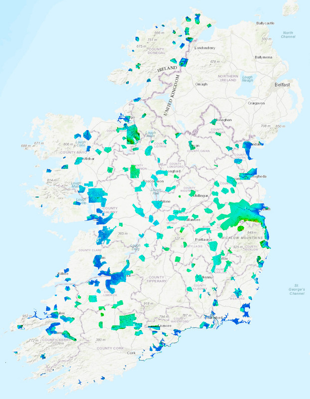
The UK has publically available 1m res lidar data ( used to be 0.5m, pity! ) - I forget what the res is for Ireland?
Thank you for taking the time to do this comparison. Yes, there is some improvement, but the remaining water glitches are still apparent. You know, when MSFS first came out, I don’t remember these glitches existing, I believe they came later with one of the early updates.
I wonder if some talented scenery designer would do something with this, perhaps by use of a water mask (is here such a thing?) to take the water off the hills.
Thanks to Nessie, this is one of the best-known bodies of water in the world, and the deepest freshwater lake in the world too. A massive tourist attraction, and filmed from every angle. Would be wonderful to fly the sim one day and see it corrected.
By the way, where you took off from, my parents lived in the village just to the left of your camera position (Fort Augustus). I climbed those hills you flew over as well. A bit different from the flat Canadian prairie I live on now.
Initially the Lidar data were restricted to the river catchments, which were progressively surveyed at resolutions of up to 0.25m, until the EA undertook to survey the whole of England at 1m. As you said, you could get hold of the raw data at one time, but I’ve just tried to get hold of the <1m datasets and no joy, they’ve been removed.
Many thanks for doing this comparison and posting it in this useful format. It must have taken some time to do.
Actually the improvement was better than I’d expected and certainly worth the £7 it cost. Being UK based I’m glad I’ve installed it.
Bought it as I live in Ireland and for the price of 2 pints and a packet of crisps find it quite good. MS didn’t over endow Ireland with their update and this seems to help with the popping in issues and looks subtly different. Doesn’t seem to affect either MK Dublin or Pyreegues Belfast. So far for me it works fine.
Cheers!
Yes, there are minor problems with water on inland reservoirs, but they are much less than with the default mesh. Of course the main culprit is the default vector data of the reservoirs (does not suppress the height grid, there are many inaccuracies). Also in this area the default mesh is a very low resolution 90m/pix interpolated to 30m/pix. Orbx british isles mesh in the Loch Ness area is 10m/pix. Maybe in a future update some vector data will be added to fix this problem.
EGVZ - Fort Augustus