Would be nice if you guys added gates to the map.
Hi, what exactly do you mean? If you zoom in on an airport on the world view, the gates and their location will be shown
I will post a image of what I mean.
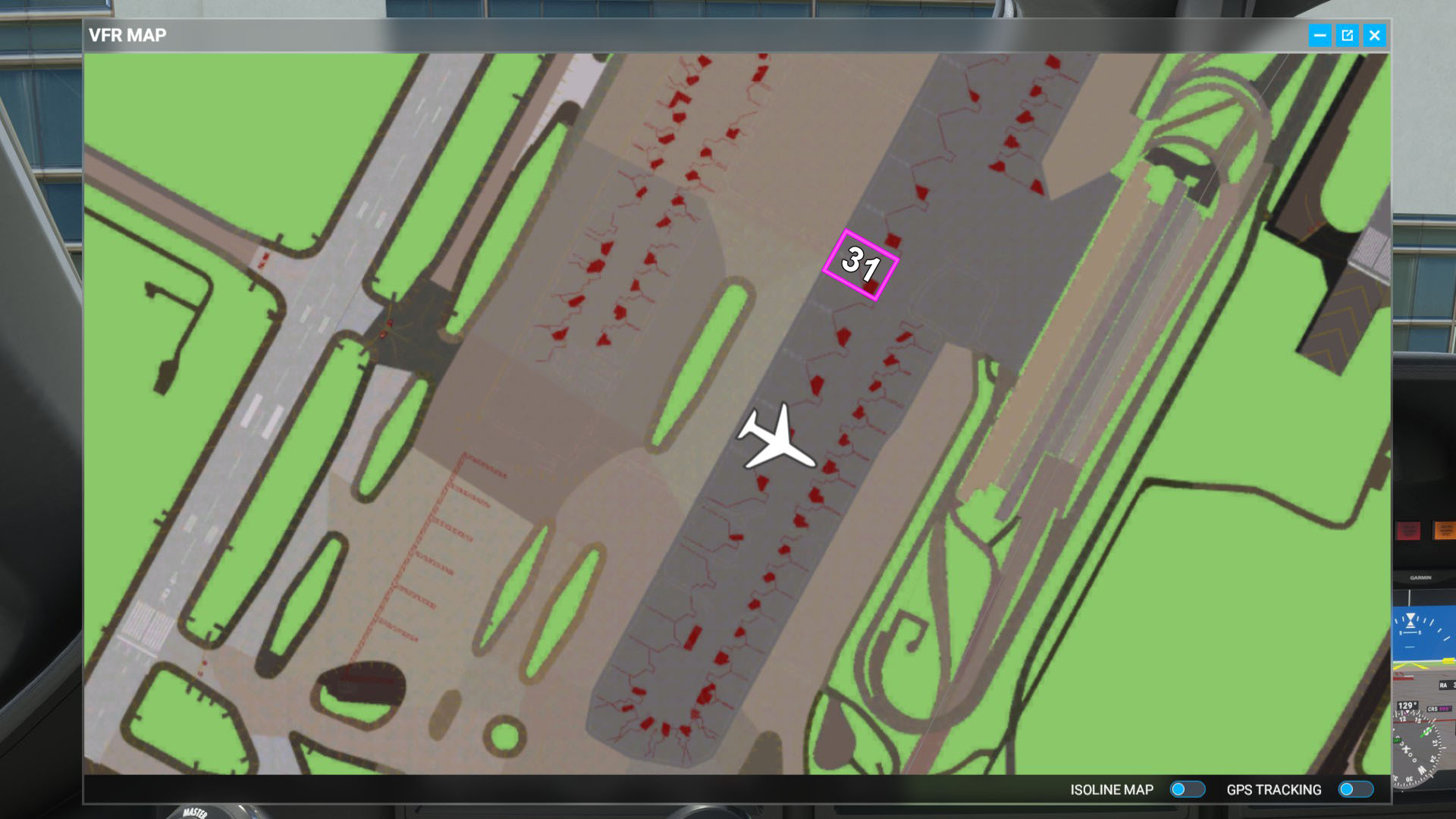
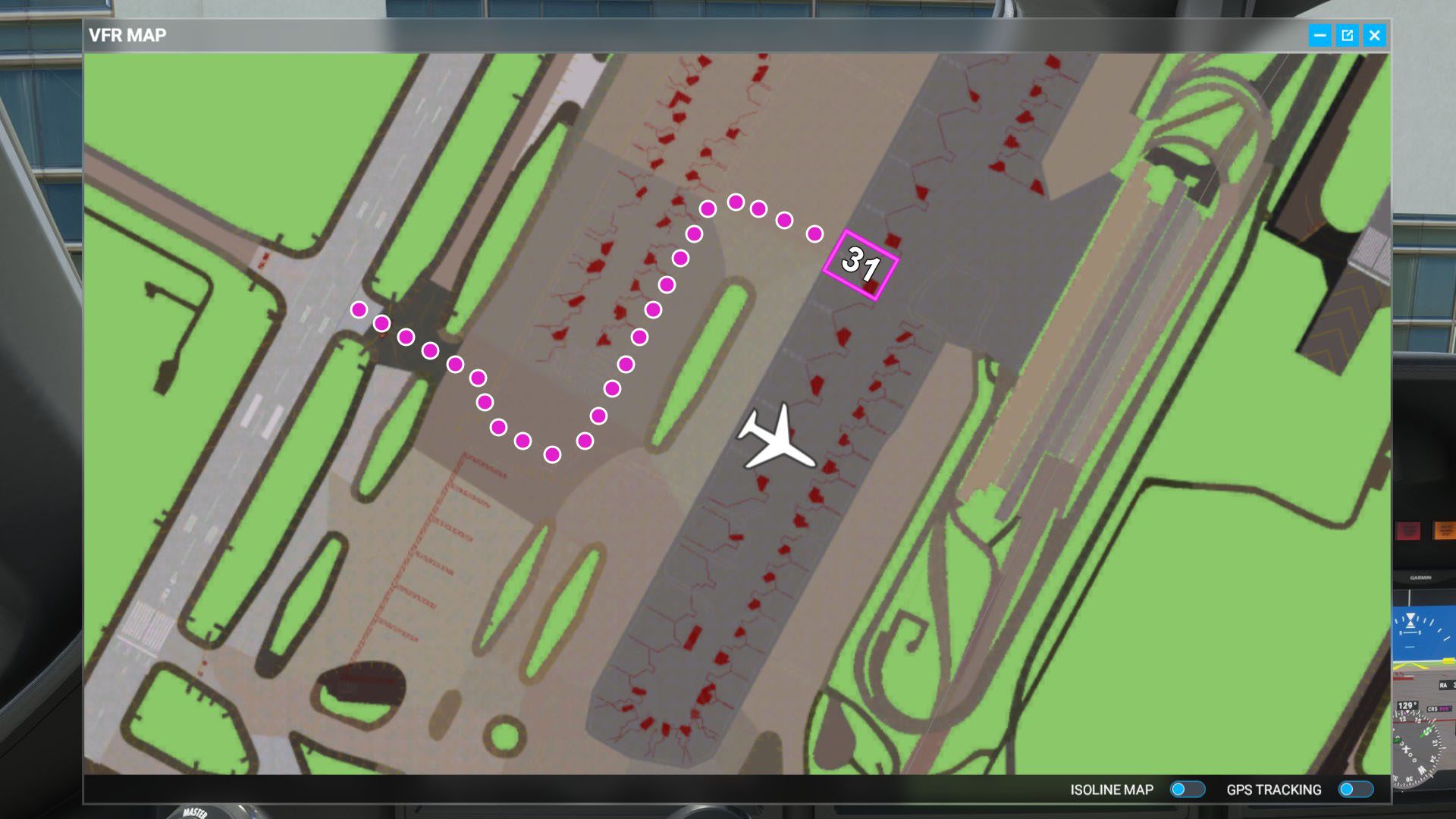
So let’s say you have been assigned a active gate after landing. In my example gate 31 is your assigned gate. When you open the VFR map it would be nice if it showed up like this.
Ah now I understand. Thank you. I’ll update the title to make it a bit clearer what you mean
1 Like
Sounds good. Thanks.
I also decided to send this suggestion over to Zen Desk too. I just feel like it would be so nice to not turn on the taxi ribbon or the AI Co Pilot just to find your gate. I mean all the data is already in place under the hood so I can’t imagine it would be challenging to a seasoned programmer to set this up.
This would be really helpful! I’ve given up on trying to find the active gate myself. My options are give up on realism by turning on the taxi path guidance, use the ATC, or just give up and use any gate. I just gave up because I wanted the realism, but having a way to see the gate would be so helpful!
1 Like
It would be great if this was considered as most airports are mislabeled or don’t match a chart. It’s not such a big deal on small airports but large ones would really benefit from a system like this and those who don’t like the ribbon like me.
I’m glad to see mods that have made the ribbon almost not visible so you can at least pretend like you know where you are going. But having a gate marker in the map would be great.
Given that the VFR Map is a totally fictitious thing, and could include anything, but is a great help to those new to flying, as a visual aid.
Please consider adding the TAXI route to the map.
Just like the Magenta line shows the in-air flight plan path, a “Taxiway Line” could show the require taxi route in a different color.
MSFS know the route.. ATC tells you, and the AI pilot can navigate it, and it can be displayed on the runway as an option (but then it is not obvious what the total route is)
FAR EASIER to implement than a “Follow Me” Vehicle !!
(That hopefully will be in 2024)
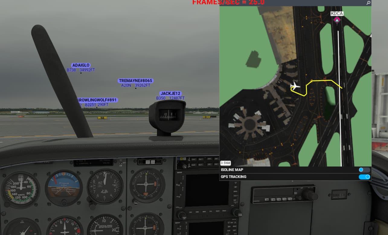
Example: (Taxi route - in this case, to parking - shown in Yellow)

1 Like
The ability to draw on the map could work too. That said, it would need the taxiways and runway designators to be clearly visible. Then open the map on an external device such as a phone or tablet just like real life. ![]()
LittleNavMap and Navigraph allow you to load the map on an external device. PC only though unfortunately.
If you’re on Xbox unfortunately you’ll need to blame Microsoft as they keep the platform seriously locked down.
1 Like
On an app like LNM you might be able to see taxiways, but you will NOT see the taxiway “ROUTE” that MSFS ATC has told you to follow.
This WISH is to add that Taxi route on the VFR map.
Obviously, it would be great if there was a way to tell other Apps what that Taxi route is, — possibly with a “Taxi Plan” API extension added to MSFS.
1 Like
This would be handy in VR. Voted.
2 Likes
We already can activate the 3D arrows but they’re big, ugly, cannot be tweaked and immersion breaking (even though some mods exist) so that would be a great addition. Voted!
1 Like
They cannot be tweaked but there are several mods out there which enable…tweaking?
You can change the size and color of the arrows, nothing more. Better than nothing though.
The arrows are fine to Guide , but it does not give you the situational awareness of what your total taxi path is, like a route plot on a map would give you.
ie The GPS magenta line is not a series of arrows IN THE AIR, guiding you over the next short part of your flight .. On the Map, it gives you the full planned flight path.
I’d be happy with slower taxi instructions so that I can note them down and then look at my apron chart.
But I like that map idea, so thumbs up ![]()