Hi,
On few Areas i have Cloud Textures from Bing Mpas on the Terrain in the MSFS 2020. It would be nicee when this get fixed. And i have also one point with pink terrain near my hometown.
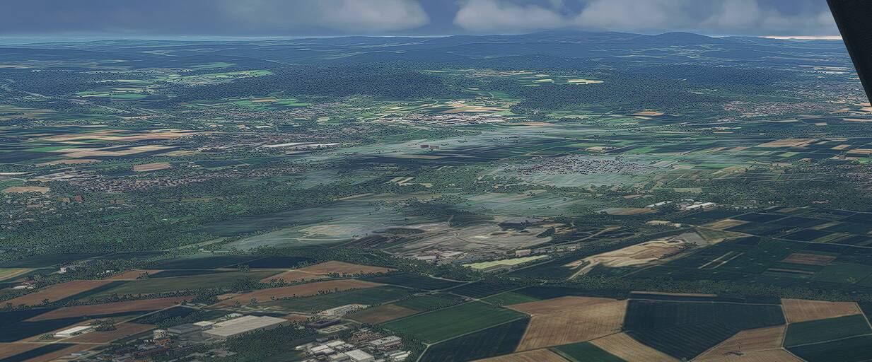
50,038654, 8,388006
regards
Legendsy
Do they also show that way in Bing Maps?
yes they do
Maybe it’d help if you at least provide the coordinates of the locations in your screenshots, since there will never be a solution that simply works globally - they need to know where issues are in order to maybe request new imagery for Bing on that location (and then update MSFS data based on it).
There are also some areas where you can see contrails along the ground, which also looks quite weird. But I didn’t note the coordinates for them since it doesn’t bother me that much.
So i have edited with coordinates which i found out with bing maps for 1 picture of the issue
You’ve prompted me to raise a similar issue where shadows appear to darken the landscape unnaturally. There’s an example here in Scotland: 57.404582,-5.689472
In that case, there’s really nothing else Asobo can do other than manually fixing the terrain textures. The dev uses the Bing Maps to download the terrain texture as is, as a quick way to get real world scenery without doing too much manual drawing.
If the data coming from Bing is showing as defective, then the terrain in the sim will also show as defective.
There’s only one fool proof solution to this, is to have Bing maps fix the satellite images instead. If the data is correct, then the terrain texture in the sim is also correct. But this is outside of Asobo’s responsibility.
If Asobo manually fix the textures, they would need to send the texture files and install them to everyone’s PC. because the locally installed texture will override any streamed texture coming from Bing Maps. This could work, but that’s a long and big effort for Asobo to do only to fix a patch of scenery that only some people would fly over. Like for example, me who likes to fly in Asia-Pacific region, I probably wouldn’t care as much as any terrain fixes that is being done in Europe but I’m being forced to install a texture file fixes, taking my PC storage spaces for a region that I hardly fly over.
Then, that’s only a patch of scenery for the area you mentioned, what about the rest of the world? Do they need to manually fix the patch every time the satellite imagery has some cloud cover or shadows? That could take years to fix and would force everyone to download more GB files of texture fixes for areas that they’ll probably never fly or realise.
Something that can be done a lot simpler and easier by just take another satellite image when the sky is clear and update the map from Bing.
Another solution is to find if there’s any third-party addon that updates the scenery. I think ORBX has a Frankfurt scenery pack which “might” fix the terrain issue for that patch of land. That’s probably the more reasonable solution that doesn’t take too much effort for everyone. Or wait for any World Update scenery downloads which hopefully fixes these patches of textures too.
I’ve just sent a Zendesk and had the idea, whilst typing it, that they could compare the satellite imagery from different altitudes (Bing maps seems to show two levels where I was seeing heavy shadowing)
These artifacts are everywhere around the world in every country I have flown over (probably over 40 countries). It is impossible to fix it. When the missing spot is relatively small because of a small cloud you get this white baked-in cloud, when the missing spot is larger, you get ugly default scenery (some same-looking fields and roads). Nothing can be fixed here.
These clouds baked into the terrain are all over the tropics. You can see them flying south from Panama City or all over Colombia for example.
They could fix this with AI, just search for white RBG ground colors and color match to surrounding green textures.
It really looks terrible, wish they would fix this, ruins immersion.
Based on what we have heard this shouldn’t be an issue in MSFS 2024 since they are using multiple satellite images/data to create the ground texture and elevations. Hope that’s true…