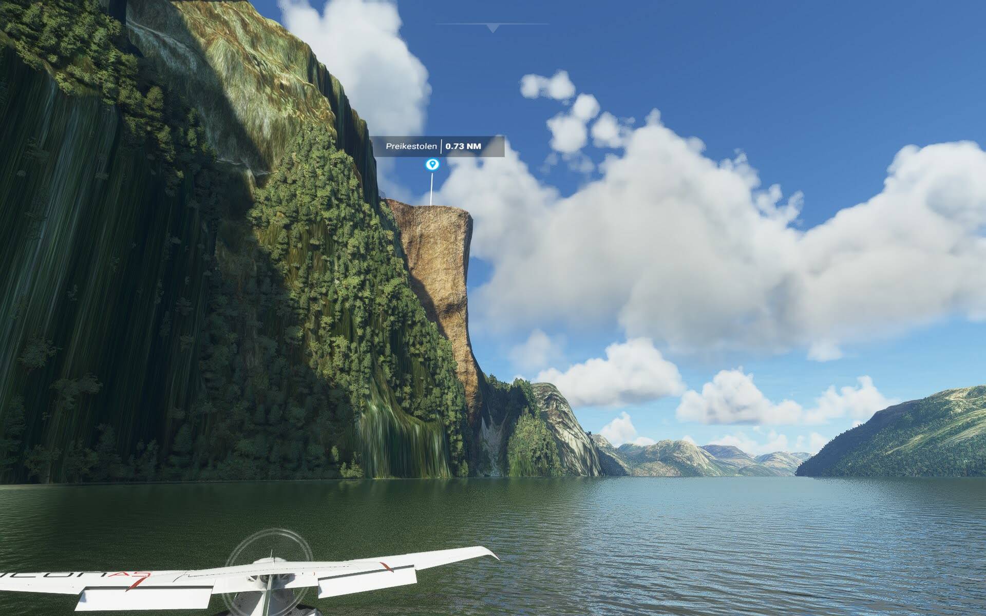
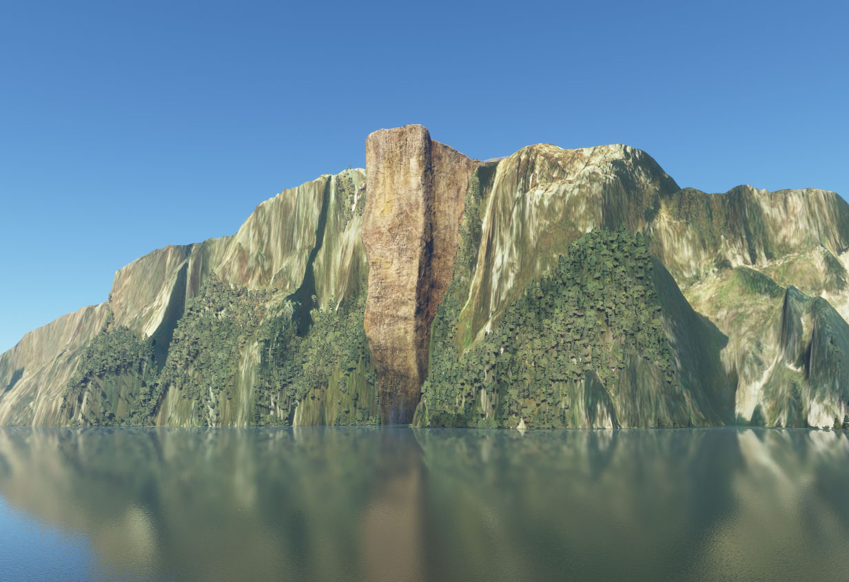
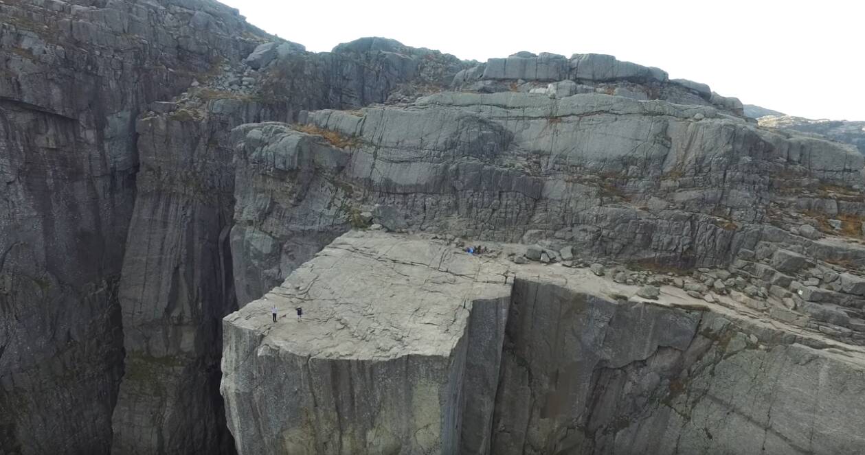
Hi folks, the improved Scandinavian landscapes finally came into being. Wonderful! One of my first flights was to the areas and sights that I myself had visited at some point. Yes! The Pulpit Rock PREIKESTOLEN is also there. But what is that?! The size of the modeled rock is way too big. If you actually take a boat below the Preigestolens on the Lysefjord, you have to look carefully to find or recognize the rock outcrop. I went down on the water with the ICON a5 in the simulator to check it out. I would say at least 5 times too big than in reality! (rather even more) Disappointing, really a shame! Or is that basically done when creating the scenery so that such highlights are particularly noticeable? What’s your opinion? Salute kjebo02
1 Like
If you’re right, which I have no reason to doubt, it’s an error and should be reported via Zendesk.
MS/Asobo would never do something like that intentionally, and it’s the sort of thing that testers without local knowledge would fail to spot.
You go into overdrive ( ![]() ) regarding scale difference.. check your zooming distance.. but there are certainly shape differences !
) regarding scale difference.. check your zooming distance.. but there are certainly shape differences !
(I voted anyway.. looking at this comparison, it seems the rock in MSFS has far to much iron in it. It’s a different kind of rocky texture..)
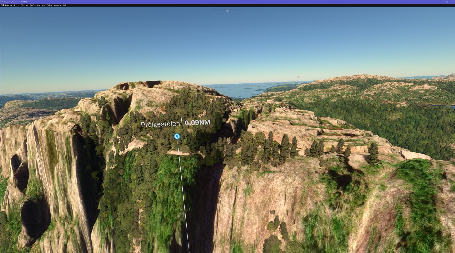
The plateau is about 25x25 meteres in real life (604 metres above sea level). The scale and color is definitely off and is just weird looking.
1 Like
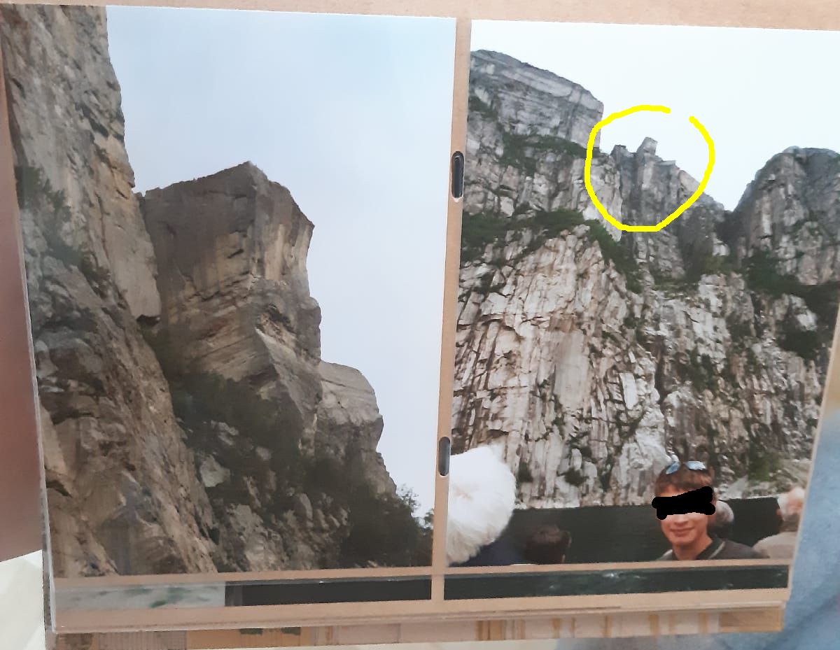
Here are my pictures. I believe the following: In the pictures above in the topic, the plateau appears to be the same size, because you can “adjust” it with the distance between “camera” and Preikestolen.
2 Likes
Both from the surface of the water. The left photo with a telephoto lens.

You’re right.. When I take another terrain elevation map, the Mikeaat DEM I see this,

Looks a bit weird, Mikeaat it’s about 50m off in height irt the Nordic update.. but the proportions are similar.. so.. it’s in the scenery object for Preikestolen itself !! the rock is completely off scale indeed.. 10x or so.. suppose they looked only at the usual pictures as viewed from above ![]() and then adjusted the scaling, to let it fit ? Same as my error in above comparison ?
and then adjusted the scaling, to let it fit ? Same as my error in above comparison ?
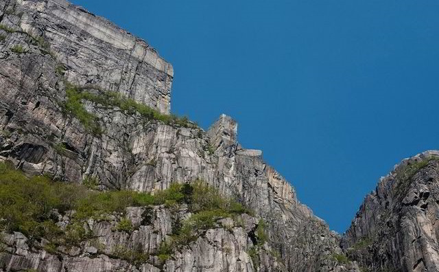
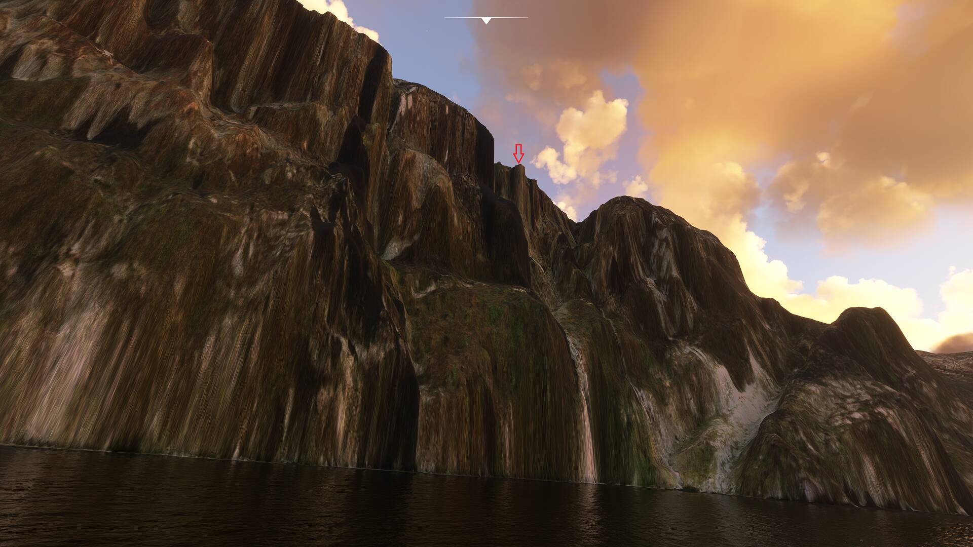
I found another RW picture from below, this is what you get with high zoom level (telelens)
Put back the default DEM.. and show the scaling error using some familiar scenery objects.. ![]()
1 Like
I live on the other side of the fjord and I can see the Pulpit Rock every day in real life, the scaling is way off and the pulpit rock should be reduced at least 5 times to reflect real life size.
I can’t post links yet, but use the following address to view drone footage showing the Pulpit Rock/Preikestolen:
youtu.be/lLhHo7i0Mwk
1 Like
Great RW view.. i’ll post it.. (just go to the top line in the browser, then Control C, go here, Control V)
(this really HAS to be solved.. Preikestolen is the main POI for this region !)

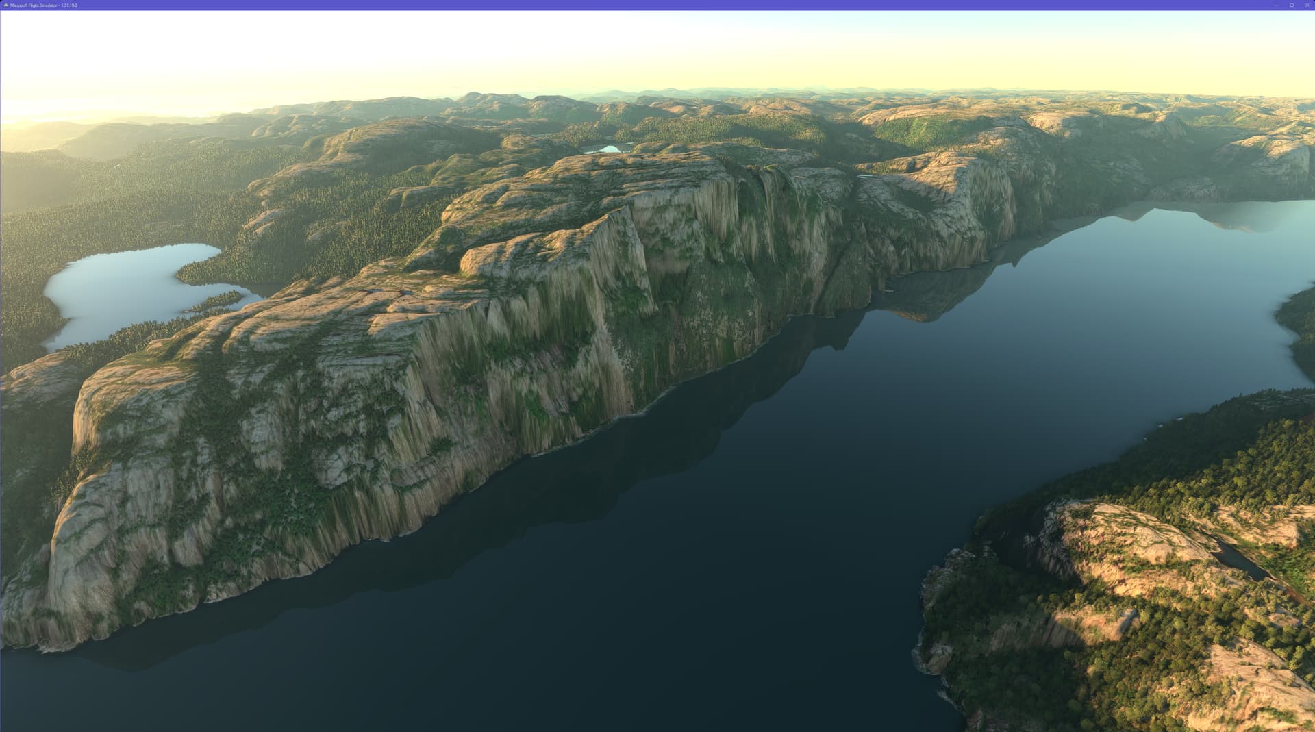
I uninstalled the Nordics POIs and took these screens of the pulpit rock as represented by the DEM:

Quite a difference compared to this nonsense:
Actually quite impressed with how detailed this DEM is, apart from the coastal glitches and the terrain morphing issues. I’m going to leave both the Nordics POIs and building archetypes uninstalled for now.
1 Like
Very interesting! I tried to find it before the Nordic Update and came to the conclusion that such a small detail as PREIKESTOLEN is not there.
Before the Nordics update the DEM resolution was 30m (I think), so I don’t think you would be able to find it then. With the update, the DEM resolution was increased to 3 m for most of Norway.
Imagine how great this would look with higher resolution textures, to compliment the elevation details ![]()
Oh, that’s right, the DEM resolution has also been improved. But for the Kjeragbolten it should still not be enough… ![]() But it’s already crazy how accurate it is!
But it’s already crazy how accurate it is!
Yesterday there was the new world update 15, with new features for the Nordic countries, including Norway. I was very hopeful that one of the most interesting landmarks that were manually modeled incorrectly was also corrected: The Preikestolen.
After my complaint here in the forum, after the first NORD World update with some clear image comparisons (July 2021) and the discussion that ensued, it was clear that it was modeled several times too large. Even the Eiffel Tower would fit on it according to calculations by forum members. Anyone who has ever been there knows that this is of course not possible. It is also not particularly noticeable if you remember your real visit there and compare it with the flyover in Flight Simulator 2020. But anyone who has ever seen Preikestolen from below from the water will immediately realize that the developers have miscalculated this sightseeing highlight PREIKESTOLEN many times over! ![]()
So here’s my urgent plea to the developers: Please fix it, otherwise you’ll make a fool of yourself among Norway connoisseurs!
An enthusiastic Flusi fan
strombo18 (Detlev Bobbe)
1 Like
The Preikestolen POI appears to be completely missing in SU15:
Partial Specs & current settings:
Build: SU15 (v1.37.19.0)
3rd-Party Addons: None, Community Addons: None
i7-12700K (No overclocking or undervolting), 32 GB 5200 MHz DDR5 CL40, Intel Arc 770 (16GB, v31.0.101.5445).
Graphics Tab: Full Screen 3840 x 2160 TAA, Render resolution - 100, AMD Fidelity - 150, VSync - On, FRL - 33% MRR (120 Hz), HDR10 - On, DX12B, TLOD @ 400, OLD @ 200, Motion Blur - Off, Other settings - all Ultra (Water Waves & Glass Cockpit Refresh Rate @ High).
Data Tab: Data Connection: All six options - On, Data Limit - Off, Bandwidth - Unlimited, Rolling Cache - Off
MSFS Version: MS-Store, Standard, plus All World and City Updates
3 Likes
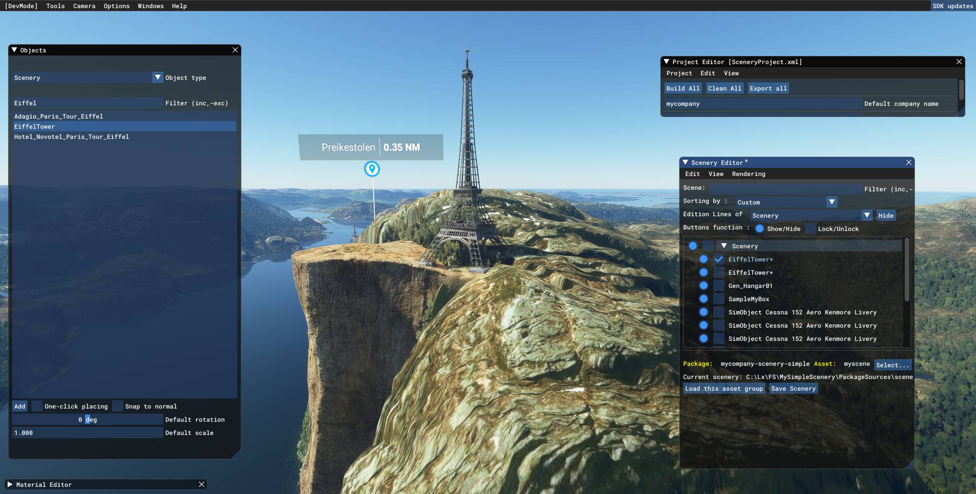
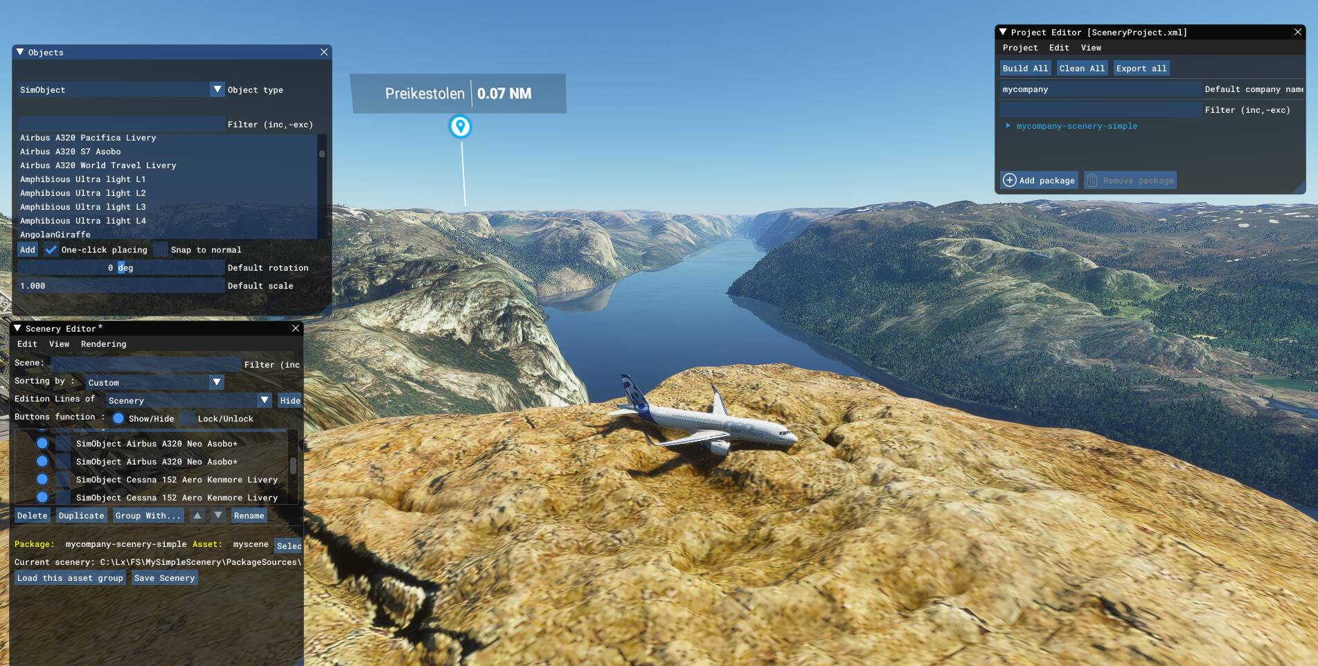
Now. The ultimate question. Wth is the Preikestolen in MSFS 2024? There is even a world photograph Mssion
where it should BE photographed. Lol. You can Not recognize this Rock. Lol.
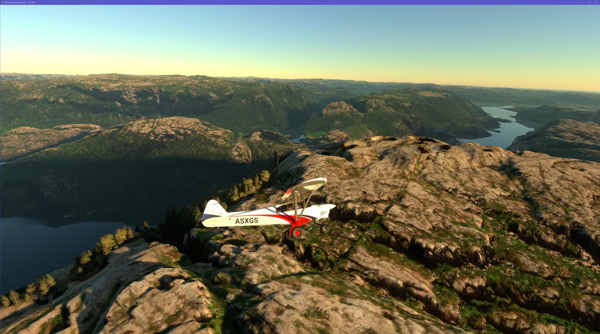
It’s there. It’s just a natural part of the scenery now, with its proper size and position. Se the images in my post above.