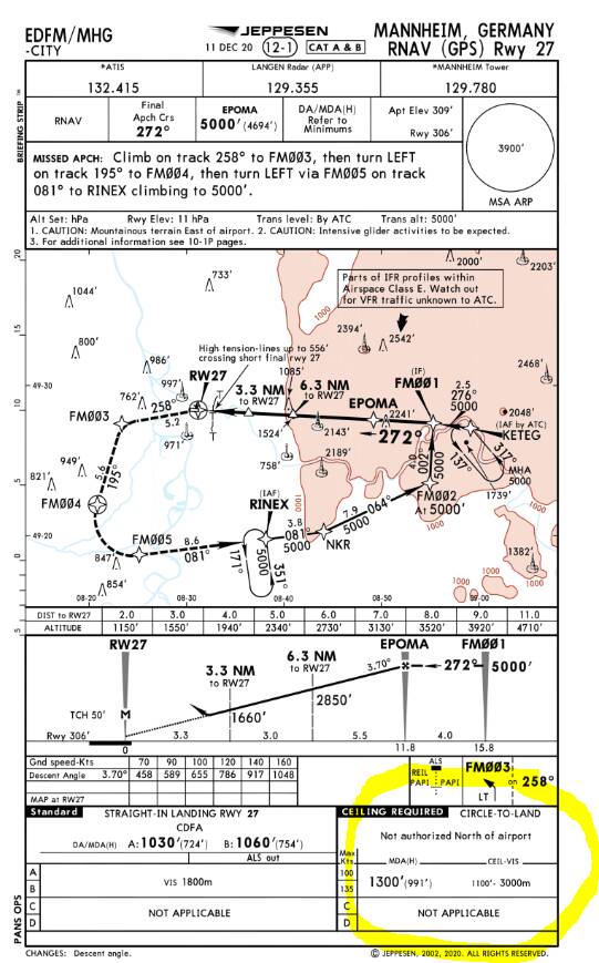
Problem:
EDFM has one runway (09/27).
27 has a localizer and an RNAV approach.
09 is visual (localizer 27 BC) only.
Now sometimes ATIS announces rw 27 in use but at the same time says “landing and departing runway 09”. Which is confusing.
ATC Center then advise me to expect RW27 RNAV approach via KETEG turn for RW09. Which is confusing to say the least. I mean if I follow the RNAV approach pattern it leads my straight in line over RW 27. How am I supposed to U-turn for RW09 then? And which altitude? RNAV KETEG requires 5000ft due to terrain restrictions. Meaning I fly over at 5000 ft which is way too high for RW09 (at 360ft). Since I’m on IFR I can’t descent at own will. All I could do is cancel IFR and do whatever I feel was right.
My questions now are:
Is it common to have one RW “in use” but another one as “landing and departure runway”? And if so, what does it mean?
Is there a procedure to make in RNAV RW-X, turning RW-Y? And if so, what is it?
Hope it makes sense a bit. I’m thankful for any suggestions.


 thank you