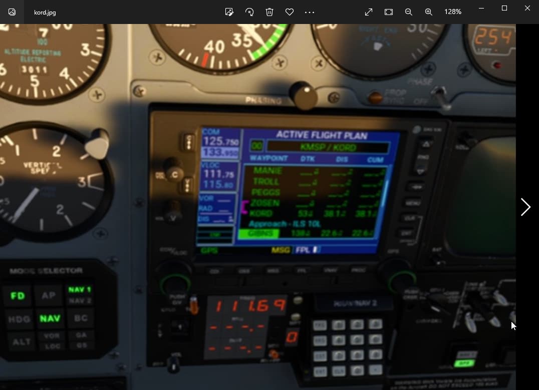
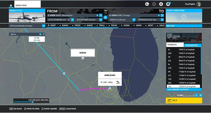
I am just getting into ILS approaches and I have a question for the group about an IFR I filed with an ILS approach. This happened to me twice yesterday. I had this flight plan from KMSP (Minneapolis) to KORD (Chicago) and had set up for the ILS 10L approach. When I was coming up on the start of the approach, it was supposed to go from PEGGS to ZOSEN to GIBNS, but when I completed the ZOSEN to GIBNS leg, the autopilot started taking me up to DEBOW which wasn’t in my flight plan (and I highlighted it in the world map screenshot). My Garmin 530 didn’t have that as a waypoint and I just now noticed that on the flightplan in the 530 it had ZOSEN to KORD with the approach listed below. I am assuming because KORD is O’hare International, that the approach listed below fills in the gaps.
So I have a few questions. Why didn’t it transition from ZOSEN to the first approach waypoint GIBNS? Why did it add DEBOW? And if someone knows how you activate the approach leg with the 530, I’d appreciate hearing that as well, because what I tried to do is activate the GIBNS to ARIST leg but it complained that I needed to activate the approach first, but when I used the menu button on the “Approach ILS 10L” portion, Activate Leg was not available. Any insights would be appreciated. I think I am missing something about how this all works.
Experiencing same problem on almost every ils approach at most airpirts.
With the Garmin 530?
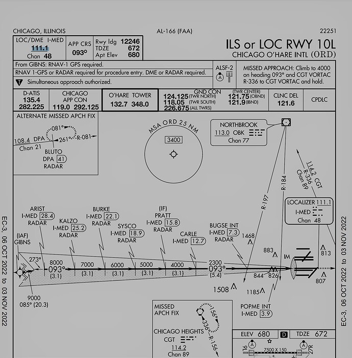
I see you don’t have the correct ILS frequency in your NAV radio, its 111.10. You should also be at 9000ft and arm the Approach before you reach GIBNS. Don’t for get to set your CDI from GPS to LOC, or it wont capture the approach when u reach the waypoint.
This video might help you with ILS approach on the Garmin 530.
Thanks for the offerings. I have watched most of Kip on the Ground’s garmin vids. And I meant to say that I had an approach for ILS 27R, so that was an error in my post as I was dialed into 111.750 coming from the west.
While that’s all super helpful and appreciated, they don’t really hit on the bugs I was pointing out. Both the G530 and the Navmap properly activated the next leg on the line (pink/white path), but the DEBOWS waypoint was neither in the FP nor indicated by the GPS/navmap lines. Also it had KORD (my destination) as the last waypoint in the Enroute section. This flightplan came straight out of the worldmap. I am guessing its a bug with the g530 and I’ve heard there was a recent upload of a new version so I’m going to test the same FPL file with the update. In my opinion, the KORD being in there at the end of the Enroute makes no sense. And as for arming the approach, I’ve done ILS approaches where the AP has no problem transitioning via the 530 and flipping to GS or approach, but I’ll make sure to test all of that again. Thanks again for the feedback.
Edit: Apologies, I was wrong. Yes, I was in fact attempting ILS 10R.and I had the wrong frequency entered. Good catch!
Two clarifications:
Are you using the improved PMS50 version of the GN530? It’s a Mod. Otherwise we assume you’re using stock? Consider using the Mod just for the improvements it brings, not necessarily certain it will change what happened here, but no harm in trying.
Did you create the flight plan in the World Map planner page of the sim? If so, consider exporting it as a .PLN and sharing it here. I think the challenge is that some of the waypoints you mentioned are part of your ENR (enroute) portion of the flight, which can vary depending upon whether you selected High or Low IFR, and as you may have noticed, the sim will put up multiple paths for the intended departure/arrival depending on whether you selected a Direct Departure and/or Direct Arrival in the dropdowns for SIDs/STARs.
So for simplicity’s sake, I recommend uploading the plan. Let everyone see what it looks like in the World Map because that’s what’s really going to drive what happens in your flight, regardless of whether you used the World Map, or an EFB like Little Nav Map, Simbrief, other to create it.
A few things. First, apologies to @iKeepOnTruckin because he’s right, I did in fact have the wrong frequency and wasn’t intending on 27R. I realized that after I responded that i had it backwards and he was in fact correct. Doesn’t affect the potential bugs or weird behavior I complained about, I don’t think, but it was a good point that I hadn’t caught.
Second, yeah, @CasualClick I am using the PMS530 mod and not the stock version. As for the PLN, yes! Thanks, I forgot that I could have shared that. Here it is. I was set up for low IFR and yes, it was done through the worldmap.
KMSP_TO_KORD.PLN (5.4 KB)
I also have a Youtube upload edited to about a minute covering the areas of confusion where my AP is going along nicely and then heads for DEBOW which was not in my FP and both the navmap and the g530 seem to activate the next leg at least in the map. I am mainly interested in why DEBOW came into play at all.


