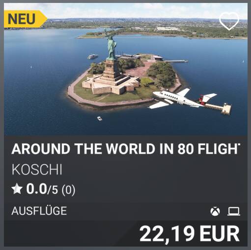
Around the World in 80 Flights
Hi,
Anyone up for another round-the-world flight? That would be cool. After a good 19 months of work—with plenty of breaks in between—I’m finally happy with the result and have published it.
The basic idea of circling the globe in 80 flights originally came from First Class Simulations and was first released for FSX. It came bundled with the Lockheed Electra 10, the plane Amelia Earhart and Fred Noonan intended to use to circle the globe, but in which they tragically lost their lives. However, the creators at FCS were primarily focused on getting from airport to airport using only a few waypoints. These 80 flights around the world are different. The total of 559 waypoints are designed so that you fly toward 156 handcrafted POIs and 21 AOIs. The entire mission consists of 4 parts, covering a total of 40,185 nautical miles. Additionally, texts in the Navlog accompany you—totaling 328 pages—a novel-length book. The aim is not to impart Wikipedia-style knowledge, but rather to present the individual legs in an atmospheric way. You will encounter countries, cities, and peoples across 5 continents—with their ecology, history, culture, religion, way of life, economy, and architecture—in a way you won’t find in either Wikipedia or travel guides.
This journey around the world is not simply a mission; it is a grand arc—a flight that connects continents, climate zones, cultures, and centuries. It is also a feeling and the realization that the Earth is vast, diverse, contradictory, and beautiful—and that from above, you not only see it but understand it. The circle closes at the place where you started, but it remains open to interpretation: You return to the same place, but not as the same person. The world you have flown over becomes part of your inner map—a mosaic of images, patterns, and stories that reveals itself with such clarity only from the air.
Specifications:
- You’ll fly around the world in a Beechcraft King Air 350i.
- The package is multilingual and has been translated into all languages available in MSFS. The default language is German. The other languages are machine-translated, so there may be errors in the translations. If you have a better translation, please send it to me.
- A GPS course is available and can be obtained. You can find help with this here: Help and Support (en-US)
- Additionally, each waypoint is marked with a clearly visible indicator. This can be enabled in the Support Options / Navigation Aids.
- The Refuel button is only active at airfields with a fuel station. However, there are a few very long legs where the fuel supply will not be sufficient. To refuel in the air, you can assign the “Repair and Refuel” function to a button or key combination in the options, or enable “unlimited fuel” in the support options.
- The weather, date, and time are freely selectable. Live weather is the default setting. One day passes after each completed leg. Because you cross the International Date Line from west to east, you’ll be on the road for exactly 79 days.
- The trip is only over once the engine and electrical systems are turned off and the parking brake is engaged. It’s best to taxi to a parking spot for this.
- Very long flights over the ocean can be skipped using the teleport function. How this works is explained at the relevant points in the Navlog.
- The flight is saved at every waypoint you fly over. If you have to interrupt the flight due to time constraints, it will resume in the air from the last waypoint you flew over.
- Don’t worry about long flights over the ocean. There is an empty waypoint there after no more than 200 nautical miles where the flight will be saved.
- The missions are designed for multiplayer, so you can play them with your friends.
Excerpt from the Navlog, Part 4 – Greenland
As you leave Nuuk behind and the autopilot slightly corrects the course to the left, the atmosphere of the flight changes once again. The flight begins with a succession of deep, sharply carved fjords that seem like the land’s dark, cold breaths. Here, the coast is not a tranquil edge, but a rugged mosaic of rock and water. The fjords cut steeply into the mountains, but so abruptly and narrowly that from the air they appear like gaping wounds in the rock. Between them, rocky ridges jut out into the sea—hard, angular, gray—and small glacier tongues hang over many valleys, draping themselves over the mountain slopes like frozen veils. It is a landscape that constantly opens and closes again, a rhythm of indentations and projections that continually refocuses the gaze.
As you follow this coastline, a sense of depth and inaccessibility emerges. The fjords are wild and abrupt—they reveal nothing, they lead nowhere; they are purely coastal phenomena. But then the landscape’s geometry shifts. The coast recedes, the mountains open up, and suddenly a vast, clear expanse lies before you. This is where the Kangerlussuaq Fjord begins.
Geologically, the Kangerlussuaq Fjord is a window into the structure of West Greenland. The rock walls consist of ancient bedrock—gneisses and granitoids—which are among the oldest rocks on Earth and are in some cases over three billion years old. This landscape is a product of the last ice ages: the ice sheet carved out the fjord like a gigantic plane, deepening the valleys, smoothing the rock faces, and creating the characteristic U-shape that is so clearly visible from the air. The further you follow the fjord, the more clearly the ice itself comes into view.
Ecologically, this western section of the fjord marks the transition from the maritime coastal world to the dry, continental tundra. The vegetation is low-growing and hardy, a carpet of dwarf birches, willows, lichens, and mosses that blankets the rocks. Musk oxen and reindeer live in this zone, moving along the valleys, and the air is clearer, drier, almost warm in summer—a climate found in only a few places in Greenland.
As you fly toward Kangerlussuaq, you cross an invisible line: the Arctic Circle. It is the latitude at which the sun no longer rises or sets on the two days of the solstice. Its radius corresponds to the axial distance of the tropics from the equator.
The Arctic Circle was already known in ancient Greece: Pytheas reported on the midnight sun in the fourth century B.C., and Eratosthenes wrote about it a century later. In medieval Europe, the Arctic and Antarctic Circles were plotted on the Cantino Planisphere of 1500.
The political backdrop remains invisible from the air, yet it still shapes the country. Greenland is an autonomous part of the Kingdom of Denmark, with extensive self-government. The Inuit majority decides on internal affairs, resources, culture, and education, while Denmark remains responsible for foreign policy, defense, and currency. However, developments in recent decades point in a clear direction: Greenland is moving step by step toward greater autonomy, driven by cultural self-confidence and the desire to retain control over its own resources.
Bug-reporting and Feedback: info@koschis-web.de, Help and Support (en-US)