where can we find this parameter in the charts? ![]()
Airport/Facilities Directory (A/FD). If the airport is listed in the A/FD, they will generally have traffic altitude and left/right pattern direction for a given runway.
If not listed, 1000’ AGL is the assumed pattern altitude.
Do you have a specific airport you need looked up?
This tends to be published in the AIP rather than the aerodrome charts. The charts will only have information where it is different from standard. Left hand pattern at 1000’ is standard most places though high performance aircraft will typically fly a larger 1500’ pattern and low performance aircraft such as micro lights might be a closer 500’ pattern.
any, well, for example WSSS. it would be nice to see a screenshot of where you get it ![]()
and now we get the problem, we don’t have two options (field) for entering the altitude, only one ![]()
What do you mean? I don’t have any problem flying a 1500’ pattern.
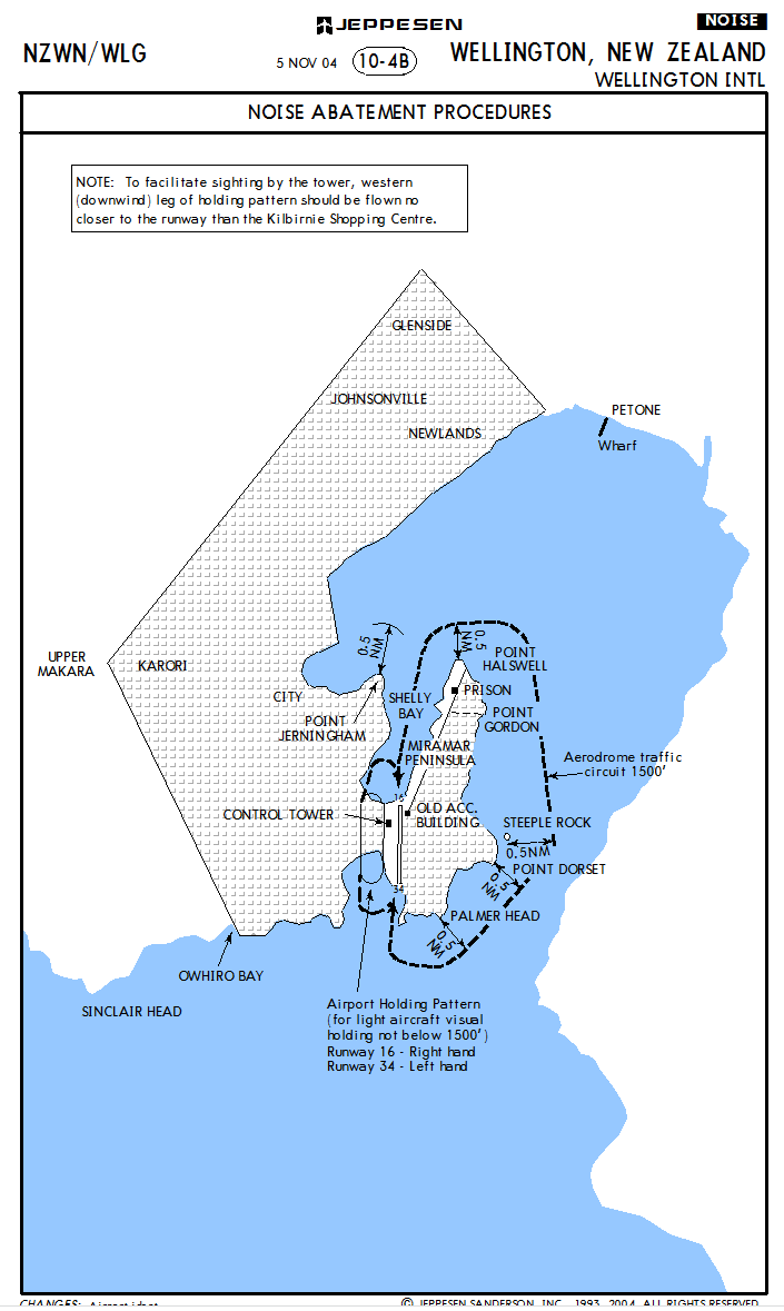
Here’s a non-standard circuit at Wellington. It’s only shown on a chart because it is non-standard. The standard circuit is described in the AIP somewhere.
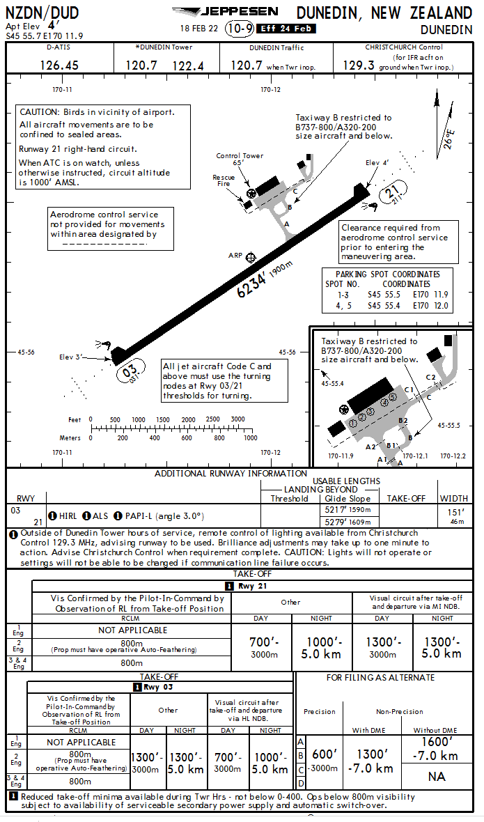
Edit: Actually I’ve put you slightly wrong, regarding New Zealand at least, in controlled aerodromes the circuit altitude is listed. See the Dunedin chart below Wellington.
you said that there could be two different options depending on the type of aircraft, and we have only one input field (at Runway definition properties->field: pattern altitude) ![]()
yes, but unfortunately it seems this far from suitable for all countries ![]()
Just make it 1000’ above the Aerodrome then, that’s standard.
By the way, as I understand it, this is only necessary for AI traffic, how can we see when AI traffic uses it?