Do you have any add-ons in your Community folder? If yes, please remove and retest before posting.
Irrelevant
Are you using Developer Mode or made changes in it?
No
Brief description of the issue:
Flying around Riverside, CA you see a wide river. That river almost never has water. It is a flood plain. At best there is a tiny stream and mostly it is underground.
Provide Screenshot(s)/video(s) of the issue encountered:
Detail steps to reproduce the issue encountered:
PC specs for those who want to assist (if not entered in your profile)
Irrelevaant
Did you submit this to Zendesk? If so, what is your ticket #?
There’s a lot more water all over Southern California in the sim that would be dry in real life. But if you think about it, that’s the limit of current technology and not likely to change.
The underlying data says these are rivers so Flight Sim cuts them out of the terrain and adds water. Without more detailed data that would set water levels, how else could they possibly do it?
2 Likes
correct. and current data on these levels is only so publicly available.
on a similar level, getting current airport data requires paying for it usually. Most flight simmers can get by with the available tools and information out there
1 Like
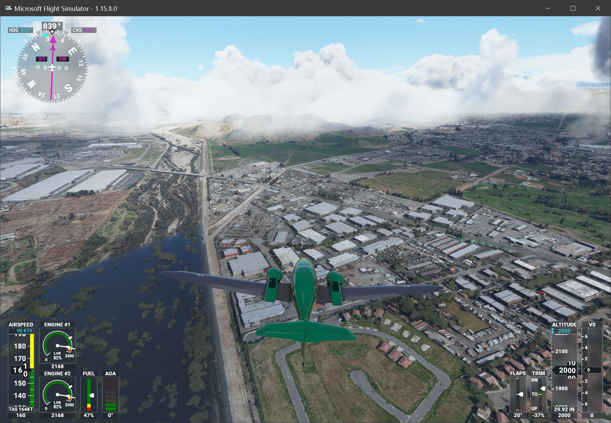
Here is another example of the Santa Ana River just North of Riverside. At the top, you can see the reality - a dry floodplain which abruptly joins a lake which continues for more than 10 miles.