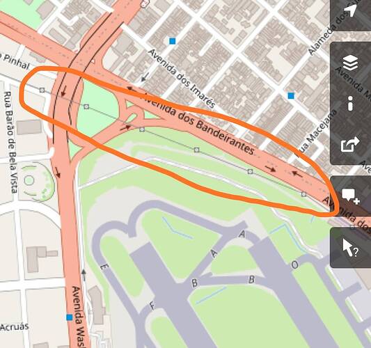
No it isn’t. Even in the pictures you can see a powerline on small posts, which is why OpenStreetMap shows them as well:
And at the same positions as on OpenStreetMap you can see the big power towers in the sim.
Each node is a post.
The fact that MSFS uses OpenStreetMap for some of the metadata is known from a bug with a huge building in Australia that was (or is?) caused by a typo in OSM metadata by some user. MSFS uses that data to render the height of autogen buildings (which is harder to identify from top-down images automatically).
The approach is totally feasible for the power towers as well, they just have to make sure not to intervene with glidepaths since the metadata doesn’t provide any height information for them.
Just checked, OSM has a type “pole” which has to be used instead of “tower”, so basically the wrong type was used. I’ll see if I can correct it…
