while flying in northern Canada on approach to Alert Airbase on Ellesmere Island (this is only a few hundred KM from north pole) I had some weird scenery loading issues. Very blurred and only loaded autogen below 500’. Flying the Cessna Citation and navigation seemed to be way off. Also The trottle wouldn’t work with AP completely off. All very weird. See attached video. Does the sim display these bugs flying close to the poles?
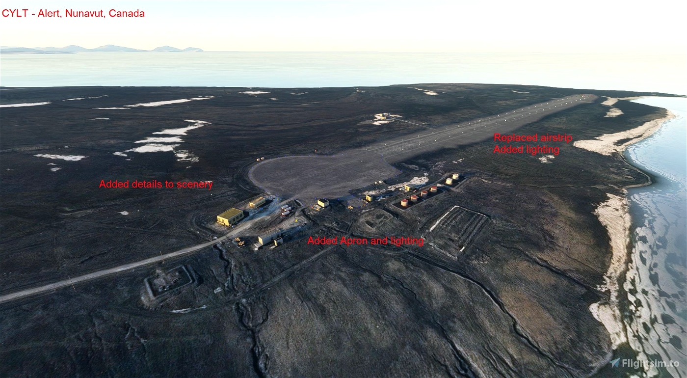
I did a CYLT Alert enhancement as I found it dreadful and dark in November - tried flying there at night and could not see a dark runway that was rougher than any hills around it!
✓ CYLT - Alert Nunavut Canada airport/scenery enhancement is a Microsoft Flight Simulator 2020 mod created by ARH64CDN. Download for free to enhance your experience in MSFS 2020.
Well not the best it is at least an improvement
Also, flying north of say 75 degrees North the VFR Map no longer works. Also satellite imagery farther north does not exist to the same level of detail as closer towards the equator. This can be seen in many of the imagery platforms on the internet and is unlikely to be improved anytime soon. It would be nice if detailed areas around the airstrips that do exist would be added.
Thanks, I’ll try that. It not so much that the scenery is very blurry all the time. Once I get below 500’ or so fairly decent scenery tiles start to load right below and around the aircraft and Autogen tree’s. Even its its not an accurate representation of the area at least its plausible. I’m curious why it doesn’t load the tiles from altitude. And the tree’s too from a much higher altitude.
OK so this video shows the issues better. I think its called LOD. Level of detail radius. It seems very small way up north at Alert. YOu can see that the terrain is pixelated but reasonably good resolution satellite images are loading right in from of the aircraft. I haven’t seen this happen anywhere else. I this that case with everyone flying up here?
Yes, it’s a bug that will be addressed in the next update. Currently LOD is tied to latitude and Alert is 82.5 degrees north. Since it’s all tied to the Mercator projection the tiles get smaller and smaller the further north (or south) you go. And actually past 85 degrees the terrain completely disappears and at 90 degrees you enter a singularity