Seems the long awaited Vegetation Distance Slider is coming with SU7. Finally, can we draw trees till the horizon?

Seems the long awaited Vegetation Distance Slider is coming with SU7. Finally, can we draw trees till the horizon?
What I request is quite simple tho
Currently these two are linked, so at 200 you’ll get nice crisp textures.
but at 100 it becomes blurry low quality compared to 200.
Above 200 to 400 doesn’t really make much of a difference texture quality wise if none.
MODERATOR EDIT:
This post and 7 below it were merged into this topic. Continuity may be lost.
The Terrain LOD graphics setting seems to affect both buildings, trees, bushes, grass AND terrain, ground textures, photogrammetry render distance.
I am getting a lot better performance at high Terrain LOD levels with photogrammetry OFF. But I want photogrammetry ON.
When I turn photogrammetry ON, I need to reduce the Terrain LOD to maintain performance, which sacrifices AI generated buildings, tree distance, ground textures, etc.
Please make these things adjustable independently if possible.
Thanks.
I voted for your topic ![]()
Thanks a lot! ![]()
Really? I thought terrain LOD only affects terrain, ie the textures. This is what I’ve read.
Isn’t it the building and tree settings that affect those same draw distances? They definitely do, but maybe not exclusively is what you’re saying?
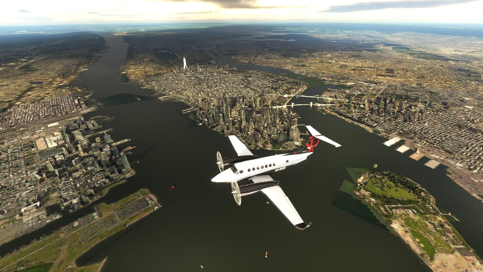
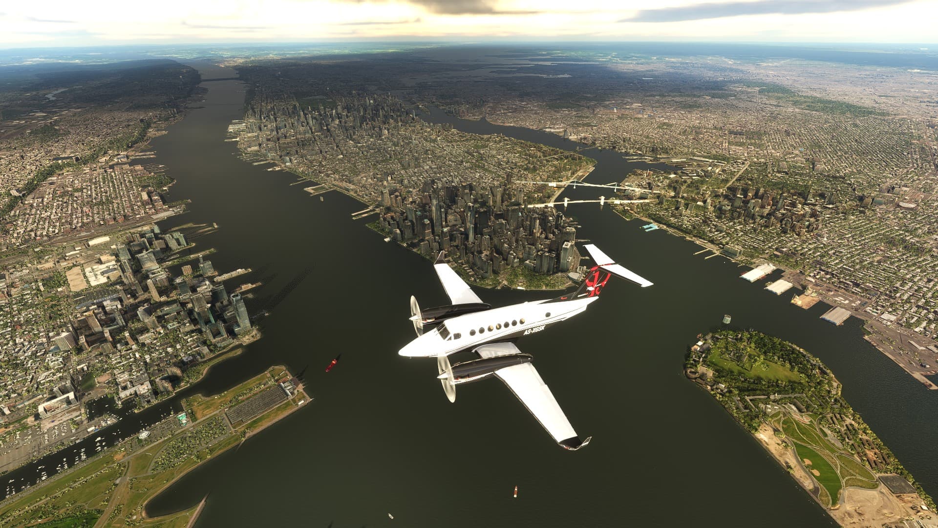
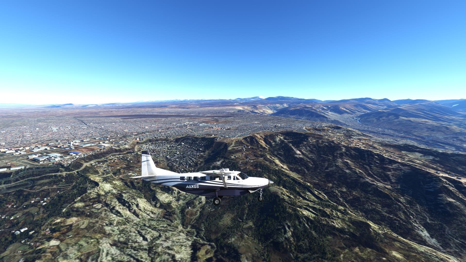
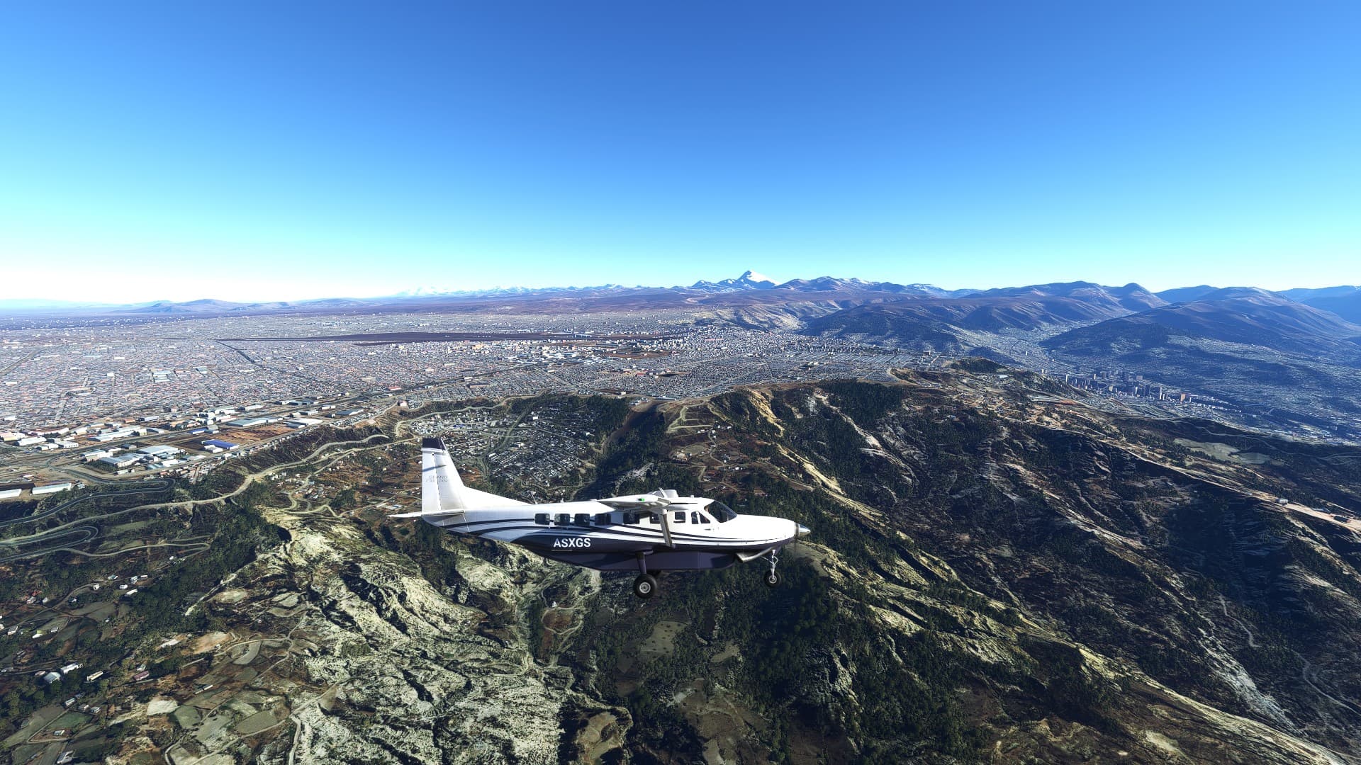
Terrain LOD affects autogen render distance as well as photogrammetry render distance. See how terrain LOD affects NYC photogrammetry for example:
My idea was to separate photogrammetry render distance from autogen render distance if possible, so that I don’t have to keep messing with the terrain LOD setting when flying in and out of photogrammetry areas.
Thanks, right, but this is all photogrammetry in the screenshot, right?
But if you say it affects autogen too, I’ll take your word for it! Never really noticed as I always have LOD at 100.
I’m not sure if that is all photogrammetry in those shots. I think there might be some autogen buildings way out in the distance (in the top right) but I’m not sure. I am certain that terrain LOD also affects autogen buildings and tree render distance. It also appears to affect texture quality somewhat. Oh, and even terrain ![]()
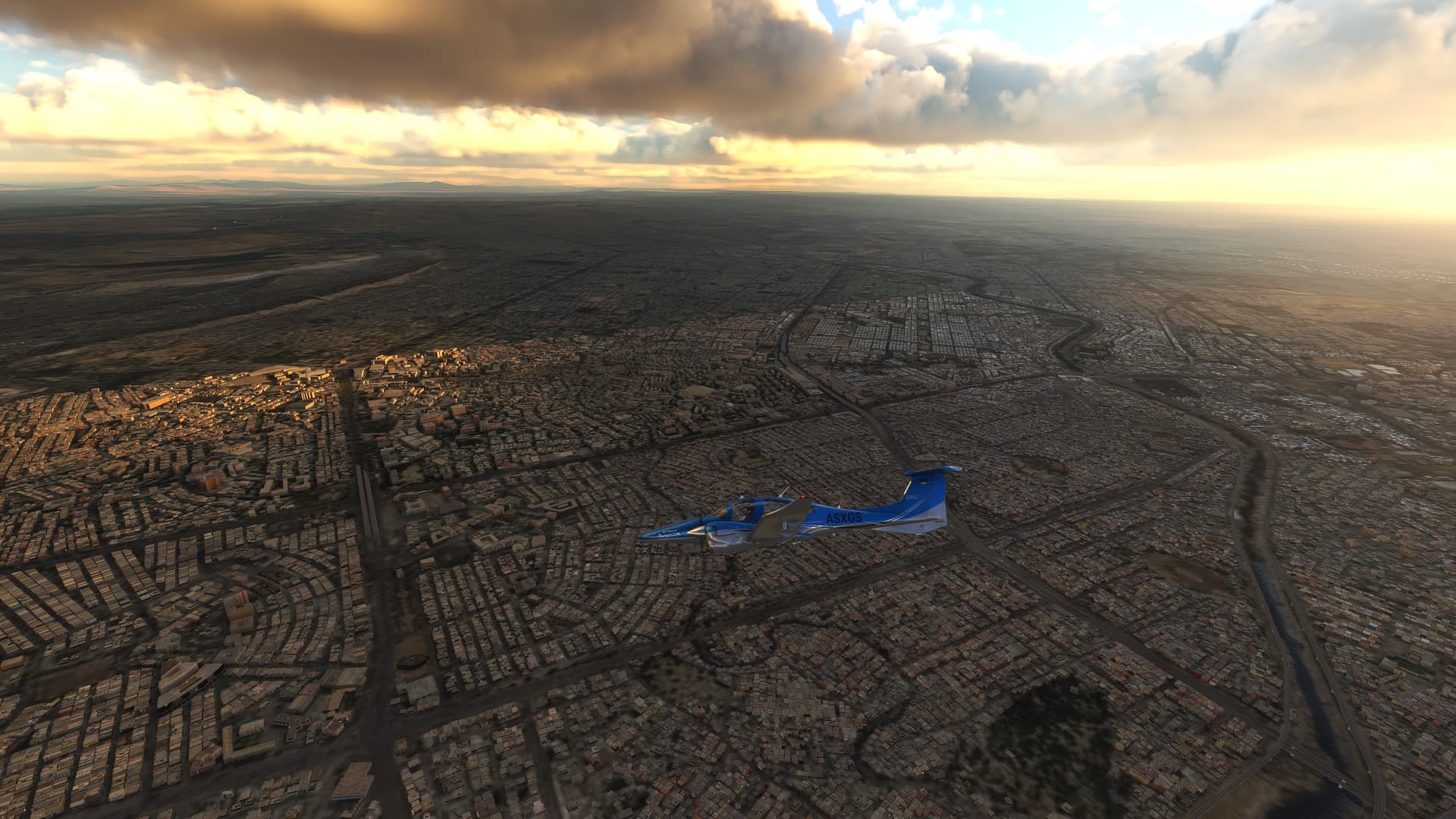
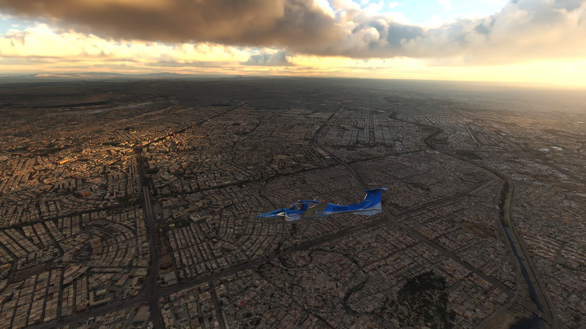
Some autogen examples (LOD 10 vs 400, no photogrammetry here):
Preface:
The Terrain Level Of Detail setting makes one of the largest impacts to performance in the simulator, because it affects the rendering distance of everything from ground textures, to buildings, to trees and other vegetation, to terrain and photogrammetry, etc. I will suggest a possible way to reduce the performance impact of the terrain LOD setting in the simulator, so that users can have finer-grained control over our performance and image quality.
What is the definition of Terrain?
Terrain is defined as the specific physical features of an area of land.
An example of terrain is a rocky and jagged coastline.Terrain has nothing to do with buildings. Nor vegetation in my opinion. So the Terrain LOD setting should not affect them directly.
Suggestion:
Giving us separate LOD sliders for other objects would help us optimize performance better, while still maintaining high image quality.
We want nice looking terrain, mountains, ground textures, far in the distance without having to bump up the buildings, photogrammetry, vegetation, and everything else’s LOD to 400 (or 200 or whatever).
Example Mockup:
Notes:
I realize that photogrammetry is sort of tied to the terrain, but I don’t think all of the other things have to be.
The buildings option already affects building rendering distance, but it also affects geometry quality and shader quality, so lowering it to increase performance is not a good option if we want to maintain buildings quality.
I believe the trees/bushes options works much the same way as the buildings setting. Lowering trees quality not only reduces the tree rendering distance, it reduces the quality and density of the trees.
Keep the separate Trees, Buildings, Grass/Bushes quality options, but don’t have them affect rendering distance, only object quality and density etc.
If the buildings and vegetation render distance relies on how far the terrain data is downloaded, then I think the solution is simple. Do not allow the user to raise the buildings, trees, etc. sliders higher than the terrain LOD. The simulator already limits object rendering distance to terrain LOD, so this will have no negative impact to image quality.
I fail to see what you want to change, exactly?
The buildings and vegetation render distance does indeed rely on how far the terrain data is downloaded, because you need to know the properties of a tile to know whether to place a tree or a building on it, and if so, what kind of object would appropriate. So, the TLOD has to be a limiting factor for object distance.
And if you watch the latest Developer Q&A, you can hear Seb explain that the other sliders do determine the drawing distance of objects within the outer TLOD perimeter, but not beyond it.
If I understand your proposed “simple solution” correctly, that would only serve to limit current flexibility in terms of drawing distance versus object density, as far as I can tell?
First of all, the buildings and trees options are not “sliders”. The terrain LOD and objects LOD settings are an example of a slider. (and the rendering scale, etc) I understand this is part of where the confusion is stemming from, so I’ve just updated my initial post.
Secondly, I explained in my initial post that the buildings and trees options do more than just affect rendering distance. They also increase or reduce the quality of objects.
What I am suggesting are sliders for rendering distances of other objects independent of terrain LOD and object quality.
The biggest performance impact comes from photogrammetry with a high terrain LOD, but I don’t know if they’ll be able to separate photogrammetry from terrain.
that would only serve to limit current flexibility in terms of drawing distance versus object density, as far as I can tell?
It won’t limit current flexibility, because object render distance is already limited by terrain LOD in the simulator.
Tongue in cheek answer-
Rename “TLOD” slider to “CPU mainthread limiter” slider then noone will want to slide it to the max. ![]()
![]()
If my suggestion was implemented, I’m guessing more people could slide it to the max without killing the main thread. However they would probably put all of the other sliders to the max too ![]() but at least there would be some finer-grain control over it, for the people that know what they are doing
but at least there would be some finer-grain control over it, for the people that know what they are doing ![]()
I think TLOD covers all things terrain, trees, photogrammetry and autogen. it’s a horizon visibility thing. It could definitely be explained better in settings. I’ve never seen so many people complain about stutters after having bought a rtx30xx and immediately turned every slider to the max without understanding the impact on CPU and not just GPU. I have my TLOD set at 200, and my system lockednon 30FPS/60Hz and it’s smooth. TLOD 100 looks fine too. I really think the devs made mistake giving everyone 400 option, but they did ask for it!! Maybe like you say breaking it out further would help. Then again, maybe not. I think what is lacking is an official FS graphics system analyser/optimiser tool, they really should have one. The NVidia one just says turn every graphics setting to medium for me - LOL, no way! Someone could make a small fortune making one that works though.
I don’t see why any modern gaming PC couldn’t render basic terrain mesh and ground textures at long distances. I think the main issue revolves around photogrammetry. Some people even say that uninstalling the photogrammetry cities for a completely different area than they fly makes a performance impact, which obviously shouldn’t be the case.
I’ve not had those kinds of issues, so haven’t tried switching with or without photogrammetry, it may seems to affect me with bandwidth warnings when in a photogrammetry dense area (I have slowish fibre broadband). I suspect on high LODs it just picks up everything to X many miles so if photogrammetry is in that range then it picks that up too. Can’t think why other regions photogrammetry would affect performance, but who knows.with this sim!
I would like to contribute to this request with a few of my observations.
The tree placement data is actually not synchronised with the underlying terrain mesh. This means that making its LOD separate from the rest could be possible, except it might not be a simple adjustment that the developers would have to make, but rather a refactoring of the LOD system that would require intervention from the Bing Maps team.
The best example of this is the Rock of Gibraltar, which I recently demonstrated in the morphing thread. You can see the correct tree data loading before the correct mesh data.
Although higher Terrain LOD does boost the draw distance of buildings, those beyond LOD 50 have extremely sparse density. As such, a Buildings setting higher than Ultra would be required to satisfy complaints (not in this thread to be clear) that the building cut-off is too obvious.
Considering that photogrammetry is something that can be disabled with a simple toggle in the settings, the dataset must be different than the rest of the world data. Therefore, I have the feeling that decoupling photogrammetry could be one of the easier solutions.
If #3 applies, then in my opinion they should separate photogrammetry into its own slider that can still go up to 400, while the rest of the terrain which is much less intensive on system/bandwidth resources can get a boost beyond 400 which will not only satisfy those seeking improved tree draw distance (as well as buildings and night lighting), but also those who want better depiction of terrain mesh which is one of the weakest aspects of this simulator (it could also allow for the removal of the coastline glitch workaround). That seems like the simplest solution to me.
Thanks a lot for your contribution!
Wow, what is going on with all of the terrain morphing in that video?! Does the amount of morphing change with the level of the terrain LOD setting?
I think the Rock of Gibraltar is an example of custom-made POI, and custom made POI seems to suffer from worse morphing issues than the standard terrain in some cases. Correct me if I am wrong.
Some pertinent info from the most recent Live Dev Q&A re: veg slider and Terrain LOD: