I have flown to places where I have never seen another simmer flying. Those places are far away from my hometown, or country… they are in the wilderness which poses its own challenges. The world is large and exciting enough to be discovered via MSFS2020.
I invite everyone to share their images and own flight plans of the most beautiful or dangerous places (airstrips) where they recently flew.
Show us the world as seen from your point of view…
Does flying though the middle of the Bermuda Triangle at night considered dangerous?
Flight plan below:
MROCTXKF_MFS_25Feb22.pln (6.2 KB)
That’s a nice flight plan. Please share it here. Thanks.
Allright, I’ve edited my initial post with the flight plan file.
1 Like
That’s great! That’s what we are seeking on this page.
Thank you.
There’s plenty of other flight videos on my Neo - YouTube channel.
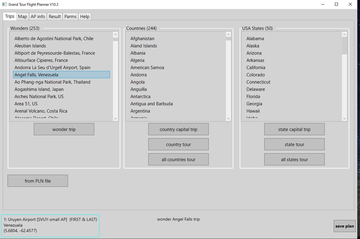
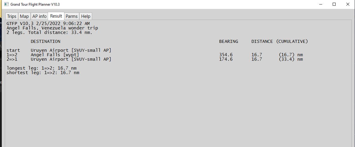
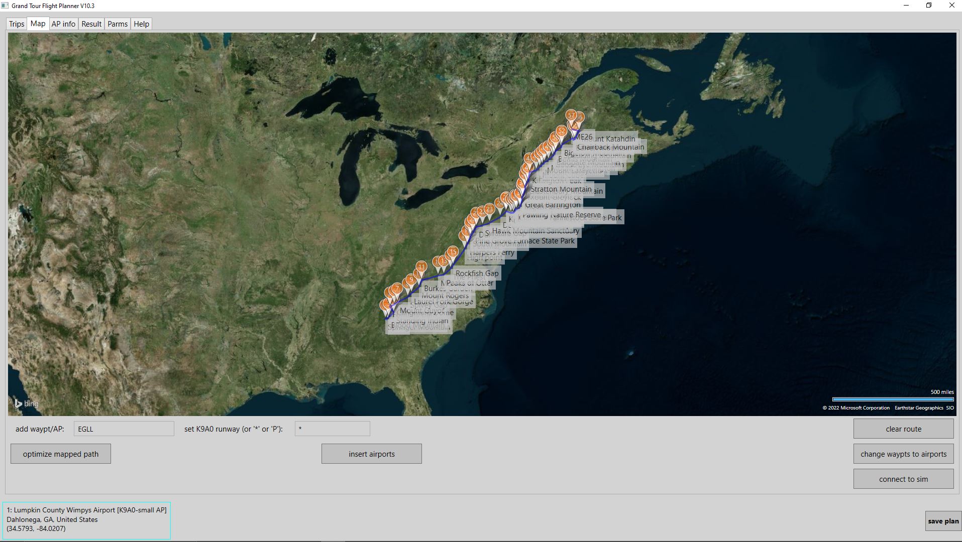
I included many “wonders” in my (free) flight planner. Here are some photos of the app.
Note: GTFP lets you make flight plans from scratch. You can add airports by name, and waypoints by description (e.g. “Angel Falls”) and by clicking on the map. You can save the plan for input to MSFS.
Thank you. That’s a great contribution on Flightsim.to, however, if not too much of trouble, please share directly on this page with some photos and flight plans. That would be easier to find everything on one location.
Thank you.
Thanks for the suggestion; I have complied.
1 Like
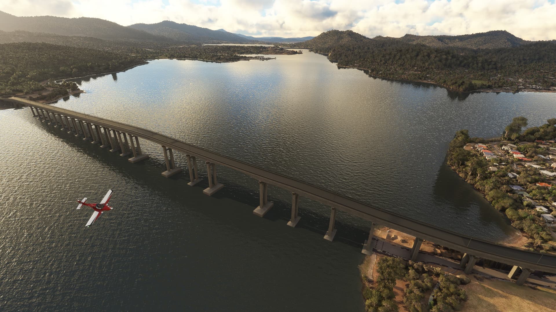
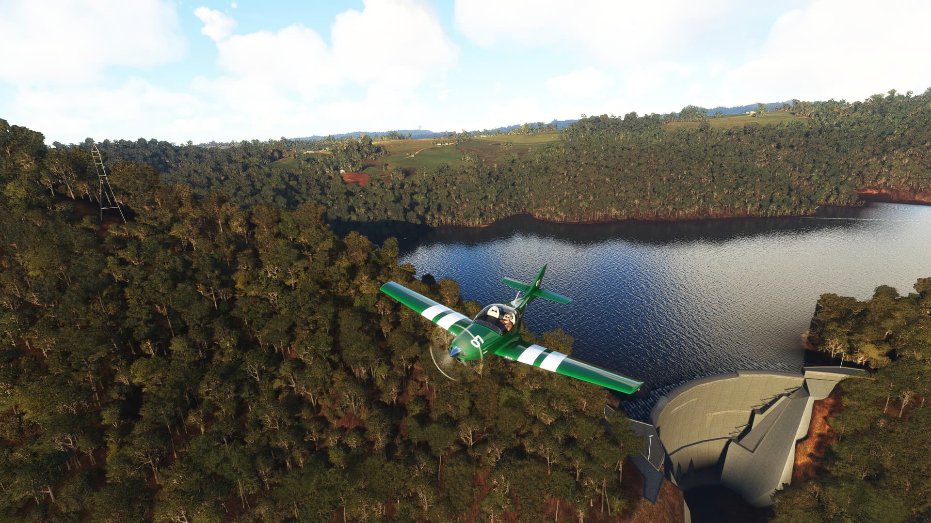
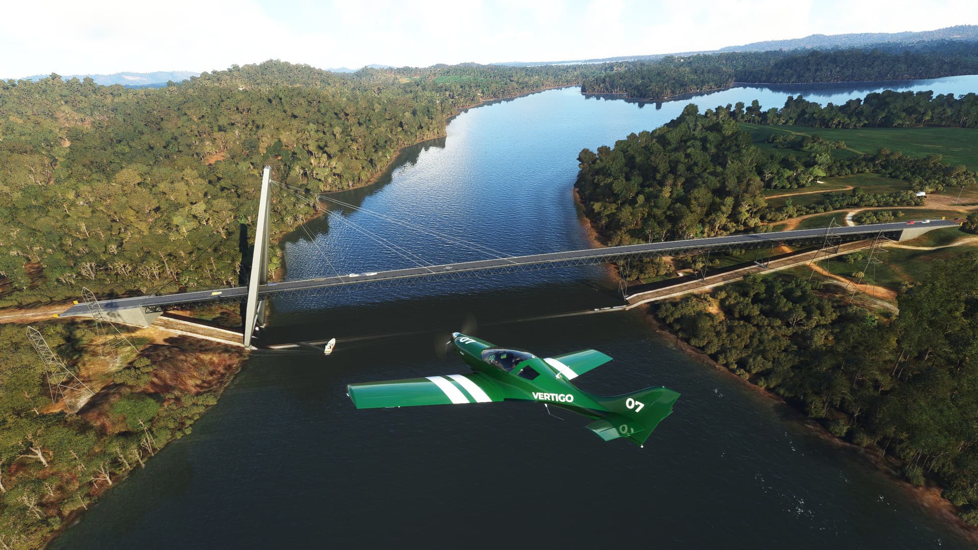
A Tasmanian island scenic flight plan covering 9 major Tasmanian landmarks including the Gordon Dam, Broadcast Australia Tower, Tasman Bridge, South Sister Lookout Antenna, Cascade Dam, Batman Bridge, Devils Gate Dam, Grange Resources Port Latta Pier and Cape Wickham Lighthouse. Not to mention several more attractions, lakes, cities and villages with sprawling fields and lakes and lagoons of Tasmania, this flight plan will offer a very scenic flight, ending with a landing challenge.
9 TASMANIAN LANDMARKS AND LANDSCAPE FLIGHT PLAN.PLN (4.4 KB)

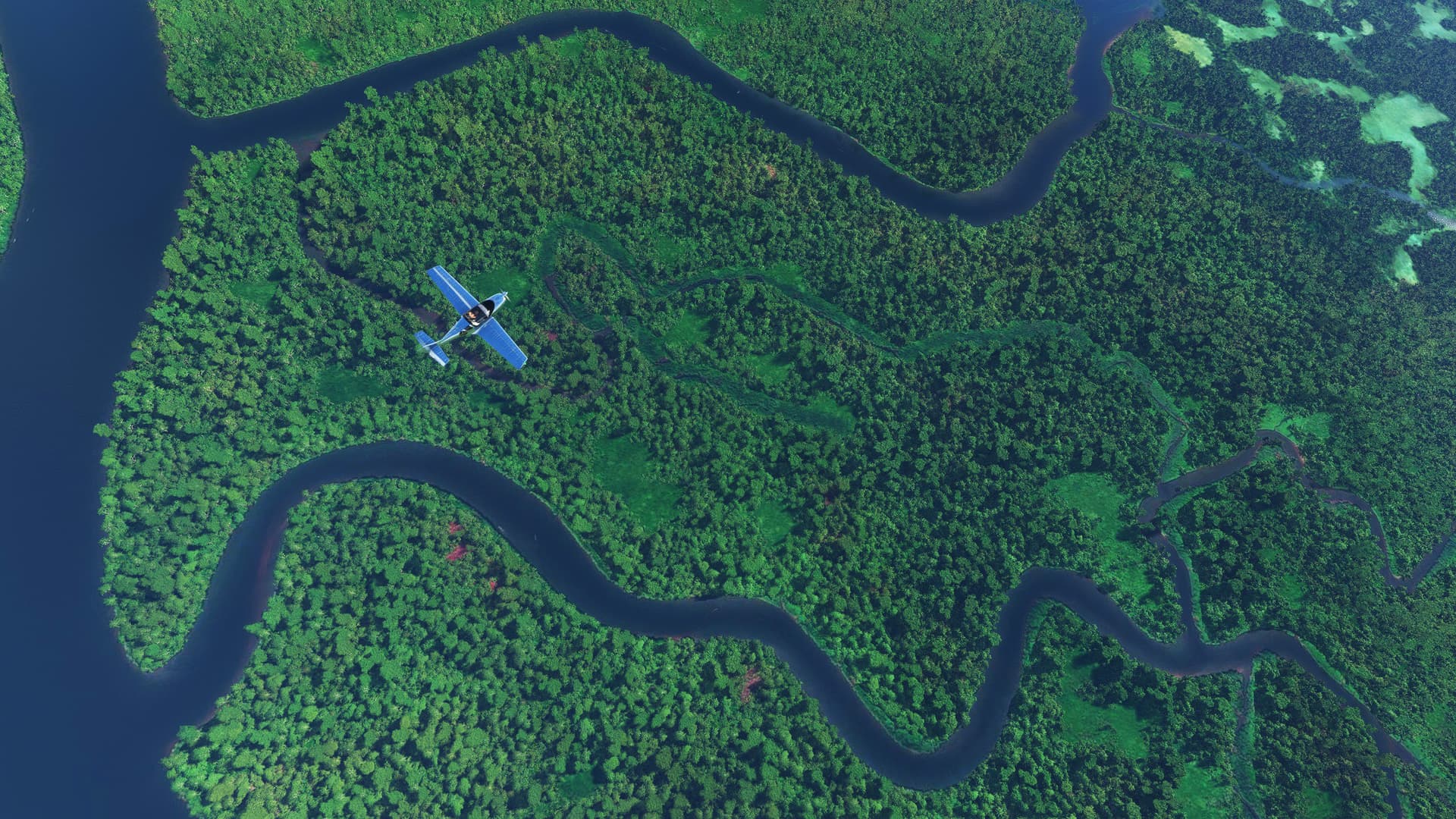
This flight plan covers 21 active volcanoes and craters of the Pacific Ring of Fire in the Indonesian island of Java. You will be flying above and around the crater lakes, lush green slopes and plains of Java before landing close to Jakarta.
21 VOLCANOES OF JAVA.PLN (7.2 KB)
1 Like
Need an add-on that messes with the instruments as you go through!
My Grandfather was a ship captain and said on a number of ocassions the gauges etc on the ship would go haywire as they went through the triangle.
Just report this to Zendesk as a bug saying that it’s unrealistic to have the instruments behave normally when flying through the Bermuda Triangle, the expected results is you need to start getting altimeter warning, heading mismatch, autopilot misbehaving, etc.
1 Like
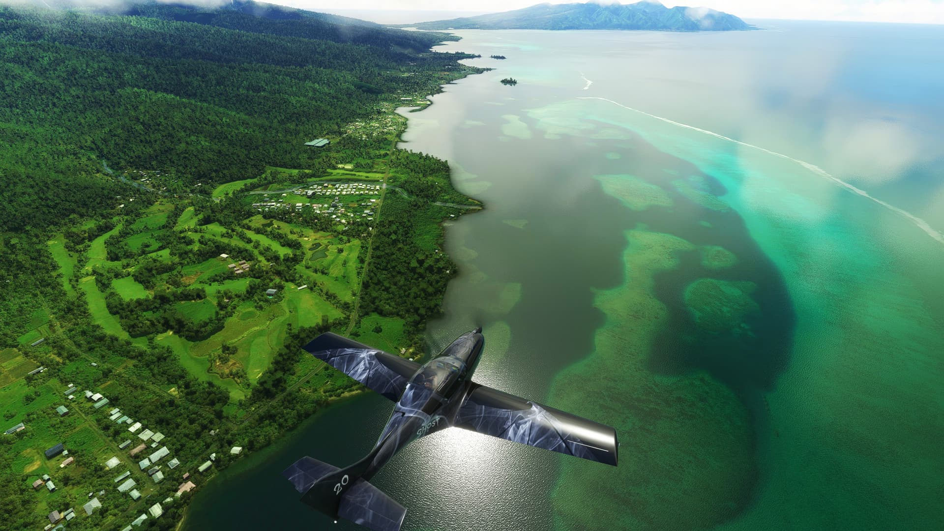
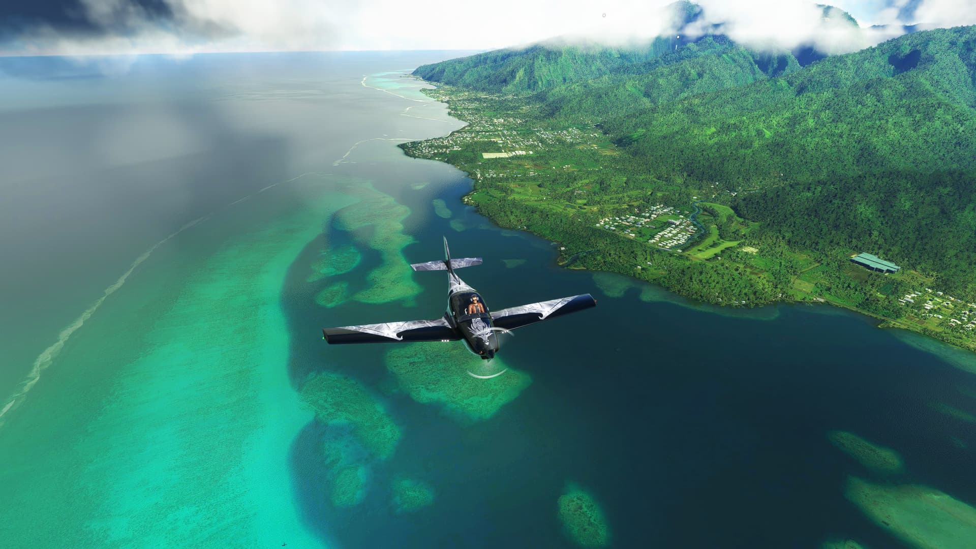
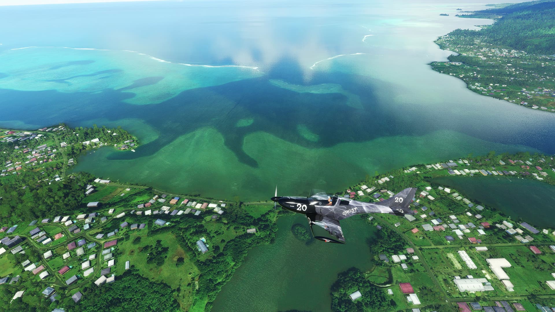
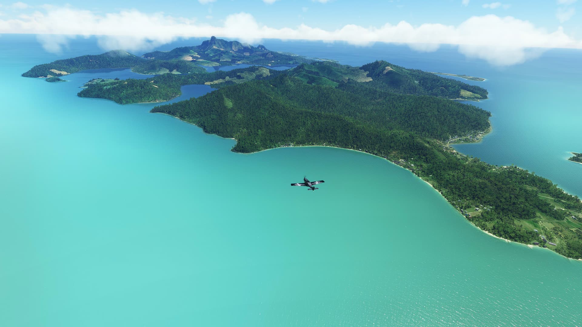
This flight plan takes you to the beautiful sprawling islands and atolls of French Polynesia in the South Pacific Ocean. This scenic flight will take a full round of Tahiti coastline where you should be clearly able to see coral reef, and from there it will take you further to various islands, including Bora-Bora. The flight is so scenic you will lose track of time. Don’t forget to watch the shallows and the reefs. Enjoy!
Tahiti.PLN (5.1 KB)
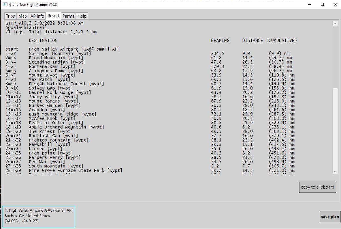
My friends are attempting to hike the Appalachian Trail. It is a huge challenge. I am attempting to “follow along” with this flight plan and MSFS.
AppalachianTrail.PLN (17.6 KB)
1 Like
Thank you for the links. If it is not of too much trouble, please share a .pln file so it’s less cumbersome and cuts a few steps.
Thanks.
 - Bermuda (BDA) - A320neo - Microsoft Flight Simulator (MSFS 2020)")