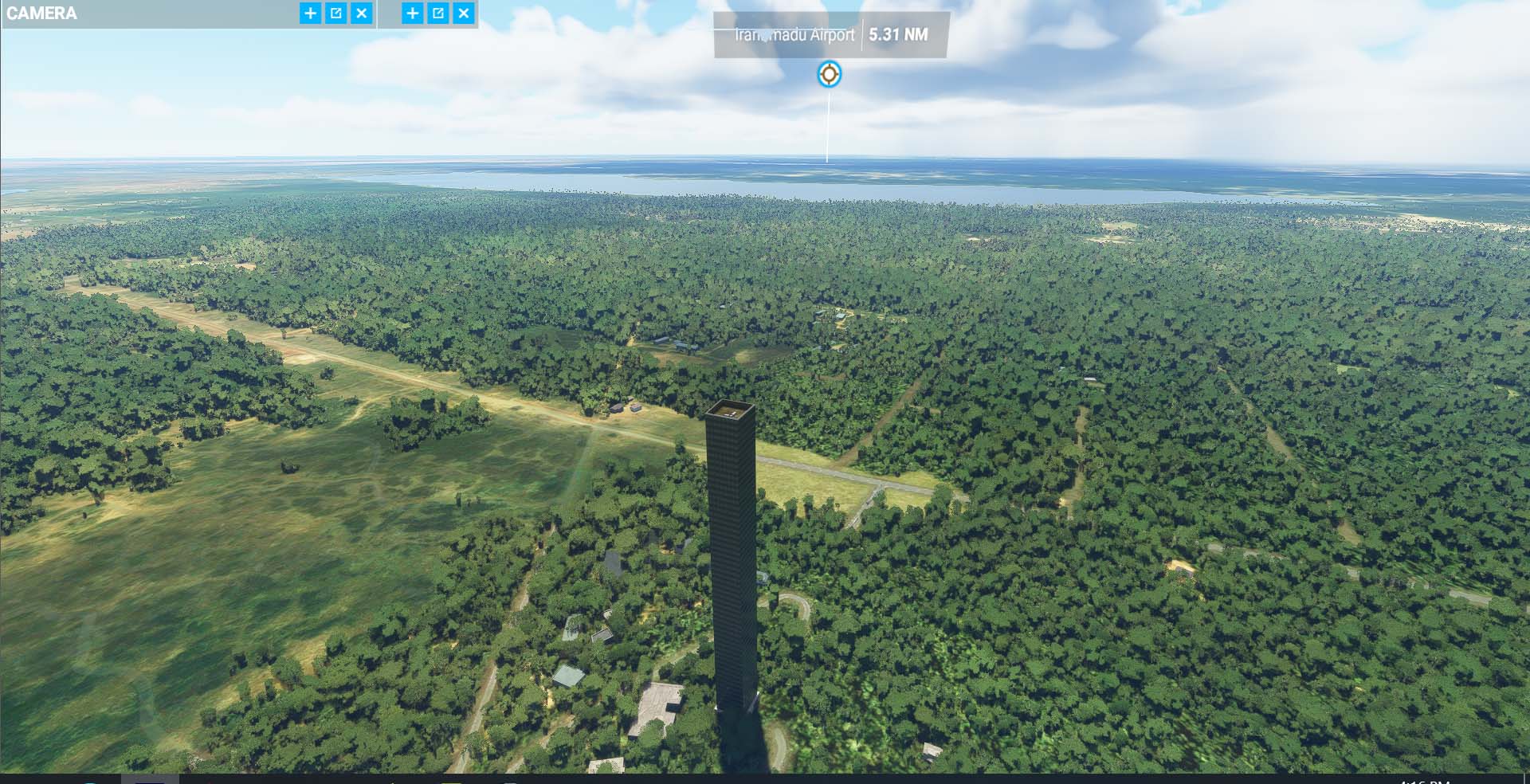
I took off from VCKI, Iranamadu, Sri Lanka, a remote air base in a rural area. Just 5-6 miles south west of the airport, I spot this curious tall thin building. I looked at a couple maps and find nothing that urban-looking in the area.
Is this a bug others have seen elsewhere or does someone know Sri Lanka sufficiently to identify this?
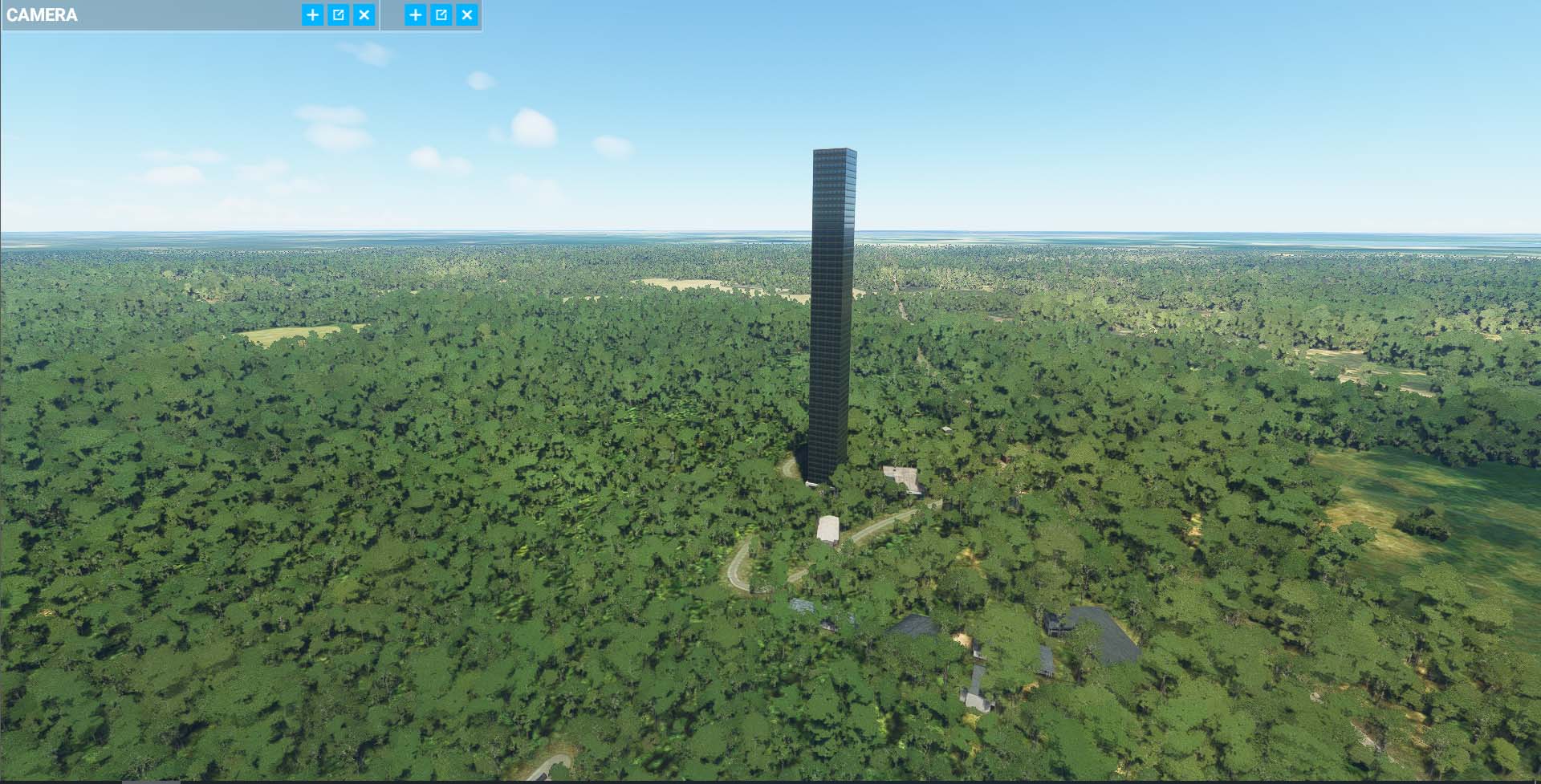
Photos toward and away from the airport direction.
(Also the airport in Jaffna, Sri Lanka is missing from MSFS. It was reported back in Sept.)
It’s probably a data issue. If the AI is getting false data from the Bing Maps source.. Like a parameter that the building is 55 stories instead of 5 stories. Then the AI will generate the building as such according to the data.
I don’t think it’s an MSFS bug or the AI Auto-Gen itself, I think they’re working the way they’re designed to. It’s just bad luck that the source Bing Maps data is wrong, so they’re rendering the building using false data.
Yeapp indeed it is a Microsoft issue. But it also depends on how those data are collected in the first place. If it is open source and everyone in the community are free to add these types of information. Then validity goes out the window. Because if anyone in the public space can make a mistake in the building metadata. Who’s going to validate them?
I find it hard to imagine that a Microsoft Bing staff is actually scouring through the entire earth and look at every single building and validate them with an actual building blueprint and documents which may or may not be publicly accessible when they never really live or know the area in Sri Lanka all the way from Seattle.
I hate to be too cynical about it but I have and I’ve seen countless minor issues referred to the so-called Zendesk and nothing happens except the person doing the submitting may get the feeling that they have done something to help improve MSFS.
For example, in this post I also mentioned missing airport in Jaffa, Sri Lanka, an international airport. I searched and saw that one submitted to Zendisk last September.
Agreed. Heck, I have a lot of decades on my odometer and I can embarrassingly say I did not know where Sri Lanka is other than somewhere near India prior to my MSFS World tour.
Thanks Neo4316 but having that in MSFS should be the responsibility of the Microsoft and Asobo people. For players residing in an area or planning to revisit regularly it makes sense to add a community folder fix but I wanted to stop there once and it did not exist. I’m now in India and likely never to return.
Actually, for disk space, security and update issues I read about, I have only three custom designs in my community folder; one otherwise missing airport and two aircraft.
Yeapp, I agree with you but to be honest… Sometimes things just don’t work out the way we want to. So either we just sit around waiting for something that will probably never come no matter how much we want it to happen. Or do we do something about it ourself and rely on the community for these fixes.
I have a few international airports that’s missing from the Indonesian region. But that’s all because the airports are newly opened in the last 5 years, but the Bing maps that the Blackshark AI uses to identify and build airports from, is reading a 10 year old satellite imagery where the airport construction hasn’t even begun yet.
So the AI is looking at a plain ground and never detects that there’s an airport there in the current state. And like I said, it’s not the AI’s or MSFS fault. It’s just bad luck that the Bing satellite imagery is severely out of date.
And it doesn’t help either if the Bing Service is only focusing on US and/or Europe region and treats like the rest of the world doesn’t exist so they kinda happy with a 10 year old satellite images while only focusing on keeping them updated for their local region.
It also doesn’t help when it comes to China region for example. They’re very limited in terms of public information about satellite images that the AI can work on. Chinese government is very careful with allowing their satellite images from being taken. So lack of publicly accessible data from the region is what’s causing a lot of issues with airports in China in MSFS.
But when you think about it, there’s really not much Microsoft can do about it without triggering an international incident even if it’s just for a game.
This is straight talk on what it takes to get updated data outside of N. America and Europe.
In one of my other side occupations, I deal with Open Source Intelligence focusing on SE Asia for politico-military affairs. Anything that would normally be “open” in the West is automatically locked down in the region, including standard DEM data and updated overheads.
Many users fail to appreciate or understand these nuances. We had one user demanding that Bing and Google demosaic the blurred out areas of the security buffer zone that extends for several miles stretching into South Korea that meets the NK border because it looked awful from VFR height. Just because everything appears digital in the West or is easily available in open source is definitely not the case elsewhere. Suffice it to say MS-Asobo takes every opportunity to improve the data, but is partly dependent upon regional authority cooperation and Bing Maps team getting access to updated info.
Needless to say, the availability of such info and the timing of release likely informs which regions of the world get updated next or how soon.
I looked it up. The tower is at 9.269634, 80.408123, and it is the Kokavil Tower, a 174-meter transmission tower:
Unfortunately, without a tower to put in its place, that’s what we’re going to see. Maybe when the scenery gateway opens up, someone with 3D modeling skills could put something closer to it in place.
That explains it.
It’s suppose it’s fortunate that the program only recognizes and mis-represents that tower and not the tens of thousands cell, water, TV/radio, microwave, ham, etc towers.