I come from a large family and have quite a few siblings. I thought I’d amuse them by sending them MSFS screen captures of what their residences and the areas around them look like “from the air.”
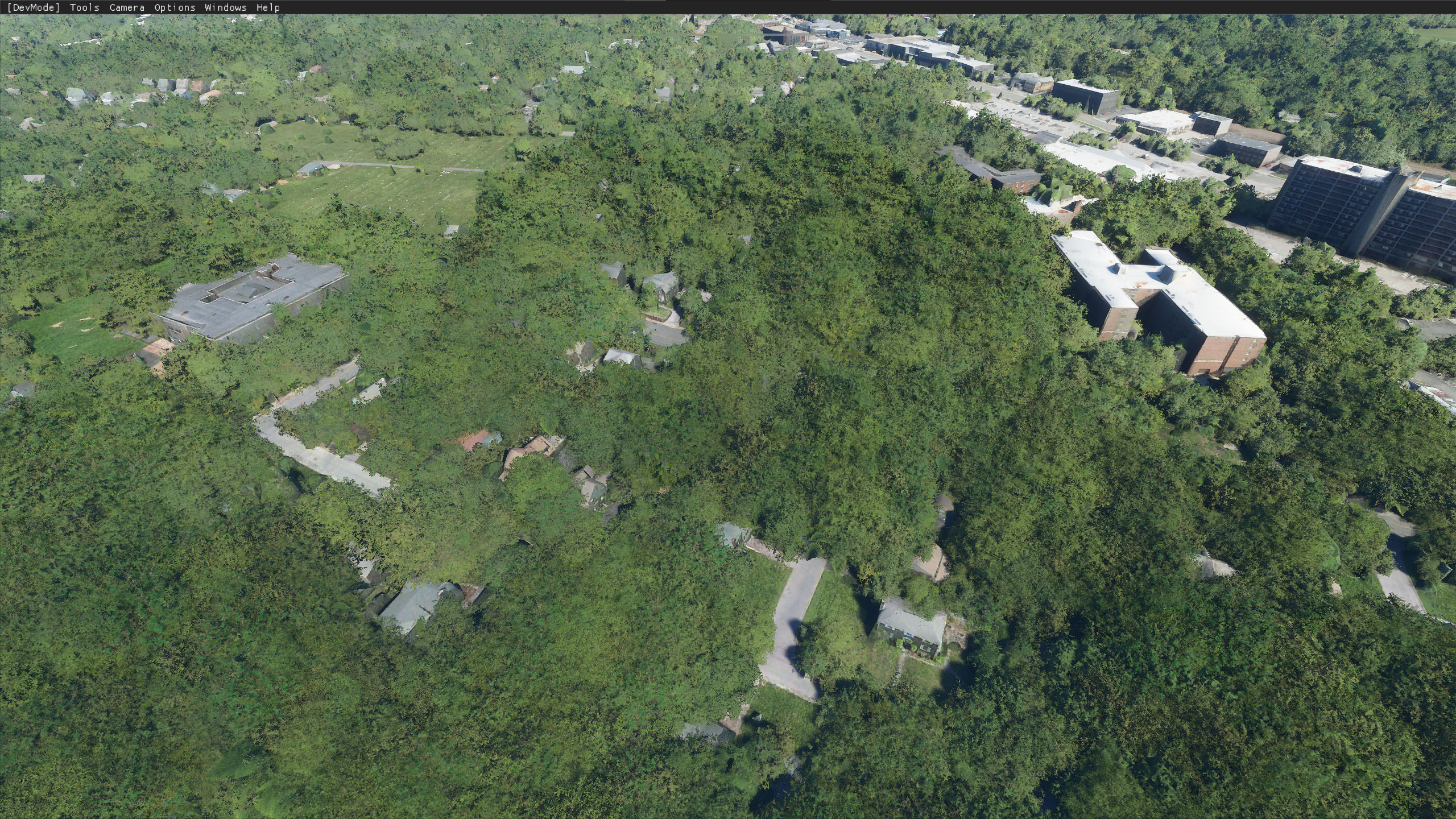
I had a lot of trouble recognizing where my siblings lived in an MSFS aerial view because basically there were WAY TOO MANY TREES and the trees covered just about everything up except for big buildings, parking lots, baseball fields, etc., that were often many streets removed from where my siblings lived.
I solved my problem by essentially using Google Maps in 3D view and rotating Google Maps with a pushpin in a house location until the faint pattern of streets or rooftops with unusual colors, e.g., red, in the MSFS view lined up with the much tree-freer Google view, which also had a street name overlay to help me out. For some sibling residences, I just made a screen capture, trees and all and left it to the particular sibling to figure out when they get their e-mailed MSFS aerial view where their house is in all the shrubbery (maybe they’ll want to use Google Maps, too?!).
There are applets like benhoto’s Track position in Windows Maps or Google Earth Pro for simultaneously tracking your location in Windows Maps or Google Earth vs. MSFS views but it would be nice if there were a way to automatically and temporarily inject a Windows Map feature/street outline into an MSFS aerial view to help orient you to where you’re flying if you just want orientation for the sort of thing I’m doing and not strict by-the-book flight procedures. If such a view could be conjured up, it would be great if it could also be used with the drone camera, as that’s what I was using, often at some considerable distance from my plane, to capture the “ideal” view to share with a sibling. If injecting a map over the MSFS aerial view were possible, maybe one could also save a low-res screen capture with GPS coordinates from the map, time of day, altitude, heading from MSFS to make it easier to document where screen captures were taken (maybe there could be a special version (or API to) of Snip & Sketch that works together with MSFS and Windows Maps to help document flights - and you could save the photos along with a .FLT file if you wanted to remember visually what a flight was all about??). Maybe, in effect, screen captures with such information could serve as a way points for new flight planning? And entering such screen captures as waypoints into a new flight plan would provide visual documentation in your flight plan of views you expected to see along the way (sorry if you can already do something like this in MSFS - haven’t done flight plans yet).
The whole time I was grumbling to myself about too many trees, I was wondering if “too many trees” was an intentional “coverup” in MSFS for saving rendering time or for hiding buildings as much as possible to avoid seeing flaws in rendering? Whatever the reason for too many trees, it results in much less realistic aerial views to send a friend or sibling and dissatisfaction with the end result. I’ve already filed a ZenDesk report.
The following two pictures illustrate what I’m talking about. Hard to get exact same views.
2nd Edit_Update: Yet Better, Even More Comparable Google Maps 3D screen capture:

MSFS aerial view of same area - can’t see the individual trees (or anything else) for the forest!