![]() Thank you using the Bug section, using templates provided will greatly help the team reproducing the issue and ease the process of fixing it.
Thank you using the Bug section, using templates provided will greatly help the team reproducing the issue and ease the process of fixing it.
Are you using Developer Mode or made changes in it?
Yes
Brief description of the issue:
Elevation spikes visible only from distance. Few meters after screenshot was taken it disapears. Slew back some meters will trigger the issue again. It reproduces under DX11 mode.
Provide Screenshot(s)/video(s) of the issue encountered:
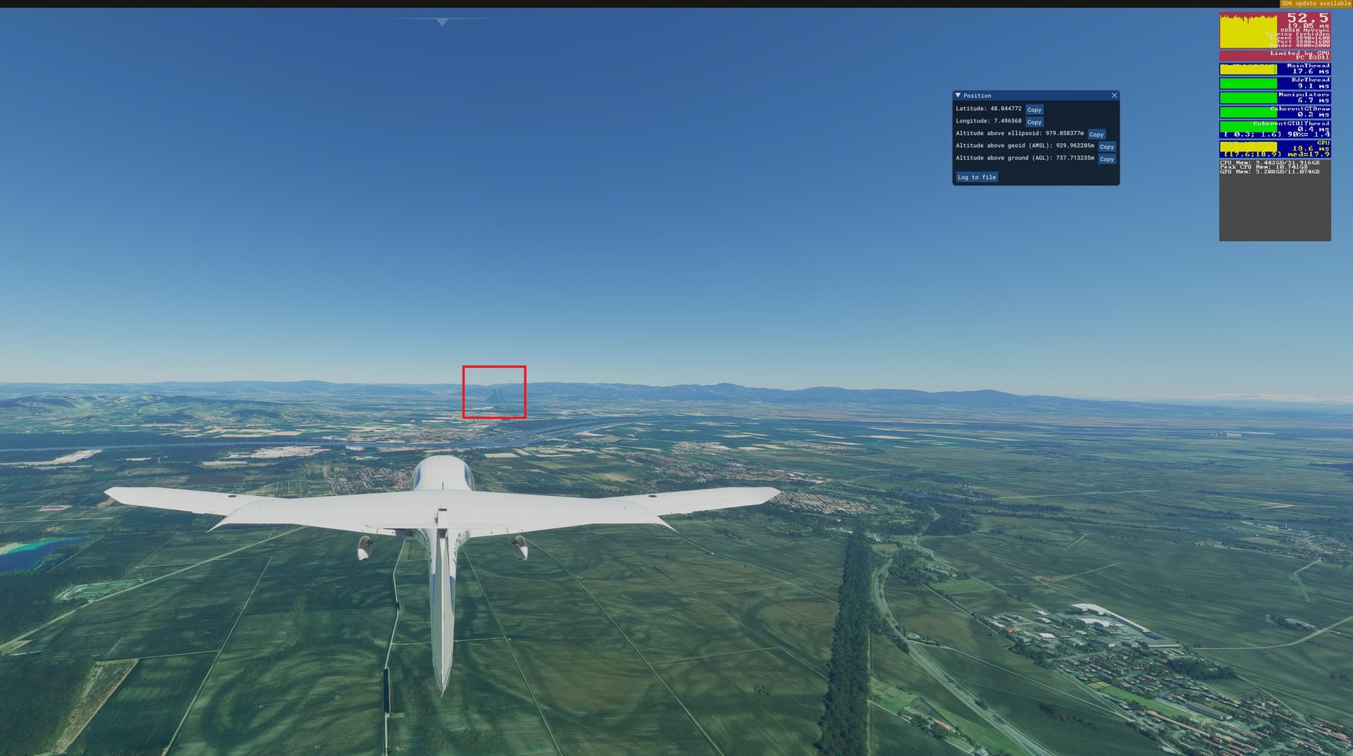
ICAO or coordinates (DevMode > Options > Display position)
Colmar (LFGA). See coordinates on screenshot: 48.044772, 7.496568
Detailed steps to reproduce the issue encountered:
Depart from Colmar heading 100º approx and flying at any altitude.
PC specs and/or peripheral set up if relevant:
N/A
![]() For anyone who wants to contribute on this issue, Click on the button below to use this template:
For anyone who wants to contribute on this issue, Click on the button below to use this template:
Do you have the same issue if you follow the OP’s steps to reproduce it?
Provide extra information to complete the original description of the issue:
If relevant, provide additional screenshots/video: