The Grand West Coast Tour

Welcome to the Grand West Coast Tour!

In this series, I will present interesting real world facts and detailed travel logs as I make my way along the US West Coast from Los Angeles to Seatlle. I am tourist here because I am from Europe, and will learn many new things beyond advertisments and television shows. My style of flying is pure landmark based, at low altitude and without any GPS or instruments. This leaves me to constantly match landmarks from Bing/Google maps to what I see in the simulator to figure out my position and orientation. It is challenging on one hand, but greatly increases immersion on the other hand because you notice so many small details about the region that you fly through. I will research those details after my flights and will learn many new things. These are the learnings that I want to share with you, and I hope you enjoy them as I travel along.

Leg1: Where is the water?
Santa Monica (KSMO) - Quail Lake Sky Park (CL46) (88km/55mi, Top Rudder Solo 103)

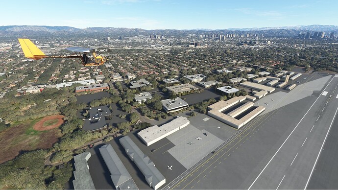
This very first leg starts at Santa Monica and leads me 55 miles into the north, which will be the major direction of my travels. Los Angeles is surprisingly easy to navigate from the air, because of large highways and the occasional green recreational area that just pop out. This being said, what pops out even more, is the actual lack of greenery even more so in the mountains surrounding LA. I myself live in an area with lots of green vegetation (central Europe) and instantly thought ‘where is the drinking water?’ upon looking at the dry-ish landscape. I picked this as my research topic for this first leg.

In a nutshell, water indeed seems to be a logistical challenge in the greater LA area. Here is what I found. While there is some ground water and surface water available, most of the water is actually imported (Los Angeles Depends on Imported Water | Sierra Club Angeles Chapter). The import logistics are dealt with using aqueducts, one of the major three amply named ‘Los Angeles Aqueduct System’. Now you might think we are talking some miles of aqueduct here and call it a day. But no, those aqueducts span many hundreds of miles carrying water from far away, that’s how isolated LA is from water.

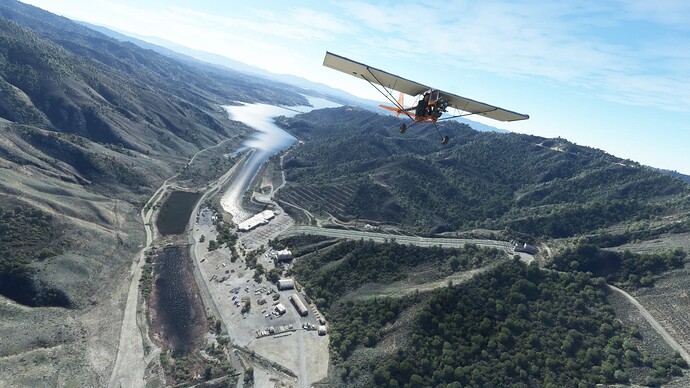
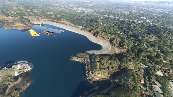
I visited a few reservoirs as well, because after all there are some mountains and it has to rain occasionally, right? One reservoir caught my eye because of a weird pipe system pointing uphill. Turns out I was at Castaic Lake, and the pipes belong to the Castaic Power Plant. This plant can do it both ways, so to say. It is a pump-storage hydroelectric plant. What is this, you ask? Well, you see, generating electricity from falling water is what everyone can do, but how about pumping water up to a lake in the mountains for storage? This is what happens here when I say the Castaic Power Plant can do it both ways. It can generate electricity from water that runs downhill through the tubes (coming from Pyramid lake) or it can pump it uphill, store it there and have it run downhill later to support electrictiy grid peak hours. The Castaic Power Plant has an average annual net generation of 319,181,000 KWh, at least that was from 2001-2012 before droughts were a thing. Doing the math, my 2h of flying in MFS maybe took 1KWh (PC with RTX2080Ti, HP Reverb G2). This makes me feel good, because this peak hour ‘requirement’ easily fits into the bill. Thank you gravity!

The star of leg 1: Castaic Power Plant

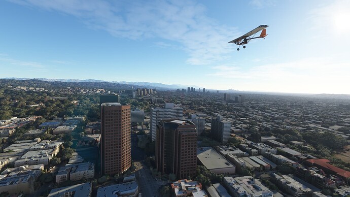
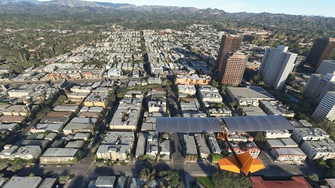
Starting off in Santa Monica and over LA


Two of the reservoires I visited (Encino and Castaic Lake)


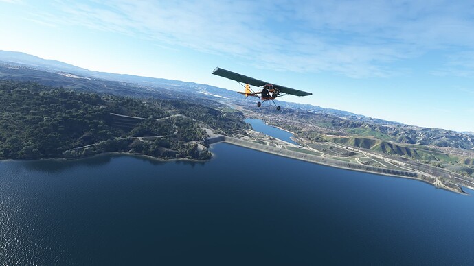
Quail Lake arrival

1 Like

This is a cool project you’re doing! Looking forward to reading more about your adventures!

Leg 2: A story of wind and getting lost
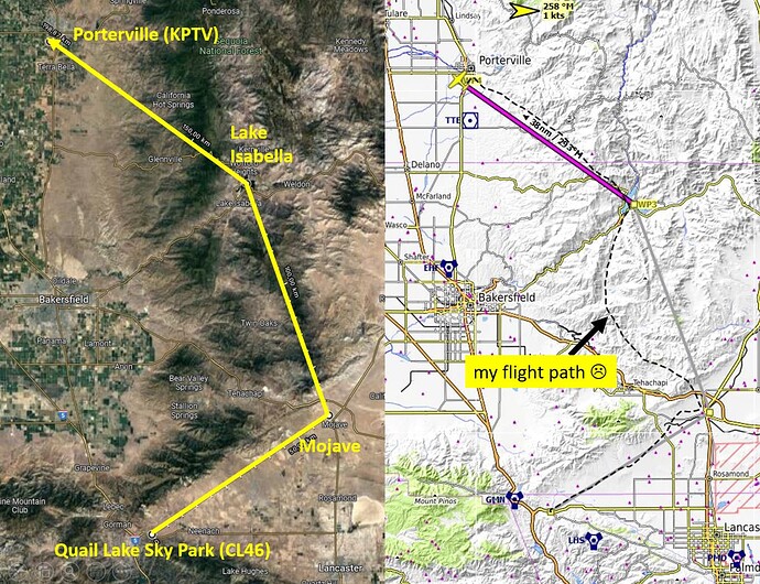
Quail Sky Lake Park (CL46) - Mojave - Lake Isabella - Porterville (KPTV) (200km/124mi, Icon A5)

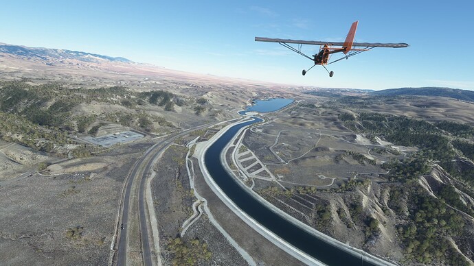
This leg was a disaster in navigation and was only saved by one tiny landmark feature.
It started at Quail Lake to Mojave, then to the north along Breckenridge Mountain to Lake Isabella and ended at the edge of Californias bread basket in Porterville. The overall notion of those trips is to chose routes involving some mountains at least.

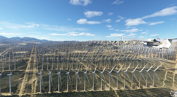
The first miles were easy, along the edge of Mojave desert to the town of Mojave. My jaw dropped a few miles before Mojave. At first I thought MFS bugged out - there were hundreds of windmill turbines! But no, those are actually real. It turns out I found the Mojave Wind Farm (or Alta Wind Energy Center), the largest wind park in the US with some 800 windmills and an electricity generation of some 3GWh. It is a crazy sight! I do not plan my flights with any famous landmarks in mind, so it is quite funny that I accidently plotted a route along the largest wind farm in the US.

Some of the windmills of the Mojave Wind Farm

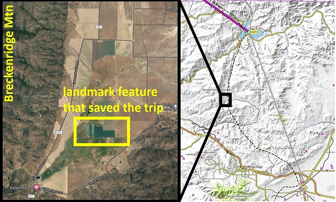
Next I went north to Lake Isabella across hilly terrain with very few landmark features. I completely drifted away to the west without noticing and was only saved by a tiny green field at the bottom of Breckenridge Mountain which I could match in Google/Bing maps. In VR, you can overlay the PC desktop with Google/Bing Maps on it while flying. So as soon as I spotted this characteristic shape in the simulator, I scrolled through the map like crazy to find it. From there on I knew my location again and corrected my flight direction for Lake Isabella. The Little NavMap tracker revealed my detour after the trip. The big ‘adventure’ of those trips always kicks in when you get completely lost, because by my rules the trip is aborted and needs to be restarted if the next destination (here Lake Isabella) is not reached. Add to that the ‘no refueling rule’ and getting lost puts you at risk of not completing the trip at all.

This little feature saved the trip. Without it, I would have never found Lake Isabella

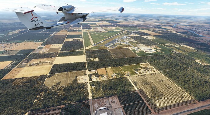
From Lake Isabella to Porterville involved a downwind mountain ascend but was overall eventless. Upon arriving there, I was welcomed by the crazy square and rectangle shaped fields all over the place. Perfect squares of 2600ft, very pleasing to the eye, that’s how they draw the agricultural fields over there. Compared to this squared perfection, the bread baskets of other countries look like a mess from the air.

Agricultural area is very organized and full of 90° angles in the US


Arrival in Porterville

Leg 3: A leg lost - How embarassing
Porterville (KPTV) - The Needles - Independence (207) (not finished, Top Rudder)

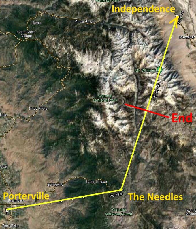
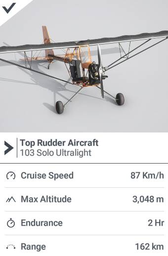
This leg was a failure beyond belief. Overconfident as I am, I picked the Top Rudder and wanted to cross the mountains to the west. Long story short, after a horrible 2h climb I eventually did not have any sort of lift left because I breached the maximum altitude of the Top Rudder. No way to cross the remaining mountains, I just bounced off of them like some fool. The idiot that I am of course only checked the height profile AFTER the trip, not before. There was just no way to cross the mountains on the intended path. Out of fuel to reach any landing strip in the area, I landed in the middle of nowhere and called mountain rescue to get me to the Independence landing strip where I will stay overnight.

That was a hard learned lesson.

RouteMarked


TopRudder

Leg 4: Carry me to Fresno, sweet updraft!
Independence(207) - Fresno(KFAT) (145km, Top Rudder 103 Solo)

Upon stranding in Independence after my mountain rescue from leg 3, I settled in and waited for my replacement Top Rudder to be delivered to Independence.
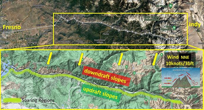
The following days I came up with a bold plan on how to cross the mountains back to Fresno after my failure from leg 3. The magic word is updraft, and if the right wind conditions are met, I should be able to use the updraft to cross the mountains like a wobbly glider. The Top Rudder is essentially so light, you can literally soar along slopes with right wind conditions and even gain height with the engine off. It is much more shaky and unstable than in a glider, but doable. This should help me to get to the right height and also to save enough fuel to reach Fresno!

The plan to get to Fresno using huge updraft sections

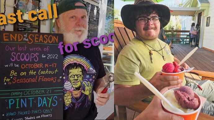
The following days I waited and waited for NNE wind to bring my plan to life, as drawn in the image. All the waiting gave me time to discover Indy. Indy is what the locals call Independence, and the first local I met was Ray. He owned the motel and ice cream shop that I both soon made my home. Ray was a true local, scooping ice cream with a passion and telling stories of the good 'ole days in Indy. Not that Indy has ever been more than a few houses in the middle of nowhere, but his stories of how his ice cream shop came to life and revitalized the town during the difficult time was worth listening to. On his website you see that his ice cream shop season usually ends on the 17th October, but upon laying out my adventurous tale in front of him and letting him know of my passion for ice cream, he kept scooping past the 17th and we grew good friends. Should you ever visit Indy, do not miss your ice cream https://eastern-sierra-ice-cream-company.business.site/

Ray was a true local (left). Ray and me (right) roughing up some ice cream.

Ray’s Den Motel. My home while I was stranded in Independence

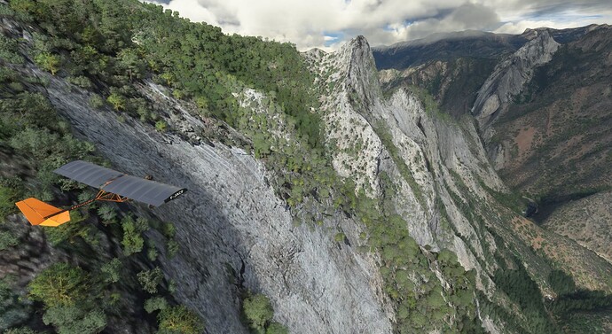
Finally, after days, my wind notification alarm was screaming while I was slurping away another ice cream! Wind from NNE, about 10knots! I jumped off my seat, hugged Ray goodbye and ran to the landing strip where my newly delivered Top Rudder was waiting for me. What can I say? The plan worked perfectly. I soared the entire green region in the map image. I crossed 12000ft using updrafts, which is 2000ft more than max altitude of the Top Ruddder, and used only 25% of my fuel even though the range circle on the map predicted 80% of my fuel being used up.

Updrafts of a lifetime ahead, the elevator awaits!

Leg 5: In honor of Amelia Earhart!
Fresno Yosemite Intl (KFAT) - Johnston Field (5CL9) - Manzanita Airstrip, Mariposa (6CL4)- Lee Vining (024) (160km/100mi, Top Rudder 103 Solo)

The last leg ended in Fresno, which I quickly left because I wanted to move closer to the edge of the Yosemite high-altitude range before crossing it to the east as soon as the right winds show up. The closest airstrip to Yosemite is Manzanita Airstrip, which I arrived at after two short and eventless hops via Johnston Field. In Manzanita, I needed anythinfg that is west wind for a successful updraft high-altitude crossing and to reach my goal Mono Lake on the other side of the range. The forecast though was telling me that I had few days off with no mentionable west wind in sight, so I decided to move into the next big town Oakhurst.

Leg 5 route and location of the crash during my first attempt right next to Amelia Earhart Peak.

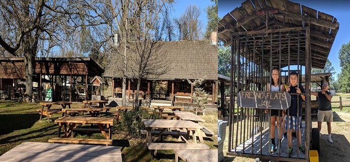
Oakhurst itself had a pretty big misunderstanding for me in place. You see, my financial situation had not exactly improved after my mountain rescue into Independence and the following ice cream rampage there. So I was on the lookout for some free accomodation. Lucky me, I actually found some open park shelters, kind of small farm buildings, and made camp there. Boy, was I lucky, the indoors were actually equiped with just the basic needs, perfect for semi-camping so to say. I made myself comfy and went to sleep over thinking of my upcoming mountain crossing. The next morning I was woken up by a very angry voice though. I opened my eyes and saw a gray haired dude waiving his arms and yelling along the lines of ‘this does it!’ and ‘you will get a proper room!’. Turns out he was the boss of the Fresno Flats Historical Village and turns out I slept in a museum exhibit! I tried to explain my situation and how ice cream ruined me, but he would not have any of it. He called his buddies and they moved me to the cage wagon. I inherited the cage from two children, who explained to me that they mistook the exhibited dairy products for free nitrition, an equally consequential misunderstanding. Long story short, I spent the next two days thinking about my mountain crossing, in a cage! Lucky me, as soon as I was released, west wind showed up and I was ready to fly!

Fresno Flats Historical Village, where a misunderstanding had me jailed for days. The two kids, the previous inhabitants of my cell, fell victim to a similar misunderstanding.

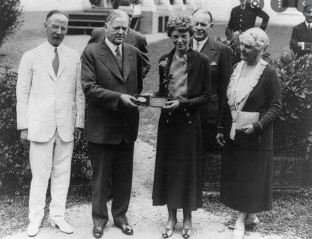
My first attempt at 5kts was unsuccessful and I stalled and crash landed in a small high altitude lake after endless and painful climbing in my Top Rudder. The updrafts just were not strong enough. Back to square one, replacement Top Rudder ordered, second attempt. The second attempt had winds of 10kts and this was enough to lift me over the huge mountains and I arrived at Mono Lake. Before coming to an end though, I want to mention that I looked at the Little NavMap tracker after my first attempt and noticed that I crashed right into Ireland Lake next to Amelia Earhart Peak. Now for the casual reader, this might not sound like much. But for enthusiastic aviators like myself it was the most proud moment. You see, Amelia Earhart was one of the pioneer aviators back when photos were still black and white. She met the president and what not. At the age of almost 40, she attempted to circumvent the globe and disappeared in the Pacific Ocean near Howland Island. Tall stories emerged how the Japanese captured her and so on. But the most plausible cause is that Howland Island just was not mapped properly at this time, so she missed navigation and ran out of fuel, and dropped into the ocean. You can imagine my face, when I realized that I crashed into, not an ocean, but a lake, right next to a peak named after Amelia Earhart.

Amelia Earhart, one of the flight pioneers of her days, with the president. She went missing after crossing the Pacific. I crashed right next to Amelia Earhart Peak in a lake.
image

Ok I might try this in the Kamov or a glider (after Su11)