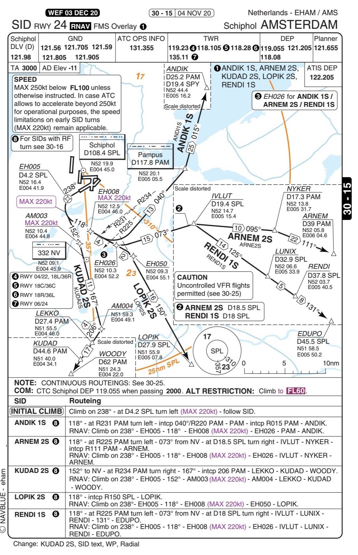
The information is no different between NavBlue and Jeppesen. There might be slight differences, but with both Jeppesen and NavBlue you generally have all the information you need to fly the departure while with the AIP charts you only have the route (only the waypoints, no detailed explanation, lead-radials etc.), MSA, initial altitude and transition altitude and need to look up the rest in the AIP text.