I am an MSFS sightseer - take off, see something, and land. I found that most downloadable flight plans are for commercial flights, and casual VFR plans are lengthy and packed with a ton of waypoints. There are very few easy, short flight plans available for beginners, light aircraft, ultralights, etc. To help fill this gap, I have been sharing my sightseeing flights on flightsim.to (search ‘Short VFR’).
The most difficult, time consuming part of creating the plans is waypoints. The distance they disappear before reaching the waypoint location varies wildly. Sometimes miles in advance and sometimes they remain visible all the way to the location. Early disappearance makes it nearly impossible to locate desired locations in urban areas. Navigating mountain valleys is difficult because most of the time waypoints are behind mountains (display is too low) or don’t show up at all. I cannot figure out what, if any, logic is used for displaying waypoints.
I’ve tried different types of waypoints (user, vor, … ) and have even tried classifying waypoints as airports with dummy ICAO codes. I’ve also tried classifying the plans as IFR versus VFR. Results: MSFS sees imported waypoints as just location coordinates, or it does not display them at all, depending on how the plan is configured.
I’ve also rummaged around in the program files to try and find waypoint configuration settings, but did not find anything relevant.
So, I thought I would ask the forum collective brain trust if anyone has any tips or knowledge that will help make my flight plans work better for casual users.
For VFR navigation, you should make a note from the charts of what will be visible around your waypoints, and write that down in the directions you (or others) will follow. Make a note of the direction and distance (which can be used to calculate expected time for a leg, based on speed) and anything visible that will help orient the pilot.
Example: “follow the river southwest until you reach the ocean, then follow the coast northwest about five NM until you see a small airport”.
Take a look at the “bush trips” for good examples of detailed step-by-step VFR directions.
Please take a look at my (free) flight planner. It will make waypoints based on a text query (like ‘Niagara Falls’). It also has a ‘tracker’ that will lead you to the waypoints (and so you do not need to depend on MSFS to get there).
I appreciate the quick responses. To clarify, my question is only regarding the narrow topic of tips and tricks for visual waypoints.
To explain: I’ve used FSX, MS Flight and MSFS for more than 15 years and understand a lot about it. A few years ago, I wrote a 70-page step-by-step XML manual for FSX gauges (Google: textinfogauge40).
However, my short VFR plans are targeted at the most basic users (new users, casual users, ultralight hops, etc.). People who want to take off, fly a short distance and see something along the way, then land, without having to know anything more than basic flight controls. Flight plans that provide simple visual waypoints for these types of users are few, and I’ve been creating short VFR plans to fill the gap.
MSFS is a great leap forward from FSX. But for user control of visual waypoints (when they appear, triggers, etc.) MSFS is a step backward from FSX. I’ve found very limited (nearly none) info regarding how to manage visual waypoints and I’m hoping there are a few folks who have discovered tips that will allow me to control them better in my plans.
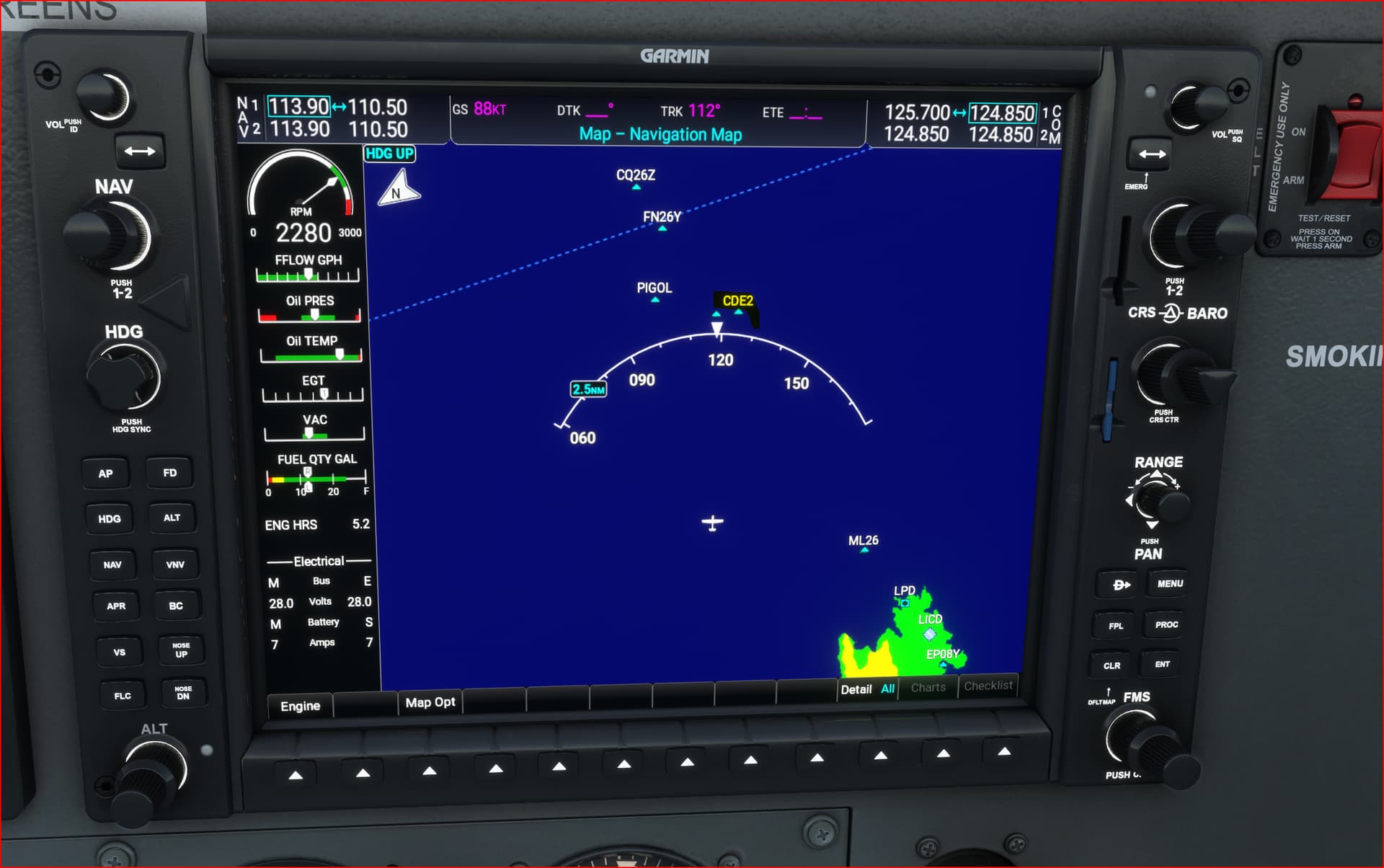
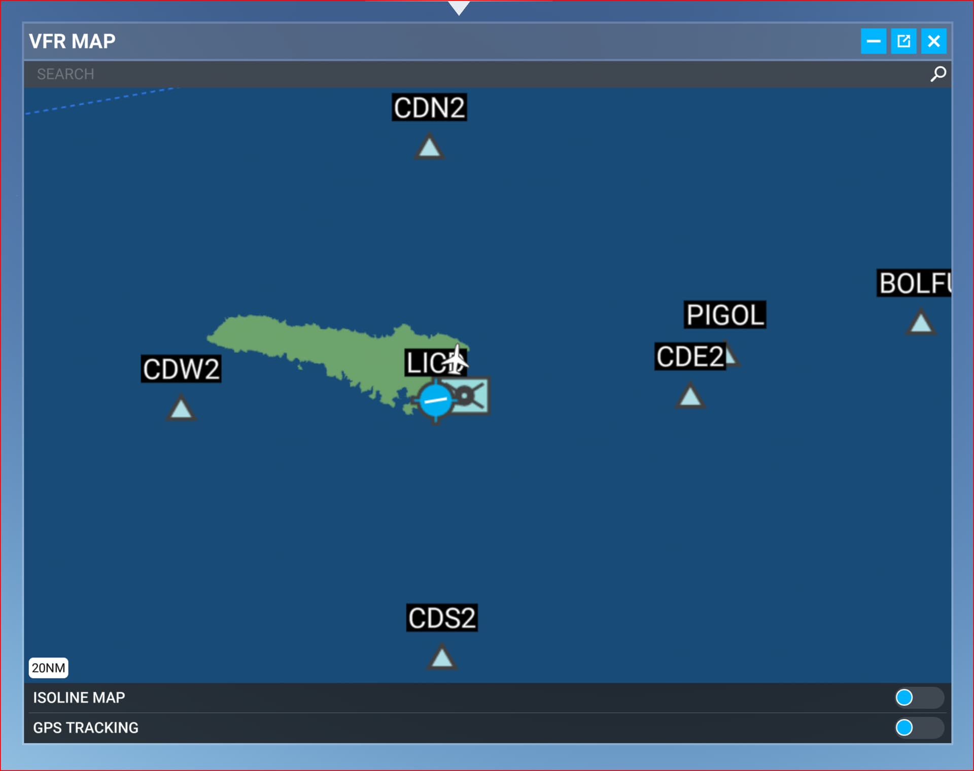
So, you’re talking about the assistance feature where little blue markers appear floating in the air over things on the ground? I really know nothing about that feature because I don’t use it. When I want to see all the new POIs added to a city or small area, I just add them as waypoints to my flight in the World Map, then bring up a map view (on the glass or the “VFR Map” tab as applicable) and follow the magenta line to the next target. Then (if the target turns out to be pretty small), it’s circling around the locale at low level until I see it. Then on to the next target.
I appreciate the suggestions, but I am well experienced with managing my own flights. This topic is regarding how I make it easier for beginner users to follow my flight plans.
Remember the first time you loaded a flight simulator and knew nothing about it? Just starting the aircraft and getting off the ground was an accomplishment. Landings were messy. Program configuration was a daunting task. Navigation was yet another level of learning. You were a beginner user.
I found that there are very few easy flight plans for beginner users. Plans that a beginner can simply load and play follow-the-waypoints on the screen in front of them. The lack of beginner flight plans is the gap I am filling with my Short VFR plans. I’m hoping they are also useful to experienced users who just want a simple flying experience.
The scope I am using for flight plan creation is:
Maximum distance of 50 miles. Preferably less than 20 miles.
Minimal number of waypoints.
Optimized for Cessna 172 or smaller.
Only requires beginner flying skills.
No additional instrumentation, utilities or tools required.
Here are the behaviors that are frustrating me:
Waypoint markers often disappear far before reaching the target. In crowded cities, it can be almost impossible to find the target after the waypoint disappears. If the target is a sightseeing item, then it renders the sightseeing flight plan useless.
The next waypoint marker is often displayed long after the current waypoint disappears. It leaves the user wondering if they should continue forward or assume that maybe waypoints are no longer going to be displayed.
The problem described above is made worse when sometimes the next waypoint is displayed long before reaching the current waypoint’s target. The current target may be the sightseeing location, which you may not yet see, but now the current waypoint is gone and the program is showing you a new marker indicating a change in direction, when you should not be changing direction.
The instant that the Pattern Entry marker for the destination airport is displayed, all interim waypoints are suppressed. In other words, if you are at WP2, and WP3 and WP4 are still ahead, the moment the Pattern Entry is displayed then WP3 and WP4 will not be displayed. If the same airport is used for both departure and destination, then the Pattern Entry marker often appears soon after takeoff and no waypoints are displayed, at all. Because my target users are not experts, I often include waypoints that align them with the destination runway. The Pattern Entry behavior eliminates the ability to do that.
In mountainous terrain, it is almost always difficult to get waypoint markers to display correctly, if they are displayed at all. I suspect in many instances the markers are actually there, but are buried inside mountains because MSFS decides their elevation.
If the distance between waypoints is short, typically less than a mile, then the next waypoint marker is often not displayed, or may only briefly flash on the screen, or may result in no further waypoints being displayed. This is a problem when POIs are near each other, and also when a POI is on a mountainside, necessitating extra waypoints to guide tight turns.
I have unsuccessfully tried to determine the logic of waypoint displays. I’ve tried flight plan configurations, aircraft types, airspeeds, times to target, types of terrain, etc., etc., and have not found a common denominator. I’m sure there is an algorithm, but in actual usage it seems waypoint behavior is completely random.
To clarify for future posters – the poster is not asking about how to describe a VFR waypoint to traditional VFR pilots, but rather is asking for any hints about the in-game assistance feature where waypoints are shown in 3d space outside the window (but may be obscured by physical objects or terrain) and the logic about when they’re visible vs obscured.