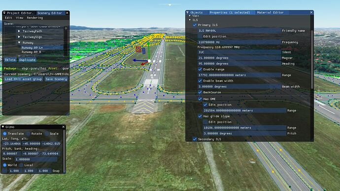
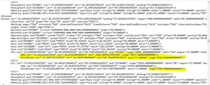
After new update we’ve got new settings for runways in the dev mode. Runway has ILS tab which can be configured, but I found few bugs which definetly must be fixed.
1. Secondary ILS not available after scenery build.
My runway was configured based on Jeppessen charts, scenery was saved, package was built and after MSFS restart I found that secondary ILS is not available and primary ILS has the secondary’s ILS freq. Looking at scene xml file I found that the secondary ILS has name end=“PRIMARY” - the same as the primary ILS. Changing for end=“SECONDARY” got fix the problem.
2. Glide slope has no snap to ground
Check your glide slope position. Especially if you have some terraforming in airport area.
I found that the glide slope altitude is under runway what makes wrong ILS descent .
Put your dev camera into runway and change the height (blue scuare) of the glide slope into the runway surface.
Glide slope position must be always snapped to ground.
3. ILS settings have ILS position, DME position and Glide slope position.
It’s weird - if you have ILS and DME - this is your glide slope. Anyway, MS decided to have a separate glide slope position despite ILS and DME.
So, where they are? For example you have runway 01 - 19.
ILS position for rwy 01 shoud be at the end of the runway 01 on ILS antenna (center) on some distance from the runway 19 threshold.
Rwy 01 DME position on side of the runway at the center of the 01 touchdown zone.
Rwy 01 glide slope is the point on the runway where your aircraft should touch the runway.
Range should be around 37.000 meters for all of them.
Don’t forget the heights of these points (see my comment #2), pitch, freq and IDs.
In best case all these settings should be setted by default, at least glide slope and ILS.
Maybe in next update?

