Next month, I plan some (real) VFR flight in San Diego. I’m currently in France, so what a better place to train than my MSFS with some homemade sceneries and Foreflight connected to my PC(1).
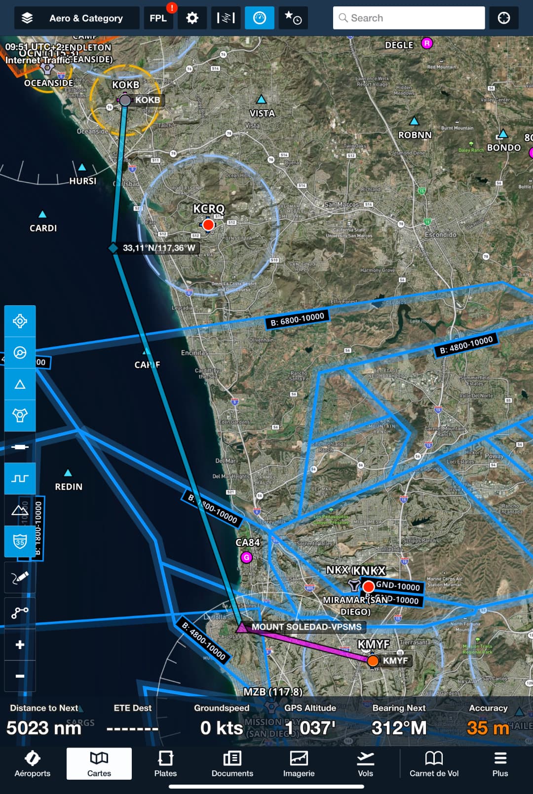
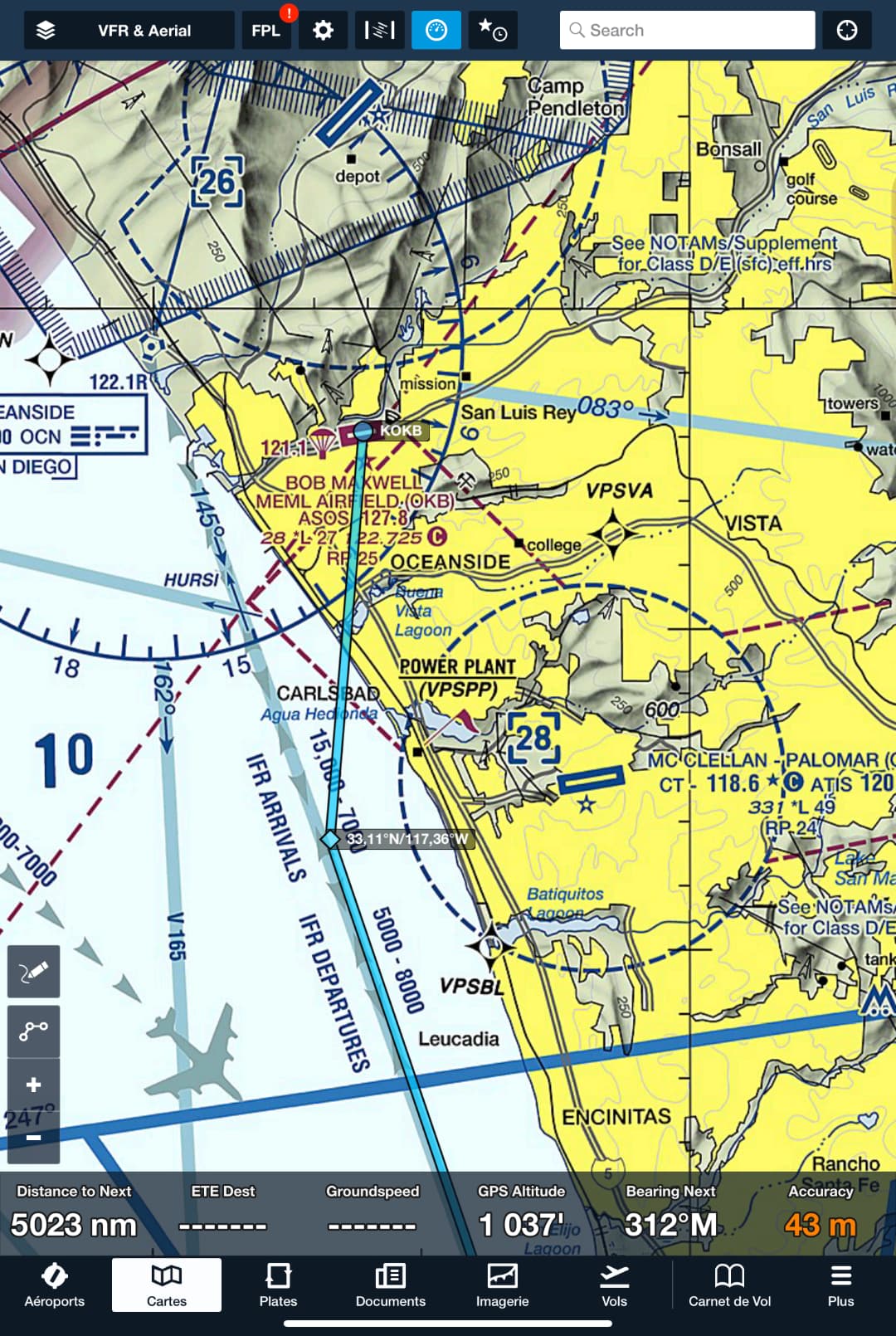
Easy VFR route: Montgomery Field (KMYF) → VPSMS (Mount Soledad) at max 1’800 ft - up north along the coastline abeam Torrey Pines Golf/Park - Avoid Class D of Palomar (KCRQ) - then join Oceanside (KOKB).
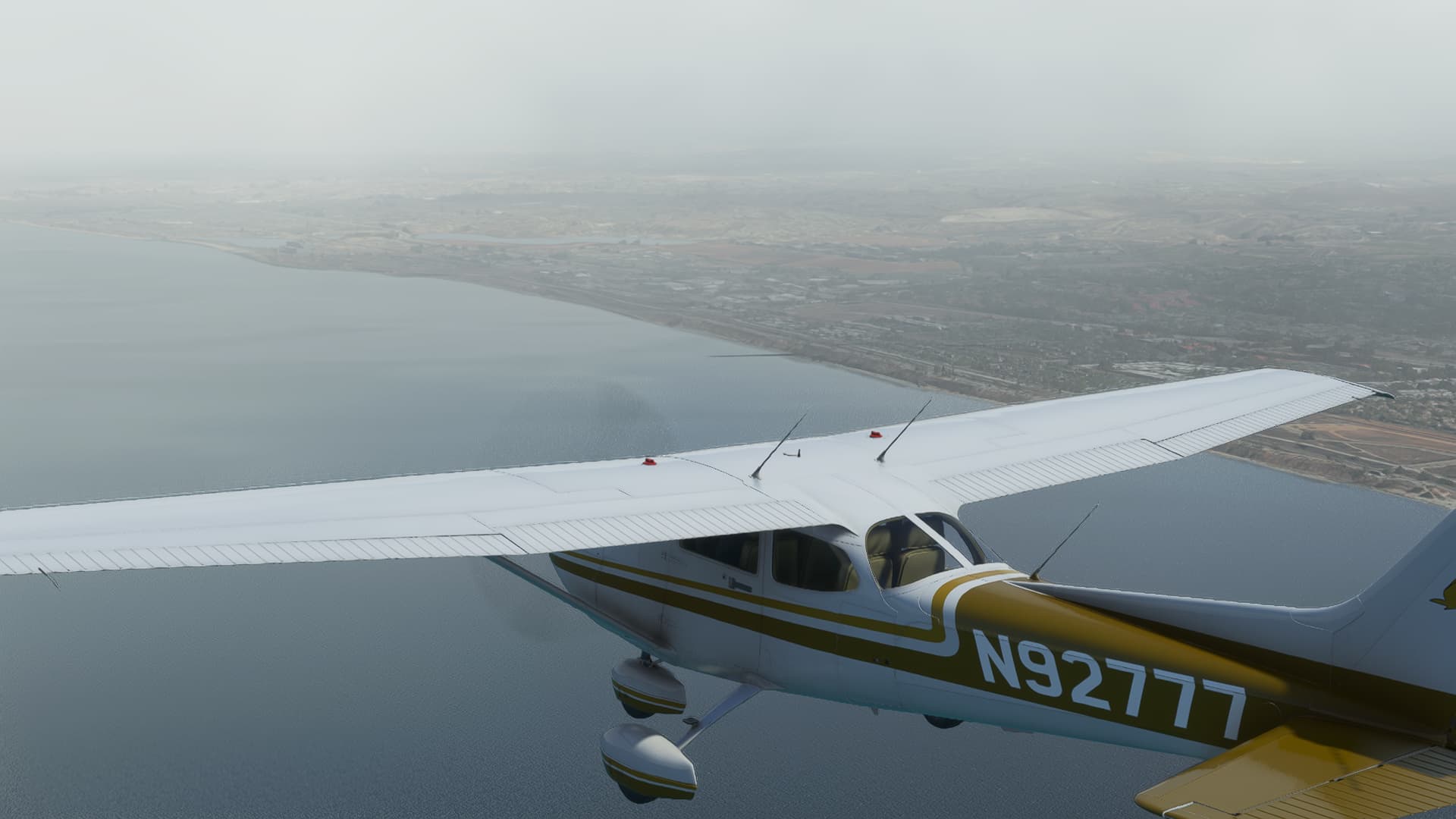
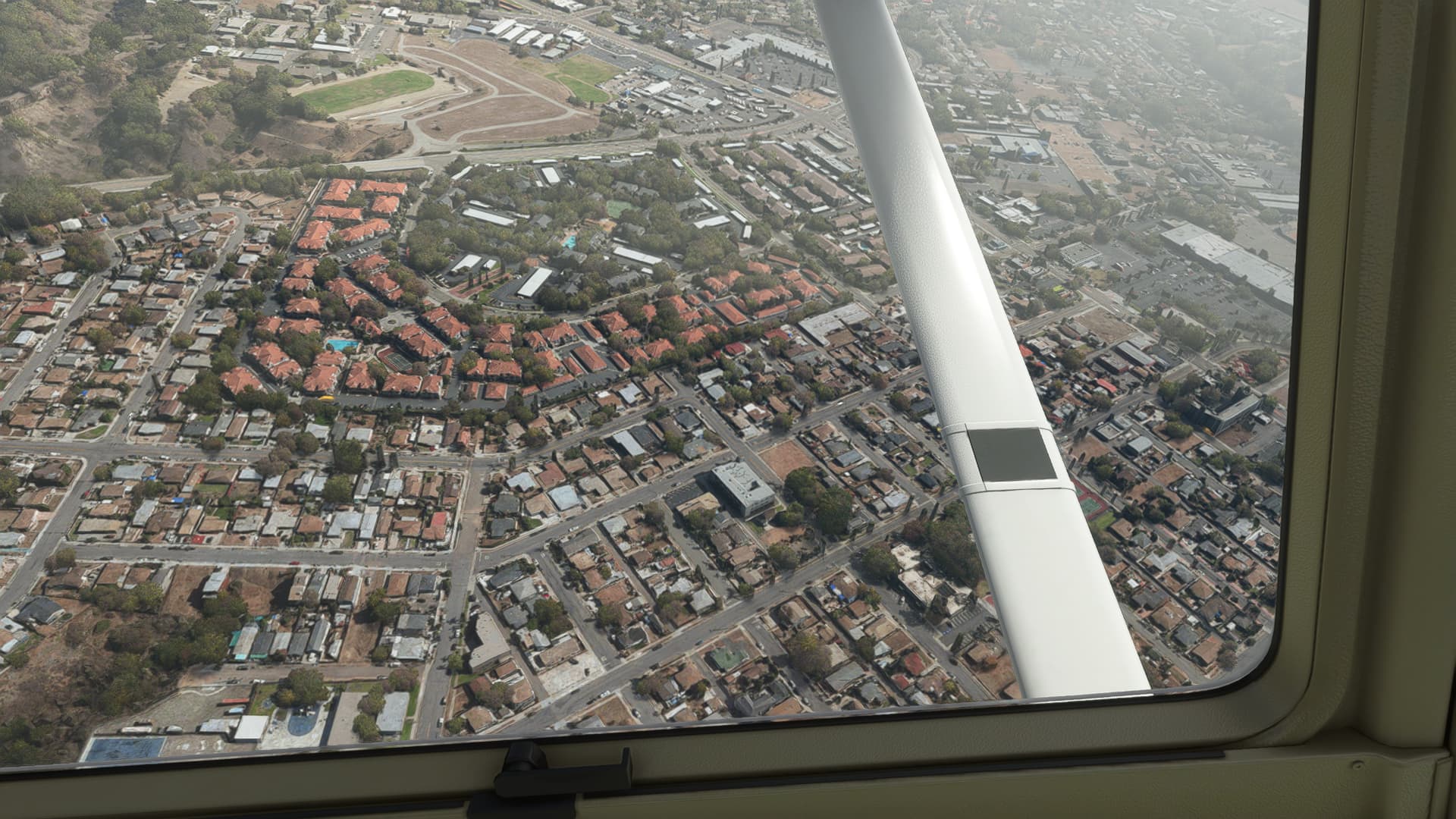
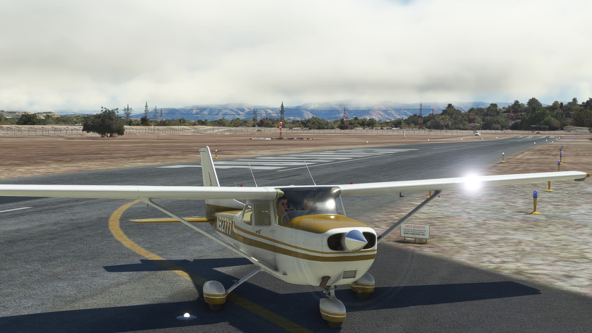
Northbound, along the Pacific coast. The depicted weather by MSFS is very close to what I imagine and what I get from a METAR (BKN015). Challenging enough to make me think of “what would I do if I were in this situation? What are my options?” and so on…
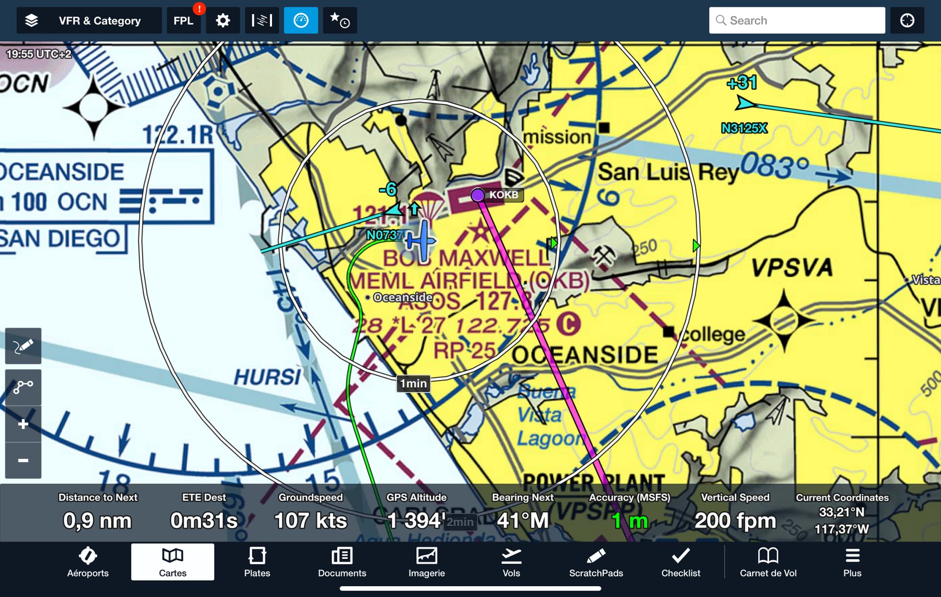
Foreflight displayed an AI small aircraft departure just when I arrive. Perfect training! I have to deal with overhead to check the field at 1’500 ft or joining directly the left downwind… Finally did a mix : overhead then a kind of 45 entry

Grey ambiance with this cloudy ceiling in California.
End of left downwind 25. There’re too much powerlines there
I suspect double power towers with the default MSFS + the “We Love VFR Region 2” scenery.
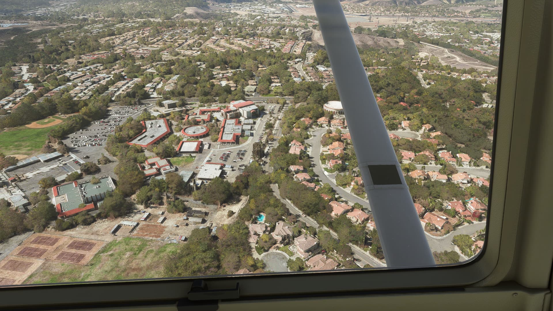
Extended left base flying over El Camino High School
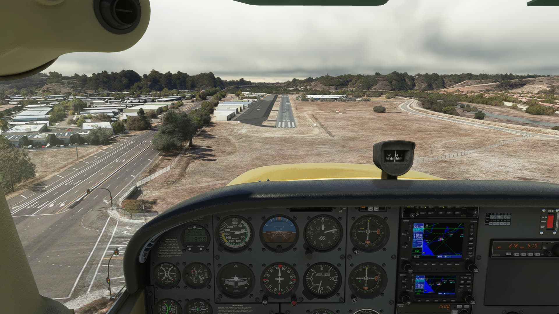
Short final 25. It was a nice idea to had these light stop poles in my
KOKB scenary
Runway 25 vacated by the left, applying strong brakes
I hope I can have a look at some of the signs I wasn’t able to identify from here (France)
Help still needed.
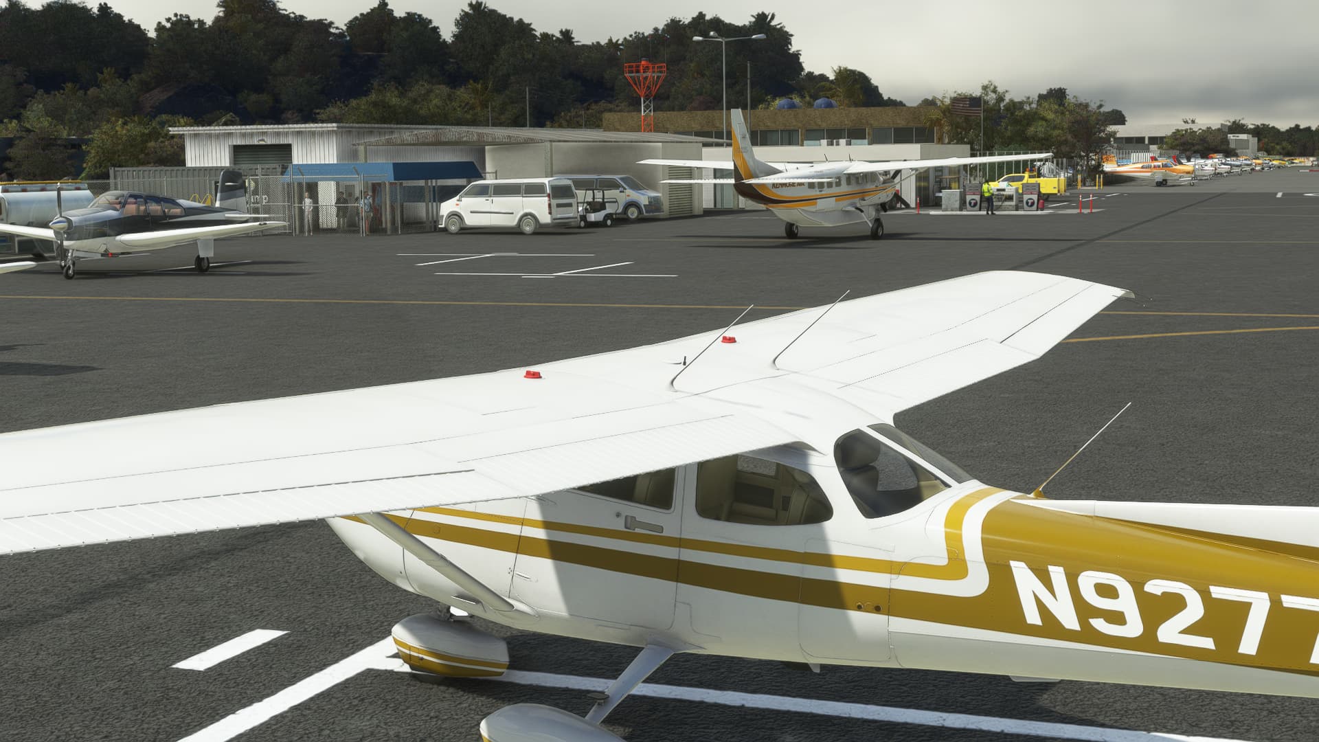
Parked at what I suppose to be a transient spot, looking at the Goflight jump plane.
(1) This is not my main PC but my second “holidays” PC (i7-10700F, RTX3060)
10 Likes
One of the best things about flying VFR or IFR is that there are always different ways to fly from departure to destination. Thank you for sharing your flight and your many regional airport contributions! MSFS is perfect for VFR flying not only because of the scenery but the many additional landmarks for scenic touring.
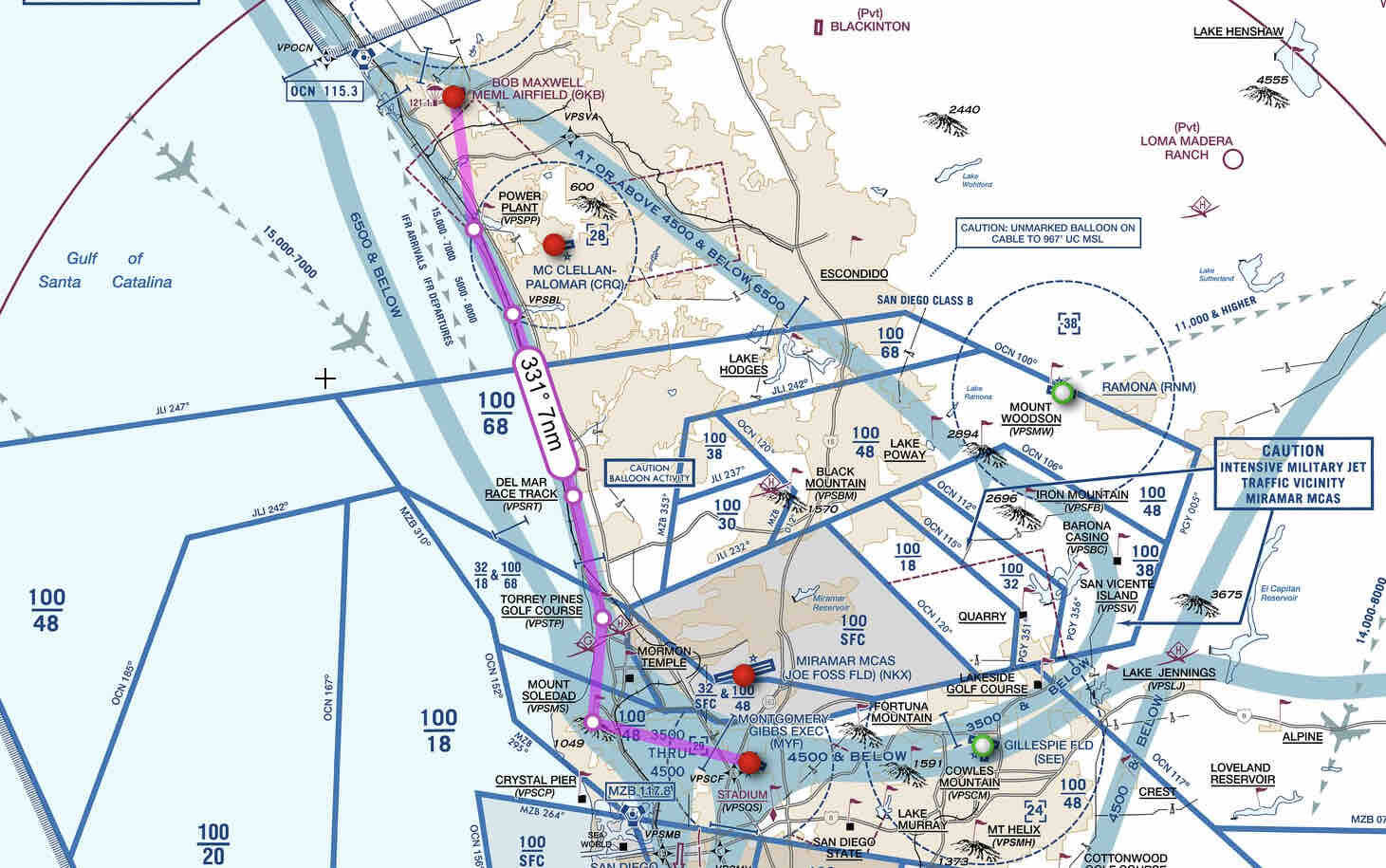
Personally, whenever I fly over water, I always make sure my altitude is high enough to reach land in the event of an emergency. Flying from Montgomery-Gibbs to Oceanside, I prefer flying over I-5 using the FAA VFR FLYWAY PLANNING CHART. Here is the VFR route I chose and the route overlay on the VFR chart (from SkyVector):
KMYF VPSMS VPSTP VPSRT VPSBL VPSPP KOKB
San Diego airspace is almost as bad as Los Angeles. Both take a lot of planning to navigate VFR around the airspace restrictions.
BTW I don’t know how many 208s GoJump has but sadly they lost one June 2022 during a visual RWY 25 approach.
2 Likes
Awesome write up and scenero planning. Oh, where did you get that great livery? 
1 Like
As a North County resident, I use your scenery often. I’ll have to check out KOKB again with a closer eye on detail to read your sign!
1 Like
Thanks for your feedback and experience sharing, as well as the reminder for the FLY chart
Thank you. The liveries for the Classic and the G1000 version are available here: https://flightsim.to/discover/N92777 The WbSim is either my manual edit or downloaded from the WBSim Discord, can’t remember
Thanks! Looking at youtube videos and on Bing/Google map, it seems there’s a sign there that I can’t identify :
In all of my sceneries where I can’t identify a sign, I put this “HELP WANTED”
1 Like