I’ve flown to a few areas in the last couple of days where I’ve been assigned visual approaches and told to expect vectors. Fine, no problem there at all.
But as soon as I get handed off to approach, they acknowlege me, tell me to continue my plan, and then I never hear from them again. I’m left at whatever altitude I’m at and will keep flying away until I’m out of their range and they hand me off to another frequency.
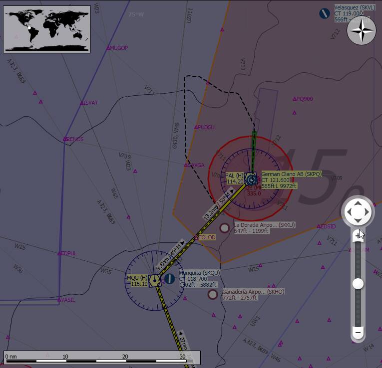
If I request vectors, they typically send me off in some random direction that makes no sense and never issue me a new vector even when I request. Yesterday I was flying to Nassau from Opa Locka. Requested vectors, and they sent me back to Florida.
The only way around this is to cancel IFR and land VFR, which is fine. But I want to know if this is just something I’m doing wrong or if there’s something actually wrong here. To me, this doesn’t seem right.
I guess ATC is buggy, but when you plan your flight including ILS approach, you follow your flightplan and as soon as you are captured ILS and get around 5-10 nm you get your landing clearance. Many times ATC speak you to correct Altitudes and let you fly your flightplan. Sometimes It doesn’t work at all and you should ignore them or request VFR.
Short amendment: I never wait for ATC requesting me to leaving my Enroute Flight level. I calculate on my own and request by myself lower FL via ATC. Normally I request direct an altitude which is near by my ILS entry height.
I appreciate your input, but I don’t understand its relevancy. This has nothing to do with ILS approaches. I do those all the time without issue. Even if I don’t enter it into my FPL at the planning stage and it gets assigned to me on arrival. No issues there at all.
The 2 airfields I was landing at had no instrument approaches. I was assigned a visual approach and told to expect vectors. That’s where it all breaks down…
In-game ATC can be pretty stupid sometimes. I’ve seen the same thing many times.
When it sent you back to Florida, there are two possibilities:
You flew an IFR plan and skipped one of the waypoints and ATC gets German about it, “How can you possibly be a few miles of your destination when you missed a waypoint 100 miles back? Nein, nein, ve must do it properly!”
It assigned to you a “supposedly” appropriate approach and transition point on the fly (if you did not select a specific approach in the planning screen), and the arrival procedure starts behind you, and it wants to send you back.
I’ve also been on an approach, all stable and a couple of minutes away from localizer intercept having gotten “descend to 4,000 feet” , and suddenly am told to “climb to 16,000 feet”. But if you ignore the stupid commands, once you are established on the ILS localizer and glideslope it will usually accept it and clear you for landing.
I’ve also been commanded to climb to 30,000 feet when I am in a Cessna 172.
As you probably know, not all waypoints/VOR/NDBs are unique in the world. I recently flew an approach into Heathrow, and suddenly the next waypoint was in Africa. Same code, 3000 miles away.
What we really need is an ATC response option called “Reject Instruction”, for things like altitude changes. ATC should also will ignore any approach waypoints that are more than 5 miles further away from the airport than you are.
And don’t get me started about being handed back and forth between a half dozen controllers every minute, all working for the same authority (XXX Center etc)
it’s not really a fluid experience right now. What I’ve been doing is request a new vector every 2-3 minutes. That normally guides you nicely to the active runway. It’s a bit hands-on and repetitive, but it seems to work… sort of.
I would be nicer if the ATC contacted you with a new vector automatically.
This is how they guided me in on my last IFR approach:
That’s what I was expecting. That’s how it should work. But it doesn’t Nassau approach kept me on a 280 heading back to Florida. I was about 10 miles from Nassau when I got the vectors. I kept requesting new every few mins, but kept getting 280 I was almost 100 miles from Nassau, Approach wasn’t handing me off, and still telling me to hold 280. I cancelled IFR and went in manually.
My flight plan was most definitely correct. No mixed up waypoints. It was laid out using the in-game flight planner then I copied that into LittleNavMap and Navigraph to follow along on my other monitor. There was no incorrect waypoint and none were missed along the way.
It’s just badly broken, it seems.
Come on now. Don’t you like talking to new people all the time? lol
That is another thing they really need to do - they tell you to “proceed to XYZ waypoint” but it is not displayed on the map. If they tell you to go somewhere, it should be visible.
Normally if they tell you to proceed to a waypoint, it’s already part of your flight plan, and should be on your MFD.
If you do get directed to another waypoint, you can always program that in with the ‘Direct to’ option.
IN real life you can request a visual approach if coming off an IFR plan, airlines do it a lot when the pilot or pilots want to use their hard earned skills.
It has many factors and requirements but it can be requested and in some cases ATC will assign a visual weather permitting and I think if the Airport has a published visual approach.
So if in your flight the weather is great and you want to go visual or ATC assign a visual they will vector you to a point and ask that have you the runway or airfeild in sight etc I think some avionics have fix’s or waypoints for visual approachs but a visual approach is generally non IFR it’s seat of the pants flying. I guess if you are given a visual approach to a runway you can tune the ILS or rnav if you want.
Here are some airliners going visual approach
I’m not sure how often it happens but it’s not a bad thing doing or being given a visual approach from an IFR plan.
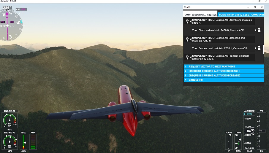
Speak of the devil, here’s a good one. ATC has me flying at 8400 feet. The mountains now 2 miles in front of me are exactly 8400 feet - I might have to clean some leaves out of the intakes but I should just clear them. Then I get a call to descend to 7700 feet.
That’s another issue. The ‘Direct To’ option needs to have a keyboard shortcut so you can just type in the name. It’s generally not a good idea to be at 5000 feet, near the airport, and spending 2 minutes face down in your Garmin trying to dial in a code one letter at a time with those finicky knobs.
Much easier to simply see them on your map, and head towards it.
You’re right. I should read more carefully. Didn’t realized you meant a visual approach after an ILS flight.
It’s stupid but ATC does not give you vectors automatically. I had it at a Greenland Airport. I had to asked several times for my vectors, a little bit strange, but finally I was on final and got my landing clearance,