I like flying VFR cross country, and I like using VORs instead of the GPS.
When planning the trip in the world map, I sometimes get routed via NDB only stations, and other types of stations that seem to have limited range, or don’t exist in the sim at all. At least I’m not getting a response on the frequencies listed in the charts.
Is there a guide to what types of stations I can actually find in the sim, and use for navigation in a steam plane?
I usually fly in Scandinavia, and VORs are a bit scarse here compared to places like the US, but it should still be possible, right?
1 Like
for VOR-VOR navigation I can really recommend LittleNavMap. It can read the MSFS navdata database, so everything will be the same as in the sim.
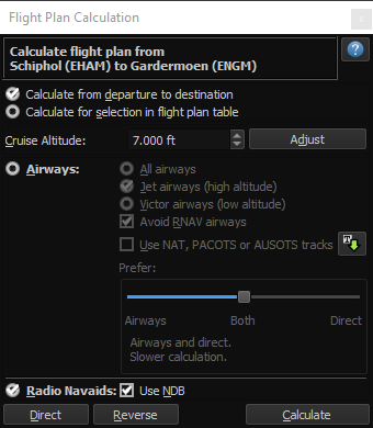
These are the settings to click to generate a VOR-VOR flightplan:
9 Likes
Thanks, I’ll try that!
I was just a bit surprised yesterday when the sim planned a route with a DME station as an enroute nav point.
I’ll play around with it some more.
Edit:
I’m using latest Navigraph cycle, and all my flight software (P2ATC, navigraph, NeoFly, Skyvector) seem to agree on frequencies, but there’s a lot of stations the radios just won’t pick up…
you can plug in the Navigraph database into LNM as well.
VOR signals can be distorted a lot by mountains though, especially if you’re flying low. They also have different ranges in the sim, especially terminal VOR’s have low range.
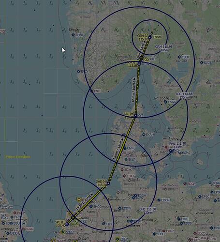
Fun thing in LNM is that you can add range rings to the VOR stations on your route, showing you when approximately you should be picking them up (again, altitude/hills/mountains permitting).
5 Likes
VOR to VOR is not really the way to fly VFR though  .
.
3 Likes
he said he liked using VOR’s though, which I why I pointed him to LNM 
2 Likes
I know, but for cross country flying it’s easy to lose a road or landmark. I like the added navigational robustness.
2 Likes
I can understand that. I like to fly VFR using VORs and NDBs as aids. I’ll mainly use landmarks and roads, but having those nav aids dialed in can really help when you’re in unfamiliar territory and unsure of what you may be seeing.
2 Likes
Yea a little ol school but I also enjoy vor-to-vor. It’s what I learned in the 70’s and it’s my fall back. And yea it’s going to eventually go away but that will probably be long after I’m gone. Glad to see other enjoy it also.
1 Like
The DC-6 really got me interested in VOR-VOR. It’s been great fun learning about it, and using it in the DC-6.
5 Likes
How do you add these rings?
right-click on the vor, and select the ‘add range ring for this VOR’ or something along those lines.
2 Likes
Thanks for that info. I never thought of enabling these until seeing your post above. I likely will now, as that can be very helpful.
1 Like
Its good to crosscheck position by creating a VOR / VOR or VOR / DME fix of course but flying from VOR to VOR is not really an option in real life within European airspace as most en-route VORs have disappeared so flying VOR to VOR would mean flying overhead one airport to the next or at least crossing terminal airspace  .
.
Need to fly pretty high to be within line-of-sight of those stations. In the Netherlands you can’t really fly high anywhere under VFR, no way you’ll be able to receive Helgoland VOR from the Netherlands  .
.
I was flying IFR in the DC-6 for that route, I just posted the screenshots as an example of what LNM can do.
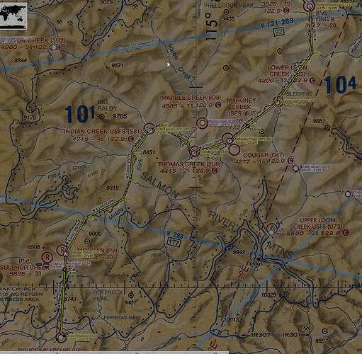
If I fly VFR the lines would never be that straight  Below picture is me flying VFR.
2 Likes
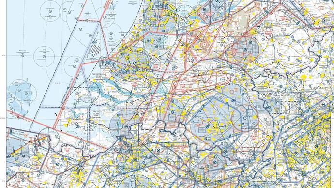
Luckily its not so congested in the US. In Europe its not as easy to fly VFR from A to B as you’ll need to circumnavigate:
- CTRs (unless planning on getting crossing clearance),
- Active Restricted / Prohibited and Dangerous areas,
- Active Temporary Reserved Airspaces (TRA),

- Special Rule Zones (SRZ),
- Bird sanctuaries and other natural reserves below certain altitudes,
- Class A airspaces
- etc., etc.
In the end there isn’t much left in certain places to roam around, let alone drawing a straight line between two VORs  . I mean, have fun finding your way through this mess:
4 Likes
Dang, wish we had maps like that for Europe…
They exist I think, they’re just not as easily accessible. OpenFlightMaps works pretty well for Europe though (and can also be loaded into LNM), and as you can see (and as @anon50268670 mentions)… loads of restrictions.
here’s the link to the OFM maps: GitHub - AmbitiousPilots/LittleNavmapOFMTheme: Open Flightmaps VFR Map Theme for Little Navmap
Thanks @AmbitiousPilots
1 Like
Navigraph claim to be working on a VFR solution, so I’ll see what they come up with eventually.
I have a 20 year old map, but a lot of the VORs have been decomissioned entirely, or have been converted to DME stations now.
So how would you fly low altitude Airways with something like a Piper Arrow III with a Garmin 100? Is that even possible?


